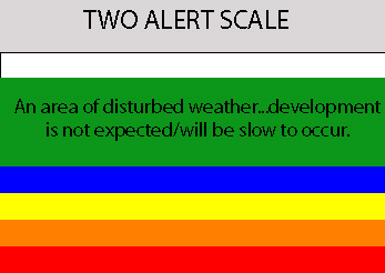
This disturbance has fast inflow. I'm not saying it will develop, it's just the only thing in town and should be watched in case it moves north:
http://www.ssd.noaa.gov/goes/east/carb/loop-vis.html
South Caribbean Disturbance
Moderator: S2k Moderators
Forum rules

The posts in this forum are NOT official forecasts and should not be used as such. They are just the opinion of the poster and may or may not be backed by sound meteorological data. They are NOT endorsed by any professional institution or STORM2K. For official information, please refer to products from the National Hurricane Center and National Weather Service.
South Caribbean Disturbance
Last edited by Sanibel on Thu Nov 08, 2007 6:53 pm, edited 1 time in total.
0 likes


Re: South Caribbean Disturbance
Like many 2007 disturbances, this shows both interesting signs of potential and possible nothing-ness as well. Like the convection emerging from Colombia to join it for instance.
0 likes
Re: South Caribbean Disturbance
Although this is close to Panama for development, there is still weak inflow going north to south from the Caribbean towards this disturbance. Has to be watched til it disappears.
0 likes
Re: South Caribbean Disturbance
True, though the season down there is almost year round, in a sense - I don't have time to search for it, but, sometime in the 1920's there was a destructive Cat 4 in late January somewhere in the southern or southeast Caribbean...
0 likes

-
Squarethecircle
- Category 5

- Posts: 2165
- Joined: Fri Oct 19, 2007 4:00 pm
- Location: Fairfax, VA
Re: South Caribbean Disturbance
Interestingly enough, some of the recent GFS runs have developed it, as well as NOGAPS and UKMET. I personally think this thing is too close to land and too far away from favorable conditions to do much of anything; might at its peak make INVEST status.
0 likes
-
wxman57

- Moderator-Pro Met

- Posts: 23177
- Age: 68
- Joined: Sat Jun 21, 2003 8:06 pm
- Location: Houston, TX (southwest)
Re: South Caribbean Disturbance
Development chances pretty close to zero. Just normal late-season convection in the SW Caribbean as the ITCZ moves southward.
0 likes
-
cycloneye

- Admin

- Posts: 149841
- Age: 69
- Joined: Thu Oct 10, 2002 10:54 am
- Location: San Juan, Puerto Rico
Re: South Caribbean Disturbance
From the 7:05 PM EST TWD:
CARIBBEAN SEA...
DISORGANIZED SHOWERS AND THUNDERSTORMS ASSOCIATED WITH A SFC
TROUGH EXTENDING BETWEEN JAMAICA AND THE W PANAMA/COSTA RICA
BORDER REMAIN OVER THE SOUTHWESTERN CARIBBEAN SEA. UPPER-LEVEL
WINDS ARE NOT FAVORABLE FOR DEVELOPMENT AT THIS TIME. CLUSTERS
OF MODERATE TO STRONG CONVECTION ARE OVER THE SW CARIBBEAN FROM
10N-14N BETWEEN 76W-81W. SIMILAR CONVECTION IS ON THE PACIFIC
SIDE ALONG THE COAST OF PANAMA...AND ALSO OVER N COLOMBIA AND
WESTERN VENEZUELA. THE COLOMBIAN LOW IS AIDING IN THE FORMATION
OF THIS CONVECTIVE ACTIVITY. MODERATE TO STRONG N TO NE WINDS OF
20-25 KT ARE BLOWING ON THE WEST SIDE OF THE SFC TROUGH. AN
EARLIER QUIKSCAT PASS ALONG WITH A FEW SHIP OBSERVATIONS
CONFIRMED THESE FORCE WINDS. MOST OF THE COMPUTER MODELS SUGGEST
THE DEVELOPMENT OF A SFC LOW IN THIS AREA.
http://www.storm2k.org/weather/hw3.php? ... hwvmetric=
0 likes

Re: South Caribbean Disturbance
seems one of the models may be seeing something there as well, this is under storm 50 which I have noticed they will use until they are convinced there is really something being seen by some of the models(or that has been my conclusion go storm 50)
http://my.sfwmd.gov/sfwmd/common/images ... orm_50.gif
http://my.sfwmd.gov/sfwmd/common/images ... orm_50.gif
0 likes

-
Gustywind

- Category 5
- Posts: 12334
- Joined: Mon Sep 03, 2007 7:29 am
- Location: Baie-Mahault, GUADELOUPE
Re:
caribepr wrote:I'm counting on you all to keep an eye on this...reminds me of Wrong Way Lenny (of course, at this time of year, anything in that area reminds me of Lenny)
0 likes
-
Squarethecircle
- Category 5
- Posts: 2165
- Joined: Fri Oct 19, 2007 4:00 pm
- Location: Fairfax, VA
Re: South Caribbean Disturbance
Everything is nice about this except the conditions; this thing, methinks, would form earlier in the year perhaps, but not in November.
0 likes
Re: South Caribbean Disturbance
Still there. Weak inflow from north still going down into it. Hmm. Seems centered over Panama. Convection and curvature are weak and look more like boundary shear than system. Still, if it persists it is in the birthplace of many late season cyclones in the very southern Caribbean.
0 likes
-
gatorcane

- S2K Supporter

- Posts: 23708
- Age: 48
- Joined: Sun Mar 13, 2005 3:54 pm
- Location: Boca Raton, FL
Re: South Caribbean Disturbance
NHC a little more bullish but indicate it is going to move into central america (what is new right?)....
000
ABNT20 KNHC 101614
TWOAT
TROPICAL WEATHER OUTLOOK
NWS TPC/NATIONAL HURRICANE CENTER MIAMI FL
1130 AM EST SAT NOV 10 2007
FOR THE NORTH ATLANTIC...CARIBBEAN SEA AND THE GULF OF MEXICO...
A LARGE AREA OF DISORGANIZED SHOWERS AND THUNDERSTORMS REMAINS OVER
THE SOUTHWESTERN CARIBBEAN SEA AND IS ASSOCIATED WITH A WEAK LOW
PRESSURE AREA AND A SURFACE TROUGH. ALTHOUGH UPPER-LEVEL WINDS ARE
BECOMING MORE FAVORABLE FOR DEVELOPMENT...THERE ARE FEW SIGNS OF
ORGANIZATION AND SIGNIFICANT DEVELOPMENT OF THIS SYSTEM IS NOT
ANTICIPATED BEFORE IT MOVES INLAND OVER CENTRAL AMERICA IN A DAY OR
TWO.
ELSEWHERE...TROPICAL CYCLONE FORMATION IS NOT EXPECTED DURING THE
NEXT 48 HOURS.
$$
FORECASTER BLAKE
Last edited by gatorcane on Sat Nov 10, 2007 11:21 am, edited 2 times in total.
0 likes
-
Tampa Bay Hurricane

- Category 5
- Posts: 5597
- Age: 38
- Joined: Fri Jul 22, 2005 7:54 pm
- Location: St. Petersburg, FL
Honestly, It is very depressing that this is not headed towards florida and the
drought SE.
As you all know, I am a storm chaser from the depths of my heart.
I do get quite sad when I don't get to experience natures power.
I can only hope that a good tropical storm forms and comes
and hits florida. I want to get it on videotape. And we need the
rain.
But my hopes have been dashed again and again by the dissappointing
invests. But I will continue to hope.
Tropical Storm Barry was nice in June, I just wish it were
officially a tropical storm at landfall so I could marvel at the
awe of the true beast.
I am really going to hope for a nice big juicy tropical storm to form
and come hit florida. It would be so awesome. It is so sad to see
the evil winter shear come and destroy my tropical storm.
I looked forward to the 2007 season, but now winter is coming
0 likes
-
Tampa Bay Hurricane
- Category 5
- Posts: 5597
- Age: 38
- Joined: Fri Jul 22, 2005 7:54 pm
- Location: St. Petersburg, FL
Who is online
Users browsing this forum: No registered users and 71 guests