 The posts in this forum are NOT official forecast and should not be used as such. They are just the opinion of the poster and may or may not be backed by sound meteorological data. They are NOT endorsed by any professional institution or

Some of the speculation for a closer track lies in the idea that the models are not handling the atmospheric heat very well. Hence, when the added heat is factored in, there will be greater downstream ridging. Modeled soundings compared to actual soundings for the most recent runs suggest that the models are handling the warmth reasonably well. If so, the storm track will not shift appreciably to the west. The decent continuity one has seen on the models and GFS ensembles with respect to the storm’s track reflects the idea that the models have done a reasonable job in handling the heat.
The only major caveat is how long it will take for the column to cool right along the coast. There, the precipitation will likely start as rain and/or sleet before changing to accumulating snow.
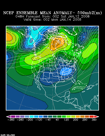
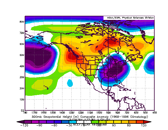
The upper air picture being painted by the NCEP ensemble suite at 48 hours bears some similarity to a composite of February 19, 1964, January 7, 1981, and January 21, 2001, though this time around the system is likely to have substantially more moisture with which to work.
NCEP Ensemble Mean 500 mb Height Anomalies: 48 hours:
Composite Analog for 2/19/1964, 1/7/1981, and 1/21/2001:
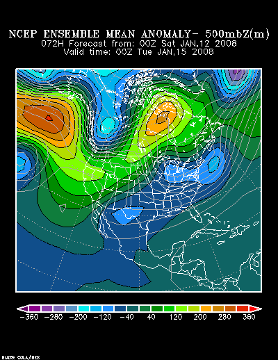
NCEP Ensemble Mean 500 mb Height Anomalies: 48 hours:
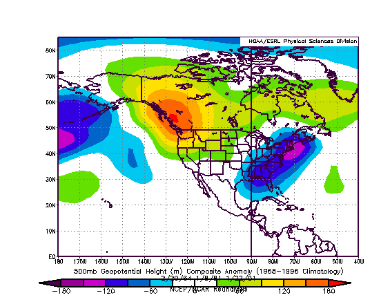
Composite Analog for 2/19/1964, 1/7/1981, and 1/21/2001:
Two of the three analog cases focused the heavier snows from New York City north and eastward. One focused the heaviest snows in the Philadelphia to New York City area.
At this time, my initial snowfall estimates are as follows:
Albany: 4”-8”
Allentown: 3”-6”
Boston: 7”-14”
Burlington: 3”-6”
Caribou: 1”-3”
Concord: 8”-16”
Hartford: 6”-12”
Harrisburg: 1”-3”
New York City: 3”-6”
Newark: 3”-6”
Philadelphia: 0.5”-1.5”
Portland: 6”-12”
Providence: 4”-8”
White Plains: 4”-8”
Worcester: 7”-14”


