CrazyC83 wrote:
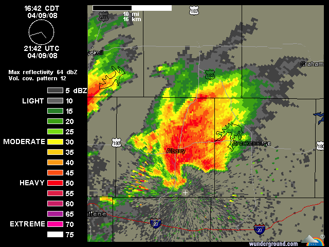
Exact same tornado probabilities as the last watch. Same forecaster too.
Kinda strange.
Moderator: S2k Moderators


RL3AO wrote:Do they have to reissue it, or can they just amend it?
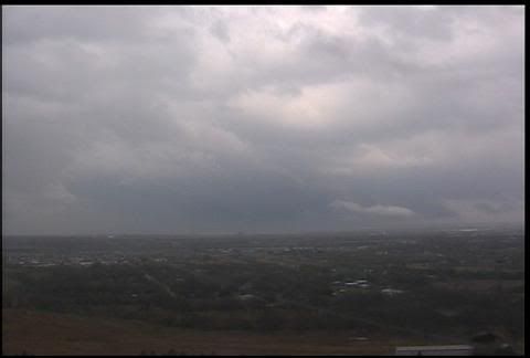
brunota2003 wrote:Is that a mesocyclone I see on the webcam right now? Like, the back edge/tail region of it?
EDIT: It just updated. Will upload a saved image of it in a minute.
Bunkertor wrote:brunota2003 wrote:Is that a mesocyclone I see on the webcam right now? Like, the back edge/tail region of it?
EDIT: It just updated. Will upload a saved image of it in a minute.
That must be a second one. The shelfcloud has already moved through
brunota2003 wrote:Bunkertor wrote:brunota2003 wrote:Is that a mesocyclone I see on the webcam right now? Like, the back edge/tail region of it?
EDIT: It just updated. Will upload a saved image of it in a minute.
That must be a second one. The shelfcloud has already moved through
I did not get a really good look at it, and it's distance is pretty far. But it definitely was interesting.
First pic is a non-edited one:
del
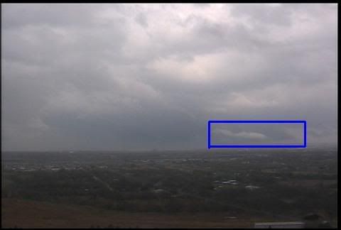
Second one is highlighting my area of question/interest:
del
It might be nothing out of the ordinary or just a Shelf cloud, I do not have any actual experience out chasing (too many trees here and am too young to really venture out on my own). More of a point spotter.

Return to “USA & Caribbean Weather”
Users browsing this forum: No registered users and 168 guests