


TC Bertha
Moderator: S2k Moderators
-
Category 5

- Category 5

- Posts: 10074
- Age: 36
- Joined: Sun Feb 11, 2007 10:00 pm
- Location: New Brunswick, NJ
- Contact:
Re: Tropical Storm Bertha in East Atlantic
This things days might be numbered, it's entering an area of no heat content. When it clears that in 48 hours, welcome to sheer city. I'd dismiss the chance of this becoming a Hurricane, or even becoming much stronger period. Any hopes of a nice long track fishy appear to be diminishing to me.


0 likes
-
Derek Ortt

Well given its in very low SSt's and low heat content right now and its still looking ok then I don't think its going to wekaen unless other factors kick in. I think the fact its got a good structure will also help to keep it going.
I think once it reaches 40W and manages to get back into the higher heat content and as long as its not fallen apart by then I see no reason why it can't strengthen at least for the first 24hrs its over that water, I think thats its best shot at becoming a powerful tropical storm, maybe higher but you just can't say to be honest!
I think once it reaches 40W and manages to get back into the higher heat content and as long as its not fallen apart by then I see no reason why it can't strengthen at least for the first 24hrs its over that water, I think thats its best shot at becoming a powerful tropical storm, maybe higher but you just can't say to be honest!
Last edited by KWT on Thu Jul 03, 2008 4:39 pm, edited 1 time in total.
0 likes
-
Gustywind

- Category 5
- Posts: 12334
- Joined: Mon Sep 03, 2007 7:29 am
- Location: Baie-Mahault, GUADELOUPE
Re:
Derek Ortt wrote:to be fair, shear is decreasing in the high shear zone and it is 5 days away from it
Yeah Derek it has a maybe a window opportunity to be something decent during its trip for sure...
0 likes

Re:
HURAKAN wrote:
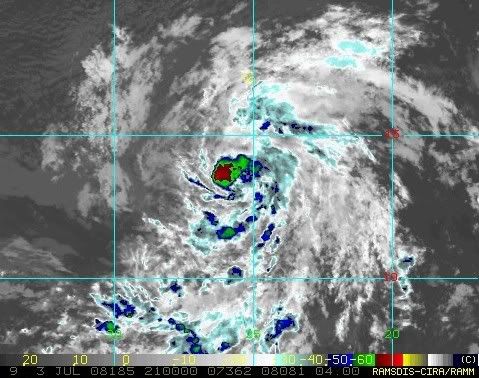
Nice look! Bertha is showing off.
It is pretty, but in a delicate way. Perfect form but kinda puny, isn't it? With all due respect.
Likely headed toward swaths of shear.
 Upper level shear.
Lower steering (latest), possibly staying south?

0 likes
-
Ed Mahmoud
Re: Tropical Storm Bertha in East Atlantic
I think that zero line on the oceanic heat content graph is at 26ºC. I think a weak system can remain steady state over water a degree or two cooler, if all else is favorable. Noting a slow intensification forecast by NHC, that appears to be the their reasoning as well.
0 likes
-
jaxfladude
- Category 5
- Posts: 1249
- Joined: Wed Aug 24, 2005 9:36 pm
- Location: Jacksonville, Fla
That may be the case Ed, it does seem to match the 26C line pretty closely looking at that chart now.
recurve, shear is high but the tendency has been for it to decrease steadily on the southern part of the high shear zone. Anyway shouldn't be a problem for at least 96-120hrs yet anyway and plenty can happen in that time as we all know.
Also won't be long till we finally have floater on Bertha.
recurve, shear is high but the tendency has been for it to decrease steadily on the southern part of the high shear zone. Anyway shouldn't be a problem for at least 96-120hrs yet anyway and plenty can happen in that time as we all know.
Also won't be long till we finally have floater on Bertha.
0 likes
-
Derek Ortt
Re:
KWT wrote:That may be the case Ed, it does seem to match the 26C line pretty closely looking at that chart now.
recurve, shear is high but the tendency has been for it to decrease steadily on the southern part of the high shear zone. Anyway shouldn't be a problem for at least 96-120hrs yet anyway and plenty can happen in that time as we all know.
Also won't be long till we finally have floater on Bertha.
I put one on http://www.nwhhc.com/satellite.html but you can only see the western extent of the circulation yet... maybe later tonight or tomorrow morning at the latest until the entire storm is available
0 likes


-
soonertwister
- Category 5
- Posts: 1091
- Joined: Mon Jun 16, 2003 2:52 pm
Re: Tropical Storm Bertha in East Atlantic
I'm an amateur, but I'm entirely unconvinced what big Bertha will take that nice parabolic recurve that is usually in the track forecast for building tropical storms. I've seen it not do so enough times that my confidence level is pretty low.
Over all the years of watching tropical systems, I've been amazed at how they confound the experts again and again. The presumption is that Bertha will recurve north and be destroyed by still existing unfavorable conditions. I've seen the scenario fail many times before.
God help a society that buys into absolutism when they can't even predict where hurricanes will go prior to the end game.
0 likes
-
Matt-hurricanewatcher
Re: Tropical Storm Bertha in East Atlantic
Still a nice system, with nice convection refiring, most likely around 35-40 knots. I expect it to strengthen to 40-45 tonight.
0 likes
I think if any deep convection does fire up over the center then its got the structure for it to up the winds a little bit IMO, if the deep convection carries on developing like it is right now as hit the Dmax later on then we should see the winds upped to 40kts I'd have thought. Still we shall have to wait and see how the cooler waters effect this system in the next 24hrs, esp at Dmin.
0 likes
-
Weatherfreak000
Re: Tropical Storm Bertha in East Atlantic
Thinking a Hurricane out of Bertha, many, many storms have proven Hurricane status is possible with minimal SST's so long as the shear ratio is correct, and current shear maps dictate Bertha has quite a lot of time ahead of it.
0 likes
-
Eyewall
Re: Tropical Storm Bertha in East Atlantic
This what im thinking. Disagree if you please.
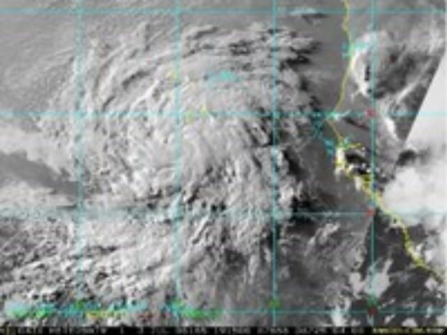
The storm is now pushing closer and closer to a dry and stable airmass:

Also looking at the heat content chart posted above, things are not working in the favor of intensification.
But as it heads on a WNW course, it will gain enough latitude to be affected by the break in the ridge and eventually curve off to sea.
The storm is now pushing closer and closer to a dry and stable airmass:
Also looking at the heat content chart posted above, things are not working in the favor of intensification.
But as it heads on a WNW course, it will gain enough latitude to be affected by the break in the ridge and eventually curve off to sea.
0 likes
Who is online
Users browsing this forum: No registered users and 27 guests