More for the record books.
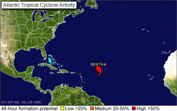
Bertha: First Atlantic hurricane and first major hurricane (Atlantic and EPAC) to be featured in the GTWO.
Moderator: S2k Moderators

x-y-no wrote:jaxfladude wrote:


Global Warming/Just favorable conditions to blame for this and the last few seasons of "rapid deepening" that we have seen.......?????
Let's not go there!

PhillyWX wrote:Not quite Wilma-esque but still very significant and rare occurrence given it's over the Central Atlantic and not in one of the typical hot spots for bombing out.
It's getting some great assistance from the upper levels with that jet streak to its north helping to evacuate the storm's updraft much more efficiently.

Stratosphere747 wrote:"Estimated" readings...
KWT wrote:Stratosphere747 wrote:"Estimated" readings...
I think the estimate has come from the raw Dvorak estimates of 6.0 which is about 948mbs I think?
I fully expect winds will eventually catch up with that low pressure if the deep convection forms, could get close to cat-4 with that pressure...

cycloneye wrote:Latest ACE:
Season total
Storm Type ACE (104 kt2)
01L (Arthur) Operational 0.3675
02L (Bertha) Operational 4.9550
Total 5.3225
http://en.wikipedia.org/wiki/Talk:2008_ ... /ACE_calcs
Code: Select all
19 7 July 5 pm EDT 100 1.0000 
KWT wrote:Stratosphere747 wrote:"Estimated" readings...
I think the estimate has come from the raw Dvorak estimates of 6.0 which is about 948mbs I think?
I fully expect winds will eventually catch up with that low pressure if the deep convection forms, could get close to cat-4 with that pressure...

WmE wrote:This is one wierd storm. A storm at the beginning of July undergoing rapid deepening in the middle of the ocean having a central pressure of 948 mbar as a weak Cat 3. That is as wierd as it can get.


jaxfladude wrote:Sorry , way too lazy to read back a page or two, but has recon been in Bertha(2008)yet?
Or is this all just estimates still.
When is the first/next recon flight?

Users browsing this forum: No registered users and 12 guests