Possible development east of Lesser Antilles,model runs here
Moderator: S2k Moderators
Forum rules
The posts in this forum are NOT official forecasts and should not be used as such. They are just the opinion of the poster and may or may not be backed by sound meteorological data. They are NOT endorsed by any professional institution or STORM2K. For official information, please refer to products from the National Hurricane Center and National Weather Service.
Re: GFS,EURO spawns New Low off Africa
All of the following have been initialized at 2008071100. Each image is at 144hrs.
UKMET
http://moe.met.fsu.edu/tcgengifs/ukm/20 ... /slp24.png
CMC
http://moe.met.fsu.edu/tcgengifs/cmc/20 ... /slp24.png
GFS:
http://moe.met.fsu.edu/tcgengifs/gfs/20 ... /slp24.png
Looks like GFS develops it most aggressively, followed by UKMET, then CMC, which shows some kind of weak low near the area...
0 likes
Re: GFS,EURO spawns New Low off Africa
NOGAPS is picking it up as well.
96hr 850MB
https://www.fnmoc.navy.mil/wxmap_cgi/cg ... 85&tau=096
180hr 850MB
https://www.fnmoc.navy.mil/wxmap_cgi/cg ... 85&tau=180
Loop 850MB
https://www.fnmoc.navy.mil/wxmap_cgi/cg ... 2008071100
96hr 850MB
https://www.fnmoc.navy.mil/wxmap_cgi/cg ... 85&tau=096
180hr 850MB
https://www.fnmoc.navy.mil/wxmap_cgi/cg ... 85&tau=180
Loop 850MB
https://www.fnmoc.navy.mil/wxmap_cgi/cg ... 2008071100
0 likes
The area doesn't look great right now with the southern region still showing convection but probably enhanced by the ITCZ. Still the models are fairly slow at development at first with only a weak low at first so I'm not expecting quick development however given low SAL, SSt's that are warm enough and shear not too bad plus the fact we've already seen Bertha form from here only a week ago all argues for development IMO.
The wave will need to be watched far more then Bertha because as Bertha exits a upper ridge forms behind it and this will keep this wave on a steady westward tracdk until Bertha totally lifts out of the way and by the time that happens this could well be a real threat to the Caribbean Islands. We shall have to wait and see.
The wave will need to be watched far more then Bertha because as Bertha exits a upper ridge forms behind it and this will keep this wave on a steady westward tracdk until Bertha totally lifts out of the way and by the time that happens this could well be a real threat to the Caribbean Islands. We shall have to wait and see.
0 likes
Yep 06z still shows Bertha in the picture and our other low as well:
http://www.nco.ncep.noaa.gov/pmb/nwprod ... n_144m.gif
http://www.nco.ncep.noaa.gov/pmb/nwprod ... n_144m.gif
0 likes
- cycloneye
- Admin

- Posts: 148741
- Age: 69
- Joined: Thu Oct 10, 2002 10:54 am
- Location: San Juan, Puerto Rico
Re: Possible development off W Africa during next several days
If you look at the cloud pattern,it looks like some kind of circulation is in the area,even though convection is not plenty at this time.


0 likes
Re: GFS,EURO spawns New Low off Africa
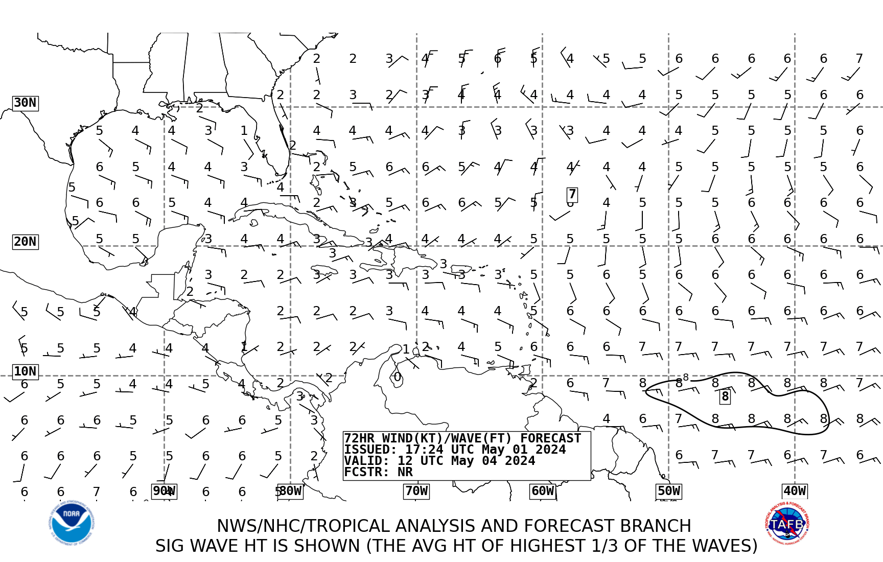
Tropical predition center sees it at 72hr. forecast.
http://www.nhc.noaa.gov/tafb_latest/atl ... testBW.gif
http://www.nhc.noaa.gov/tafb_latest/atl ... testBW.gif
0 likes
-
Dean4Storms
- S2K Supporter

- Posts: 6358
- Age: 62
- Joined: Sun Aug 31, 2003 1:01 pm
- Location: Miramar Bch. FL
-
Ed Mahmoud
Re: Possible development off W Africa during next several days
Way too soon to make any bold stands, in my unofficial and amateur opinion, but if the European is right, lower heights near Florida might draw this towards Florida and the Southeast, or could even recurve it at the last minute. The Gulf looks safe. Of course, that all depends on the Euro being correct at 10 days.

Looks to be under a tad bit of shear now from the East, but that should improve, and a strong mid-level Easterly jet should help give it a kick start.

Disclaimer: This is an unofficial and amateur opinion, and Storm2K not only doesn't endorse it, they are probably a little embarrased every time I post.

Looks to be under a tad bit of shear now from the East, but that should improve, and a strong mid-level Easterly jet should help give it a kick start.
Disclaimer: This is an unofficial and amateur opinion, and Storm2K not only doesn't endorse it, they are probably a little embarrased every time I post.
0 likes
The problem with the Euro is Bertha is still at 30N even at 168hrs, if it clears out quicker then ther eis a greater chance of heights building in behind it. There seems to be two options, the first is Bertha takes its sweet time getting out of the way like the 06z GFS and the 0z ECM and the weakness is still in place when this system comes along...or it gets out of the way so that by the time this system comes along a weak ridge has built back in and this outs the Caribbean Islands and also the east coast at greater risk.
0 likes
Who is online
Users browsing this forum: No registered users and 99 guests


