ATL: Tropical Depression Dolly
Moderator: S2k Moderators
-
Chigger_Lopez
- Tropical Depression

- Posts: 72
- Joined: Thu Sep 11, 2003 10:11 pm
- Location: Jupiter, FL
I was just listening to CNBC and they were talking about Oil comodities and mentioned that people shorting the comodities could get blasted b/c there is a system in the carribean now and the models all shifted north putting it into the GOM. That was surprising they are mentioning that already, like it was a certainty or something.
0 likes

Re: ATL: INVEST 94L in Eastern Caribbean
Just wondering - "if" this were to develop any at all, and "if" it were to threaten any part of the U.S., how soon in advance would watches or warnings be issued?
0 likes

Re: ATL: INVEST 94L in Eastern Caribbean
LaBreeze wrote:Just wondering - "if" this were to develop any at all, and "if" it were to threaten any part of the U.S., how soon in advance would watches or warnings be issued?
When its 36-48 hours away from land.
0 likes
-
cheezyWXguy

- Category 5

- Posts: 6242
- Joined: Mon Feb 13, 2006 12:29 am
- Location: Dallas, TX


-
DanKellFla

- Category 5
- Posts: 1291
- Joined: Fri Mar 17, 2006 12:02 pm
- Location: Lake Worth, Florida
IMO the center should stay offshore however and the westerly movement is just a guide, its current movement is more like 280 so it shouldn't come ashore and besides there isn't much really to disrupt right now!
Last edited by KWT on Thu Jul 17, 2008 5:55 pm, edited 1 time in total.
0 likes

Re:
HURAKAN wrote:
That's the fourth TCFA!
#1: http://www.webcitation.org/5ZK67v5VQ
#2: http://www.webcitation.org/5ZK6GMLLi
#3: http://www.webcitation.org/5ZMTpZxNQ
0 likes


-
Innotech

- Category 5
- Posts: 1031
- Joined: Mon Aug 30, 2004 5:32 pm
- Location: Lafayette, Louisiana
- Contact:
Re: ATL: INVEST 94L in Eastern Caribbean
I think thats the truly frightning part. after 24 hours of strong shear and it is still close to a tropical cyclone. Imagine this thing in a less sheared environment.
0 likes
-
Ed Mahmoud
Re:
KWT wrote:Hmmm maybe a little more convection Hurakan but pretty much the exact same presentation as yesterday probably thanks to the shear levels its under right now.
The 'shape' looks a little better. A touch less sheared, I'd guess.
It probably will develop in a day or two, but I think by then it'll be too far South to feel any weakness that might pull it into anyplace in the Gulf but maybe the BOC on its way to a second Mexican landfall.
But we'll have #96L soon. I think once the sun sets on Florida and the land based storms die down a tad, the storms offshore will really fire up.
IMHO.
0 likes
-
senorpepr

- Military Met/Moderator

- Posts: 12542
- Age: 43
- Joined: Fri Aug 22, 2003 9:22 pm
- Location: Mackenbach, Germany
- Contact:
Re: Re:
Ed Mahmoud wrote:But we'll have #96L soon. I think once the sun sets on Florida and the land based storms die down a tad, the storms offshore will really fire up.
IMHO.
96L already exists, or did you mean 96L will strengthen once the sun sets?
0 likes
-
HURAKAN

- Professional-Met

- Posts: 46086
- Age: 38
- Joined: Thu May 20, 2004 4:34 pm
- Location: Key West, FL
- Contact:
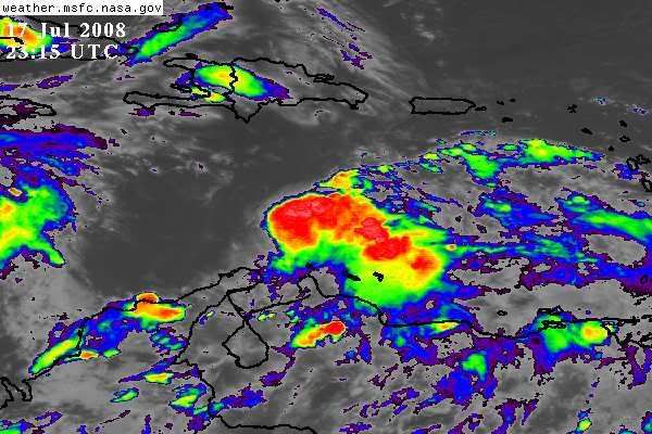
TROPICAL WEATHER DISCUSSION
NWS TPC/NATIONAL HURRICANE CENTER MIAMI FL
805 PM EDT THU JUL 17 2008
TROPICAL WAVE IS ALONG 66W S OF 18N WITH A 1009 MB LOW ALONG THE
WAVE AXIS NEAR 13N. MOVING W NEAR 20 KT. WHILE CONDITIONS
CURRENTLY DO NOT APPEAR TO BE FAVORABLE FOR DEVELOPMENT...
THUNDERSTORM ACTIVITY ASSOCIATED WITH THE LOW HAS INCREASED
DURING THE DAY AND AN AIR FORCE RESERVE RECONNAISSANCE AIRCRAFT
INVESTIGATED THIS SYSTEM EARLIER TODAY AND DID NOT FIND ANY
SIGNIFICANT DEVELOPMENT. HOWEVER...HEAVY RAINS AND GUSTY WINDS
ARE POSSIBLE IN NORTHERN VENEZUELA AND ADJACENT ISLANDS TONIGHT
AND TOMORROW. SCATTERED SHOWERS/THUNDERSTORMS ARE S OF 15N TO
OVER THE ABC ISLANDS W OF THE WAVE AXIS TO 71W WITH SCATTERED
SHOWERS AND POSSIBLE ISOLATED THUNDERSTORMS COVERING THE
REMAINDER OF THE AREA S OF 17N BETWEEN 60W-69W.
0 likes
-
cycloneye

- Admin

- Posts: 148741
- Age: 69
- Joined: Thu Oct 10, 2002 10:54 am
- Location: San Juan, Puerto Rico
Re: ATL: INVEST 94L in Eastern Caribbean
8 PM TWO:
AN AIR FORCE RESERVE UNIT RECONNAISSANCE AIRCRAFT INVESTIGATING THE
LARGE AREA OF DISTURBED WEATHER OVER THE SOUTHEASTERN CARIBBEAN SEA
FOUND A BROAD CLOSED CIRCULATION BUT NO WELL-DEFINED CIRCULATION
CENTER. ADDITIONALLY...THUNDERSTORM ACTIVITY REMAINS DISORGANIZED.
HOWEVER...ENVIRONMENTAL CONDITIONS ARE EXPECTED TO GRADUALLY BECOME
A LITTLE MORE FAVORABLE FOR DEVELOPMENT...AND THIS SYSTEM STILL HAS
THE POTENTIAL TO BECOME A TROPICAL DEPRESSION DURING THE NEXT DAY
OR SO AS IT MOVES WESTWARD AT 20-25 MPH. REGARDLESS OF
DEVELOPMENT...HEAVY RAINS AND GUSTY WINDS ARE POSSIBLE OVER
NORTHERN VENEZUELA AND ADJACENT ISLANDS TONIGHT AND TOMORROW.
0 likes
Who is online
Users browsing this forum: No registered users and 71 guests