ATL: Invest 97L in Central Atlantic

Moderator: S2k Moderators

Message
Author
User avatar
cycloneye
Admin
Admin
Posts: 145295
Age: 68
Joined: Thu Oct 10, 2002 10:54 am
Location: San Juan, Puerto Rico

Re: Ex 97L in East Atlantic

#201 Postby cycloneye » Thu Jul 24, 2008 9:47 am

wzrgirl1 wrote:so does the thread need to be moved again?


Not yet,until ATCF releases the best track and reactivates 97L,although it is at the navy site.
0 likes   

User avatar
HURAKAN
Professional-Met
Professional-Met
Posts: 46086
Age: 38
Joined: Thu May 20, 2004 4:34 pm
Location: Key West, FL
Contact:

#202 Postby HURAKAN » Thu Jul 24, 2008 9:49 am

The system was never taken out of NRL, if my memory serves me right.
0 likes   

User avatar
tailgater
S2K Supporter
S2K Supporter
Posts: 3339
Joined: Sun Jul 11, 2004 9:13 pm
Location: St. Amant La.

Re: Ex 97L in East Atlantic

#203 Postby tailgater » Thu Jul 24, 2008 10:06 am

I can't get over how large this wave is. I wouldn't think development would occur till it gets @55W, but I see the TPC has it breaking into 2 sections with the northern half closing off and re curving.
http://www.nhc.noaa.gov/tafb_latest/atl ... testBW.gif
Seems to have a good circulation @ 15N 35W at mid to low levels.
Here's a nice loop of it.
http://hadar.cira.colostate.edu/ramsdis ... at1_0.html
0 likes   

User avatar
HURAKAN
Professional-Met
Professional-Met
Posts: 46086
Age: 38
Joined: Thu May 20, 2004 4:34 pm
Location: Key West, FL
Contact:

#204 Postby HURAKAN » Thu Jul 24, 2008 10:11 am

It's really large and we could see the northern part develop in the Atlantic and the southern part try to develop in the Caribbean or develop in the EPAC. Still, I'm just guessing and we will have to wait. I continue being pleased by the overall organization of the system and expect it will at least try to develop over warmer waters.
0 likes   

User avatar
cycloneye
Admin
Admin
Posts: 145295
Age: 68
Joined: Thu Oct 10, 2002 10:54 am
Location: San Juan, Puerto Rico

Re: Ex 97L in East Atlantic

#205 Postby cycloneye » Thu Jul 24, 2008 10:14 am

Its really large the overall circulation with a center at 15n.

Image
0 likes   

User avatar
tailgater
S2K Supporter
S2K Supporter
Posts: 3339
Joined: Sun Jul 11, 2004 9:13 pm
Location: St. Amant La.

Re: Ex 97L in East Atlantic

#206 Postby tailgater » Thu Jul 24, 2008 10:23 am

I don't know what the forecast holds in store for this 1 but it won't be easy for it to develop with this in front of it.
http://hadar.cira.colostate.edu/ramsdis ... _ls_0.html
0 likes   

User avatar
gatorcane
S2K Supporter
S2K Supporter
Posts: 23691
Age: 47
Joined: Sun Mar 13, 2005 3:54 pm
Location: Boca Raton, FL

Re: Ex 97L in East Atlantic

#207 Postby gatorcane » Thu Jul 24, 2008 10:24 am

It truly is a gigantic system, although it lacks convection and tenacity. Take a look at the Atlantic wide-view shot where you can see the circulation envelope of ex-97 is about as large as the Gulf of Mexico :eek:

Image
0 likes   

Ed Mahmoud

Re: Ex 97L in East Atlantic

#208 Postby Ed Mahmoud » Thu Jul 24, 2008 11:24 am

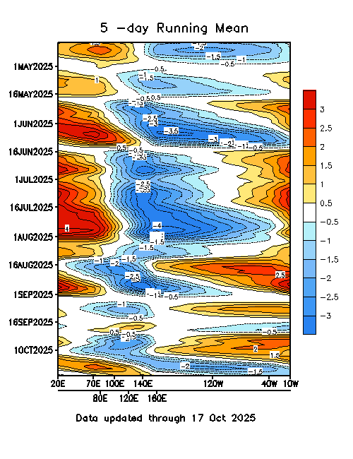
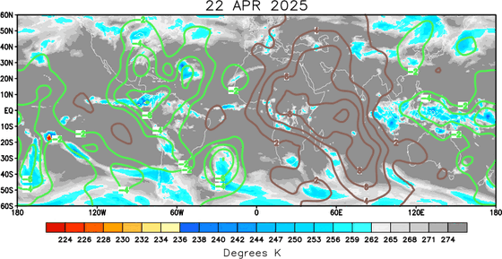
Posted a couple of pages back, upward motion/MJO isn't currently favorable for development.

Not that it means it can't happen, just somewhat less likely.

Image
0 likes   

Cyclone1
Category 5
Category 5
Posts: 2739
Age: 33
Joined: Tue Jun 12, 2007 12:03 pm
Location: Florida

#209 Postby Cyclone1 » Thu Jul 24, 2008 11:25 am

Geez, that is a huge circulation... And if it's on NRL, why are we posting here?
Last edited by Cyclone1 on Thu Jul 24, 2008 11:32 am, edited 2 times in total.
0 likes   

RL3AO
Moderator-Pro Met
Moderator-Pro Met
Posts: 16308
Joined: Thu Jun 14, 2007 10:03 pm
Location: NC

Re: Ex 97L in East Atlantic

#210 Postby RL3AO » Thu Jul 24, 2008 11:27 am

Image

Yep Ed. Wave is currently in favorable MJO conditions, but that will change over the next few days.
0 likes   

Ed Mahmoud

Re: Ex 97L in East Atlantic

#211 Postby Ed Mahmoud » Thu Jul 24, 2008 11:28 am

Speaking of dry air and subsidence...

Image
0 likes   

Ed Mahmoud

Re: Ex 97L in East Atlantic

#212 Postby Ed Mahmoud » Thu Jul 24, 2008 11:36 am

I'm going to go out on a huge limb here, and unofficially predict this won't be 'Edouard' in the next 3 days.
0 likes   

User avatar
hial2
S2K Supporter
S2K Supporter
Posts: 809
Joined: Fri Oct 10, 2003 9:20 pm
Location: Indian trail N.C.

Re: Ex 97L in East Atlantic

#213 Postby hial2 » Thu Jul 24, 2008 11:51 am

Ed Mahmoud wrote:I'm going to go out on a huge limb here, and unofficially predict this won't be 'Edouard' in the next 3 days.


Proud of you, Ed..."A small step for man,a giant leap for Ed".. J/K :D

Actually Ed you have more internal fortitude than I have...this is turning out to be a crazy year to prognosticate..I remember reading respected pros saying that "D" had no chance to develop,and we all know what happened..at least this will be an interesting year (hopefully NOT memorable).
0 likes   

User avatar
cycloneye
Admin
Admin
Posts: 145295
Age: 68
Joined: Thu Oct 10, 2002 10:54 am
Location: San Juan, Puerto Rico

Re: Ex 97L in East Atlantic

#214 Postby cycloneye » Thu Jul 24, 2008 12:47 pm


ABNT20 KNHC 241746
TWOAT
TROPICAL WEATHER OUTLOOK
NWS TPC/NATIONAL HURRICANE CENTER MIAMI FL
200 PM EDT THU JUL 24 2008

FOR THE NORTH ATLANTIC...CARIBBEAN SEA AND THE GULF OF MEXICO...

THE NATIONAL HURRICANE CENTER IS ISSUING ADVISORIES ON TROPICAL
STORM DOLLY...CENTERED ABOUT 30 MILES NORTHWEST OF LAREDO TEXAS.

A LARGE WESTWARD-MOVING TROPICAL WAVE...IS LOCATED OVER THE TROPICAL
EASTERN ATLANTIC ABOUT 700 MILES WEST OF THE CAPE VERDE ISLANDS.
SHOWER ACTIVITY IS VERY LIMITED AT THIS TIME AND SIGNIFICANT
DEVELOPMENT OF THIS SYSTEM IS NOT EXPECTED DURING THE NEXT COUPLE
OF DAYS.

ELSEWHERE...TROPICAL CYCLONE FORMATION IS NOT EXPECTED DURING THE
NEXT 48 HOURS.

$$
FORECASTER AVILA
0 likes   

User avatar
cycloneye
Admin
Admin
Posts: 145295
Age: 68
Joined: Thu Oct 10, 2002 10:54 am
Location: San Juan, Puerto Rico

Re: Ex 97L in East Atlantic

#215 Postby cycloneye » Thu Jul 24, 2008 2:31 pm

From the 2 PM discussion:

A HIGH AMPLITUDE TROPICAL WAVE IS ALONG 34W S OF 23N MOVING W
NEAR 20 KT. VIS SATELLITE IMAGERY INDICATES A BROAD CYCLONIC
CIRCULATION AND A 1012 MB LOW IS ADDED ALONG THE WAVE AXIS NEAR
14N. THIS LOW IS FORECAST BY THE COMPUTER MODELS TO MOVE WNW
DURING THE NEXT 24-48 HOURS. SHOWER ACTIVITY IS VERY LIMITED AT
THIS TIME AND SIGNIFICANT DEVELOPMENT OF THIS SYSTEM IS NOT
EXPECTED DURING THE NEXT COUPLE OF DAYS. THE WAVE SHOWS UP VERY
WELL ON THE MIMIC-TPW PRODUCT FROM CIMSS WHERE A LARGE BULGE OF
MOISTURE IS OBSERVED. IN ADDITION...THE 850 MB RELATIVE
VORTICITY ALSO SUPPORTS THE PRESENCE OF THIS SFC LOW. TIGHT PRES
GRADIENT BETWEEN THE LOW AND THE ATLC SFC HIGH WILL PRODUCE SOME
INCREASE IN WINDS ACROSS THE CENTRAL ATLC DURING THE UPCOMING
WEEKEND.
0 likes   

HUC
Category 2
Category 2
Posts: 590
Joined: Fri Oct 03, 2003 3:48 pm
Location: Basse-Terre Guadeloupe

Re: Ex 97L in East Atlantic

#216 Postby HUC » Thu Jul 24, 2008 3:39 pm

Just a question: the N R L site dont't work????
0 likes   

RL3AO
Moderator-Pro Met
Moderator-Pro Met
Posts: 16308
Joined: Thu Jun 14, 2007 10:03 pm
Location: NC

Re: Ex 97L in East Atlantic

#217 Postby RL3AO » Thu Jul 24, 2008 3:41 pm

HUC wrote:Just a question: the N R L site dont't work????


Works fine for me.
0 likes   

HUC
Category 2
Category 2
Posts: 590
Joined: Fri Oct 03, 2003 3:48 pm
Location: Basse-Terre Guadeloupe

Re: Ex 97L in East Atlantic

#218 Postby HUC » Thu Jul 24, 2008 3:44 pm

I will close my computer, and resart... and see Thank.
0 likes   

User avatar
Gustywind
Category 5
Category 5
Posts: 12334
Joined: Mon Sep 03, 2007 7:29 am
Location: Baie-Mahault, GUADELOUPE

#219 Postby Gustywind » Thu Jul 24, 2008 3:57 pm

Hi HUC i've got the same problem it does not work = http://www.nrlmry.navy.mil/tc_pages/tc_home.html ???
0 likes   

User avatar
HURAKAN
Professional-Met
Professional-Met
Posts: 46086
Age: 38
Joined: Thu May 20, 2004 4:34 pm
Location: Key West, FL
Contact:

#220 Postby HURAKAN » Thu Jul 24, 2008 4:06 pm

It's working just fine for me!
0 likes   


Return to “2008”

Who is online

Users browsing this forum: No registered users and 4 guests