ATL: Tropical Depression Edouard

Moderator: S2k Moderators

Message
Author
Stormcenter
S2K Supporter
S2K Supporter
Posts: 6684
Joined: Wed Sep 03, 2003 11:27 am
Location: Houston, TX

Re:

#1481 Postby Stormcenter » Mon Aug 04, 2008 8:36 am

xironman wrote:Looks like the midlevel is jogging north while the lower level still has a bit of a southward angle.


Yep it does look that way.

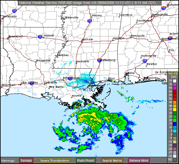
http://radar.weather.gov/radar.php?prod ... x&loop=yes
0 likes   

User avatar
HURAKAN
Professional-Met
Professional-Met
Posts: 46086
Age: 38
Joined: Thu May 20, 2004 4:34 pm
Location: Key West, FL
Contact:

#1482 Postby HURAKAN » Mon Aug 04, 2008 8:38 am

Image
0 likes   

User avatar
cycloneye
Admin
Admin
Posts: 145473
Age: 68
Joined: Thu Oct 10, 2002 10:54 am
Location: San Juan, Puerto Rico

Re: ATL: Tropical Storm Edouard - Gulf of Mexico

#1483 Postby cycloneye » Mon Aug 04, 2008 8:38 am

04/1145 UTC 28.3N 90.1W T2.5/2.5 EDOUARD -- Atlantic Ocean

http://www.ssd.noaa.gov/PS/TROP/positions.html

0 likes   

Ed Mahmoud

Re: ATL: Tropical Storm Edouard - Gulf of Mexico

#1484 Postby Ed Mahmoud » Mon Aug 04, 2008 8:39 am

Based on the official policy of my business' landlord, Walton Houston Galleria Financial Center, a hurricane warning for tomorrow would mean a free vacation day. So I'm hoping for a hurricane warning (without the verification, of course, I like my trees, lights and central air conditioning).


But unless something surprising happens, I don't see justification for that, and I am unofficially predicting I will be driving on the I-610 West Loop in showers/isolated squalls, on the way to my office, tomorrow morning near sunrise.
0 likes   

xironman
S2K Supporter
S2K Supporter
Posts: 2522
Joined: Sun Jun 10, 2007 4:53 pm
Location: NoVA

#1485 Postby xironman » Mon Aug 04, 2008 8:40 am

It is not going to go until it gets vertically stacked, if that happens in the next 6 hours then you will have a chance for a hurricane.
0 likes   

Derek Ortt

#1486 Postby Derek Ortt » Mon Aug 04, 2008 8:41 am

the convection is NOT that impressive this morning

looks like a UL dropped just west of the storm... chances of hurricane intensity are decreasing. However, this is a small storm; thus, it is subject to wild fluctuations in intensity
0 likes   

jabman98
Category 1
Category 1
Posts: 379
Joined: Fri Apr 25, 2003 12:15 pm
Location: Houston, TX

Re: ATL: Tropical Storm Edouard - Gulf of Mexico

#1487 Postby jabman98 » Mon Aug 04, 2008 8:43 am

So far just clear blue skies here in Houston. We got a bit of rain last night - not a whole lot - so there's dew on the grass for a change. Occasional whiff of a breeeze. You'd never guess there was anything brewing in the Gulf without following via TV, computer, whatever.
0 likes   

User avatar
KWT
Category 5
Category 5
Posts: 31415
Joined: Tue Aug 17, 2004 11:02 am
Location: UK!!!

#1488 Postby KWT » Mon Aug 04, 2008 8:44 am

Derek I guess thats the feature that has been causing the westerly shear over Ed this morning. Equally I don't think it looks that bad either to be honest but you are the pro not me!

T-numbers going suggesting that its getting better organised though right now the numbers do only support minimal TS.
0 likes   

Sanibel
Category 5
Category 5
Posts: 10375
Joined: Mon Aug 30, 2004 11:06 pm
Location: Offshore SW Florida

Re: ATL: Tropical Storm Edouard - Gulf of Mexico

#1489 Postby Sanibel » Mon Aug 04, 2008 8:46 am

The WV loop shows what looks to be a ULL diving to the SW right next to Eduoard. If this is a ULL it will position right next to Eduoard's SW and possibly be a rapid venter right next to the coast:


http://www.ssd.noaa.gov/goes/east/gmex/loop-wv.html


I see Derek also noticed that.
Last edited by Sanibel on Mon Aug 04, 2008 8:47 am, edited 1 time in total.
0 likes   

physicx07
Tropical Storm
Tropical Storm
Posts: 215
Joined: Wed May 28, 2008 7:46 am
Location: Miami

Re:

#1490 Postby physicx07 » Mon Aug 04, 2008 8:46 am

Yeah, these small systems do tend to confound in the gulf. What was that storm last year that went from nothing to minimal hurricane in like 18 hrs? It needs to stack up though first.

Derek Ortt wrote:the convection is NOT that impressive this morning

looks like a UL dropped just west of the storm... chances of hurricane intensity are decreasing. However, this is a small storm; thus, it is subject to wild fluctuations in intensity
0 likes   

Bailey1777
S2K Supporter
S2K Supporter
Posts: 962
Joined: Mon Jul 31, 2006 6:23 pm
Location: Houston, Texas

#1491 Postby Bailey1777 » Mon Aug 04, 2008 8:47 am

What is going on? The radar showing MLC? is heading North it looks like
0 likes   

User avatar
HURAKAN
Professional-Met
Professional-Met
Posts: 46086
Age: 38
Joined: Thu May 20, 2004 4:34 pm
Location: Key West, FL
Contact:

#1492 Postby HURAKAN » Mon Aug 04, 2008 8:50 am

Image
0 likes   

User avatar
Extremeweatherguy
Category 5
Category 5
Posts: 11095
Joined: Mon Oct 10, 2005 8:13 pm
Location: Florida

#1493 Postby Extremeweatherguy » Mon Aug 04, 2008 8:50 am

I think the radar loop northward motion could be an illusion. As precipitation wraps around the center to the north and as some old precipitation dies out to the centers west, it gives the system the appearance of heading more northward than it actually is. More likely than not, the center is still heading mostly W or WNW. But who knows? I could be wrong.
Last edited by Extremeweatherguy on Mon Aug 04, 2008 8:51 am, edited 1 time in total.
0 likes   

Smurfwicked
Tropical Storm
Tropical Storm
Posts: 164
Age: 40
Joined: Mon Sep 03, 2007 7:47 pm
Location: SETX

Re: Re:

#1494 Postby Smurfwicked » Mon Aug 04, 2008 8:50 am

physicx07 wrote:Yeah, these small systems do tend to confound in the gulf. What was that storm last year that went from nothing to minimal hurricane in like 18 hrs? It needs to stack up though first.

Derek Ortt wrote:the convection is NOT that impressive this morning

looks like a UL dropped just west of the storm... chances of hurricane intensity are decreasing. However, this is a small storm; thus, it is subject to wild fluctuations in intensity


That was Humberto pretty much the same general area just coming from a different direction.
0 likes   

physicx07
Tropical Storm
Tropical Storm
Posts: 215
Joined: Wed May 28, 2008 7:46 am
Location: Miami

Re: ATL: Tropical Storm Edouard - Gulf of Mexico

#1495 Postby physicx07 » Mon Aug 04, 2008 8:51 am

I notice the fix cited in cycloneye's post gives the position a big jog to the north, from 28.1 a little bit ago to 28.3 while longitude is the same. Is this a Dvorak fix or a met. reviewed location fix?
0 likes   

User avatar
KWT
Category 5
Category 5
Posts: 31415
Joined: Tue Aug 17, 2004 11:02 am
Location: UK!!!

#1496 Postby KWT » Mon Aug 04, 2008 8:52 am

Quite possibly Sanibel its what I thought earlier on as well when I saw that ULL it may help to fan out the system in the end.

Fizz your talking about Humberto, though Lorenzo did the same thing as well later that season.
0 likes   

Stormcenter
S2K Supporter
S2K Supporter
Posts: 6684
Joined: Wed Sep 03, 2003 11:27 am
Location: Houston, TX

Re:

#1497 Postby Stormcenter » Mon Aug 04, 2008 8:52 am

Extremeweatherguy wrote:I think the radar loop northward motion could be an illusion. As precipitation wraps around the center to the north and as some old precipitation dies out to the centers west, it gives the system the appearance of heading more northward than it actually is. More likely than not, the center is still heading mostly W or WNW. But who knows? I could be wrong.


I say it's started the wnw motion the NHC had projected. IMO.
0 likes   

Sanibel
Category 5
Category 5
Posts: 10375
Joined: Mon Aug 30, 2004 11:06 pm
Location: Offshore SW Florida

Re: ATL: Tropical Storm Edouard - Gulf of Mexico

#1498 Postby Sanibel » Mon Aug 04, 2008 8:52 am

I think the radar shows a better eye.
0 likes   

Dean4Storms
S2K Supporter
S2K Supporter
Posts: 6358
Age: 62
Joined: Sun Aug 31, 2003 1:01 pm
Location: Miramar Bch. FL

#1499 Postby Dean4Storms » Mon Aug 04, 2008 8:54 am

Just getting up this AM after a long night, looks like our LLC went completely exposed overnight as Derek pointed out yesterday the DMAX did not occur with Edouard, dry air I suspect.

Anyway, looking at this storm this morning it appears our storm is increasing its convective activity at the same time appears to be decoupled/sheared. Between the speed up in forward speed which decreases its time over water, the shear and disorganized look to Edouard I wouldn't expect much more than a Tropical Storm at landfall.
0 likes   

xironman
S2K Supporter
S2K Supporter
Posts: 2522
Joined: Sun Jun 10, 2007 4:53 pm
Location: NoVA

Re: ATL: Tropical Storm Edouard - Gulf of Mexico

#1500 Postby xironman » Mon Aug 04, 2008 8:54 am

The MLC seems disconnected and heading north on radar, they did not get together again, just like Humberto it is taking a long time to get stacked. But there is convection breaking out all over where I think the LLC is to the south http://wwwghcc.msfc.nasa.gov/cgi-bin/ge ... quality=90
0 likes   


Return to “2008”

Who is online

Users browsing this forum: No registered users and 1 guest