ATL: Tropical Depression Edouard

Moderator: S2k Moderators

Message
Author
User avatar
HouTXmetro
Category 5
Category 5
Posts: 3949
Joined: Sun Jun 13, 2004 6:00 pm
Location: District of Columbia, USA

Re: ATL: Tropical Storm Edouard - Gulf of Mexico

#1941 Postby HouTXmetro » Mon Aug 04, 2008 3:36 pm

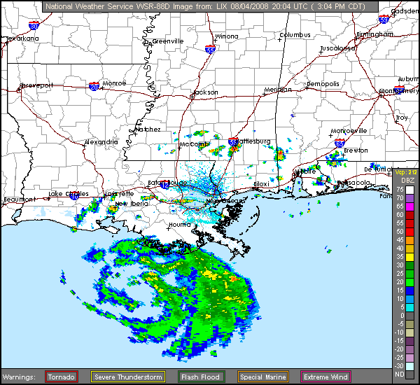
oyster_reef wrote:Looking at the recent IR it looks like he's losing his cold tops.
Sucking in dry air.


IMO he lost his cold tops early this morning.
0 likes   

User avatar
Evil Jeremy
S2K Supporter
S2K Supporter
Posts: 5463
Age: 32
Joined: Mon Apr 10, 2006 2:10 pm
Location: Los Angeles, CA

#1942 Postby Evil Jeremy » Mon Aug 04, 2008 3:38 pm

My guess: 45 MPH and 1001 MB at the new advisory
0 likes   

Sanibel
Category 5
Category 5
Posts: 10375
Joined: Mon Aug 30, 2004 11:06 pm
Location: Offshore SW Florida

Re: ATL: Tropical Storm Edouard - Gulf of Mexico

#1943 Postby Sanibel » Mon Aug 04, 2008 3:38 pm

If I went by looks alone I would say this is tightening up with muscular compact form and a thickening west side. Wouldn't be a wise gamble to be suggesting complacency at this point IMHO. Now we can return to people asserting I'm suggesting a category 5 blow-up.
Last edited by Sanibel on Mon Aug 04, 2008 3:39 pm, edited 2 times in total.
0 likes   

kurtpage
Tropical Storm
Tropical Storm
Posts: 228
Joined: Tue Sep 20, 2005 11:16 pm
Location: Texas

Re:

#1944 Postby kurtpage » Mon Aug 04, 2008 3:39 pm

Evil Jeremy wrote:My guess: 45 MPH and 1001 MB at the new advisory


I say 45 and 1000
0 likes   

Air Force Met
Military Met
Military Met
Posts: 4372
Age: 56
Joined: Tue Jul 08, 2003 9:30 am
Location: Roan Mountain, TN

Re: ATL: Tropical Storm Edouard - Gulf of Mexico

#1945 Postby Air Force Met » Mon Aug 04, 2008 3:39 pm

Shockwave wrote:4 o'clock is the next update right? If the satelittle does any justoce to what the update will be, what could we expect? 60-65 sustained winds?


No...don't expect much of a change....
0 likes   

jinftl
Category 5
Category 5
Posts: 4312
Joined: Tue Aug 31, 2004 4:47 pm
Location: fort lauderdale, fl

Re: Re:

#1946 Postby jinftl » Mon Aug 04, 2008 3:40 pm

agree....probably drop some of the tropical storm warnings as well for LA

kurtpage wrote:
Evil Jeremy wrote:My guess: 45 MPH and 1001 MB at the new advisory


I say 45 and 1000
0 likes   

Ed Mahmoud

Re: Re:

#1947 Postby Ed Mahmoud » Mon Aug 04, 2008 3:40 pm

bayoubebe wrote:
Frank2 wrote:It seems we have posters here who want to see Ed explode, and, others here who are trying to make some sense of the situation as per Ed's slow growth - please give us a chance to share our knowledge with you, since it'll help to stem any rumors...

Ed looks well-organized on satellite, but, as Derek mentioned, nothing yet per recon that is any higher than mentioned in the last NHC advisory...

It's close proximity to land is helping to slow it's development, but, we'll see what happens...


When you say " give us a chance to share "OUR" knowledge here," I"m curious, are you a pro met?
I don't post much, I do read here, most especially when there is a tropical storm out there. I tend to take the pro mets posts the most serious. I like coming here for information about the tropical conditions.
If you don't mind, can you clarify the OUR in your above post, and if you have some sort of profession in the weather field.

Thank you.
Thank you to all the pros out there providing information.


Frank2 worked at NHC for a while. August TDs in Houston are usually mid 70sF, and can run closer to 80. But the issue is dry air at mid levels.

Special 18Z sounding from LCH does look a little less dry in the mid levels than 12Z sounding...

Image
0 likes   

Shockwave
Tropical Storm
Tropical Storm
Posts: 167
Joined: Fri Jul 25, 2008 7:33 am
Location: Lafayette, TN
Contact:

Re: ATL: Tropical Storm Edouard - Gulf of Mexico

#1948 Postby Shockwave » Mon Aug 04, 2008 3:41 pm

Air Force Met wrote:
Shockwave wrote:4 o'clock is the next update right? If the satelittle does any justoce to what the update will be, what could we expect? 60-65 sustained winds?


No...don't expect much of a change....


Ok, thanks. But boy does it sure does look threatning...
0 likes   

User avatar
hurricanetrack
HurricaneTrack.com
HurricaneTrack.com
Posts: 1781
Joined: Tue Dec 02, 2003 10:46 pm
Location: Wilmington, NC
Contact:

#1949 Postby hurricanetrack » Mon Aug 04, 2008 3:42 pm

For those who might have enough knowledge of such things, I am curious as to why the GFDL and the HWRF differ so greatly on intensity? How could two models of the modern era be so different? It's not a ghastly difference but the GFDL shows ~990mb and the HWRF shows 1003mb near landfall. Why? I guess if we knew that exactly then we could fix which one is broke...but anyhow, I am curious and I think other people probably are too.
0 likes   

User avatar
KWT
Category 5
Category 5
Posts: 31415
Joined: Tue Aug 17, 2004 11:02 am
Location: UK!!!

#1950 Postby KWT » Mon Aug 04, 2008 3:43 pm

Indeed I think the only change we will see in the next advisory will be the pressure slightly down.

as others have said the mid level dry air is doing a number on this systems chances of strengthening.
0 likes   

Sanibel
Category 5
Category 5
Posts: 10375
Joined: Mon Aug 30, 2004 11:06 pm
Location: Offshore SW Florida

Re: ATL: Tropical Storm Edouard - Gulf of Mexico

#1951 Postby Sanibel » Mon Aug 04, 2008 3:43 pm

GFDL is notoriously aggressive on intensity and is said to measure windspeed higher from the surface than other models.
0 likes   

User avatar
terrapintransit
Category 1
Category 1
Posts: 275
Age: 50
Joined: Tue Sep 04, 2007 8:08 pm
Location: Williamsport, Pa

Re: ATL: Tropical Storm Edouard - Gulf of Mexico

#1952 Postby terrapintransit » Mon Aug 04, 2008 3:44 pm

I agree shockwave. It does appear more threatning now. It's developing more of a tighter wrap. Maybe it's just our newbie eyes playing tricks on us.
0 likes   

Shockwave
Tropical Storm
Tropical Storm
Posts: 167
Joined: Fri Jul 25, 2008 7:33 am
Location: Lafayette, TN
Contact:

Re:

#1953 Postby Shockwave » Mon Aug 04, 2008 3:45 pm

hurricanetrack wrote:For those who might have enough knowledge of such things, I am curious as to why the GFDL and the HWRF differ so greatly on intensity? How could two models of the modern era be so different? It's not a ghastly difference but the GFDL shows ~990mb and the HWRF shows 1003mb near landfall. Why? I guess if we knew that exactly then we could fix which one is broke...but anyhow, I am curious and I think other people probably are too.


I'm not pro by any means, but in the past I've heard of reasons for a big difference is models, is due to the uncertainity of the projected path and strength of a event or tropical wave.
0 likes   

Shockwave
Tropical Storm
Tropical Storm
Posts: 167
Joined: Fri Jul 25, 2008 7:33 am
Location: Lafayette, TN
Contact:

Re: ATL: Tropical Storm Edouard - Gulf of Mexico

#1954 Postby Shockwave » Mon Aug 04, 2008 3:47 pm

terrapintransit wrote:I agree shockwave. It does appear more threatning now. It's developing more of a tighter wrap. Maybe it's just our newbie eyes playing tricks on us.


I guess so, but like any weather system, you've got to have ALL of the dynamics and points working together and if one thing is out of whack...it's a no go.
0 likes   

User avatar
HURAKAN
Professional-Met
Professional-Met
Posts: 46086
Age: 38
Joined: Thu May 20, 2004 4:34 pm
Location: Key West, FL
Contact:

#1955 Postby HURAKAN » Mon Aug 04, 2008 3:47 pm

Image
0 likes   

User avatar
Evil Jeremy
S2K Supporter
S2K Supporter
Posts: 5463
Age: 32
Joined: Mon Apr 10, 2006 2:10 pm
Location: Los Angeles, CA

#1956 Postby Evil Jeremy » Mon Aug 04, 2008 3:48 pm

Advisory should be arriving any moment now. This is probably one of the most anticipated advisories yet from this storm because of all of the intensity confusion.
0 likes   

Stormcenter
S2K Supporter
S2K Supporter
Posts: 6684
Joined: Wed Sep 03, 2003 11:27 am
Location: Houston, TX

Re: ATL: Tropical Storm Edouard - Gulf of Mexico

#1957 Postby Stormcenter » Mon Aug 04, 2008 3:48 pm

Sanibel wrote:GFDL is notoriously aggressive on intensity and is said to measure windspeed higher from the surface than other models.


This is true most the part except for Katrina. The GFDL was unfortunately dead on with that one from the get go.
0 likes   

RL3AO
Moderator-Pro Met
Moderator-Pro Met
Posts: 16308
Joined: Thu Jun 14, 2007 10:03 pm
Location: NC

#1958 Postby RL3AO » Mon Aug 04, 2008 3:50 pm

999.9 mb extrapolated from recon.
0 likes   

CrazyC83
Professional-Met
Professional-Met
Posts: 34002
Joined: Tue Mar 07, 2006 11:57 pm
Location: Deep South, for the first time!

#1959 Postby CrazyC83 » Mon Aug 04, 2008 3:50 pm

Probably 40 kt/1000mb.
0 likes   

User avatar
WmE
Category 2
Category 2
Posts: 696
Age: 36
Joined: Sat Jun 17, 2006 11:23 am
Location: Vienna, Austria

Re:

#1960 Postby WmE » Mon Aug 04, 2008 3:50 pm

RL3AO wrote:999.9 mb extrapolated from recon.


Looks to be down to 1000mbar. Still slow intensification.

edit: if any.
0 likes   


Return to “2008”

Who is online

Users browsing this forum: No registered users and 8 guests