
Stormcenter wrote:HouTXmetro wrote:http://www.wunderground.com/radar/radblast.asp?zoommode=out&num=6&delay=15&scale=0.750&noclutter=0&ID=LCH&type=N0R&lat=0&lon=0&label=you&showstorms=0&map.x=435&map.y=365.5¢erx=325¢ery=163&lightning=0&smooth0&showlabels=1&rainsnow=0
This Loop out of Lake Charles is much better to me.
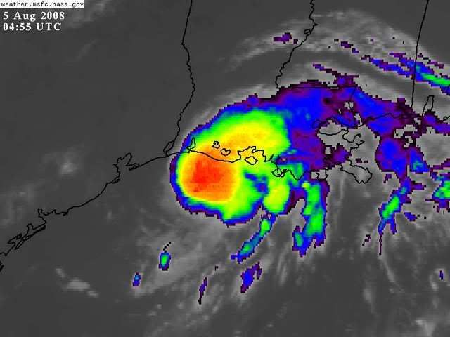
Looks wnw toward TX/LA border but hey it may just be that "radar illusion"
I've been reading about today.
Are you sure you're looking at the center? It seems to me you're looking at a dry slot that's NORTH of the actual center.


