kpost wrote:The environment doesn't look very favorable to the north.
Does that mean complete poof or stay south?
Poof is likely. This poor system had its opportunities but never had a nice break.


Look at the current shear above 30ºN.
Moderator: S2k Moderators


kpost wrote:The environment doesn't look very favorable to the north.
Does that mean complete poof or stay south?


kpost wrote:http://euler.atmos.colostate.edu/~vigh/guidance/northatlantic/track_early5.png
if that was the position at 0000UTC then this wave has been well south of the southernmost model line even the XTRP. I have been going on the lat/lon that i have seen on here mostly and eyeballing it. What is wrong here and what is right? I am getting very confused.
I also found this if this is what some models are running why is it not an invest
http://euler.atmos.colostate.edu/~vigh/guidance/northatlantic/intensity_early5.png
Honeyko wrote:Rita analog looking better and better....


Honeyko wrote:http://www.ghcc.msfc.nasa.gov/GOES/goeseastconus.html
The center has been going due west the last few hours.
Rita analog looking better and better....
cpdaman wrote:we seem to be piling the crow higher for each side here
i think the increasing shear east of florida will be the key, should the direction of the shear be ENE or so , i think it will be of minimal influence, should the angle stay N or NNE then the relatiive shear should prohibit anything.
What direction will the shear turn? from the trough over the eastern Conus at latitudes appox 23-25 because if you notice, it appears to be turning back more west/wnw as it approached 69w


kpost wrote:Honeyko wrote:Really starting to turn now, and....boom! There they go.
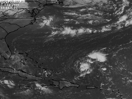
image or link please
Honeyko wrote:Really starting to turn now, and....boom! There they go.
Users browsing this forum: No registered users and 39 guests


