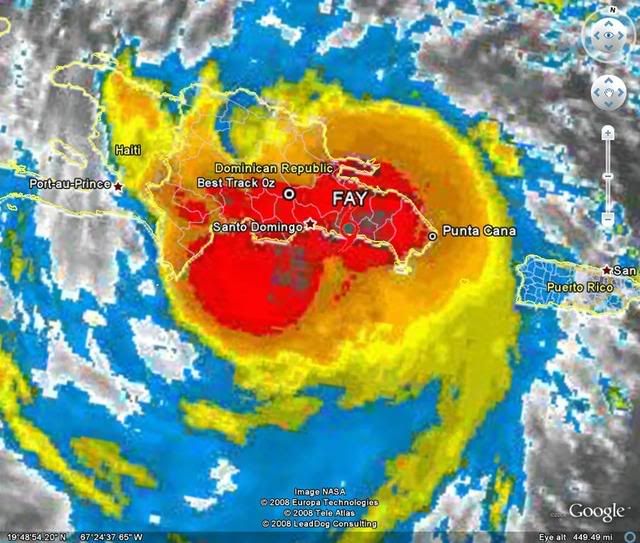
southmdwatcher wrote:Fay is just about to meet the mountains of Hispaniola. Head on, by the look of it.
If the LLC dissipates, it's likely to reform near the stronger convection. I don't believe that the mountains will contain Fay.
Moderator: S2k Moderators


AtlanticWind wrote:Could be seeing things but it looks like Fay could be getting tugged a .little north maybe due to land interaction.


LSU2001 wrote:Ok stupid question here but with the very strong convection building west of Hisp. over the open water is it possible that we could see a center relocation?? I thought I had read somewhere that fairly weak systems sometimes relocate the center due to land interaction.
Tim


Aric Dunn wrote:ok well everyone get some sleep tonight as there is nothing to watch radar is to far away
and dont even try to say its moving one way or the other while the center is being disrupted by 10,000ft mountains
a general wnw motion of the "cloud mass".( there wil be no way to effectively track any center not even with obs as there is to many mountain and satellite will not work either since oragraphic lifting will screw with your eyes pretty bad) is in store tonight and depending on how much survives will determine how fast it regernates.. my advise is get some sleep cause its going to be a very busy next few days if enough survives..
later
oh and LLC do not go over mountains ... they go bye bye.. death to LLC new one will have to reform once over water...

HURAKAN wrote:southmdwatcher wrote:Fay is just about to meet the mountains of Hispaniola. Head on, by the look of it.
If the LLC dissipates, it's likely to reform near the stronger convection. I don't believe that the mountains will contain Fay.
RL3AO wrote:Anyone else worried about Fays LLC redeveloping off the southern coast?
Also, the NHC will have to forecast a cane at 11 because of the GFDL/HWRF.
RL3AO wrote:Anyone else worried about Fays LLC redeveloping off the southern coast?
Also, the NHC will have to forecast a cane at 11 because of the GFDL/HWRF.
CYCLONE MIKE wrote:What is supposed to cause a weakness in the ridge that is forecast to turn Fay nnw or n in 3 days or so? Chances of it actually happening? Could the models continue to shift more to the west as they shifted more east over the last couple of days before it was classified?


RL3AO wrote:Anyone else worried about Fays LLC redeveloping off the southern coast?
Also, the NHC will have to forecast a cane at 11 because of the GFDL/HWRF.
Users browsing this forum: Google [Bot] and 28 guests