ATL GUSTAV: Tropical Depression - Discussion
Moderator: S2k Moderators

Re: ATL: Invest 94L in East Atlantic
notice the dry air to its W/NW in that pic.....just one of the reasons it cant maintain convection.
0 likes


Re: ATL: Invest 94L in East Atlantic
This might be like 92L which formed into Fay. A good looking tropical wave for a long time before developing.
0 likes
-
cheezyWXguy

- Category 5

- Posts: 6281
- Joined: Mon Feb 13, 2006 12:29 am
- Location: Dallas, TX
Re: ATL: Invest 94L in East Atlantic
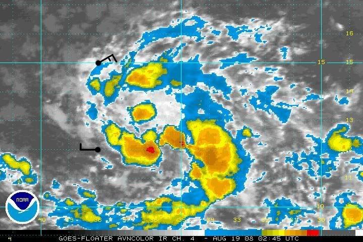
It most certainly continues to organize convection. Now a burst directly over the center, with another small one developing on the nw side of it. In addition, convection further away from the center continues to form, and reds are now appearing. Dont be so sure that this thing wont develop. It may be slightly later than I thought, but well just have to see what the dmax brings.
0 likes

-
HURAKAN

- Professional-Met

- Posts: 46084
- Age: 39
- Joined: Thu May 20, 2004 4:34 pm
- Location: Key West, FL
- Contact:
Loop: http://rammb.cira.colostate.edu/ramsdis ... _floater_2
Continues to organize. The pessimism I have been reading and the comparisons to the previous 94L or 92L seem to be unfounded at the moment. It's the middle of August and development is possible. I still think that we must wait at least 24 hours before saying poof or TD 7. Furthermore, what is the hurry?
Continues to organize. The pessimism I have been reading and the comparisons to the previous 94L or 92L seem to be unfounded at the moment. It's the middle of August and development is possible. I still think that we must wait at least 24 hours before saying poof or TD 7. Furthermore, what is the hurry?
0 likes
Re:
HURAKAN wrote:Loop: http://rammb.cira.colostate.edu/ramsdis ... _floater_2
Continues to organize. The pessimism I have been reading and the comparisons to the previous 94L or 92L seem to be unfounded at the moment. It's the middle of August and development is possible. I still think that we must wait at least 24 hours before saying poof or TD 7. Furthermore, what is the hurry?
No hurry here Hurakan..
0 likes

-
Matt-hurricanewatcher
Re: ATL: Invest 94L in East Atlantic
Looks good and has a closed LLC. Who here believes that if it was in the gulf that the nhc would be writing advisories on it? Thank you.
0 likes
-
ConvergenceZone
.gif)
- Category 5
- Posts: 5241
- Joined: Fri Jul 29, 2005 1:40 am
- Location: Northern California
Re: ATL: Invest 94L in East Atlantic
It is kinda funny that the naysayers are writing this one off so quickly....
0 likes
-
cycloneye

- Admin

- Posts: 149276
- Age: 69
- Joined: Thu Oct 10, 2002 10:54 am
- Location: San Juan, Puerto Rico
Re: ATL: Invest 94L in East Atlantic
This pass was made around 5:00 PM EDT.It shows the circulation elongated but closed.

0 likes

-
cycloneye
- Admin
- Posts: 149276
- Age: 69
- Joined: Thu Oct 10, 2002 10:54 am
- Location: San Juan, Puerto Rico
Re:
RL3AO wrote:
The southern buoy had a northeast wind at 9kt six hours ago, how has a west wind.
The northern buoy has a pressure of 1012 mb up from 1010 mb earlier. Probably diurnal related?
That bouy has wind changing directions all day long.Tonight mostly WSW and West Winds are there.
http://www.ndbc.noaa.gov/station_page.php?station=41026
0 likes


-
cycloneye
- Admin
- Posts: 149276
- Age: 69
- Joined: Thu Oct 10, 2002 10:54 am
- Location: San Juan, Puerto Rico
Re: ATL: Invest 94L in East Atlantic
A Flareup going on.Now its eclipse time.Lets see after its over how it looks.

0 likes

-
cheezyWXguy
- Category 5
- Posts: 6281
- Joined: Mon Feb 13, 2006 12:29 am
- Location: Dallas, TX
Re:
Cyclenall wrote:It's making a decent comeback early this morning. The rate in which convection just flared over this system suggests that this one is serious business. I would not be shocked to see a TD within the next 18-24 hours.
If the center is in the red, then i expect td tomorrow morning at 11...but, more likely 5 or 11pm tomorrow
0 likes

Re: ATL: Invest 94L in East Atlantic
I'm so involved with Fay which is directly affecting me. Whats the synoptic set up with 94L,will it make it across?
0 likes
-
cheezyWXguy
- Category 5
- Posts: 6281
- Joined: Mon Feb 13, 2006 12:29 am
- Location: Dallas, TX
Re: ATL: Invest 94L in East Atlantic
boca wrote:I'm so involved with Fay which is directly affecting me. Whats the synoptic set up with 94L,will it make it across?
models point 94 to eastern fla, and are near the ne antilles or ne of there in about 5 days. Ridge appears to be strong enough to push this west.
0 likes
-
Ivanhater

- Storm2k Moderator

- Posts: 11221
- Age: 39
- Joined: Fri Jul 01, 2005 8:25 am
- Location: Pensacola
Re: ATL: Invest 94L in East Atlantic
I still don't expect much from this one..not much model support, fairly stable atmosphere. and some shear in its path
0 likes
Who is online
Users browsing this forum: No registered users and 88 guests