ATL HANNA: Extratropical - Discussion
Moderator: S2k Moderators

Re: ATL: Tropical Storm Hanna in Western Atlantic
I wonder if that SW motion takes shape will it move than S , SE than E or move more west after it went SW. Does that make sense.
0 likes
Re: ATL: Tropical Storm Hanna in Western Atlantic
If a ridge pattern is forecast to remain in place, it would probably be some type of west or northwest motion, depending on the strength and orientation of the ridge.....if the ridge holds of course for that long of time.
One thing I know for sure...no one in florida likes to see a storm that is east of us by less than 600 miles begin a sw movement....which would be the case if the forecast holds
One thing I know for sure...no one in florida likes to see a storm that is east of us by less than 600 miles begin a sw movement....which would be the case if the forecast holds
boca wrote:I wonder if that SW motion takes shape will it move than S , SE than E or move more west after it went SW. Does that make sense.
0 likes
-
Bocadude85

- Category 5

- Posts: 2991
- Age: 39
- Joined: Mon Apr 18, 2005 2:20 pm
- Location: Honolulu,Hi
Re: ATL: Tropical Storm Hanna in Western Atlantic
boca wrote:I wonder if that SW motion takes shape will it move than S , SE than E or move more west after it went SW. Does that make sense.
I would tend to think she would have to move to the West with such a strong high in place
Last edited by Bocadude85 on Thu Aug 28, 2008 10:19 pm, edited 1 time in total.
0 likes
Re: ATL: Tropical Storm Hanna in Western Atlantic
i'm a bit skeptical of a strong high being in place for the next week............3-4 days sure.....but this year.........now if we were talkling about last year i would be very scared...right now just concerned...crossing fingers she will turn north than out to sea at the end of her loop ( i mean one would think there would be a trough in the next 7-8 days) right?
very nice o town very nice
very nice o town very nice
Last edited by cpdaman on Thu Aug 28, 2008 10:22 pm, edited 1 time in total.
0 likes
Re: ATL: Tropical Storm Hanna in Western Atlantic
The real question is how long the ridge is in place before the turn up the caost. Will it be at the Florida coastline, the western Bahamas , or NE of the Bahamas.
0 likes
-
meteorologyman
- Category 2

- Posts: 541
- Joined: Wed Mar 15, 2006 6:48 pm
- Location: Florida, Kissimmee/St.CLoud
Re: ATL: Tropical Storm Hanna in Western Atlantic
She's still continuing to explode, that's not a good sign.
I'm afraid to see what I wake up to tomorrow.
I'm afraid to see what I wake up to tomorrow.
0 likes
-
Bocadude85
- Category 5
- Posts: 2991
- Age: 39
- Joined: Mon Apr 18, 2005 2:20 pm
- Location: Honolulu,Hi
Re: ATL: Tropical Storm Hanna in Western Atlantic
cpdaman wrote:i'm a bit skeptical of a strong high being in place for the next week............3-4 days sure.....but this year.........now if we were talkling about last year i would be very scared...right now just concerned.
that strong high has not built in yet.. isnt forcast to build in until next week.. by that time Hanna should be NE of the Bahamas..
0 likes
-
LAwxrgal

- S2K Supporter

- Posts: 1763
- Joined: Tue Jul 06, 2004 1:05 pm
- Location: Reserve, LA (30 mi west of NOLA)
Re: ATL: Tropical Storm Hanna in Western Atlantic
Is it my imagination, or is Hanna just plowing that ULL out of the way?
0 likes

Re: ATL: Tropical Storm Hanna in Western Atlantic
cpdaman wrote:i'm a bit skeptical of a strong high being in place for the next week............3-4 days sure.....but this year.........now if we were talkling about last year i would be very scared...right now just concerned...crossing fingers she will turn north than out to sea at the end of her loop ( i mean one would think there would be a trough in the next 7-8 days) right?
very nice o town very nice
are there models that forecast this to go out to sea in the long term
0 likes
Re: ATL: Tropical Storm Hanna in Western Atlantic
LAwxrgal wrote:Is it my imagination, or is Hanna just plowing that ULL out of the way?
almost looks like it
but remember ULL's are fickle , should this one stop moving again, while hanna keeps moving WNW then she will become more sheared again, i don't think hanna is out of the woods shear wise, but it appears she will at least survive (when that appeared more questionable earlier today)
0 likes
-
Stormcenter
- S2K Supporter
- Posts: 6689
- Joined: Wed Sep 03, 2003 11:27 am
- Location: Houston, TX
I don't care what the European model (What do they know about American weather?:) is saying I don't like Hannah's odds of making it into the GOM at all.
http://www.wunderground.com/tropical/tr ... ml#a_topad
http://www.wunderground.com/tropical/tr ... ml#a_topad
0 likes
-
cheezyWXguy

- Category 5
- Posts: 6282
- Joined: Mon Feb 13, 2006 12:29 am
- Location: Dallas, TX
Re:
Stormcenter wrote:I don't care what the European model (What do they know about American weather?:) is saying I don't like Hannah's odds of making it into the GOM at all.
http://www.wunderground.com/tropical/tr ... ml#a_topad
As much as I support your worries at a gom threat, I dont think that was the best link to support your claim. There is only one hurricane that goes into the GOM from this point and its Andrew. Nonetheless its a scenario that must be considered, especially with a southward turn at the end of the forecast.
0 likes
-
Chigger_Lopez
- Tropical Depression

- Posts: 72
- Joined: Thu Sep 11, 2003 10:11 pm
- Location: Jupiter, FL
Re:
gatorcane wrote:this is some of the most impressive DEEP convection I have seen in the Atlantic basin in quite sometime
The thought keeps crossing my mind that maybe Hanna will be the more powerful of the duo --- hmmm

Sorry, I am catching up on posts. Gator I think it will be much Larger than Gustav in total size and may just affect a much larger area. Just compare Hannah to FLorida and realize that if it develops into a strong hurricane it will most likely grow even larger in total size. Scary if it ends up being strong to boot.
0 likes
Re: Re:
I would be interested to know what are other historical tracks for storms in a similar location for months other than august (which the wunderground link shows)....esp september tracks....may give us more data to look at, esp. tracks with a sw dip east of the bahamas
cheezyWXguy wrote:Stormcenter wrote:I don't care what the European model (What do they know about American weather?:) is saying I don't like Hannah's odds of making it into the GOM at all.
http://www.wunderground.com/tropical/tr ... ml#a_topad
As much as I support your worries at a gom threat, I dont think that was the best link to support your claim. There is only one hurricane that goes into the GOM from this point and its Andrew. Nonetheless its a scenario that must be considered, especially with a southward turn at the end of the forecast.
0 likes
-
AJC3

- Admin

- Posts: 4153
- Age: 62
- Joined: Tue Aug 31, 2004 7:04 pm
- Location: Ballston Spa, New York
- Contact:
Re: Re:
jinftl wrote:I would be interested to know what are other historical tracks for storms in a similar location for months other than august (which the wunderground link shows)....esp september tracks....may give us more data to look at, esp. tracks with a sw dip east of the bahamas.
The analogy many folks have been using is Betsy (27 AUG - 13 SEP 1965)

Someone posted the H50 pattern for Betsy on another board, and there were some similarities.
0 likes
-
eastcoastFL

- Category 5
- Posts: 3996
- Age: 44
- Joined: Thu Apr 12, 2007 12:29 pm
- Location: Palm City, FL
Re: ATL: Tropical Storm Hanna in Western Atlantic
i dont know why but Hanna gives me a bad feeling
0 likes
Re: ATL: Tropical Storm Hanna in Western Atlantic
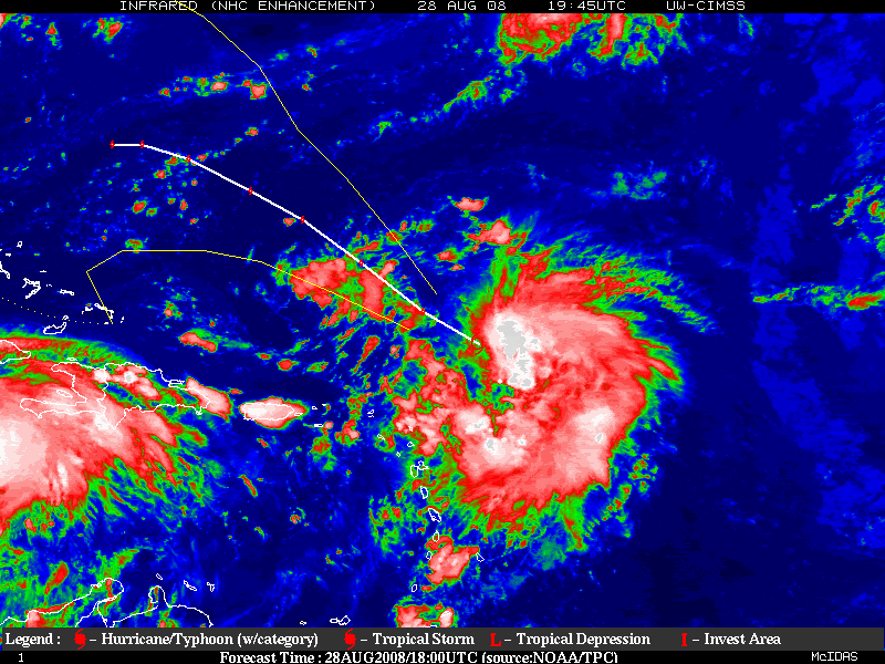
deep black infared blob sustained to the SE of the LLC
wondering what is going on at 20/59 , this deep convection doesn't appear sheared yet is concentrated SE , as well as well south (near 17N/60W) llic is 21/60.5
http://www.ssd.noaa.gov/goes/flt/t2/loop-avn.html
guess it is due to the good divergence to the SE of the center
http://cimss.ssec.wisc.edu/tropic/real- ... g8dvg.html
Last edited by cpdaman on Fri Aug 29, 2008 12:03 am, edited 1 time in total.
0 likes
-
eastcoastFL
- Category 5
- Posts: 3996
- Age: 44
- Joined: Thu Apr 12, 2007 12:29 pm
- Location: Palm City, FL
Who is online
Users browsing this forum: No registered users and 56 guests