LowndesCoFire wrote:
Hurricane Kate 1985
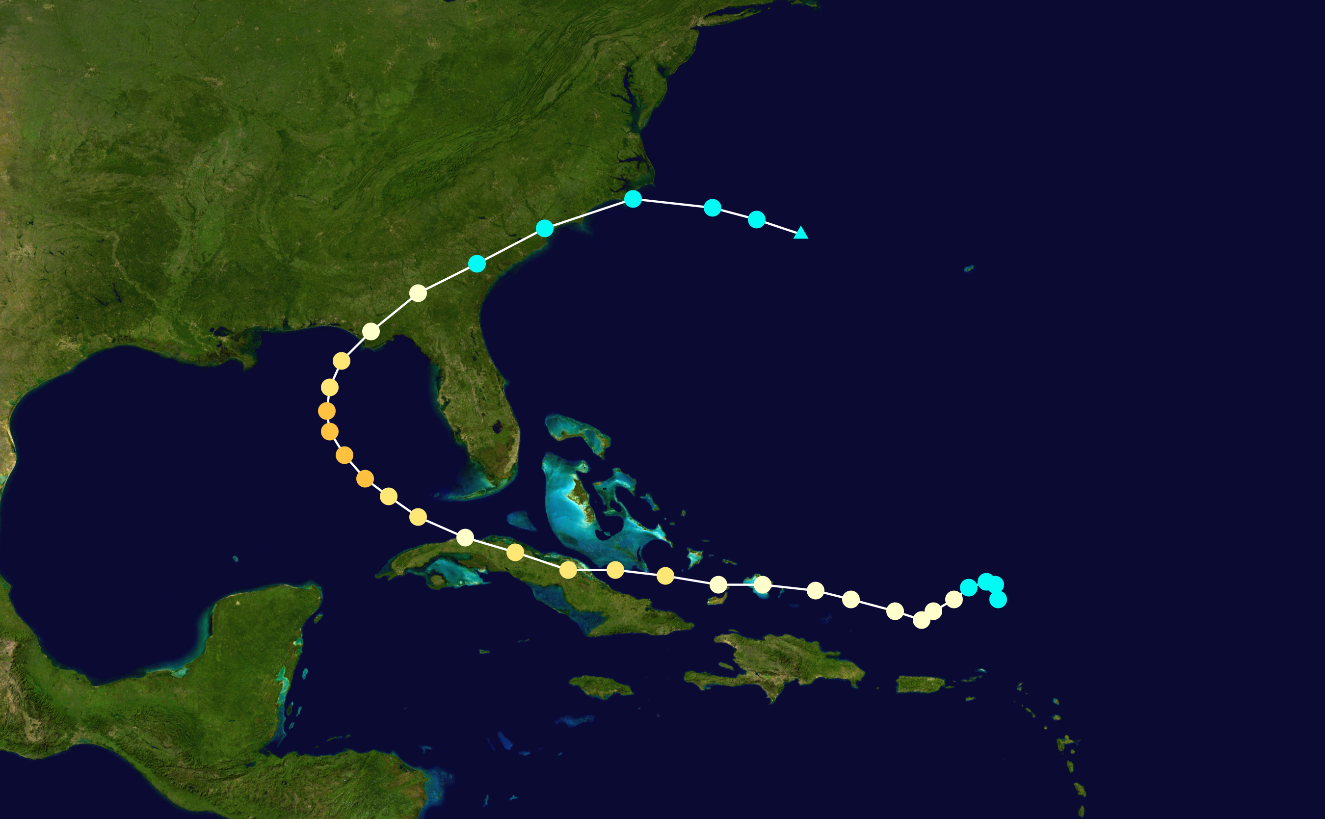
November, at that!
Moderator: S2k Moderators


But I'm a degreed met who specializes in polarimetric radar . . . does that mean I have to stick to radar boards?zeusman wrote:Ed Mahmoud wrote:Seems reasonable. And Derek isn't just a degreed met, he is a degreed met who specializes in tropical cyclones...
That beats me.. I am a degreed met who specializes in meso scale snowfall paterns in mountainous terrain.... Perhaps I should stick to the Avalanche boards


gatorcane wrote:Found it...
00 UTC GFS run will start here:
http://www.nco.ncep.noaa.gov/pmb/nwprod ... /fpc.shtml

Blown_away wrote:gatorcane wrote:Found it...
00 UTC GFS run will start here:
http://www.nco.ncep.noaa.gov/pmb/nwprod ... /fpc.shtml
If these runs are further S and W I'm very comfortable a SFL EC mainland landfall is very low.

Looks like it's starting to roll in . . . I like how its WSW motion through 12 hours is not as dramatic as in the 18Z run, and closer to what's really happening. Perhaps a fresh round of radiosonde and recon data is helping?gatorcane wrote:Found it...
00 UTC GFS run will start here:
http://www.nco.ncep.noaa.gov/pmb/nwprod ... /fpc.shtml
thetruesms wrote:Looks like it's starting to roll in . . . I like how its WSW motion through 12 hours is not as dramatic as in the 18Z run, and closer to what's really happening. Perhaps a fresh round of radiosonde and recon data is helping?gatorcane wrote:Found it...
00 UTC GFS run will start here:
http://www.nco.ncep.noaa.gov/pmb/nwprod ... /fpc.shtml


gatorcane wrote:thetruesms wrote:Looks like it's starting to roll in . . . I like how its WSW motion through 12 hours is not as dramatic as in the 18Z run, and closer to what's really happening. Perhaps a fresh round of radiosonde and recon data is helping?gatorcane wrote:Found it...
00 UTC GFS run will start here:
http://www.nco.ncep.noaa.gov/pmb/nwprod ... /fpc.shtml
looks similar to the 12Z run so far out to 30 hours...WSW towards Cuba...so far.
gatorcane wrote:GFS 00 UTC => IKE makes landfall in eastern Cuba at 54 hours.
This ridge is amazing....
The SE Florida threat continues to diminish....
gatorcane wrote:GFS 00 UTC => IKE makes landfall in eastern Cuba at 54 hours.
This ridge is amazing....
The SE Florida threat continues to diminish....
Let's see if it hits the Yucatan on this run.


Users browsing this forum: No registered users and 6 guests


