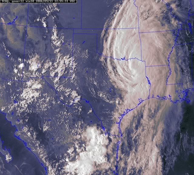
I'm looking through the archives, and this seems very similar to another storm in 1941, with the inland threat that the NHC probably will not be bold enough to forecast:
http://www.crh.noaa.gov/dtx/stories/dtxcane.phpThe Astonishing Storm of September 25th, 1941 Earlier, I mentioned "one storm that screams for attention", but maybe "howls" would be more appropriate. Before researching this project, I expected to find the above case scenarios, but not the following...
A tropical storm formed in mid September over the eastern Gulf of Mexico (off the coast of Florida) on September 17th, 1941. It pushed west across the Gulf, stopping only to make a loop in its track, well south of New Orleans. By this time it was a hurricane, intensifying briefly to a category #3 storm (111-130 mph wind) offshore as it took aim on eastern Texas.
The hurricane made landfall on the 23rd near Freeport, Texas with an estimated wind of 110 mph, extremely high tides of nearly 11 feet and a barometer reading of 28.31 inches (959 MB). Further to the northeast, a ship just offshore of Texas City recorded a lowest pressure of 28.66 inches and winds of 83 mph. Other wind gusts were estimated near 100 mph at several locations near the hurricane's center along the Texas Gulf Coast. The hurricane quickly weakened to a category #1 (74-95 mph) as it made landfall and by the time the storm pushed on north to Houston, wind gusts had already dropped to 75 mph. Four lives were lost from the storm in Texas and property damage was estimated at $6.5 million (1941 dollars).
The storm continued to roar on its northward path through Texas and by 7 am on the 24th, it was located near the city of Tyler, over extreme northeast Texas. From this point on, the storm's last 36 hours or so really grabs ones interest for peculiarity as it tracked through the Mississippi Valley and on into the Great Lakes. From 7AM on the 24th to 7am the 25th, the storm shot northeast from Tyler to near Battle Creek, Michigan, covering close to 1000 miles in 24 hours! Thus, the forward movement of the remnants of the hurricane averaged 40 to 45 mph as it approached Southern Lower Michigan. As the storm tracked into the Great Lakes, it
merged with a fairly strong cold front that pushed across the upper Midwest into the Lakes. The combination of the strong push of cool fall air, strong upper level dynamics and the remnants of the hurricane created quite a storm (not unlike the more common intense late fall cyclones that are seen in the Great Lakes). In addition, the track and speed of our "hurricane" brings to mind that of the "Panhandle Low" type of low pressure system in the winter (more information). While the speed of the system was fairly quick, it's not uncommon for hurricanes to accelerate northeast as they become extratropical and get "picked up" by the mid-latitude upper winds or jet stream. Yet, what was really unusual and noteworthy was the surface wind that accompanied the storm as it moved through the Great Lakes. By the time hurricanes make it this far north, they usually have blown themselves out, at least to the extent that surface winds are only gusting to, at best, 30 or 40 mph. Note the following, taken from the Detroit weather records on September 25th, 1941:
Windstorm: An intense tropical cyclone moving up from the Gulf thru eastern Texas (causing great damage in Texas), along the Missip. Valley and thence Newd across Ill & Mich, passing W & NW of Detroit with gale force winds and gusts to 65 mph from 10:18 AM - 2:30 PM & gusts to 75 mph 12:30 PM - 2:00 PM (see envelope back of book for newspaper clippings).
Most of the above noted news clippings show widespread wind damage to trees and power lines that would be commonplace in severe thunderstorms or a derecho. A derecho is a widespread windstorm consisting of a complex of thunderstorms that develop into a long-lived squall line. But there also were some unusual or freakish happenings (as the Detroit Free Press deemed them) as well. The following is taken September 26th, 1941, the day after, from the Detroit Free Press about the storm:
"River goes dry"
There were many freakish effects of the wind, including baring of the Detroit River "middle grounds" off Belle Isle when water was backed into Lake St. Clair. The southwest gale literally blew the water out of The Detroit River, reducing its level by three feet, and leaving hundreds of pleasure craft high and dry on the muddy bottom. Several yachts broke their mooring or were heeled over at the Detroit Yacht Club. Another odd effect was the noticeable swaying of Downtown skyscrapers as the full force of the gale struck. Office employees who left tall downtown skyscrapers, were later reassured by engineers.
The Free Press goes on to say that "shortly after noon,
the wind blew steadily at 56 miles an hour, but a times gusts reached hurricane velocity of 75 miles an hour." Dozens of people were injured by falling glass from windows blown out or debris tossed by the wind. One woman was literally blown into a fire hydrant, suffering a possible skull fracture. Other reports of scattered damage to homes and businesses across the region were mentioned in the article. In addition, the fierce wind churned up giant waves on the Lakes, including Lake Huron into the St. Clair River where two barges were blown ashore from of the shipping channel, even after dropping their heaviest anchors. In Southeast Lower Michigan, Storm Warnings were posted on Lakes Huron, Erie and St Clair at 10:30, the morning of the 25th. Downed telephone lines caused a disruption of service and communication across the Great Lakes and elsewhere. The "dying" hurricane left a trail of damage from Texas clear up into the Great Lakes and Canada. The wind of the storm was equated to an intense fall low pressure system that hit the area on November 29th, 1919 in which the wind blew 67 mph in Detroit and to the "Black Friday" storm in November of 1913.
The fact that the hurricane, after weakening and becoming extratropical, traveled over a thousand miles and still was able to maintain that much wind is extraordinary in itself. As the storm moved into Southern Lower Michigan, its center tracked northeast across Battle Creek, Lansing, Saginaw and then out over Lake Huron and into Ontario. Judging by the lowest pressure readings at Detroit (29.25 inches) and Flint (29.17 inches), where the wind gusted to 69 mph, its central pressure was estimated to around 29.10 inches (about 985 MB). Quite impressive for the remnants of a "dying" hurricane in the Great Lakes in September. In fact, this is the second lowest pressure reading ever recorded in Detroit during the month of September (the first being 29.21 inches on Sep 29th, 1966, during the passage of an intense early fall low pressure system).
One can only make a random guess as to the chances of another hurricane-force wind storm, from remnants of an actual hurricane, hitting the Great Lakes again. Since it was the only one of its kind in the record books at Detroit since records began in 1870, it may take several 100 years before another similar storm affects the region!