Lyons mentioned that if the storm stays weak it could move more towards the west towards east coast but if it stays strong it could be a fish storm.
Thanks - I was watching Leave it to Beaver and missed the Tropical Update...
LOL
Moderator: S2k Moderators


Frank2 wrote:Lyons mentioned that if the storm stays weak it could move more towards the west towards east coast but if it stays strong it could be a fish storm.
Thanks - I was watching Leave it to Beaver and missed the Tropical Update...
LOL


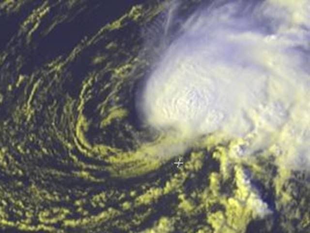
ronjon wrote:Well on our way to seeing Kyle shortly. The GFDL and HWRF both take soon to be Kyle northward toward Bermuda with a bend NW toward the end of the 5 day runs. A possible wrinkle in the forecast is the formation of another low pressure (initially baroclinic but perhaps becoming subtropical) off the FL/GA coast. Some models have this low move W-NW into GA or N FL with Kyle perhaps swinging toward the NW. Not sure how it'll sort out.


captain east wrote:I think it's a depression right about now, what about you guys?


wxman57 wrote:ronjon wrote:Well on our way to seeing Kyle shortly. The GFDL and HWRF both take soon to be Kyle northward toward Bermuda with a bend NW toward the end of the 5 day runs. A possible wrinkle in the forecast is the formation of another low pressure (initially baroclinic but perhaps becoming subtropical) off the FL/GA coast. Some models have this low move W-NW into GA or N FL with Kyle perhaps swinging toward the NW. Not sure how it'll sort out.
I'm thinking this system may merge with the nontropical low along the east coast late this week. That's why the models are indicating north then NW beyond day 4. Digging upper trof along the east coast may draw 93L/Kyle on in.


wxman57 wrote:And here's the 132hr 12Z GFS mean flow valid 7pm Friday. Big low cranking up over the southeast U.S. will prevent any westward movement to Florida or the Gulf. It'll be interesting to see what becomes of this storm when it merges with the frontal low late in the week.


cpdaman wrote:wxman is it not odd for a deepening low pressure to be over Land in GA. regardless if it's tropical or not

wxman57 wrote:cpdaman wrote:wxman is it not odd for a deepening low pressure to be over Land in GA. regardless if it's tropical or not
That's a mid to upper-level low over the southeast U.S., not a surface low. Any surface low would be off to the east along the cold front. And it's quite common to have strong upper lows over land. It's not a tropical low.
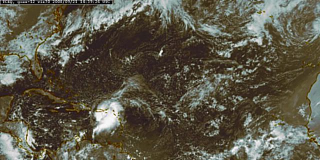
Here's a 17Z surface plot. Definitely no TD out there now. Not much of any LLC. Very disorganized.
Users browsing this forum: No registered users and 12 guests