Tornado outbreak - February 10-11, 8+ dead
Moderator: S2k Moderators
Forum rules

The posts in this forum are NOT official forecast and should not be used as such. They are just the opinion of the poster and may or may not be backed by sound meteorological data. They are NOT endorsed by any professional institution or STORM2K.


New TOR on the first cell thats now in Tulsa AOR.
BULLETIN - EAS ACTIVATION REQUESTED
TORNADO WARNING
NATIONAL WEATHER SERVICE TULSA OK
435 PM CST TUE FEB 10 2009
THE NATIONAL WEATHER SERVICE IN TULSA HAS ISSUED A
* TORNADO WARNING FOR...
WESTERN OSAGE COUNTY IN NORTHEAST OKLAHOMA
PAWNEE COUNTY IN NORTHEAST OKLAHOMA
* UNTIL 500 PM CST
* AT 433 PM CST...NATIONAL WEATHER SERVICE DOPPLER RADAR INDICATED A
SEVERE THUNDERSTORM CAPABLE OF PRODUCING A TORNADO 5 MILES
SOUTHWEST OF PAWNEE...MOVING NORTHEAST AT 35 MPH.
* SOME LOCATIONS NEAR THE PATH OF THIS STORM INCLUDE...PAWNEE...
SKEDEE...RALSTON AND FAIRFAX.
0 likes
Re:
CrazyC83 wrote:There is still a big unknown as mentioned on KOCO - what happens when the storms go southeast? The conditions in the path of the training supercells so far have been quite marginal...
I'm wondering if we are going to get anything to develop ahead of the front/dry line/squall line?
0 likes
-
Crostorm

- Category 5

- Posts: 2060
- Age: 51
- Joined: Mon Dec 25, 2006 3:51 pm
- Location: Croatia-Europe
- Contact:
Re:
RL3AO wrote:New TOR on the first cell thats now in Tulsa AOR.
BULLETIN - EAS ACTIVATION REQUESTED
TORNADO WARNING
NATIONAL WEATHER SERVICE TULSA OK
435 PM CST TUE FEB 10 2009
THE NATIONAL WEATHER SERVICE IN TULSA HAS ISSUED A
* TORNADO WARNING FOR...
WESTERN OSAGE COUNTY IN NORTHEAST OKLAHOMA
PAWNEE COUNTY IN NORTHEAST OKLAHOMA
* UNTIL 500 PM CST
* AT 433 PM CST...NATIONAL WEATHER SERVICE DOPPLER RADAR INDICATED A
SEVERE THUNDERSTORM CAPABLE OF PRODUCING A TORNADO 5 MILES
SOUTHWEST OF PAWNEE...MOVING NORTHEAST AT 35 MPH.
* SOME LOCATIONS NEAR THE PATH OF THIS STORM INCLUDE...PAWNEE...
SKEDEE...RALSTON AND FAIRFAX.

0 likes
-
CrazyC83
- Professional-Met

- Posts: 34315
- Joined: Tue Mar 07, 2006 11:57 pm
- Location: Deep South, for the first time!
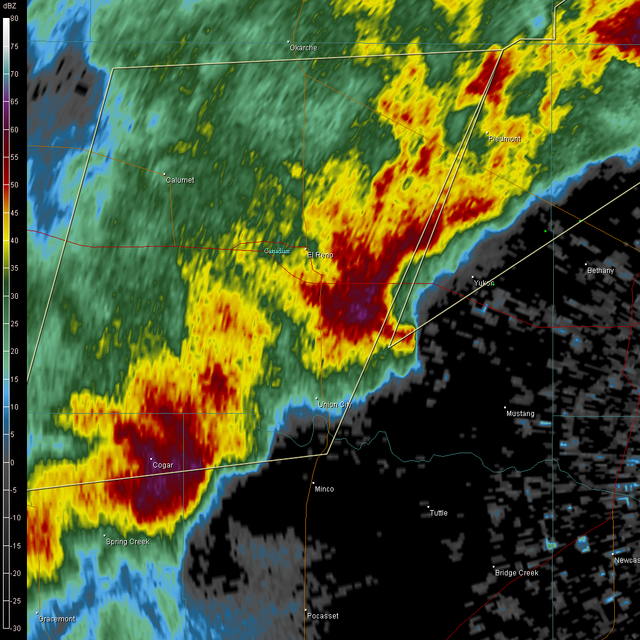
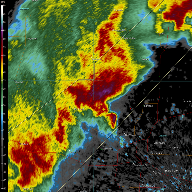
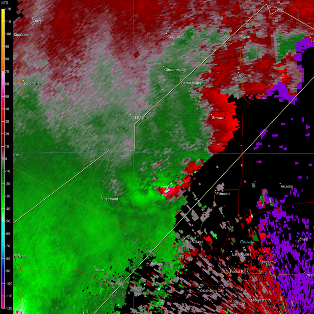
KOCO: Large lowering in the clouds north of Bethany...rotating quite a bit, might be a tornado warning there soon.
Last edited by CrazyC83 on Tue Feb 10, 2009 5:44 pm, edited 1 time in total.
0 likes
-
somethingfunny

- ChatStaff

- Posts: 3926
- Age: 37
- Joined: Thu May 31, 2007 10:30 pm
- Location: McKinney, Texas
Re:
CrazyC83 wrote:There is still a big unknown as mentioned on KOCO - what happens when the storms go southeast? The conditions in the path of the training supercells so far have been quite marginal...
I don't know but the showers have been quite widespread here across DFW this afternoon. Although the sun got us up to around 70 earlier, right now the rain has cooled us off a bit and the clouds aren't breaking. The main event for DFW may end up being no more than a marginally severe squall line late tonight, unless these showers clear out before sunset.
0 likes
Return to “USA & Caribbean Weather”
Who is online
Users browsing this forum: Cpv17, South Texas Storms, Stratton23 and 78 guests