Models expect this system to hang around for the next several days, which may allow the system to become subtropical. Ana, if you're there, knock twice!!!
Moderator: S2k Moderators


Cookie wrote:is this the same system as in the other thread?


Tampa Bay Hurricane wrote:Cookie wrote:is this the same system as in the other thread?
This system is way out over the Atlantic Ocean...but the other thread
concerns a future low in the Gulf of Mexico. Getting busy out there!
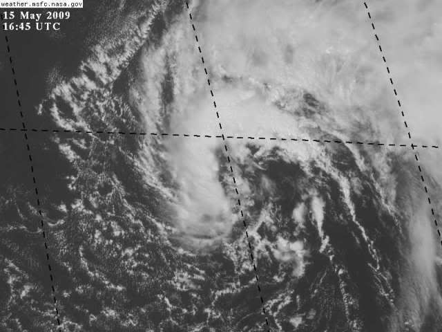
This system looks to be acquiring a defined circulation- I bet 40% this gets a
name as a subtropical system.
Tampa Bay Hurricane wrote:No problem
This low LOOKS really well defined. Still cold core though.
Cookie wrote:Tampa Bay Hurricane wrote:No problem
This low LOOKS really well defined. Still cold core though.
sorry an amateur question but with this being further north then the other why do you think this one has better chance of development then the other one? wouldn't the waters be a lot more colder then the one near the GOM?


Users browsing this forum: No registered users and 178 guests