ENSO Updates (2007 thru 2023)
Moderator: S2k Moderators
Forum rules

The posts in this forum are NOT official forecasts and should not be used as such. They are just the opinion of the poster and may or may not be backed by sound meteorological data. They are NOT endorsed by any professional institution or STORM2K. For official information, please refer to products from the National Hurricane Center and National Weather Service.
-
cycloneye

- Admin

- Posts: 149154
- Age: 69
- Joined: Thu Oct 10, 2002 10:54 am
- Location: San Juan, Puerto Rico
Re: ENSO Updates
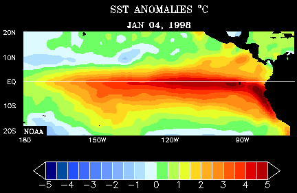
Here is a great loop of the strong El Nino of 1997-98 and how it transitioned to La Nina in 1999.
0 likes
-
El Nino

- Category 1

- Posts: 454
- Age: 48
- Joined: Sun Oct 16, 2005 3:18 pm
- Location: Lima - Miraflores (Peru)
- Contact:
Re: ENSO Updates
http://www.pmel.noaa.gov/tao/jsdisplay/plots/gif/sst_wind_anom_5day_ps32.gif
Very interesting to see this. Cold anomalies are developping in the W part, and warm anomalies are coming back in the E part. Meanwhile winds are more and more coming from the West ... The real beginning of El Nino ?
Very interesting to see this. Cold anomalies are developping in the W part, and warm anomalies are coming back in the E part. Meanwhile winds are more and more coming from the West ... The real beginning of El Nino ?
0 likes
-
cycloneye
- Admin
- Posts: 149154
- Age: 69
- Joined: Thu Oct 10, 2002 10:54 am
- Location: San Juan, Puerto Rico
Re: ENSO Updates=30 day SOI continues positive (Since July 3rd)
2010 looks very promising for those who like to track Tropical Cyclones in the North Atlantic basin.But we have to see first how the 2009 season pans out with the mixed signals that ENSO has.

The 30 day SOI index has gone down a little,but still remains at positive territory and that status has been since July 3rd.
2009060420090703 .4
2009060520090704 .4
2009060620090705 1.2
2009060720090706 .5
2009060820090707 .6
2009060920090708 .6
2009061020090709 2.9
2009061120090710 4.5
2009061220090711 5.9
2009061320090712 8.2
2009061420090713 8.9
2009061520090714 8.9
2009061620090715 8.2
2009061720090716 8.2
2009061820090717 9.6
2009061920090718 11
2009062020090719 11.7
2009062120090720 11.6
2009062220090721 10.9
2009062320090722 10.2
2009062420090723 9.5
2009062520090724 8.8
2009062620090725 7.5
2009062720090726 6.8
2009062820090727 5.5
2009062920090728 4.2
2009063020090729 2.2

http://www.bom.gov.au/climate/enso/soi.dt3
For those who dont know what the SOI does in terms of ENSO here is the SOI glossary.
http://www.bom.gov.au/climate/glossary/soi.shtml
The 30 day SOI index has gone down a little,but still remains at positive territory and that status has been since July 3rd.
2009060420090703 .4
2009060520090704 .4
2009060620090705 1.2
2009060720090706 .5
2009060820090707 .6
2009060920090708 .6
2009061020090709 2.9
2009061120090710 4.5
2009061220090711 5.9
2009061320090712 8.2
2009061420090713 8.9
2009061520090714 8.9
2009061620090715 8.2
2009061720090716 8.2
2009061820090717 9.6
2009061920090718 11
2009062020090719 11.7
2009062120090720 11.6
2009062220090721 10.9
2009062320090722 10.2
2009062420090723 9.5
2009062520090724 8.8
2009062620090725 7.5
2009062720090726 6.8
2009062820090727 5.5
2009062920090728 4.2
2009063020090729 2.2
http://www.bom.gov.au/climate/enso/soi.dt3
For those who dont know what the SOI does in terms of ENSO here is the SOI glossary.
http://www.bom.gov.au/climate/glossary/soi.shtml
0 likes
-
cycloneye
- Admin
- Posts: 149154
- Age: 69
- Joined: Thu Oct 10, 2002 10:54 am
- Location: San Juan, Puerto Rico
Re: ENSO Updates
Climate Prediction Center 7/27/09 Update
No changes from last weeks numbers at El Nino 3 / 3-4 and 4 areas.The only decrease was at El Nino 1-2 area.In other words,what we have in the Pacific right now is a weak El Nino and it has stayed that way since early July.The question is has el nino peaked so quickly or is going to reach moderate status at some point down the road?
Last Weeks Numbers:
Niño 4= +0.6ºC
Niño 3.4= +0.9ºC
Niño 3= +1.0ºC
Niño1+2= +0.8ºC
This Weeks Numbers:
Niño 4=+0.6ºC
Niño 3.4=+0.9ºC
Niño 3=+1.0ºC
Niño1+2=+0.6ºC

http://www.cpc.ncep.noaa.gov/products/a ... ts-web.pdf
No changes from last weeks numbers at El Nino 3 / 3-4 and 4 areas.The only decrease was at El Nino 1-2 area.In other words,what we have in the Pacific right now is a weak El Nino and it has stayed that way since early July.The question is has el nino peaked so quickly or is going to reach moderate status at some point down the road?
Last Weeks Numbers:
Niño 4= +0.6ºC
Niño 3.4= +0.9ºC
Niño 3= +1.0ºC
Niño1+2= +0.8ºC
This Weeks Numbers:
Niño 4=+0.6ºC
Niño 3.4=+0.9ºC
Niño 3=+1.0ºC
Niño1+2=+0.6ºC
http://www.cpc.ncep.noaa.gov/products/a ... ts-web.pdf
0 likes
-
deltadog03

- Professional-Met

- Posts: 3580
- Joined: Tue Jul 05, 2005 6:16 pm
- Location: Macon, GA
-
cycloneye
- Admin
- Posts: 149154
- Age: 69
- Joined: Thu Oct 10, 2002 10:54 am
- Location: San Juan, Puerto Rico
Re: ENSO Updates
I haved not seen big changes of this graphic in almost a month.If something has to be mentioned,that +1.0C circle has turned a little more smaller than before as in the past data it was extending all the way to 100w.

http://www.pmel.noaa.gov/tao/
http://www.pmel.noaa.gov/tao/
0 likes
-
El Nino
- Category 1
- Posts: 454
- Age: 48
- Joined: Sun Oct 16, 2005 3:18 pm
- Location: Lima - Miraflores (Peru)
- Contact:
Re: ENSO Updates
I thought El Nino was redevelopping but now, I'm not sure anymore. And it appears that sub-surface anomalies are easying ...
0 likes
-
Category 5

- Category 5

- Posts: 10074
- Age: 36
- Joined: Sun Feb 11, 2007 10:00 pm
- Location: New Brunswick, NJ
- Contact:
Re: ENSO Updates=30 day SOI continues positive (Since July 3rd)
cycloneye wrote:2010 looks very promising for those who like to track Tropical Cyclones in the North Atlantic basin.But we have to see first how the 2009 season pans out with the mixed signals that ENSO has.
....really? Its July 28th and we're already talking about next season?

0 likes
-
cycloneye
- Admin
- Posts: 149154
- Age: 69
- Joined: Thu Oct 10, 2002 10:54 am
- Location: San Juan, Puerto Rico
Re: ENSO Updates
El Nino wrote:I thought El Nino was redevelopping but now, I'm not sure anymore. And it appears that sub-surface anomalies are easying ...
Whatever graphic you look to,it shows no real progress of El Nino changing from weak towards being in a moderate status.If anything,it has stalled its warming.

0 likes
-
deltadog03
- Professional-Met
- Posts: 3580
- Joined: Tue Jul 05, 2005 6:16 pm
- Location: Macon, GA
-
cycloneye
- Admin
- Posts: 149154
- Age: 69
- Joined: Thu Oct 10, 2002 10:54 am
- Location: San Juan, Puerto Rico
Re: ENSO Updates
The last two days has seen the daily soi index gone to negative.The 30 day soi index has followed with falling numbers but still at positive status.
28-Jul-2009 -6.09
29-Jul-2009 -15.14
http://www.longpaddock.qld.gov.au/Seaso ... SOIValues/
28-Jul-2009 -6.09
29-Jul-2009 -15.14
http://www.longpaddock.qld.gov.au/Seaso ... SOIValues/
0 likes
-
cycloneye
- Admin
- Posts: 149154
- Age: 69
- Joined: Thu Oct 10, 2002 10:54 am
- Location: San Juan, Puerto Rico
Re: ENSO Updates
If you look at the tao graphic at 7 posts above,the circle of +1.0C continues to get smaller.
0 likes
-
cycloneye
- Admin
- Posts: 149154
- Age: 69
- Joined: Thu Oct 10, 2002 10:54 am
- Location: San Juan, Puerto Rico
Re: ENSO Updates
No big change on todays updated graphic of the anomalies in the Pacific.In other words,El Nino has not made more progress towards moderate status since Climate Prediction Center made the classification at July 9th.In fact,if you look closely,you can see a little difference between July 9 and July 30 by the less orange color on the July 30 graphic.
July 9

July 30

July 9
July 30
0 likes
-
Blown Away

- S2K Supporter

- Posts: 10253
- Joined: Wed May 26, 2004 6:17 am
-
cycloneye
- Admin
- Posts: 149154
- Age: 69
- Joined: Thu Oct 10, 2002 10:54 am
- Location: San Juan, Puerto Rico
Re: ENSO Updates
Blown_away wrote:Are there any similarities between El Nino of 2004 and this year?
There is a difference between 2009 and 2004 and that is cooler anomalies at el nino 1-2 and el nino 3.That is known as El Nino Modoki.Article about that here. http://green.yahoo.com/news/ap/20090709 ... _nino.html
July 31,2004

0 likes
-
cycloneye
- Admin
- Posts: 149154
- Age: 69
- Joined: Thu Oct 10, 2002 10:54 am
- Location: San Juan, Puerto Rico
Re: ENSO Updates
Hmmm,the subsurface was warmer in mid July than by the end of that month.El Nino getting stronger,I dont see it by this and the other graphics that are posted in the thread.The very slow Atlantic activity has to be blamed to other factors than from El Nino at this point IMO.

0 likes
Re: ENSO Updates
We started July with a nino region 3.4 sst anomaly of +1.0C deg. We ended the month with an anomaly of +0.8C. The higher the sst anomaly, the stronger the el nino, so at the very least, conditions have held constant for the last month, or even weakened a bit in terms of el nino strength.
That fact, along with the out-of-whack SOI readings (should be negative during an el nino....instead they have been positive since mid-June), suggest we are still looking at a weak el nino and an atmosphere still very much in flux.
Dr. Jeff Master's blog yesterday mentioned just this...
El Niño conditions have remained steady over the tropical Eastern Pacific over the past month. Ocean temperatures in the area 5°N - 5°S, 120°W - 170°W, also called the "Niño 3.4 region", remain at 0.8°C above average, which is 0.3°C above the threshold for a weak El Niño, according to the Australian Bureau of Meteorology. An increase of another 0.2°C would push the current El Niño into the "moderate" category.
The chart below shows the strength of the sst anomalies....the higher the anomaly, the stronger the el nino. As of now, the 2006 el nino was stronger in terms of sst anomalies. The 'backing-off' of el nino strength can also be seen in July 2009.
cycloneye wrote:Hmmm,the subsurface was warmer in mid July than by the end of that month.El Nino getting stronger,I dont see it by this and the other graphics that are posted in the thread.The very slow Atlantic activity has to be blamed to other factors than from El Nino at this point IMO.
0 likes
-
cycloneye
- Admin
- Posts: 149154
- Age: 69
- Joined: Thu Oct 10, 2002 10:54 am
- Location: San Juan, Puerto Rico
Re: ENSO Updates
Climate Prediction Center 8/3/09 update
Last weeks numbers by area:
El Nino 4 +0.6C
El Nino 3-4 +0.9C
El Nino 3 +1.0C
El Nino 1-2 +0.6C
This weeks numbers:
The latest weekly SST departures are:
Niño 4 +0.6ºC
Niño 3.4 +0.8ºC
Niño 3 +0.9ºC
Niño1+2 +0.7ºC
http://www.cpc.ncep.noaa.gov/products/a ... ts-web.pdf
Three of the areas went down from last weeks readings.Only el nino 1-2 area went but only a notch.In other words,what we have here continues to be a weak El Nino.
jinftl,what is your take on the latest numbers?
0 likes
Re: ENSO Updates
It would appear that we have continued confirmation that while conditions did steadily transition from la nina in early 2009 to enso neutral in the springtime and to el nino initial thresholds in late may/early june, that there has been no strengthening of the el nino for the last 6 weeks or so. We have reached a plateau in terms of sst anomalies....and that statement is actually a 'stretch' when you look at the data....if i was to write what the actual data suggests, there has been a slight weakening of the el nino conditions in terms of sst anomalies and size of the area experiencing the highest sst anomalies. Making that claim would be so contrary to what we are expecting to see, that I hesitate for sure....but, the data is the data.
That said, there have been instances..many of them...where the path to el nino is not a straight line, conditions plateau, pull back some, etc.....and then in time, begin to escalate again. Almost all forecasts show a strengthening el nino by fall and winter....but is the epac warmer in terms of sst anomalies than it was a month ago? Nope. Have we journeyed deeper into el nino territory since the start of the season? Not really....maybe even a bit opposite of that is true. Add in the completely anomalous SOI index being positive during the last 7 weeks, and there is no way to make the argument the atmosphere/oceans are in a no-questions-asked strong el nino phase.
As of now....the key words being 'as of'...the 2004 el nino is very comparable to the current one. The average sst anomaly for July-Aug-Sept 2004 was 0.8C. The current (and steady for the last month) sst anomaly = 0.8C.
cycloneye wrote:Climate Prediction Center 8/3/09 update
Last weeks numbers by area:
El Nino 4 +0.6C
El Nino 3-4 +0.9C
El Nino 3 +1.0C
El Nino 1-2 +0.6C
This weeks numbers:
The latest weekly SST departures are:
Niño 4 +0.6ºC
Niño 3.4 +0.8ºC
Niño 3 +0.9ºC
Niño1+2 +0.7ºC
http://www.cpc.ncep.noaa.gov/products/a ... ts-web.pdf
Three of the areas went down from last weeks readings.Only el nino 1-2 area went but only a notch.In other words,what we have here continues to be a weak El Nino.
jinftl,what is your take on the latest numbers?
0 likes