Disturbance fizzeled in Eastern Atlantic

This is the general tropical discussion area. Anyone can take their shot at predicting a storms path.

Moderator: S2k Moderators

Forum rules

The posts in this forum are NOT official forecasts and should not be used as such. They are just the opinion of the poster and may or may not be backed by sound meteorological data. They are NOT endorsed by any professional institution or STORM2K. For official information, please refer to products from the National Hurricane Center and National Weather Service.

Help Support Storm2K
Message
Author
User avatar
HURAKAN
Professional-Met
Professional-Met
Posts: 46086
Age: 38
Joined: Thu May 20, 2004 4:34 pm
Location: Key West, FL
Contact:

Re: Strong wave in far Eastern Atlantic (Possible development?)

#81 Postby HURAKAN » Sun Aug 02, 2009 5:51 am

Image

Still looks good but we will have to see down the road.
0 likes   

User avatar
cycloneye
Admin
Admin
Posts: 143879
Age: 68
Joined: Thu Oct 10, 2002 10:54 am
Location: San Juan, Puerto Rico

Re: Strong wave in far Eastern Atlantic (Possible development?)

#82 Postby cycloneye » Sun Aug 02, 2009 5:58 am

Only GFS has the most agressive stance to this and it is not a strong system that the model develops,only to TD status the most.The rest of the models are vague from not having anything,to having small hints of something.So right now is a wait and see situation.
0 likes   

User avatar
Gustywind
Category 5
Category 5
Posts: 12334
Joined: Mon Sep 03, 2007 7:29 am
Location: Baie-Mahault, GUADELOUPE

#83 Postby Gustywind » Sun Aug 02, 2009 6:27 am

Image
0 likes   

User avatar
cycloneye
Admin
Admin
Posts: 143879
Age: 68
Joined: Thu Oct 10, 2002 10:54 am
Location: San Juan, Puerto Rico

Re: Strong wave in far Eastern Atlantic (Possible development?)

#84 Postby cycloneye » Sun Aug 02, 2009 7:07 am

Looking at the closeups of images,still the low pressure is inside Africa but getting closer to the coast so later today it will emerge and that is when we have to see what will occur,organization or poof.

Image

Image
0 likes   

tolakram
Admin
Admin
Posts: 19990
Age: 61
Joined: Sun Aug 27, 2006 8:23 pm
Location: Florence, KY (name is Mark)

Re: Strong wave in far Eastern Atlantic (Possible development?)

#85 Postby tolakram » Sun Aug 02, 2009 8:00 am

Image
0 likes   

User avatar
wxman57
Moderator-Pro Met
Moderator-Pro Met
Posts: 22951
Age: 67
Joined: Sat Jun 21, 2003 8:06 pm
Location: Houston, TX (southwest)

Re: Strong wave in far Eastern Atlantic

#86 Postby wxman57 » Sun Aug 02, 2009 8:42 am

Convection appears to be decreasing now as the wave moves into a fairly dry environment. That MIMIC TPW loop site appears to be not updating, so we can't get a good look at the lower-level moisture (600mb to surface) and see any rotation. Last image was over 12 hours ago. It's a fairly strong wave, but it doesn't appear that development is likely over the coming week. I'm really doubting that we'll see Ana by the 8th.
0 likes   

User avatar
cycloneye
Admin
Admin
Posts: 143879
Age: 68
Joined: Thu Oct 10, 2002 10:54 am
Location: San Juan, Puerto Rico

Re: Strong wave in far Eastern Atlantic

#87 Postby cycloneye » Sun Aug 02, 2009 8:48 am

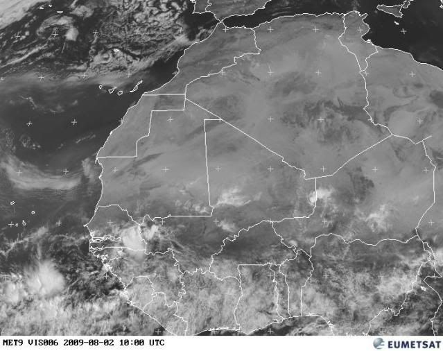
wxman57 wrote:Convection appears to be decreasing now as the wave moves into a fairly dry environment. That MIMIC TPW loop site appears to be not updating, so we can't get a good look at the lower-level moisture (600mb to surface) and see any rotation. Last image was over 12 hours ago. It's a fairly strong wave, but it doesn't appear that development is likely over the coming week. I'm really doubting that we'll see Ana by the 8th.


Do you have the garp?
0 likes   

User avatar
HURAKAN
Professional-Met
Professional-Met
Posts: 46086
Age: 38
Joined: Thu May 20, 2004 4:34 pm
Location: Key West, FL
Contact:

#88 Postby HURAKAN » Sun Aug 02, 2009 8:50 am

Image

Image

Still there.
0 likes   

User avatar
cycloneye
Admin
Admin
Posts: 143879
Age: 68
Joined: Thu Oct 10, 2002 10:54 am
Location: San Juan, Puerto Rico

Re: Strong wave in far Eastern Atlantic

#89 Postby cycloneye » Sun Aug 02, 2009 9:40 am

Here is the loop of the area.Looks like some rotation within the convection South of Cape Verde islands.The rotation you see just inland is the low pressure,but it does not have much convection as the area in the water.I would look more to the convection area for any signs of organization if (and is a big if) it does so.

Image
0 likes   

Dean4Storms
S2K Supporter
S2K Supporter
Posts: 6358
Age: 62
Joined: Sun Aug 31, 2003 1:01 pm
Location: Miramar Bch. FL

#90 Postby Dean4Storms » Sun Aug 02, 2009 9:52 am

Only pick-up game in town for sure! If it stays close enough to the ITCZ and that moisture it might have a chance, any movement to the NW and it is bones! :sun:
0 likes   

User avatar
brunota2003
S2K Supporter
S2K Supporter
Posts: 9476
Age: 34
Joined: Sat Jul 30, 2005 9:56 pm
Location: Stanton, KY...formerly Havelock, NC
Contact:

#91 Postby brunota2003 » Sun Aug 02, 2009 10:10 am

yep, just south of 10N and on the line of 20W, certainly looks like some kind of low is there.
0 likes   

jinftl
Category 5
Category 5
Posts: 4312
Joined: Tue Aug 31, 2004 4:47 pm
Location: fort lauderdale, fl

Re:

#92 Postby jinftl » Sun Aug 02, 2009 10:41 am

if this can maintain itself and not go 'poof', then what the environment will be like downstream will be the key....major development at this longitude would be the quickest way to get a fish storm....a long trakker typically needs to find that balance between going 'poof' and organizing too quickly off the coast of africa if it wants to do a transatlanic crossing.

be interesting to see what the wave train looks like over the next month to 6 weeks...shoot enough canons, and some will launch properly.

brunota2003 wrote:yep, just south of 10N and on the line of 20W, certainly looks like some kind of low is there.
0 likes   

User avatar
brunota2003
S2K Supporter
S2K Supporter
Posts: 9476
Age: 34
Joined: Sat Jul 30, 2005 9:56 pm
Location: Stanton, KY...formerly Havelock, NC
Contact:

#93 Postby brunota2003 » Sun Aug 02, 2009 10:46 am

Indeed...the only thing is, if it tries to develop here and goes "poleward" (the way of the fish), then it will surely not last long on this earth.
0 likes   

Sanibel
Category 5
Category 5
Posts: 10375
Joined: Mon Aug 30, 2004 11:06 pm
Location: Offshore SW Florida

Re: Strong wave in far Eastern Atlantic

#94 Postby Sanibel » Sun Aug 02, 2009 12:14 pm

Weak spin and headed towards the dry zone.
0 likes   

User avatar
Gustywind
Category 5
Category 5
Posts: 12334
Joined: Mon Sep 03, 2007 7:29 am
Location: Baie-Mahault, GUADELOUPE

#95 Postby Gustywind » Sun Aug 02, 2009 2:19 pm

Kevin Roth, Lead Meteorologists, The Weather Channel
Aug. 2, 2009 1:53 pm ET
Closer to home in the Atlantic Basin all is fairly quiet. A low pressure area will move off western Africa by tomorrow and will be monitored as it moves into a dry, stable environment.

http://www.weather.com/newscenter/hurri ... om=hp_news
0 likes   

User avatar
Ivanhater
Storm2k Moderator
Storm2k Moderator
Posts: 11153
Age: 38
Joined: Fri Jul 01, 2005 8:25 am
Location: Pensacola

Re: Strong wave in far Eastern Atlantic

#96 Postby Ivanhater » Sun Aug 02, 2009 2:45 pm

Not to bad..

Image
0 likes   

User avatar
alan1961
Category 2
Category 2
Posts: 771
Joined: Mon Mar 20, 2006 11:58 am
Location: Derby, Derbyshire, England
Contact:

Re: Strong wave in far Eastern Atlantic

#97 Postby alan1961 » Sun Aug 02, 2009 3:42 pm

I know its the ITCZ but does anyone see spiraling with the convective mass at 43 west 10 north on animation?, probably playing tricks with me but just thought i'd ask. :roll:
0 likes   

Ed Mahmoud

Re: Strong wave in far Eastern Atlantic

#98 Postby Ed Mahmoud » Sun Aug 02, 2009 4:39 pm

AccuWX PPV Japanese Met Agency Global-

In 8 days, closed low has opened back to a convectively active wave, about a day or two from the Lesser Antilles.
0 likes   

User avatar
wxman57
Moderator-Pro Met
Moderator-Pro Met
Posts: 22951
Age: 67
Joined: Sat Jun 21, 2003 8:06 pm
Location: Houston, TX (southwest)

Re: Strong wave in far Eastern Atlantic

#99 Postby wxman57 » Sun Aug 02, 2009 5:51 pm

Could definitely see some lower-level spin on visible satellite today. But convection is minimal, and it seems to be merging with the ITCZ. Nearest observation is 400 miles to the west, so no help there. GFS sees the vorticity, develops a weak low, then recurves it northward late this week. I suppose it might have a shot at development. Or maybe I should say that I can't absolutely rule out development over the next 3-5 days. But chances are not high, probably under 10% and likely under 5%.

If it maintains moderate convection overnight (looks to be west of the spin), and if that spin is still evident tomorrow, then an invest may be declared. I think it's moving too fast now, though. By Wed/Thu, the GFS indicates high to the north weakening. This could allow for consolidation (if there's anything left by then). Just something to keep an eye on.
0 likes   

User avatar
cycloneye
Admin
Admin
Posts: 143879
Age: 68
Joined: Thu Oct 10, 2002 10:54 am
Location: San Juan, Puerto Rico

Re: Strong wave in far Eastern Atlantic

#100 Postby cycloneye » Sun Aug 02, 2009 6:05 pm

We may have a LLC here although a weak one,there are some good winds there.This pass was made at 4:01 PM EDT.

Image

Image
0 likes   


Return to “Talkin' Tropics”

Who is online

Users browsing this forum: Google Adsense [Bot], mixedDanilo.E, NotoSans and 185 guests