12z UKMET develops this wave.
NEW TROPICAL STORM FORECAST TO DEVELOP AFTER 48 HOURS
FORECAST POSITION AT T+ 48 : 14.4N 22.1W
VERIFYING TIME POSITION STRENGTH TENDENCY
-------------- -------- -------- --------
12UTC 04.09.2009 14.4N 22.1W MODERATE
00UTC 05.09.2009 15.3N 24.2W WEAK LITTLE CHANGE
12UTC 05.09.2009 16.3N 26.7W MODERATE INTENSIFYING SLIGHTLY
00UTC 06.09.2009 17.4N 28.6W MODERATE LITTLE CHANGE
12UTC 06.09.2009 17.8N 30.7W WEAK WEAKENING SLIGHTLY
00UTC 07.09.2009 18.1N 32.5W WEAK WEAKENING SLIGHTLY
12UTC 07.09.2009 17.9N 34.5W WEAK WEAKENING SLIGHTLY
00UTC 08.09.2009 17.9N 36.2W WEAK LITTLE CHANGE
12UTC 08.09.2009 17.6N 38.0W WEAK LITTLE CHANGE
Also GFS has it developing.
http://www.nco.ncep.noaa.gov/pmb/nwprod ... loop.shtml
Strong wave in Eastern Atlantic
Moderator: S2k Moderators
Forum rules

The posts in this forum are NOT official forecasts and should not be used as such. They are just the opinion of the poster and may or may not be backed by sound meteorological data. They are NOT endorsed by any professional institution or STORM2K. For official information, please refer to products from the National Hurricane Center and National Weather Service.
-
otowntiger
- Category 5

- Posts: 1932
- Joined: Tue Aug 31, 2004 7:06 pm
Re: Yet another vigorous wave about to emerge African Coast
cycloneye wrote:12z UKMET develops this wave.
NEW TROPICAL STORM FORECAST TO DEVELOP AFTER 48 HOURS
FORECAST POSITION AT T+ 48 : 14.4N 22.1W
VERIFYING TIME POSITION STRENGTH TENDENCY
-------------- -------- -------- --------
12UTC 04.09.2009 14.4N 22.1W MODERATE
00UTC 05.09.2009 15.3N 24.2W WEAK LITTLE CHANGE
12UTC 05.09.2009 16.3N 26.7W MODERATE INTENSIFYING SLIGHTLY
00UTC 06.09.2009 17.4N 28.6W MODERATE LITTLE CHANGE
12UTC 06.09.2009 17.8N 30.7W WEAK WEAKENING SLIGHTLY
00UTC 07.09.2009 18.1N 32.5W WEAK WEAKENING SLIGHTLY
12UTC 07.09.2009 17.9N 34.5W WEAK WEAKENING SLIGHTLY
00UTC 08.09.2009 17.9N 36.2W WEAK LITTLE CHANGE
12UTC 08.09.2009 17.6N 38.0W WEAK LITTLE CHANGE
Also GFS has it developing.
http://www.nco.ncep.noaa.gov/pmb/nwprod ... loop.shtml
Yeah, but as a huge fish.
0 likes
-
StormClouds63
- Category 2

- Posts: 583
- Age: 62
- Joined: Tue May 13, 2008 11:56 am
- Location: Southwest Louisiana
Re: Yet another vigorous wave about to emerge African Coast
otowntiger:
You beat me to it. Yes, Fred looks very fishy ... It's an early run, but the re-curve scenario appears set in stone for 2009 ... so much for my hunch of Fred breaking the trend! Does look like a pretty strong system, perhaps a major hurricane down the line.
You beat me to it. Yes, Fred looks very fishy ... It's an early run, but the re-curve scenario appears set in stone for 2009 ... so much for my hunch of Fred breaking the trend! Does look like a pretty strong system, perhaps a major hurricane down the line.
0 likes
-
StormClouds63
- Category 2
- Posts: 583
- Age: 62
- Joined: Tue May 13, 2008 11:56 am
- Location: Southwest Louisiana
Re: Yet another vigorous wave about to emerge African Coast
Wx_Warrior:
The mets at Channel 6 do a great job ... watch them regularly. They were the first who kept warning people of the tremendous storm surge associated w/Ike. So if they see a GOM threat down-the-line, I'll be paying close attention. Hoping for a carbon-copy of Bill with recurve and weakening.
The mets at Channel 6 do a great job ... watch them regularly. They were the first who kept warning people of the tremendous storm surge associated w/Ike. So if they see a GOM threat down-the-line, I'll be paying close attention. Hoping for a carbon-copy of Bill with recurve and weakening.
0 likes


Re: Yet another vigorous wave about to emerge African Coast
StormClouds63 wrote:Wx_Warrior:
The mets at Channel 6 do a great job ... watch them regularly. They were the first who kept warning people of the tremendous storm surge associated w/Ike. So if they see a GOM threat down-the-line, I'll be paying close attention. Hoping for a carbon-copy of Bill with recurve and weakening.
Have the Channel 6 mets said this system (or any other for that matter) is a GOM threat?
0 likes


-
StormClouds63
- Category 2
- Posts: 583
- Age: 62
- Joined: Tue May 13, 2008 11:56 am
- Location: Southwest Louisiana
Re: Yet another vigorous wave about to emerge African Coast
Wx_Warrior wrote:This storm isn't the one that will worry GOM'ers. Just wait for this monster coming off of Africa that won't recurve! 2 week EURO is nasty......
Now back to E
This was mentioned in the Erika thread.
0 likes
-
Wx_Warrior
- Category 5
- Posts: 2718
- Joined: Thu Aug 03, 2006 3:58 pm
- Location: Beaumont, TX
Re: Yet another vigorous wave about to emerge African Coast
On the 6 thing: absolutely not.
My brother just told me one of those over Africa was picked up by the EURO and it heads west in the Atlantic but the pro Model didn't go any further.
My brother just told me one of those over Africa was picked up by the EURO and it heads west in the Atlantic but the pro Model didn't go any further.
0 likes
Re: Yet another vigorous wave about to emerge African Coast
Wx_Warrior wrote:On the 6 thing: absolutely not.
My brother just told me one of those over Africa was picked up by the EURO and it heads west in the Atlantic but the pro Model didn't go any further.
Does the European go out to two weeks? I know it goes out to 10 days, but I hadn't heard it went out 2 weeks.
0 likes
-
Wx_Warrior
- Category 5
- Posts: 2718
- Joined: Thu Aug 03, 2006 3:58 pm
- Location: Beaumont, TX
Re: Yet another vigorous wave about to emerge African Coast
If you pay for the EURO, it goes out further.
0 likes
-
chzzdekr81

- S2K Supporter

- Posts: 189
- Joined: Sun Aug 30, 2009 7:54 pm
- Location: Orange, Texas (SETX)
- Contact:
Re: Yet another vigorous wave emerging from African Coast
That storm over the coast of Africa looks like it might turn into "Fred" pretty soon.
0 likes
-
lonelymike
- S2K Supporter
- Posts: 634
- Joined: Sat Jul 26, 2008 10:12 am
- Location: walton county fla
Re: Yet another vigorous wave emerging from African Coast
Is kind of a high latitude so el fisho probably. 
0 likes

Re: Yet another vigorous wave emerging from African Coast
Development, and time therof will depend a lot on whether it can create a new bust of convection near the center of rotation when it gets fully over water. Of course, quick development likely means a fish, but it looks to me like the area of vorticity is near and below 10 north, which can be pretty hard to pull northward, especially if it does not develop until 35 west or farther.
0 likes
-
srainhoutx

- S2K Supporter
- Posts: 6919
- Age: 68
- Joined: Sun Jan 14, 2007 11:34 am
- Location: Haywood County, NC
- Contact:
Re: Yet another vigorous wave emerging from African Coast
BigA wrote:Development, and time therof will depend a lot on whether it can create a new bust of convection near the center of rotation when it gets fully over water. Of course, quick development likely means a fish, but it looks to me like the area of vorticity is near and below 10 north, which can be pretty hard to pull northward, especially if it does not develop until 35 west or farther.
The year of 50W.
0 likes
-
cycloneye

- Admin

- Posts: 149222
- Age: 69
- Joined: Thu Oct 10, 2002 10:54 am
- Location: San Juan, Puerto Rico
Re: Another vigorous wave emerging from African Coast
TROPICAL WEATHER OUTLOOK
NWS TPC/NATIONAL HURRICANE CENTER MIAMI FL
200 AM EDT THU SEP 3 2009
FOR THE NORTH ATLANTIC...CARIBBEAN SEA AND THE GULF OF MEXICO...
THE NATIONAL HURRICANE CENTER IS ISSUING ADVISORIES ON TROPICAL
STORM ERIKA LOCATED JUST WEST OF GUADELOUPE IN THE LEEWARD ISLANDS.
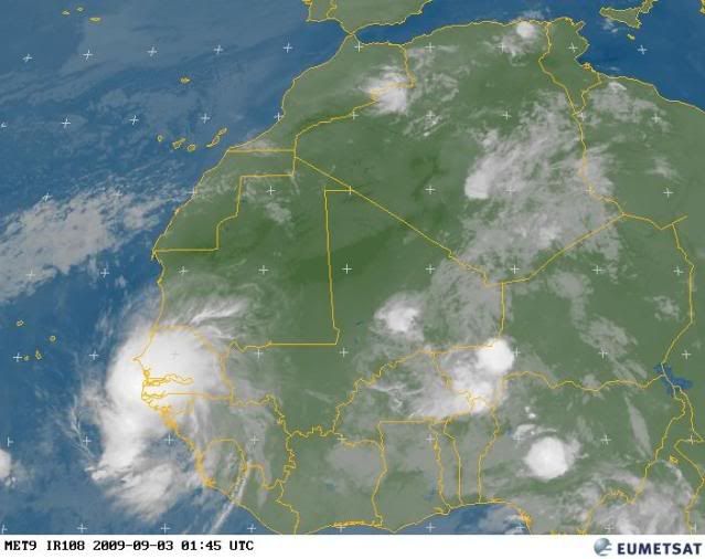
A VIGOROUS TROPICAL WAVE LOCATED NEAR THE WEST COAST OF AFRICA...A
FEW HUNDRED MILES TO THE EAST-SOUTHEAST OF THE CAPE VERDE
ISLANDS...IS ACCOMPANIED BY A LARGE AREA OF CLOUDINESS AND SHOWERS.
SOME SLOW DEVELOPMENT OF THIS SYSTEM IS POSSIBLE OVER THE NEXT
COUPLE OF DAYS AS IT MOVES WESTWARD AT 10 TO 15 MPH OVER THE FAR
EASTERN TROPICAL ATLANTIC. THERE IS A LOW CHANCE...LESS THAN 30
PERCENT...OF THIS SYSTEM BECOMING A TROPICAL CYCLONE DURING THE
NEXT 48 HOURS.
ELSEWHERE...TROPICAL CYCLONE FORMATION IS NOT EXPECTED DURING THE
NEXT 48 HOURS.
$$
FORECASTER PASCH
NWS TPC/NATIONAL HURRICANE CENTER MIAMI FL
200 AM EDT THU SEP 3 2009
FOR THE NORTH ATLANTIC...CARIBBEAN SEA AND THE GULF OF MEXICO...
THE NATIONAL HURRICANE CENTER IS ISSUING ADVISORIES ON TROPICAL
STORM ERIKA LOCATED JUST WEST OF GUADELOUPE IN THE LEEWARD ISLANDS.
A VIGOROUS TROPICAL WAVE LOCATED NEAR THE WEST COAST OF AFRICA...A
FEW HUNDRED MILES TO THE EAST-SOUTHEAST OF THE CAPE VERDE
ISLANDS...IS ACCOMPANIED BY A LARGE AREA OF CLOUDINESS AND SHOWERS.
SOME SLOW DEVELOPMENT OF THIS SYSTEM IS POSSIBLE OVER THE NEXT
COUPLE OF DAYS AS IT MOVES WESTWARD AT 10 TO 15 MPH OVER THE FAR
EASTERN TROPICAL ATLANTIC. THERE IS A LOW CHANCE...LESS THAN 30
PERCENT...OF THIS SYSTEM BECOMING A TROPICAL CYCLONE DURING THE
NEXT 48 HOURS.
ELSEWHERE...TROPICAL CYCLONE FORMATION IS NOT EXPECTED DURING THE
NEXT 48 HOURS.
$$
FORECASTER PASCH
0 likes

-
cycloneye
- Admin
- Posts: 149222
- Age: 69
- Joined: Thu Oct 10, 2002 10:54 am
- Location: San Juan, Puerto Rico
Re: Vigorous wave emerging from African Coast (Code Yellow)
TROPICAL WEATHER OUTLOOK
NWS TPC/NATIONAL HURRICANE CENTER MIAMI FL
800 AM EDT THU SEP 3 2009
FOR THE NORTH ATLANTIC...CARIBBEAN SEA AND THE GULF OF MEXICO...
THE NATIONAL HURRICANE CENTER IS ISSUING ADVISORIES ON TROPICAL
STORM ERIKA LOCATED ABOUT 40 MILES SOUTHWEST OF ST. KITTS IN THE
LEEWARD ISLANDS.
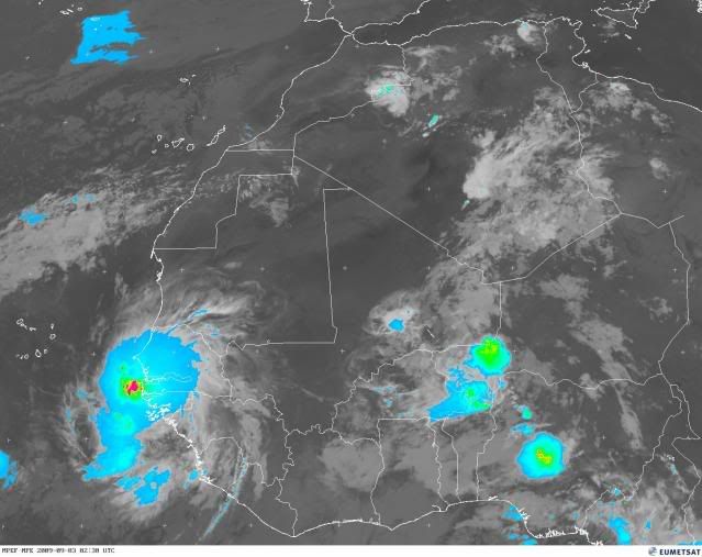
A VIGOROUS TROPICAL WAVE LOCATED ABOUT 500 MILES EAST-SOUTHEAST OF
THE CAPE VERDE ISLANDS IS ACCOMPANIED BY A LARGE AREA OF CLOUDINESS
AND SHOWERS. SLOW DEVELOPMENT OF THIS SYSTEM IS POSSIBLE OVER THE
NEXT COUPLE OF DAYS AS IT MOVES WESTWARD AT 10 TO 15 MPH OVER THE
FAR EASTERN TROPICAL ATLANTIC. THERE IS A LOW CHANCE...LESS THAN 30
PERCENT...OF THIS SYSTEM BECOMING A TROPICAL CYCLONE DURING THE
NEXT 48 HOURS.
ELSEWHERE...TROPICAL CYCLONE FORMATION IS NOT EXPECTED DURING THE
NEXT 48 HOURS.
$$
FORECASTER BRENNAN

NWS TPC/NATIONAL HURRICANE CENTER MIAMI FL
800 AM EDT THU SEP 3 2009
FOR THE NORTH ATLANTIC...CARIBBEAN SEA AND THE GULF OF MEXICO...
THE NATIONAL HURRICANE CENTER IS ISSUING ADVISORIES ON TROPICAL
STORM ERIKA LOCATED ABOUT 40 MILES SOUTHWEST OF ST. KITTS IN THE
LEEWARD ISLANDS.
A VIGOROUS TROPICAL WAVE LOCATED ABOUT 500 MILES EAST-SOUTHEAST OF
THE CAPE VERDE ISLANDS IS ACCOMPANIED BY A LARGE AREA OF CLOUDINESS
AND SHOWERS. SLOW DEVELOPMENT OF THIS SYSTEM IS POSSIBLE OVER THE
NEXT COUPLE OF DAYS AS IT MOVES WESTWARD AT 10 TO 15 MPH OVER THE
FAR EASTERN TROPICAL ATLANTIC. THERE IS A LOW CHANCE...LESS THAN 30
PERCENT...OF THIS SYSTEM BECOMING A TROPICAL CYCLONE DURING THE
NEXT 48 HOURS.
ELSEWHERE...TROPICAL CYCLONE FORMATION IS NOT EXPECTED DURING THE
NEXT 48 HOURS.
$$
FORECASTER BRENNAN
0 likes
Re: Vigorous wave emerging from African Coast (Code Yellow)
Weird "ring" type circulation.
Looks like nothing will seriously develop without a strong MJO this year.
No idea what this one will do.
Looks like nothing will seriously develop without a strong MJO this year.
No idea what this one will do.
0 likes
Who is online
Users browsing this forum: No registered users and 89 guests