
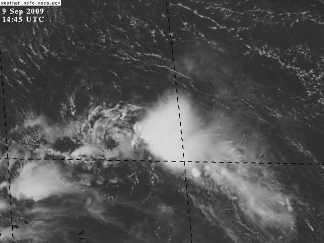
Our little central Atlantic wave is spouting convection like a choo choo train in shear.
Should get pushed into recurve up that trough border ahead.
Tropical Wave north of the Greater Antilles
Moderator: S2k Moderators
Forum rules

The posts in this forum are NOT official forecasts and should not be used as such. They are just the opinion of the poster and may or may not be backed by sound meteorological data. They are NOT endorsed by any professional institution or STORM2K. For official information, please refer to products from the National Hurricane Center and National Weather Service.
-
Blown Away

- S2K Supporter

- Posts: 10253
- Joined: Wed May 26, 2004 6:17 am
Re:
HURAKAN wrote:
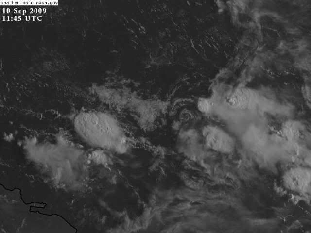
The LLC is more present than ever
What are the lat/longs of this LLC? I don't see it.
0 likes

-
somethingfunny

- ChatStaff

- Posts: 3926
- Age: 37
- Joined: Thu May 31, 2007 10:30 pm
- Location: McKinney, Texas
-
Blown Away
- S2K Supporter
- Posts: 10253
- Joined: Wed May 26, 2004 6:17 am
Re: Tropical Wave north of the Lesser Antilles
0 likes
Re: Tropical Wave north of the Lesser Antilles
I think they've given up on anything forming in that area and I'm not going to argue. 
0 likes

Re: Tropical Wave north of the Lesser Antilles
drezee wrote:it will pass just n of this buoy....look for W winds
http://www.ndbc.noaa.gov/station_page.php?station=41043
We have west winds for like 5 hours south of this thing....it is at the surface...
0 likes

Re: Tropical Wave north of the Lesser Antilles

Looks like it's on a secret stealth mission to become a TC off the coast of N.C. j/j kinda.
It does look like it has grown in size a wee bit.
0 likes
-
HURAKAN

- Professional-Met

- Posts: 46084
- Age: 39
- Joined: Thu May 20, 2004 4:34 pm
- Location: Key West, FL
- Contact:
Re: Tropical Wave north of the Lesser Antilles
drezee wrote:drezee wrote:it will pass just n of this buoy....look for W winds
http://www.ndbc.noaa.gov/station_page.php?station=41043
We have west winds for like 5 hours south of this thing....it is at the surface...
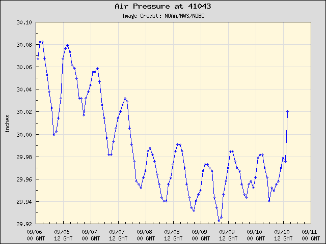
Still there
0 likes
Re: Tropical Wave north of the Lesser Antilles
North of Antilles is notoriously unsupportive this year.
0 likes
-
HURAKAN
- Professional-Met
- Posts: 46084
- Age: 39
- Joined: Thu May 20, 2004 4:34 pm
- Location: Key West, FL
- Contact:
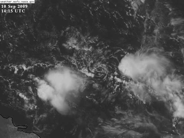
Link: http://wwwghcc.msfc.nasa.gov/GOES/goeseastconus.html
Create a loop of the area in question and you will see that this system is very well-defined. It just needs shear to relax and boom, we will get something to track.
Create a loop of the area in question and you will see that this system is very well-defined. It just needs shear to relax and boom, we will get something to track.
0 likes
-
HURAKAN
- Professional-Met
- Posts: 46084
- Age: 39
- Joined: Thu May 20, 2004 4:34 pm
- Location: Key West, FL
- Contact:
Re: Tropical Wave north of the Greater Antilles
Elsewhere in the tropics
Early next week, we should be alert for tropical storm development over the waters between the Bahamas and North Carolina, along an old frontal zone. None of the reliable models are forecasting tropical storm development in this area or in the Gulf of Mexico, though.
Jeff Masters
Early next week, we should be alert for tropical storm development over the waters between the Bahamas and North Carolina, along an old frontal zone. None of the reliable models are forecasting tropical storm development in this area or in the Gulf of Mexico, though.
Jeff Masters
0 likes
Re: Tropical Wave north of the Greater Antilles
A 1015 MB SURFACE LOW IS N OF PUERTO RICO NEAR 21N65W. THE LOW
IS SUPPORTED BY AN UPPER LEVEL LOW NEAR 26N65W. LOW-LEVEL
CONVERGENCE NEAR THE SURFACE LOW IS SUPPORTING ISOLATED
SHOWERS/POSSIBLE THUNDERSTORMS FROM 19N-27N BETWEEN 61W-68W. A
WEAK 1020 MB SURFACE HIGH IS N OF THE SURFACE LOW CENTERED NEAR
29N60W.
IS SUPPORTED BY AN UPPER LEVEL LOW NEAR 26N65W. LOW-LEVEL
CONVERGENCE NEAR THE SURFACE LOW IS SUPPORTING ISOLATED
SHOWERS/POSSIBLE THUNDERSTORMS FROM 19N-27N BETWEEN 61W-68W. A
WEAK 1020 MB SURFACE HIGH IS N OF THE SURFACE LOW CENTERED NEAR
29N60W.
0 likes
Who is online
Users browsing this forum: No registered users and 100 guests