The Ship models show very slow development over the next 12 hours and then a steady increase as ex-Fred moves towards Florida. This seems to be in line w/ Aric Dunn's maps showing lower shear as this systems nears the Bahamas.
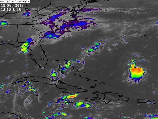
BTW, convection building a little on the W side of the circulation.
http://www.ssd.noaa.gov/goes/east/tatl/loop-avn.html
ATL: TROPICAL LOW ex-FRED (ex-07L)
Moderator: S2k Moderators
-
Blown Away

- S2K Supporter

- Posts: 10253
- Joined: Wed May 26, 2004 6:17 am


-
HURAKAN

- Professional-Met

- Posts: 46084
- Age: 39
- Joined: Thu May 20, 2004 4:34 pm
- Location: Key West, FL
- Contact:
ATL: TROPICAL LOW ex-FRED - RECON
217
NOUS42 KNHC 181500
WEATHER RECONNAISSANCE FLIGHTS
CARCAH, NATIONAL HURRICANE CENTER, MIAMI, FL.
1100 AM EDT FRI 18 SEPTEMBER 2009
SUBJECT: TROPICAL CYCLONE PLAN OF THE DAY (TCPOD)
VALID 19/1100Z TO 20/1100Z SEPTEMBER 2009
TCPOD NUMBER.....09-113
I. ATLANTIC REQUIREMENTS
1. REMNANTS OF HURRICANE FRED
FLIGHT ONE -- TEAL 70
A. 19/1800Z
B. AFXXX 0107A INVEST
C. 19/1500Z
D. 26.0N 70.8W
E. 19/1700Z TO 19/2200Z
F. SFC TO 10,000 FT
FLIGHT TWO -- TEAL 71
A. 20/0600Z
B. AFXXX 0207A FRED
C. 20/0200Z
D. 26.8N 72.0W
E. 20/0400Z TO 20/0700Z
F. SFC TO 10,000 FT
2. SUCCEEDING DAY OUTLOOK: CONTINUE 12 HRLY FIXES IF
SYSTEM IS A THREAT.
II. PACIFIC REQUIREMENTS
1. NEGATIVE RECONNAISSANCE REQUIREMENTS.
2. SUCCEEDING DAY OUTLOOK.....NEGATIVE.
WVW
0 likes
-
HURAKAN
- Professional-Met
- Posts: 46084
- Age: 39
- Joined: Thu May 20, 2004 4:34 pm
- Location: Key West, FL
- Contact:
217
NOUS42 KNHC 181500
WEATHER RECONNAISSANCE FLIGHTS
CARCAH, NATIONAL HURRICANE CENTER, MIAMI, FL.
1100 AM EDT FRI 18 SEPTEMBER 2009
SUBJECT: TROPICAL CYCLONE PLAN OF THE DAY (TCPOD)
VALID 19/1100Z TO 20/1100Z SEPTEMBER 2009
TCPOD NUMBER.....09-113
I. ATLANTIC REQUIREMENTS
1. REMNANTS OF HURRICANE FRED
FLIGHT ONE -- TEAL 70
A. 19/1800Z
B. AFXXX 0107A INVEST
C. 19/1500Z
D. 26.0N 70.8W
E. 19/1700Z TO 19/2200Z
F. SFC TO 10,000 FT
FLIGHT TWO -- TEAL 71
A. 20/0600Z
B. AFXXX 0207A FRED
C. 20/0200Z
D. 26.8N 72.0W
E. 20/0400Z TO 20/0700Z
F. SFC TO 10,000 FT
2. SUCCEEDING DAY OUTLOOK: CONTINUE 12 HRLY FIXES IF
SYSTEM IS A THREAT.
II. PACIFIC REQUIREMENTS
1. NEGATIVE RECONNAISSANCE REQUIREMENTS.
2. SUCCEEDING DAY OUTLOOK.....NEGATIVE.
WVW
Just in case!
0 likes
-
Nederlander
- S2K Supporter
- Posts: 1259
- Joined: Sat Jul 19, 2008 4:28 pm
- Location: Conroe, TX
Re: ATL: TROPICAL LOW ex-FRED (ex-07L) - Computer Models
artist wrote:still labelled 07 by sfwd -
Why are the other models not showing up on this map? Are they just not initializing a LLC?
0 likes
-
deltadog03

- Professional-Met
- Posts: 3580
- Joined: Tue Jul 05, 2005 6:16 pm
- Location: Macon, GA
-
Bocadude85

- Category 5

- Posts: 2991
- Age: 39
- Joined: Mon Apr 18, 2005 2:20 pm
- Location: Honolulu,Hi
Re: ATL: TROPICAL LOW ex-FRED (ex-07L)
Will be interesting to see what happens with Fred as he nears the Bahamas... looks like he is headed more towards Central Florida.. as what I do not know.
0 likes
-
Blown Away
- S2K Supporter
- Posts: 10253
- Joined: Wed May 26, 2004 6:17 am
Re: ATL: TROPICAL LOW ex-FRED (ex-07L) - Computer Models
I never buy W bound named tropical system landfalls N of Vero Beach Florida to the Ga/SC line. I don't care what the models say.
0 likes
-
gatorcane

- S2K Supporter
- Posts: 23708
- Age: 48
- Joined: Sun Mar 13, 2005 3:54 pm
- Location: Boca Raton, FL
Re: ATL: TROPICAL LOW ex-FRED (ex-07L)
well it seems to be organizing but good thing is that is running out of real estate, thankfully. Northerly shear seems to be hitting it also and that coupled with dry air should keep it in check.
0 likes
-
deltadog03
- Professional-Met
- Posts: 3580
- Joined: Tue Jul 05, 2005 6:16 pm
- Location: Macon, GA

-
Blown Away
- S2K Supporter
- Posts: 10253
- Joined: Wed May 26, 2004 6:17 am
Re: ATL: TROPICAL LOW ex-FRED (ex-07L)
Within the past 24 hours:
Back to code yellow, well defined LLC, convection building around LLC, back on the NRL, BAM models running again, and reconnaissance flight on stand by. For an El Nino season that's pretty good! Go Fred!!
Back to code yellow, well defined LLC, convection building around LLC, back on the NRL, BAM models running again, and reconnaissance flight on stand by. For an El Nino season that's pretty good! Go Fred!!
0 likes
-
AdamFirst

- S2K Supporter
- Posts: 2490
- Age: 36
- Joined: Thu Aug 14, 2008 10:54 am
- Location: Port Saint Lucie, FL
Re: ATL: TROPICAL LOW ex-FRED (ex-07L)
Sanibel wrote:Yes, I think a naked spiral alert should be issued.
Everyone start putting up your shutters and buying your canned goods
0 likes

-
Evil Jeremy

- S2K Supporter
- Posts: 5463
- Age: 32
- Joined: Mon Apr 10, 2006 2:10 pm
- Location: Los Angeles, CA
Re: ATL: TROPICAL LOW ex-FRED (ex-07L)
gatorcane wrote:well it seems to be organizing but good thing is that is running out of real estate, thankfully. Northerly shear seems to be hitting it also and that coupled with dry air should keep it in check.
The shear is expected to lessen over the next couple of days allowing for better conditions.
0 likes
-
Evil Jeremy
- S2K Supporter
- Posts: 5463
- Age: 32
- Joined: Mon Apr 10, 2006 2:10 pm
- Location: Los Angeles, CA
Re: ATL: TROPICAL LOW ex-FRED (ex-07L) - Computer Models
Blown_away wrote:I never buy W bound named tropical system landfalls N of Vero Beach Florida to the Ga/SC line. I don't care what the models say.
If I may ask, why?
0 likes
-
Nederlander
- S2K Supporter
- Posts: 1259
- Joined: Sat Jul 19, 2008 4:28 pm
- Location: Conroe, TX
Re: ATL: TROPICAL LOW ex-FRED (ex-07L) - Computer Models
Evil Jeremy wrote:Blown_away wrote:I never buy W bound named tropical system landfalls N of Vero Beach Florida to the Ga/SC line. I don't care what the models say.
If I may ask, why?
Probably because a lot of times, storms don't gain as much latitude as the models think or at least as quickly. Just my amateur observation..
0 likes
-
HURAKAN
- Professional-Met
- Posts: 46084
- Age: 39
- Joined: Thu May 20, 2004 4:34 pm
- Location: Key West, FL
- Contact:
697
ABNT20 KNHC 181730
TWOAT
TROPICAL WEATHER OUTLOOK
NWS TPC/NATIONAL HURRICANE CENTER MIAMI FL
200 PM EDT FRI SEP 18 2009
FOR THE NORTH ATLANTIC...CARIBBEAN SEA AND THE GULF OF MEXICO...
A SMALL LOW PRESSURE AREA...ASSOCIATED WITH THE REMNANTS OF FRED...
IS CENTERED ABOUT 460 MILES SOUTH OF BERMUDA AND IS PRODUCING
INTERMITTENT SHOWER AND THUNDERSTORM ACTIVITY. UPPER-LEVEL WINDS
COULD BECOME MORE FAVORABLE FOR SOME DEVELOPMENT AS THE SYSTEM
MOVES WEST-NORTHWESTWARD AT 10 TO 15 MPH. THERE IS A LOW
CHANCE...LESS THAN 30 PERCENT...OF THIS SYSTEM BECOMING A TROPICAL
CYCLONE DURING THE NEXT 48 HOURS.
THUNDERSTORM ACTIVITY HAS DECREASED NEAR A BROAD AREA OF LOW
PRESSURE CENTERED ABOUT MIDWAY BETWEEN AFRICA AND THE LESSER
ANTILLES. HOWEVER...ENVIRONMENTAL CONDITIONS COULD STILL SUPPORT
SOME SLOW DEVELOPMENT OF THIS SYSTEM OVER THE NEXT COUPLE OF DAYS
AS IT MOVES WEST-NORTHWESTWARD AT AROUND 10 MPH. THERE IS A MEDIUM
CHANCE...30 TO 50 PERCENT...OF THIS SYSTEM BECOMING A TROPICAL
CYCLONE DURING THE NEXT 48 HOURS.
ELSEWHERE...TROPICAL CYCLONE FORMATION IS NOT EXPECTED DURING THE
NEXT 48 HOURS.
$$
FORECASTER BLAKE
0 likes
Who is online
Users browsing this forum: No registered users and 7 guests