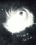
As I was saying yesterday, these two looked like they might do the FUJIWHARA EFFECT. Now it's pretty certain. I'm a little surprised that the JTWC hasn't used the term, since it's definitely the proper name for it. Anyway, here's the link to the wikipedia entry:
http://en.wikipedia.org/wiki/Fujiwhara_effectThe one sentence "The two vortices will be attracted to each other, and eventually spiral into the center point and merge."
is misleading, because that can only happen if one is much stronger than the other and atmospheric conditions are just right. But they straighten it out pretty well after that. The point they should have stressed is that when the two cyclones are near or at the same strength is when you see the maximum fujiwhara effect, where they rotate around their midpoint cyclonically until upper winds push them apart.
Anyway, these two are definitely going to start doing the fujiwhara within the next 12-24 hours. Since MELOR will be much stronger, we should expect PARMA to get pulled east much more than MELOR will go west. And since MELOR is stronger and will be closer to the stronger part of the upper southwesterlies, it will recurve pretty soon after the interaction anyway. But I wouldn't be surprised if it goes a little more west due to the interaction.
Here's the last JTWC prognosis reasoning where they talk about it:
WDPN33 PGTW 031500
MSGID/GENADMIN/NAVMARFCSTCEN PEARL HARBOR HI/JTWC//
SUBJ/PROGNOSTIC REASONING FOR TYPHOON 19W (PARMA) WARNING NR 24//
RMKS/
1. FOR METEOROLOGISTS.
2. 12 HOUR SUMMARY AND ANALYSIS.
A. TYPHOON 19W (PARMA), LOCATED APPROXIMATELY 220 NM NORTH OF
MANILA, PHILIPPINES, HAS TRACKED NORTHWESTWARD AT 06 KNOTS OVER
THE PAST SIX HOURS. THE TYPHOON HAS MADE LANDFALL WITH EXTREME
NORTHEASTERN LUZON, AND IS NOW LOCATED NEAR THE NORTH-CENTRAL
COASTLINE. THE ONLY REPORTING OBSERVATION SITE IN NORTHERN LUZON
(RPLI) HAD WINDS SUSTAINED AT 20 KNOTS (GUSTING TO 32 KNOTS) AS
OF 1000Z. SEA LEVEL PRESSURE WAS ALSO REPORTED AT 993 MB.
DVORAK VALUES FROM PGTW ESTIMATE THE INTENSITY AT 77 KNOTS.
3. FORECAST REASONING
A. THE FORECAST REASONING HAS NOT CHANGED SIGNIFICANTLY SINCE
THE PREVIOUS PROGNOSTIC REASONING BULLETIN.
B. THE SYSTEM WILL EMERGE INTO THE LUZON STRAIT AS A WEAKENED
SYSTEM, THOUGH GENERALLY FAVORABLE ENVIRONMENTAL CONDITIONS WILL
FACILITATE FURTHER INTENSIFICATION. HOWEVER, INTENSIFICATION WILL BE
LIMITED DUE TO UPWELLING OF COOLER WATER, WHICH IS TYPICAL OF SLOW-
MOVING SYSTEMS. THE SYSTEM WILL MORE OR LESS STALL IN THE LUZON
STRAIT FOR THE NEXT 36 - 48 HOURS UNTIL RIDGING IS ABLE TO BUILD BACK
IN FROM THE EAST. RIDGING IS EXPECTED TO RE-ESTABLISH ITSELF ONCE TY
20W SUFFICIENTLY MOVES OUT TO THE NORTHEAST.
C.
A DEGREE OF DIRECT CYCLONE INTERACTION IS EXPECTED TO OCCUR
WITH TY 20W, WHICH WILL BEND PARMA'S FORECAST TRACK SLIGHTLY
EQUATORWARD AFTER TAU 48. BETWEEN TAU 96 AND 120, TY 20W WILL PUSH
OUT TO THE NORTHEAST, REORIENTING THE MONSOON TROUGH SOUTHWEST TO
NORTHEAST, AND ALLOWING RIDGING TO WORK BACK INTO THE SOUTHEAST OF
THE SYSTEM. THESE CHANGES WILL ALSO ALLOW PARMA TO TRACK
NORTHEASTWARD. INTENSITY GUIDANCE KEEPS PEAK INTENSITY BETWEEN 90
AND 100 KNOTS, BUT A STRONGER SYSTEM IS NOT UNLIKELY AS IT MOVES
INTO THE PHILIPPINE SEA.