ENSO Updates (2007 thru 2023)

This is the general tropical discussion area. Anyone can take their shot at predicting a storms path.

Moderator: S2k Moderators

Forum rules

The posts in this forum are NOT official forecasts and should not be used as such. They are just the opinion of the poster and may or may not be backed by sound meteorological data. They are NOT endorsed by any professional institution or STORM2K. For official information, please refer to products from the National Hurricane Center and National Weather Service.

Help Support Storm2K
Message
Author
User avatar
cycloneye
Admin
Admin
Posts: 145282
Age: 68
Joined: Thu Oct 10, 2002 10:54 am
Location: San Juan, Puerto Rico

Re: ENSO Updates=BoM 1/6/10 update=El Nino may have peaked

#1041 Postby cycloneye » Wed Jan 06, 2010 6:23 am

Australians 1/6/10 ENSO Update

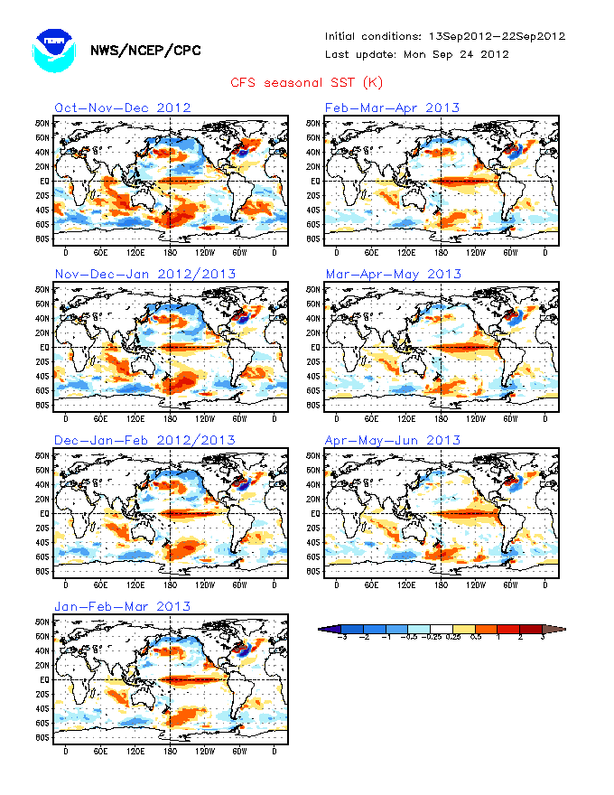
El Nino may have reached the peak of the mountain and go down from here.However,I prefer to wait a little more to see trends in that direction as is the first time the Aussies are saying that.

http://www.bom.gov.au/climate/enso/

Summary: Pacific Ocean warming near its peak

Central Pacific Ocean temperatures remain well above El Niño thresholds. Trade wind strength returned to near normal over the past fortnight, slightly reducing the excessive warmth of the equatorial Pacific Ocean. However, significant areas remain more than 2°C above average at the surface, and over 4°C warmer than normal at depth.

Climate models suggest that tropical Pacific temperatures may have peaked for this event, though are likley to remain above El Niño thresholds until the southern autumn.

Despite a rise in recent days, the Southern Oscillation Index has generally remained at levels typical of an El Niño event over the past fortnight. Similarly, cloudiness and rainfall near the equator have remained enhanced, typical of a mature El Niño event. The influence of El Niño events on Australian rainfall typically declines by mid to late summer.

In Brief

The tropical Pacific Ocean sea surface remains significantly warmer than the long-term average in central and eastern areas.

The sub-surface water of the tropical Pacific remains warmer than the long-term average.

The latest approximate 30-day SOI value is −5; the monthly value for December was −7.

Trade winds have strengthened to near normal conditions across the Pacific.

Cloudiness near the date-line remains above average.

All of the above are consistent with a moderate strength El Niño event, which most leading international computer models surveyed by the Bureau predict will persist through the southern hemisphere summer, but decline thereafter.

Details

Sea surface temperatures (SSTs) across the tropical Pacific Ocean remained above normal for the month of December. The SST anomaly map for December is available here; the map shows warm anomalies in excess of +1°C covering most of the tropical Pacific east of the dateline, with anomalies exceeding +2°C in parts of the central and far eastern Pacific. The map also shows near-normal SSTs covering most of the western Pacific and northern waters around Australia. The monthly NINO indices for December were +1.5°C, +1.8°C and +1.3°C for NINO3, NINO3.4 and NINO4 respectively. NINO3 and NINO 3.4 warmed when compared with November values; NINO3 by approximately 0.2°C and NINO3.4 by 0.1°C. NINO4 cooled by approximately 0.2°C over the same time. For both NINO3 and NINO3.4, the December values were the warmest monthly values since the El Niño of 1997/98.

Image

In terms of weekly data, the most recent NINO indices are +1.4°C, +1.7°C and +1.4°C for NINO3, NINO3.4 and NINO4 respectively for the week ending 3 January. When compared with two weeks ago all indices have fallen slightly; NINO4 by -0.1°C, NINO3 and NINO3.4 by -0.2°C. The 7-day SST anomaly map shows warm anomalies in excess of +1°C covering most of the tropical Pacific east of the dateline. In some areas, particularly between 170°W and 150°W, ocean temperatures are more than +2°C above normal, with a small regions having anomalies in excess of +3°C. When compared with anomalies observed two weeks ago, the central and eastern Pacific sea surface has cooled slightly. An animation of recent SST changes is available.

A four-month sequence of sub-surface Pacific Ocean equatorial temperature anomaly is available here. The sequence shows the rapid warming of the sub-surface through October and November, with anomalies greater than +4°C present in the eastern Pacific, between 110°W and 140°W. However, weak negative anomalies that propagated eastwards during December displaced some of the warm anomalies along the thermocline, particularly in the central Pacific. A recent map for the 5 days ending 3 January shows some cooling of the sub-surface in the western Pacific, with cool anomalies displacing the warm anomalies on and to the east of the dateline. When compared with two weeks ago, the far eastern Pacific sub-surface has cooled slightly although this region remains warmer than normal. An animation of recent sub-surface changes changes is available.

Trade winds have strengthened across the equatorial Pacific after having been weaker than normal throughout much of December, the result of a westerly wind burst entering the western Pacific. The latest weekly wind anomalies are shown in the TAO/TRITON map (small image above) for the five days ending 3 January. The map shows that on a weekly scale weak easterly anomalies are now evident in the central and eastern Pacific.

The SOI has risen over the past two weeks after being relatively stable for most of December; although the SOI is still at values typical of an El Niño event. The current 30-day SOI value (4 January) is −5. The monthly value for December was −7. The current SOI values are typical for this stage of an El Niño event SOI graph, SOI table).

Cloudiness near the date-line over the equatorial Pacific has been generally above normal (i.e. Outgoing Longwave Radiation below average) since July, in keeping with the development of the El Niño event. Cloudiness for the past two months has been well above average, apart from a short period of decreased cloudiness in mid-December.

In the latest survey of eight international computer models, all are predicting warm conditions to persist throughout the southern hemisphere summer. A majority of computer models are predicting that Pacific Ocean SSTs will start to cool by March next year, which is the typical timing for the decay of El Niño events. Recent forecasts from the POAMA model, run daily at the Bureau of Meteorology, show a continuation of warming with SSTs remaining above El Niño thresholds through the summer months.
0 likes   
Visit the Caribbean-Central America Weather Thread where you can find at first post web cams,radars
and observations from Caribbean basin members Click Here

wobblehead
Tropical Storm
Tropical Storm
Posts: 133
Joined: Fri Jul 15, 2005 12:51 pm
Location: Mobile.Al

#1042 Postby wobblehead » Wed Jan 06, 2010 10:50 pm

"A majority of computer models are predicting that Pacific Ocean SSTs will start to cool by March next year, which is the typical timing for the decay of El Niño events."

Report is current as of Jan 6, 2010 so I suspect the above statement should state SSTs will start to cool by March this year. Probably just a left over from last year. If not we are in for a wait for a decline of El Nino.
0 likes   

User avatar
cycloneye
Admin
Admin
Posts: 145282
Age: 68
Joined: Thu Oct 10, 2002 10:54 am
Location: San Juan, Puerto Rico

Re:

#1043 Postby cycloneye » Thu Jan 07, 2010 7:06 am

wobblehead wrote:"A majority of computer models are predicting that Pacific Ocean SSTs will start to cool by March next year, which is the typical timing for the decay of El Niño events."

Report is current as of Jan 6, 2010 so I suspect the above statement should state SSTs will start to cool by March this year. Probably just a left over from last year. If not we are in for a wait for a decline of El Nino.


It was a typing error.
0 likes   
Visit the Caribbean-Central America Weather Thread where you can find at first post web cams,radars
and observations from Caribbean basin members Click Here

User avatar
cycloneye
Admin
Admin
Posts: 145282
Age: 68
Joined: Thu Oct 10, 2002 10:54 am
Location: San Juan, Puerto Rico

Re: ENSO Updates=El Nino to last until late Spring

#1044 Postby cycloneye » Thu Jan 07, 2010 8:14 am

If you look closely at the images from December 21rst and January 11th,it seems that some of the little reds are not there at the 11th image.Lets continue to watch and see if what the Australians said about El Nino peaking is really occuring.

December 21rst

Image

January 11

Image

http://www.osdpd.noaa.gov/ml/ocean/sst/anomaly.html
0 likes   
Visit the Caribbean-Central America Weather Thread where you can find at first post web cams,radars
and observations from Caribbean basin members Click Here

User avatar
cycloneye
Admin
Admin
Posts: 145282
Age: 68
Joined: Thu Oct 10, 2002 10:54 am
Location: San Juan, Puerto Rico

Re: ENSO Updates=El Nino to last until late Spring

#1045 Postby cycloneye » Mon Jan 11, 2010 1:21 pm

Climate Prediction Center 1/11/10 Weekly Update

There were decreases in the anomaly temperatures at El Nino 1-2 and El Nino 3 areas,but overall no big changes from the previous status of El Nino that continues to be in a moderate to strong status.

Last Week Numbers

Niño 4= +1.4ºC
Niño 3.4= +1.8ºC
Niño 3= +1.4ºC
Niño1+2= +0.7ºC


This Week Numbers

Niño 4= +1.5ºC
Niño 3.4= +1.8ºC
Niño 3= +1.2ºC
Niño1+2= +0.3ºC


http://www.cpc.ncep.noaa.gov/products/a ... ts-web.pdf

Image
0 likes   
Visit the Caribbean-Central America Weather Thread where you can find at first post web cams,radars
and observations from Caribbean basin members Click Here

User avatar
cycloneye
Admin
Admin
Posts: 145282
Age: 68
Joined: Thu Oct 10, 2002 10:54 am
Location: San Juan, Puerto Rico

Re: ENSO Updates=El Nino to last until late Spring

#1046 Postby cycloneye » Mon Jan 18, 2010 8:58 am

This loop of the anomalies in the Pacific shows what appears to be some weakening of El Nino,although not a big deal.As the updates from the Australians and Climate Prediction Center have said,El Nino may have peaked.Lets continue to watch the progress of ENSO to see if a trend towards El Nino weakening sustains or is a blip.

Image
0 likes   
Visit the Caribbean-Central America Weather Thread where you can find at first post web cams,radars
and observations from Caribbean basin members Click Here

User avatar
cycloneye
Admin
Admin
Posts: 145282
Age: 68
Joined: Thu Oct 10, 2002 10:54 am
Location: San Juan, Puerto Rico

Re: ENSO Updates=El Nino to last until late Spring

#1047 Postby cycloneye » Mon Jan 18, 2010 10:07 am

Climate Prediction Center 1/18/10 weekly update

This update shows some decreases including a modest decrease of .01 at El Nino 3-4.We can't say yet about a trend of sustained weakening but it looks like it has peaked.

Last Week Numbers

Niño 4= +1.5ºC
Niño 3.4= +1.8ºC
Niño 3= +1.2ºC
Niño1+2= +0.3ºC


This Week Numbers

Niño 4= +1.5ºC
Niño 3.4= +1.7ºC
Niño 3= +1.1ºC
Niño1+2= +0.3ºC


http://www.cpc.ncep.noaa.gov/products/a ... ts-web.pdf

Image
0 likes   
Visit the Caribbean-Central America Weather Thread where you can find at first post web cams,radars
and observations from Caribbean basin members Click Here

jinftl
Category 5
Category 5
Posts: 4312
Joined: Tue Aug 31, 2004 4:47 pm
Location: fort lauderdale, fl

Re: ENSO Updates=Climate Prediction Center 1/18/10 update

#1048 Postby jinftl » Mon Jan 18, 2010 5:24 pm

IRI graphic below compares the current el nino with other years that had comparable ones (as measured by nino region 3.4 sst anomalies). In the analogue years, the peaks of the el ninos were in winter (just like the current one which is forecast to be currently peaking), and by the peak of the hurricane season, only the '86-'87 analogue had signficant el nino conditions remaining. The rest had transitioned to predominantly enso neutral conditions...to even la nina conditions in some cases (el nino is defined as the nino 3.4 sst anomaly being over +0.5C, enso neutral is -0.5C to +0.5C, and la nina is under -0.5C).

Image
0 likes   

User avatar
cycloneye
Admin
Admin
Posts: 145282
Age: 68
Joined: Thu Oct 10, 2002 10:54 am
Location: San Juan, Puerto Rico

Re: ENSO Updates=BoM and CPC=El Nino may have peaked

#1049 Postby cycloneye » Wed Jan 20, 2010 9:02 am

Australians 1/20/10 update

Some cooling in small areas of the Pacific.March will be the key month to see where El Nino is at that time.

http://www.bom.gov.au/climate/enso/

Details
The Pacific Ocean sea surface temperature (SST) remains warmer than the long-term average across the central and eastern tropical Pacific. The SST anomaly map for December shows warm anomalies in excess of +1°C covering most of the tropical Pacific east of the dateline, with anomalies exceeding +2°C in parts of the central and far eastern Pacific. The map also shows near-normal SSTs covering most of the western Pacific and northern waters around Australia. The monthly NINO indices for December were +1.5°C, +1.8°C and +1.3°C for NINO3, NINO3.4 and NINO4 respectively. The NINO3 and NINO3.4 values were the warmest monthly values recorded since the El Niño of 1997/98.

Image

In terms of weekly data, the most recent NINO indices are +1.2°C, +1.7°C and +1.3°C for NINO3, NINO3.4 and NINO4 respectively. When compared with two weeks ago, the central Pacific has cooled slightly; NINO3 cooled by approximately 0.2°C and NINO4 by approximately 0.1°C. The 7-day SST anomaly map shows warm anomalies in excess of +1°C covering most of the tropical Pacific east of 170°E, while ocean temperatures are more than 2°C above average between the date-line and 140°W. When compared with anomalies observed a fortnight ago, the central and eastern Pacific sea surface has cooled slightly. An animation of recent SST changes is available.

A four-month sequence of sub-surface Pacific Ocean equatorial temperature anomaly shows a significant warming of the central and then eastern tropical Pacific through October and November, with warm anomalies in excess of +4°C evident between 110°W and 140°W by the end of November. During December, although the sub-surface continued to warm in the far east, the central Pacific sub-surface water began to cool. A recent map for the 5 days ending 18 January shows that a large volume of warmer than normal water persists below the surface of the tropical Pacific, with anomalies exceeding +4°C in the eastern Pacific. When compared with two weeks ago, the sub-surface of the equatorial Pacific has slightly cooled. An animation of recent sub-surface changes is available.

An archive of past SST and sub-surface temperature charts is available.

Trade winds have strengthened across the central and eastern tropical Pacific over the first half of January, with trades now near normal in strength across the central Pacific and slightly stronger than normal in the eastern Pacific. Trade winds remain weaker than average in the far western Pacific. The latest weekly wind anomalies are shown in the TAO/TRITON map (small image above) for the five days ending 18 January.

The SOI has increased slowly through January, after being relatively stable for most of December. The current 30-day SOI value (18 January) is −3, which is in the neutral range. The monthly value for December was −7. The 90-day value remains low, at −8. (SOI graph, SOI table).

Cloudiness near the date-line across the equatorial Pacific is another important indicator of El Niño conditions, as it typically increases near and to the east of the dateline during these episodes. Consistent with an El Niño event, cloudiness near the dateline has been generally greater than normal since July. Cloudiness over the past two months has been particularly enhanced near the date-line, typical of a mature El Niño event.

Most international computer models are predicting that the warm tropical Pacific Ocean temperatures will persist in El Niño regions over the remainder of the southern hemisphere summer. The majority of models are predicting a gradual cooling of SSTs by March and a return to neutral conditions by the southern hemisphere autumn or winter. Typically, autumn is a transitional period for ENSO, hence model predictions of El Niño that forecast through this period are less reliable than at other times of the year. Recent forecasts from the POAMA model, run daily at the Bureau of Meteorology, show a gradual cooling with SSTs remaining above El Niño thresholds through the southern hemisphere summer and autumn.
0 likes   
Visit the Caribbean-Central America Weather Thread where you can find at first post web cams,radars
and observations from Caribbean basin members Click Here

User avatar
srainhoutx
S2K Supporter
S2K Supporter
Posts: 6919
Age: 67
Joined: Sun Jan 14, 2007 11:34 am
Location: Haywood County, NC
Contact:

Re: ENSO Updates=BoM and CPC=El Nino may have peaked

#1050 Postby srainhoutx » Wed Jan 20, 2010 9:06 am

There are some hints that El Nino may rebound a touch and linger longer than some early forecasts have called for. It will be interesting to see if this infact happens and how early projections will change come March/April.
0 likes   
Carla/Alicia/Jerry(In The Eye)/Michelle/Charley/Ivan/Dennis/Katrina/Rita/Wilma/Ike/Harvey

Member: National Weather Association
Wx Infinity Forums
http://wxinfinity.com/index.php

Facebook.com/WeatherInfinity
Twitter @WeatherInfinity

User avatar
cycloneye
Admin
Admin
Posts: 145282
Age: 68
Joined: Thu Oct 10, 2002 10:54 am
Location: San Juan, Puerto Rico

Re: ENSO Updates=BoM and CPC=El Nino may have peaked

#1051 Postby cycloneye » Wed Jan 20, 2010 6:43 pm

January ENSO Models update

If the models are right,by August el Nino will be gone and replaced by Neutral conditions.Below are the graphics and discussion of this January update by IRI.

Image

Image

http://iri.columbia.edu/climate/ENSO/cu ... nical.html

Current Conditions

As of mid-January 2010, SSTs are above-average throughout the central and eastern equatorial Pacific, indicative of El Niño conditions. Between mid-June and mid-July, SSTs in the east-central tropical Pacific warmed to levels indicative of weak El Niño conditions. Starting in October, intermittently strong westerly wind anomalies in the western Pacific, extending into the central Pacific, substantially increased the magnitude of the warm SST anomalies. The traditional Southern Oscillation Index (SOI) became negative during October, as did the equatorial SOI. The traditional SOI has remained negative since then, although the equatorial SOI returned to neutral in November and remains neutral. Positive convection anomalies were observed intermittently near and just west of the dateline between June and September, and became somewhat stronger and more persistent since October. On the oceanic side, equatorial heat content had been above-average since early in the year, and became stronger since October. The SST anomalies are likely to remain moderately to strongly positive, at least for the next couple months, due to the supply of accumulated anomalous sub-surface heat.

For December 2009, the SST anomaly in the NINO3.4 region was 1.83 C, sufficient to be classified as moderate(+) El Niño conditions for this time of year. For the Oct-Nov-Dec season the anomaly was 1.51 degrees C. Currently the IRI's definition of El Niño conditions rests on an index of SST anomalies, averaged over the NINO3.4 region (5S-5N; 170W-120W), exceeding the warmest 25%-ile of the historical distribution, and similarly for La Niña relative to the 25%-ile coldest conditions in the historical distribution. The NINO3.4 anomaly necessary to qualify as La Niña or El Niño conditions for the Jan-Feb-Mar and the Feb-Mar-Apr seasons are approximately (-0.55C, 0.50) and (-0.45, 0.40), respectively.


Expected Conditions

The most recent weekly SST anomaly in the NINO3.4 region is 1.7 C, indicating moderate-to-strong El Niño conditions in the tropical Pacific. What is the outlook for the ENSO status going forward? The spells of strengthened westerly wind anomalies along the equator in the western Pacific for several weeks in September/October, and again in November/December, provided substantial positive depth anomalies to the central and eastern thermocline. Beginning in October, the spatial pattern of SST anomalies, and of the subsurface temperature anomalies, become more structured and reminiscent of El Niño events. However, the extent to which this pattern of SST anomalies has induced a strong, multi-month atmospheric response leading to air-sea couping of the type observed in strong El Niño events, has not been great. Significant positive convection anomalies have appeared, and are currently observed, near and just west of the dateline. While this has been somewhat suggestive of air-sea coupling, eastward expansion of the anomalous convection would allow for more significant coupling. So far, this stronger, more obvious air-sea coupling has not been evident during this El Nino despite the presence of moderate to strong SST anomalies at locations favorable for such coupling.

January is the time of year when existing ENSO events are often in their mature phase, and typically persist for one to four subsequent months while weakening. For this event, it seems most likely that El Niño conditions will persist at least into mid-March 2010, and, given the currently strong subsurface anomalies, may endure for another few months. A premature dissipation, such as that observed in early 2007, seems unlikely for this event.

Presently, the models and observations taken together indicate probabilities of about 97% for maintaining El Niño conditions and about 3% for dissipation to ENSO-neutral conditions for the Jan-Feb-Mar season in progress. Going forward, probabilities for El Niño stay at or above 90% through Feb-Mar-Apr, after which they decrease to approximately 55-60% by Apr-May-Jun 2010, falling to climatological probabilities of 25% by Jul-Aug-Sep. Probabilities for La Niña conditions are predicted to be negligible for the next several months, not exceeding 10% until May-Jun-Jul 2010.


The above assessment was made in part on the basis of an examination of the current forecasts of ENSO prediction models as well as the observed conditions. For purposes of this discussion, El Niño SST conditions are defined as SSTs in the NINO3.4 region being in the warmest 25% of their climatological distribution for the 3-month period in question over the 1950-present timeframe. The corresponding cutoff in terms of degrees C of SST anomaly varies seasonally, being close to 0.40 degrees C in boreal late-spring to early-summer season and as high as 0.75 degrees C in late boreal autumn. La Niña conditions are defined as NINO3.4 region SSTs being in the coolest 25% of the climatological distribution. Neutral conditions occupy the remaining 50% of the distribution. These definitions were developed such that the most commonly accepted El Niño and La Niña episodes are reproduced.

The models are in general agreement in their ENSO forecasts through the first few months of the 10-month forecast period, but show differences toward the end of the period. The statistical and dynamical models agree in predicting weakening El Niño conditions, beginning either currently or within the next 1 to 2 months, through summer 2010. The details of the timing and the rate of dissipation differ among models. The warmest NINO3.4 forecasts come from the dynamical models, with forecasts for the initial period most closely in agreement with the observations of the most recently completed month (December). For the current Jan-Feb-Mar season, 100% of the models are predicting El Niño conditions; none predict ENSO-neutral conditions. At lead times of 4 or more months into the future, statistical and dynamical models that incorporate information about the ocean's observed sub-surface thermal structure generally exhibit higher predictive skill than those that do not. Among models that do use sub-surface temperature information, 8 of 15 (53%) indicate El Niño conditions for the May-Jun-Jul season, and 7 of 15 (47%) predict ENSO-neutral SSTs. (Note 1). Caution is advised in interpreting the distribution of model forecasts as the actual probabilities. At longer leads, the skill of the models degrades, and skill uncertainty must be convolved with the uncertainties from initial conditions and differing model physics, leading to more climatological probabilities in the long-lead ENSO Outlook than might be suggested by the suite of models. Furthermore, the expected skill of one model versus another has not been established using uniform validation procedures, which may cause a difference in the true probability distribution from that taken verbatim from the raw model predictions.


An alternative way to assess the probabilities of the three possible ENSO conditions is to use the mean of the forecasts of all models, and to construct a standard error function centered on that mean. The standard error would be Gaussian in shape, and would have its width determined by an estimate of overall expected model skill for the season of the year and the lead time. Higher skill would result in a relatively narrower error distribution, while low skill would result in an error distribution with width approaching that of the historical observed distribution. This method shows probabilities for El Niño at about 100% and 99% for Jan-Feb-Mar and Feb-Mar-Apr, respectively, declining to 54% by May-Jun-Jul 2010 and 43% by Jun-Jul-Aug. The same cautions mentioned above for the distribution of model forecasts apply to this alternative method of inferring probabilities, due to differing model biases and skills. In particular, this approach considers only the mean of the predictions, and not the range across the models, nor the ensemble range within individual models.


The IRI's probabilistic ENSO forecast takes into account the indications of this set of models, the outcome of the standard error approach described above, and additional factors such as the very latest observations that may have developed after the initialization times of some of the models. It indicates a 97% probability for El Niño conditions in the Jan-Feb-Mar season in progress, slowly decreasing to near 82% for Mar-Apr-May 2010 and decreasing rapidly thereafter.
0 likes   
Visit the Caribbean-Central America Weather Thread where you can find at first post web cams,radars
and observations from Caribbean basin members Click Here

User avatar
Blown Away
S2K Supporter
S2K Supporter
Posts: 10145
Joined: Wed May 26, 2004 6:17 am

Re: ENSO=Models forecast El Nino to last until late spring

#1052 Postby Blown Away » Thu Jan 21, 2010 12:27 pm

What effect does El Nino to Neutral conditions have on the strength of the Bermuda High during the hurricane season?
0 likes   
Hurricane Eye Experience: David 79, Irene 99, Frances 04, Jeanne 04, Wilma 05... EYE COMING MY WAY IN 2024…
Hurricane Brush Experience: Andrew 92, Erin 95, Floyd 99, Matthew 16, Irma 17, Ian 22, Nicole 22…

User avatar
cycloneye
Admin
Admin
Posts: 145282
Age: 68
Joined: Thu Oct 10, 2002 10:54 am
Location: San Juan, Puerto Rico

Re: ENSO=Models forecast El Nino to last until late spring

#1053 Postby cycloneye » Thu Jan 21, 2010 1:37 pm

Below are one month apart graphics from December 21st to January 21st of how El Nino is doing.Somewhat less reds on the January graphic.

December 21st

Image

January 21st

Image
0 likes   
Visit the Caribbean-Central America Weather Thread where you can find at first post web cams,radars
and observations from Caribbean basin members Click Here

User avatar
BigA
Professional-Met
Professional-Met
Posts: 1317
Joined: Sun Jul 24, 2005 10:56 pm

Re: ENSO=Models forecast El Nino to last until late spring

#1054 Postby BigA » Thu Jan 21, 2010 3:25 pm

Blown_away wrote:What effect does El Nino to Neutral conditions have on the strength of the Bermuda High during the hurricane season?


From a presentation that I saw at the AMS meeting this year, El Nino tends to cause storms to recurve earlier. My extrapolation of this would be that the strength of the El Nino would be inversely correlated with the strength/effect of the Bermuda High. That said, the speaker also said that if the warming is in the central Pacific, she found that storms tended to go more westward. However, I do not know how much data she used for this central Pacific conclusion, nor do I know where the warm anomalies will be come hurricane season.
0 likes   

User avatar
cycloneye
Admin
Admin
Posts: 145282
Age: 68
Joined: Thu Oct 10, 2002 10:54 am
Location: San Juan, Puerto Rico

Re: ENSO=Models forecast El Nino to last until late spring

#1055 Postby cycloneye » Fri Jan 22, 2010 1:14 pm

The Southern Occilation Index has gone up in the past few days signaling that what the recent data from Climate Prediction Center and the Australians have showed about El Nino may have reached its peak.

Image

Daily SOI Index

http://www.longpaddock.qld.gov.au/Seaso ... SOIValues/
0 likes   
Visit the Caribbean-Central America Weather Thread where you can find at first post web cams,radars
and observations from Caribbean basin members Click Here

User avatar
cycloneye
Admin
Admin
Posts: 145282
Age: 68
Joined: Thu Oct 10, 2002 10:54 am
Location: San Juan, Puerto Rico

Re: ENSO=Models forecast El Nino to last until late spring

#1056 Postby cycloneye » Sat Jan 23, 2010 3:17 pm

Here is the subsurface loop that shows the blue expanding a little bit.Lets continue to watch what happens in the next couple of months and see if El Nino is fading slowly or hangs a little longer than what the models are forecasting.

Image
0 likes   
Visit the Caribbean-Central America Weather Thread where you can find at first post web cams,radars
and observations from Caribbean basin members Click Here

User avatar
cycloneye
Admin
Admin
Posts: 145282
Age: 68
Joined: Thu Oct 10, 2002 10:54 am
Location: San Juan, Puerto Rico

Re: ENSO Updates=CPC 1/25/10=El Nino sst anomalies decrease

#1057 Postby cycloneye » Mon Jan 25, 2010 2:10 pm

Climate Prediction Center 1/25/10 update

This weekly update shows big decreases in all the El Nino areas including El Nino 3-4.A definite trend towards El Nino fading or is only noise?

Last Week Numbers

Niño 4= +1.5ºC
Niño 3.4= +1.7ºC
Niño 3= +1.1ºC
Niño1+2= +0.3ºC


This Week Numbers

Niño 4= +1.4ºC
Niño 3.4= +1.4ºC
Niño 3= +0.8ºC
Niño1+2= +0.1ºC


http://www.cpc.ncep.noaa.gov/products/a ... ts-web.pdf

Image
0 likes   
Visit the Caribbean-Central America Weather Thread where you can find at first post web cams,radars
and observations from Caribbean basin members Click Here

User avatar
Macrocane
Category 5
Category 5
Posts: 4218
Age: 36
Joined: Sun May 24, 2009 5:35 pm
Location: El Salvador

Re: ENSO Updates=CPC 1/25/10=El Nino sst anomalies decrease

#1058 Postby Macrocane » Mon Jan 25, 2010 2:45 pm

This week's CFS ensemble mean shows El Niño fading a little for a couple of months and then it becames steady for several months with the anomaly near 1.0 °C. I don't like that scenario, that would mean the second consecutive year with higher than normal temperatures and irregular rain patterns for Central America.
0 likes   

User avatar
BigA
Professional-Met
Professional-Met
Posts: 1317
Joined: Sun Jul 24, 2005 10:56 pm

Re: ENSO Updates=CPC 1/25/10=El Nino sst anomalies decrease

#1059 Postby BigA » Mon Jan 25, 2010 3:58 pm

From what the January models seem to show, it looks like El Nino is going to weaken substantially in the next two months, then gradually thereafter.
0 likes   

User avatar
cycloneye
Admin
Admin
Posts: 145282
Age: 68
Joined: Thu Oct 10, 2002 10:54 am
Location: San Juan, Puerto Rico

Re: ENSO Updates=CPC 1/25/10=El Nino sst anomalies decrease

#1060 Postby cycloneye » Mon Jan 25, 2010 5:20 pm

There is no consensus among the models on when El Nino will vanish or if it mantains around albeit a weak one when the peak of the Atlantic Hurricane Season (August,September,October) arrives as many dynamic models vanish El Nino by late Spring / Early Summer.Below is the CFS (NCEP) model that mantains El Nino thru August,September and October but again a weaker El Nino from the Moderate to Strong El Nino that is now present.

Image
0 likes   
Visit the Caribbean-Central America Weather Thread where you can find at first post web cams,radars
and observations from Caribbean basin members Click Here


Return to “Talkin' Tropics”

Who is online

Users browsing this forum: No registered users and 27 guests