Jim Lushine's Dry SFL May Theory Is On The Clock!

This is the general tropical discussion area. Anyone can take their shot at predicting a storms path.

Moderator: S2k Moderators

Forum rules

The posts in this forum are NOT official forecasts and should not be used as such. They are just the opinion of the poster and may or may not be backed by sound meteorological data. They are NOT endorsed by any professional institution or STORM2K. For official information, please refer to products from the National Hurricane Center and National Weather Service.

Help Support Storm2K
Message
Author
User avatar
Blown Away
S2K Supporter
S2K Supporter
Posts: 10147
Joined: Wed May 26, 2004 6:17 am

Jim Lushine's Dry SFL May Theory Is On The Clock!

#1 Postby Blown Away » Mon May 03, 2010 7:36 pm

Image
Article to explain Jim Lushine's theory:
https://www.insurancejournal.com/news/s ... /54367.htm

Well SFL May was very dry so it's time to BUMP this post. Jim Lushine's theory is not hardcore science, but it is an interesting theory for those of us that track SFL hurricanes. Years ago I emailed Robert Molleda from the Miami NWS about this theory and here is some information he provided to me:
Per Mr. Molleda:
(1) Jim Lushine used rainfall data from Miami, Ft Lauderdale, and Palm Beach International Airports for his study. (2) Jim Lushine told him that rain amounts favorable for SFL hurricanes were either one or two standard deviations below average, or something around 1” for the month of May. (3) Robert said there have been correlation studies and these studies couldn’t come up with a strong correlation between dry Mays and SFL rainfall. Thus, they discounted this theory until they can do a more thorough analysis area wide.
Last edited by Blown Away on Mon Jun 03, 2024 7:20 am, edited 6 times in total.
0 likes   
Hurricane Eye Experience: David 79, Irene 99, Frances 04, Jeanne 04, Wilma 05... EYE COMING MY WAY IN 2024…
Hurricane Brush Experience: Andrew 92, Erin 95, Floyd 99, Matthew 16, Irma 17, Ian 22, Nicole 22…

User avatar
Blown Away
S2K Supporter
S2K Supporter
Posts: 10147
Joined: Wed May 26, 2004 6:17 am

Re: Jim Lushine's Theory: Dry SFL May = High SFL Hurricane Risk?

#2 Postby Blown Away » Tue May 04, 2010 6:34 am

LUSHINE LINE MAY HINT IF STORM WILL HIT
Palm Beach Post, Jun 8, 2004 | by ELIOT KLEINBERG Palm Beach
Hurricane groupies now have the Lushine Line, an imaginary boundary in the ocean that might foretell whether major storms will strike South Florida.

The line, running due north of the Dominican Republic's east coast, along longitude 68 degrees west from latitude 19 to 26 degrees north, was developed by Jim Lushine, meteorologist for the National Weather Service's Miami office.

Since 1851, 14 "major hurricanes" - with sustained winds of at least 111 mph - are recorded to have struck South Florida, from Jupiter to Homestead and from the Naples area south. Of the 14, a dozen went through the line, Lushine said.

"It's an area you really watch for," Lushine said last week at the South Florida Hurricane Conference in Fort Lauderdale.

But Lushine noted that such exercises always have caveats. He said 140 systems of at least tropical-storm strength have crossed the line, and only 12 struck South Florida as major hurricanes. And two major hurricanes struck South Florida without crossing the line, he said. "It's not that it can't happen because Lushine said it has to cross the line," he said.

There's some obvious and simple logic behind Lushine's method.
All 12 of the 14 major hurricanes that crossed the line and struck South Florida were "Cape Verde" storms, named for the island chain off Africa's west coast where great storms form, then grow as they cross thousands of miles of warm Atlantic waters.

Storms passing north of the line tend to make that historical curve away from land, where most die in the open ocean. Those passing south of the line do one of two things.

They stay in a western path that takes them south of the peninsula, then into the Gulf of Mexico, or they fall victim to the high ground of Cuba and Hispaniola, which tear up a hurricane's circulation like a crowbar in the spokes of a bicycle wheel.

The two major storms that failed to cross the line but still struck the peninsula came in 1910 and 1950. Both were late-season storms that sprang up in the Caribbean and struck from the south.

The northernmost of the 12 to cross the line was Andrew, crossing at about 25.5 degrees north latitude. The southernmost, crossing at about 19 degrees north, was the 1928 Lake Okeechobee hurricane.
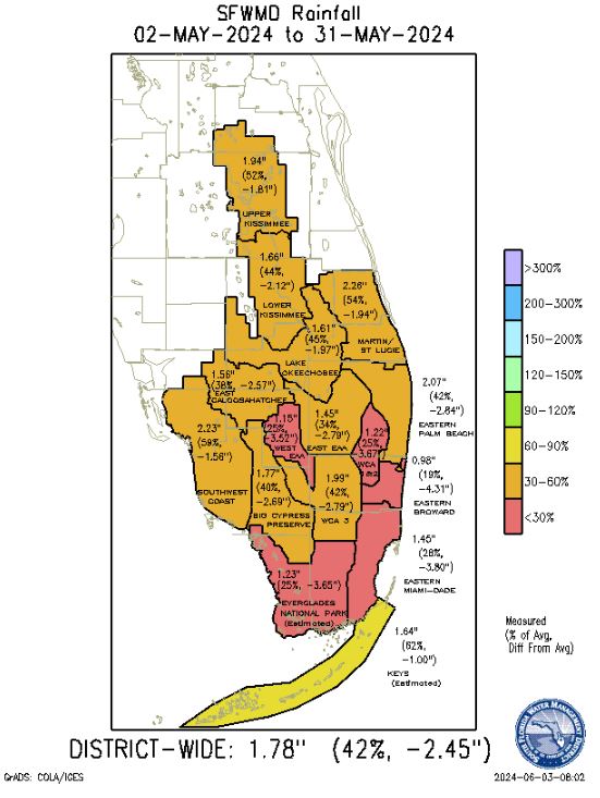
Lushine also theorizes a connection between dry Mays and hurricanes striking Florida.

Since 1912, 16 hurricanes have affected the Miami-Dade, Broward and Palm Beach County region. The average of May rainfall totals recorded at the three major airports in those counties was below normal in years when 15 of those storms struck, the exception being 1964 (Cleo).

Last month, Lushine said, was the 13th-driest May on record. Eight of the 12 driest Mays produced a tropical storm or hurricane that struck the three-county region. Six of those Mays led to hurricanes, with five of those becoming major hurricanes. The driest May on record was 1965, when Betsy struck; the second-driest was 1992, the year of Andrew.

Lushine is retiring after 42 years in the business, 33 of them at the Miami office. This will be his last hurricane season.
"I hope," he said, "it goes out with a whimper and not a bang."

- eliot_kleinberg@pbpost.com
Copyright 2004
0 likes   
Hurricane Eye Experience: David 79, Irene 99, Frances 04, Jeanne 04, Wilma 05... EYE COMING MY WAY IN 2024…
Hurricane Brush Experience: Andrew 92, Erin 95, Floyd 99, Matthew 16, Irma 17, Ian 22, Nicole 22…

User avatar
weatherwindow
Category 4
Category 4
Posts: 904
Joined: Mon Sep 20, 2004 9:48 am
Location: key west/ft lauderdale

Re: Jim Lushine's Theory: Dry SFL May = High SFL Hurricane Risk?

#3 Postby weatherwindow » Tue May 04, 2010 6:37 am

despite a few flops, i believe that there may be some weak positive correlation/telelconnect at work here...more importantly, however it does appear that the persistent longwave ridge-trough pattern, affecting the southeast all winter,has finally been replaced(albeit, perhaps only shortterm). it will be interesting to note if this ridging is only a shortterm phenomenon or a more persistent blocking trough-ridge pattern change... which could have possible consequences down the road.....rich
0 likes   

User avatar
boca
Category 5
Category 5
Posts: 6367
Age: 60
Joined: Mon Dec 15, 2003 8:49 am
Location: Boca Raton,FL

Re: Jim Lushine's Theory: Dry SFL May = High SFL Hurricane Risk?

#4 Postby boca » Tue May 04, 2010 9:29 pm

After are wet winter and early spring. Our May is dry,the longwave pattern has an upper high over us. Only 20% rain chances at most during the next 7 days.
0 likes   

User avatar
boca
Category 5
Category 5
Posts: 6367
Age: 60
Joined: Mon Dec 15, 2003 8:49 am
Location: Boca Raton,FL

Re: Jim Lushine's Theory: Dry SFL May = High SFL Hurricane Risk?

#5 Postby boca » Thu May 06, 2010 6:25 am

THE FORECAST SCENARIO FOR FRIDAY AND BEYOND WILL BE FOR A DEEP
LAYERED MEAN RIDGE TO GRADUALLY BUILD IN ACROSS FLORIDA. THIS WILL
GRADUALLY LEAD TO INCREASING STABILITY ALONG WITH A LOWERING OF
MOISTURE LEVELS. STILL...INSTABILITY LOOKS SUFFICIENT ON FRIDAY
FOR SCATTERED TSTORMS FOCUSED OVER THE INTERIOR. LESS MOISTURE ON
SATURDAY WILL LEAD TO LESS CONVECTION...WITH JUST A SLIGHT CHANCE
ACROSS SE AREAS. RIDGE REALLY LOOKS TO TAKE HOLD NEXT WEEK WITH
BOTH GFS AND ECMWF SHOWING THE RIDGE MOVING INTO THE EASTERN GULF
AND EVENTUALLY OVERHEAD BY THE MIDDLE/LATTER PART OF NEXT WEEK.
MOISTURE LEVELS LOOK RATHER LOW TOO...AND WITH LARGE SCALE
SUBSIDENCE...IT LOOKS LIKE A DRY AND WARM EXTENDED PERIOD.

Hello dry May!!!
0 likes   

User avatar
thetruesms
Professional-Met
Professional-Met
Posts: 844
Age: 41
Joined: Thu Aug 16, 2007 1:14 pm
Location: Tallahasee, FL
Contact:

#6 Postby thetruesms » Thu May 06, 2010 8:53 am

However, before that happens, we've got a chance for some severe weather this afternoon.
Image

Take a passing upper disturbance, a moisture axis from that dissipating boundary, some sea breeze, and voila - slight risk of severe weather. Mid-level subsidence on the western half of the peninsula might keep things down a bit on that side, but the eastern half looks like it has a juicy setup for some pulse storms.
0 likes   

User avatar
Blown Away
S2K Supporter
S2K Supporter
Posts: 10147
Joined: Wed May 26, 2004 6:17 am

Re: Jim Lushine's Theory: Dry SFL May = High SFL Hurricane Risk?

#7 Postby Blown Away » Thu May 06, 2010 8:05 pm

:uarrow:
You nailed it, we had some showers rate along the coast today, no more than 10 miles inland.
0 likes   
Hurricane Eye Experience: David 79, Irene 99, Frances 04, Jeanne 04, Wilma 05... EYE COMING MY WAY IN 2024…
Hurricane Brush Experience: Andrew 92, Erin 95, Floyd 99, Matthew 16, Irma 17, Ian 22, Nicole 22…

User avatar
DESTRUCTION5
Category 5
Category 5
Posts: 4423
Age: 43
Joined: Wed Sep 03, 2003 11:25 am
Location: Stuart, FL

Re: Jim Lushine's Theory: Dry SFL May = High SFL Hurricane Risk?

#8 Postby DESTRUCTION5 » Thu May 06, 2010 8:52 pm

Blown Away wrote::uarrow:
You nailed it, we had some showers rate along the coast today, no more than 10 miles inland.


Did'nt we test this same pathetic theory last year to a bust? lol
0 likes   
GATOR NATION IS E V E R Y W H E R E !

User avatar
gatorcane
S2K Supporter
S2K Supporter
Posts: 23691
Age: 47
Joined: Sun Mar 13, 2005 3:54 pm
Location: Boca Raton, FL

#9 Postby gatorcane » Thu May 06, 2010 10:09 pm

Lots of rain in palm beach county today. Seems the rainy season has already started. So far about normal on rainfall.
0 likes   

User avatar
boca
Category 5
Category 5
Posts: 6367
Age: 60
Joined: Mon Dec 15, 2003 8:49 am
Location: Boca Raton,FL

Re: Jim Lushine's Theory: Dry SFL May = High SFL Hurricane Risk?

#10 Postby boca » Fri May 07, 2010 7:56 am

It should dry out here during the next 7 to 10 days.
0 likes   

Frank2
Category 5
Category 5
Posts: 4061
Joined: Mon Jul 25, 2005 12:47 pm

Re: Jim Lushine's Theory: Dry SFL May = High SFL Hurricane Risk?

#11 Postby Frank2 » Fri May 07, 2010 1:52 pm

April was incredibly wet, but so far May is drier (though not completely dry), so we'll see if Jim is correct...
0 likes   

User avatar
thetruesms
Professional-Met
Professional-Met
Posts: 844
Age: 41
Joined: Thu Aug 16, 2007 1:14 pm
Location: Tallahasee, FL
Contact:

Re: Jim Lushine's Theory: Dry SFL May = High SFL Hurricane Risk?

#12 Postby thetruesms » Fri May 07, 2010 1:57 pm

Frank2 wrote:April was incredibly wet, but so far May is drier (though not completely dry), so we'll see if Jim is correct...
Image

Month to Date % of normal precip. So depending on where you are, it's really rained in May, or it hasn't rained at all. :lol:

edit - yes, percentage of normal a week into the month is a bit misleading :oops:
0 likes   

User avatar
Recurve
Category 5
Category 5
Posts: 1640
Joined: Tue Aug 16, 2005 8:59 pm
Location: St. Petersburg, FL

Re: Jim Lushine's Theory: Dry SFL May = High SFL Hurricane Risk?

#13 Postby Recurve » Sat May 08, 2010 4:56 pm

As reference, in South Florida, May is typically drier than any summer month, with June, September and October having the highest rainfall.
This is average precipitation for Tavernier in the Florida Keys

Code: Select all

Average Total Precipitation (in.)
Jan  2.03
Feb    1.90    
Mar  1.98
April    1.94    
May  3.84
June  6.50
July  4.18
Aug   5.37
Sep  7.06
Oct  6.70
Nov  2.45
Dec  1.99
Total 45.95
0 likes   

jinftl
Category 5
Category 5
Posts: 4312
Joined: Tue Aug 31, 2004 4:47 pm
Location: fort lauderdale, fl

Re: Jim Lushine's Theory: Dry SFL May = High SFL Hurricane Risk?

#14 Postby jinftl » Sun May 09, 2010 3:29 pm

On the mainland of south florida, May is typically somewhat wetter. And I guess that it is departure from average (not how wet the month typically is overall) that determines whether it is a "Lushine May" in South Florida. We are very much on track for a below normal rainfall month...so far...of course that could change quickly during the 2nd half of the month, but rainfall the first half has been/is forecast to be anemic at best.

Average May rainfall:

Miami (airport): 5.52"
Fort Lauderdale (airport): 6.33"
West Palm Beach (airport): 5.39"

May 2010 rainfall month-to-date (as of 5/9/10:)
Miami: 0.02"
Fort Lauderdale: 0.17"
West Palm Beach: 0.57"


Looks like we will at least get though mid-month with little additional rainfall. Per NWS Miami Discussion:

.EXTENDED FORECAST...
THE HIGH WILL REMAIN NEARLY STATIONARY MIDDLE OF THIS WEEK INTO
NEXT WEEKEND WHILE SLOWLY WEAKENING. THIS WILL KEEP THE BREEZY
WINDS ALONG THE EAST COAST METRO AREAS FOR WEDNESDAY...BEFORE
SLOWLY DECREASING TO 10 TO 15 KNOTS BY LATE THIS WEEK INTO NEXT
WEEKEND. SO HAVE KEPT THE SLIGHT CHANCE OF LIGHT SHOWERS ALONG THE
EAST COAST METRO AREAS ON WEDNESDAY...BEFORE GOING TO A SLIGHT 10
POPS FOR LATE THIS WEEK INTO NEXT WEEKEND. FOR REST OF THE
CWA...THE WEATHER SHOULD BE DRY DURING THIS TIME BUT THERE COULD
BE ONE OR TWO SHOWERS DURING THE AFTERNOON HEATING. SO HAVE KEPT A
SLIGHT 10 POPS OVER REST OF THE CWA EACH DAY DURING THIS TIME.
0 likes   

User avatar
brunota2003
S2K Supporter
S2K Supporter
Posts: 9476
Age: 34
Joined: Sat Jul 30, 2005 9:56 pm
Location: Stanton, KY...formerly Havelock, NC
Contact:

#15 Postby brunota2003 » Sun May 09, 2010 5:11 pm

Well, not all theories are going to prove true 100% of the time. That said, perhaps there is a correlation...but it deals with more than one month. For instance, April and May together might be more accurate. Or you might need to look at the first 6 months, to determine the last 6 months.
0 likes   

User avatar
Blown Away
S2K Supporter
S2K Supporter
Posts: 10147
Joined: Wed May 26, 2004 6:17 am

Re: Jim Lushine's Theory: Dry SFL May = High SFL Hurricane Risk?

#16 Postby Blown Away » Thu May 13, 2010 6:31 am

Link to NWS Miami forecast:
http://forecast.weather.gov/product.php ... glossary=1

SFL area: Staying dry through the weekend with rain chances next week, but they are not as aggressive on next weeks rain as they were a few days ago.
0 likes   
Hurricane Eye Experience: David 79, Irene 99, Frances 04, Jeanne 04, Wilma 05... EYE COMING MY WAY IN 2024…
Hurricane Brush Experience: Andrew 92, Erin 95, Floyd 99, Matthew 16, Irma 17, Ian 22, Nicole 22…

User avatar
Blown Away
S2K Supporter
S2K Supporter
Posts: 10147
Joined: Wed May 26, 2004 6:17 am

Re: Jim Lushine's Theory: Dry SFL May = High SFL Hurricane Risk?

#17 Postby Blown Away » Sat May 15, 2010 8:44 am

Some rain chances early this week and then the high builds back in later this week.

AREA FORECAST DISCUSSION
NATIONAL WEATHER SERVICE MIAMI FL
724 AM EDT SAT MAY 15 2010

DISCUSSION...
..HIGH RISK OF RIP CURRENTS EAST COAST BEACHES OF SOUTH FLORIDA TODAY...
..WETTER PATTERN ON THE WAY SUNDAY INTO MIDDLE OF NEXT WEEK...

DISCUSSION...
HIGH PRESSURE OVER THE WESTERN ATLANTIC WATERS EARLY THIS MORNING WILL
SLOWLY WEAKEN AND MOVE FURTHER EAST INTO THE ATLANTIC WATERS TODAY
INTO TONIGHT. THIS WILL ALSO ALLOW FOR A TROUGH OF LOW PRESSURE
OVER THE WESTERN PORTION OF THE UNITED STATES TO MOVE EAST AND
INTO THE EASTERN PORTION OF THE UNITED STATES BY LATE SUNDAY.

THEREFORE...THE EASTERLY WINDS OF 15 TO 20 MPH WILL CONTINUE
TODAY BEFORE SLOWLY SWINGING SOUTHEAST AND DECREASING TO 10 TO 15
MPH BY SUNDAY. AT THE SAME TIME...THE ATMOSPHERE WILL BECOME MORE
UNSTABLE OVER SOUTH FLORIDA TODAY INTO SUNDAY ALLOWING FOR
ISOLATED SHOWERS OVER THE CWA TODAY AND SCATTERED SHOWERS AND
THUNDERSTORMS OVER THE CWA ON SUNDAY. THE ONLY EXCEPTION TO THIS IS
OVER THE WEST COAST METRO AREAS OF SOUTH FLORIDA WHERE SCATTERED
SHOWERS AND THUNDERSTORMS WILL OCCUR THIS AFTERNOON...AND NUMEROUS
SHOWERS AND THUNDERSTORMS WILL OCCUR SUNDAY AFTERNOON...DUE TO THE
WEST COAST SEA BREEZE DEVELOPING EACH AFTERNOON AND REMAIN OVER
THE AREA.

THE TROUGH OF LOW PRESSURE WILL REMAIN NEARLY STATIONARY OVER THE
EASTERN UNITED STATES EARLY NEXT WEEK ALLOWING FOR A WEAK COLD
FRONT TO WORK DOWN FROM THE NORTH...AND STALL OUT OVER CENTRAL
FLORIDA BY MIDDLE OF NEXT WEEK. THIS WILL KEEP THE STEERING FLOW
SOUTHWEST OVER THE CWA FOR THE EARLY TO MIDDLE PART OF NEXT
WEEK...AND ALLOW FOR TROPICAL MOISTURE TO WORK INTO THE AREA FROM
THE CARIBBEAN SEA. SO WILL CONTINUE WITH THE SCATTERED POPS OVER
THE CWA FOR THE EARLY TO MIDDLE OF NEXT WEEK WITH THE HIGHEST POPS
OVER THE EAST COAST METRO AREAS.

THE LATEST LONG RANGE MODELS STILL CONTINUE TO SHOW SMALL SHORTWAVES
LIFTING FROM THE SOUTHWEST TO NORTHEAST ACROSS THE PENINSULA
DURING SUNDAY AFTERNOON INTO MIDDLE OF NEXT WEEK. THIS COULD ALLOW
FOR A FEW OF THE STORMS TO BECOME STRONG ESPECIALLY ALONG THE WEST
COAST METRO AREAS ON SUNDAY BEFORE SHIFTING TO THE EAST COAST
METRO AREAS FOR THE EARLY TO MIDDLE OF NEXT WEEK. THE PRIMARY
IMPACTS AT THIS TIME SHOULD BE GUSTY WINDS...LOCALLY HEAVY
RAINFALL...AND SMALL HAIL. SO WILL CONTINUE TO MENTION THIS IN THE
MORNING HWO.

EXTENDED FORECAST...
THE TROUGH OF LOW PRESSURE WILL THEN START TO BREAK DOWN DURING
THE END OF NEXT WEEK...AS HIGH PRESSURE REBUILDS OVER THE WESTERN
ATLANTIC WATERS.
THIS WILL ALLOW FOR THE EASTERLY WIND FLOW TO
RETURN TO THE AREA FOR THE END OF NEXT WEEK INTO NEXT WEEKEND
ALONG WITH SOME DRIER AIR. SO WILL CONTINUE TO SHOW ISOLATED TO
LOW END SCATTERED POPS OVER SOUTH FLORIDA DURING THIS TIME.

MARINE...
THE WINDS WILL BE EASTERLY TODAY AT 15 TO 20 KNOTS OVER THE CWA
WATERS...EXCEPT 10 TO 15 KNOTS OVER THE NEAR-SHORE GULF WATERS.
THE EASTERLY WINDS WILL THEN SLOWLY SWING TO A SOUTHEAST DIRECTION
LATE TONIGHT INTO SUNDAY WHILE SLOWLY DECREASING TO 10 TO 15
KNOTS. THE WINDS WILL THEN BE SOUTHERLY EARLY TO MIDDLE OF NEXT
WEEK WITH SEEDS OF LESS THAN 15 KNOTS. THE SEAS OVER THE CWA
WATERS WILL REMAIN BELOW 6 FEET TODAY INTO MIDDLE OF NEXT WEEK.
SO THE ONLY HEADLINES FOR TODAY WILL BE THE SCEC FOR ALL OF THE
CWA WATERS...EXCEPT FOR THE NEAR-SHORE GULF WATERS WHERE THERE
WILL BE NO HEADLINES.

FIRE WEATHER...
THE RELATIVE HUMIDITIES THIS WEEKEND WILL REMAIN ABOVE THE 35
PERCENT LEVEL...DUE TO THE INCREASE IN TROPICAL MOISTURE FROM THE
CARIBBEAN SEA. SO NO HEADLINES ARE EXPECTED FOR THE FIRE WEATHER
THIS WEEKEND FOR SOUTH FLORIDA.

.PRELIMINARY POINT TEMPS/POPS...
WEST PALM BEACH 86 75 86 75 / 20 20 50 30
FORT LAUDERDALE 86 77 86 77 / 20 20 50 30
MIAMI 87 76 87 76 / 20 20 50 30
NAPLES 90 72 89 73 / 30 20 60 40
0 likes   
Hurricane Eye Experience: David 79, Irene 99, Frances 04, Jeanne 04, Wilma 05... EYE COMING MY WAY IN 2024…
Hurricane Brush Experience: Andrew 92, Erin 95, Floyd 99, Matthew 16, Irma 17, Ian 22, Nicole 22…

Patrick99
Category 5
Category 5
Posts: 1770
Joined: Mon May 24, 2004 3:43 pm
Location: SW Broward, FL

Re: Jim Lushine's Theory: Dry SFL May = High SFL Hurricane Risk?

#18 Postby Patrick99 » Sun May 16, 2010 12:03 am

I think this will indeed be a dry May, as you said, only moderate chances early this week, then the high builds back in for who knows how long.

Think the dry May theory holds some credence. Strong western Atlantic high pressure in May often seems to connect to strong west Atlantic high pressure in late August/September.....implying higher chances for a S FL hit, assuming there's a hurricane there to ride underneath the high.

I think the Lushine theory is just an indication that the necessary conditions may be there in Aug/Sept for a SFL hit
0 likes   

User avatar
gatorcane
S2K Supporter
S2K Supporter
Posts: 23691
Age: 47
Joined: Sun Mar 13, 2005 3:54 pm
Location: Boca Raton, FL

#19 Postby gatorcane » Sun May 16, 2010 8:50 am

I don't know about dry yet -- the first two weeks in May are typically the driest two weeks in the entire year for South Florida and the rainy season typically starts the third week which we are about to start. Earlier in May we had some good rains here in Palm Beach County with Seabreeze-induced convection in a very summer-like regime.

We have had a strong High pressure system pumping in the E to SE winds for the past week or so. I don't remember these types of strong High pressure ridges the past few years, however, it is fairly common to get them in May.

Looks like the ridge will weaken and get nudged eastward by an approaching inverted trough that will switch the windflow to SW to NE at the mid and upper-levels with low-level SE windflow. That will set the stage for some good convection across all of South FL the first few days of this week. I expect the official start of the rainy season to happen early this week also and some rainfall out of this.
0 likes   

User avatar
weatherwindow
Category 4
Category 4
Posts: 904
Joined: Mon Sep 20, 2004 9:48 am
Location: key west/ft lauderdale

Re: Jim Lushine's Theory: Dry SFL May = High SFL Hurricane Risk?

#20 Postby weatherwindow » Sun May 16, 2010 9:03 am

altho, i cant link a source...the standard for determining the official starting date of the wet season...three consecutive days of 70deg dewpoints...with the dewpoints remaining above 70deg thereafter, with few transitory departures, until the dry season commences late fall....rich
0 likes   


Return to “Talkin' Tropics”

Who is online

Users browsing this forum: GCANE, Google Adsense [Bot] and 59 guests