LUSHINE LINE MAY HINT IF STORM WILL HITPalm Beach Post, Jun 8, 2004 | by ELIOT KLEINBERG Palm Beach
Hurricane groupies now have the Lushine Line, an imaginary boundary in the ocean that might foretell whether major storms will strike South Florida.
The line, running due north of the Dominican Republic's east coast, along longitude 68 degrees west from latitude 19 to 26 degrees north, was developed by Jim Lushine, meteorologist for the National Weather Service's Miami office.
Since 1851, 14 "major hurricanes" - with sustained winds of at least 111 mph - are recorded to have struck South Florida, from Jupiter to Homestead and from the Naples area south. Of the 14, a dozen went through the line, Lushine said.
"It's an area you really watch for," Lushine said last week at the South Florida Hurricane Conference in Fort Lauderdale.
But Lushine noted that such exercises always have caveats. He said 140 systems of at least tropical-storm strength have crossed the line, and only 12 struck South Florida as major hurricanes. And two major hurricanes struck South Florida without crossing the line, he said. "It's not that it can't happen because Lushine said it has to cross the line," he said.
There's some obvious and simple logic behind Lushine's method.
All 12 of the 14 major hurricanes that crossed the line and struck South Florida were "Cape Verde" storms, named for the island chain off Africa's west coast where great storms form, then grow as they cross thousands of miles of warm Atlantic waters.
Storms passing north of the line tend to make that historical curve away from land, where most die in the open ocean. Those passing south of the line do one of two things.
They stay in a western path that takes them south of the peninsula, then into the Gulf of Mexico, or they fall victim to the high ground of Cuba and Hispaniola, which tear up a hurricane's circulation like a crowbar in the spokes of a bicycle wheel.
The two major storms that failed to cross the line but still struck the peninsula came in 1910 and 1950. Both were late-season storms that sprang up in the Caribbean and struck from the south.
The northernmost of the 12 to cross the line was Andrew, crossing at about 25.5 degrees north latitude. The southernmost, crossing at about 19 degrees north, was the 1928 Lake Okeechobee hurricane.
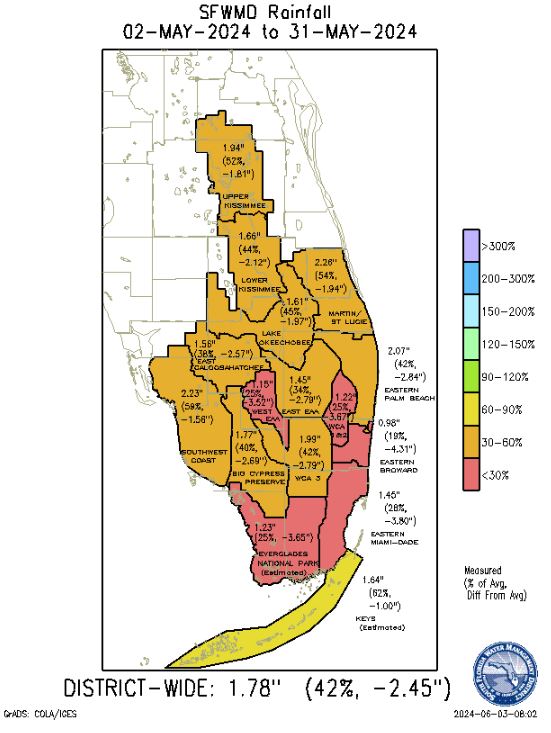
Lushine also theorizes a connection between dry Mays and hurricanes striking Florida.
Since 1912, 16 hurricanes have affected the Miami-Dade, Broward and Palm Beach County region. The average of May rainfall totals recorded at the three major airports in those counties was below normal in years when 15 of those storms struck, the exception being 1964 (Cleo).
Last month, Lushine said, was the 13th-driest May on record. Eight of the 12 driest Mays produced a tropical storm or hurricane that struck the three-county region. Six of those Mays led to hurricanes, with five of those becoming major hurricanes. The driest May on record was 1965, when Betsy struck; the second-driest was 1992, the year of Andrew.
Lushine is retiring after 42 years in the business, 33 of them at the Miami office. This will be his last hurricane season.
"I hope," he said, "it goes out with a whimper and not a bang."
-
eliot_kleinberg@pbpost.comCopyright 2004


