ENSO Updates (2007 thru 2023)

This is the general tropical discussion area. Anyone can take their shot at predicting a storms path.

Moderator: S2k Moderators

Forum rules

The posts in this forum are NOT official forecasts and should not be used as such. They are just the opinion of the poster and may or may not be backed by sound meteorological data. They are NOT endorsed by any professional institution or STORM2K. For official information, please refer to products from the National Hurricane Center and National Weather Service.

Help Support Storm2K
Message
Author
User avatar
cycloneye
Admin
Admin
Posts: 145303
Age: 68
Joined: Thu Oct 10, 2002 10:54 am
Location: San Juan, Puerto Rico

Re: ENSO Updates=CPC 5/24/10=El Nino 3.4 down to -0.2

#1421 Postby cycloneye » Mon May 24, 2010 9:39 am

Climate Prediction Center 5/24/10 update

The declines continue in all the regions of ENSO except for El Nino 4 that is down at a slower pace.La Nina is closer than ever now.

Last Week Numbers

Niño 4= +0.4ºC
Nino 3.4= -0.1
Niño 3= 0.0ºC
Niño1+2= +0.4ºC


This Week Numbers

Niño 4= +0.3ºC
Nino 3.4= -0.2
Niño 3= -0.2ºC
Niño 1+2= -0.1ºC


http://www.cpc.ncep.noaa.gov/products/a ... ts-web.pdf

Image
0 likes   
Visit the Caribbean-Central America Weather Thread where you can find at first post web cams,radars
and observations from Caribbean basin members Click Here

User avatar
cycloneye
Admin
Admin
Posts: 145303
Age: 68
Joined: Thu Oct 10, 2002 10:54 am
Location: San Juan, Puerto Rico

Re: ENSO Updates=CPC 5/24/10=Nino 3.4 down to -0.2

#1422 Postby cycloneye » Mon May 24, 2010 1:42 pm

Here is todays image of the subsurface in the Pacific,and you can see how the cold waters are dominating the ocean.IMO,La Nina will be declared officially by late June or early July.

Image
0 likes   
Visit the Caribbean-Central America Weather Thread where you can find at first post web cams,radars
and observations from Caribbean basin members Click Here

User avatar
KWT
Category 5
Category 5
Posts: 31415
Joined: Tue Aug 17, 2004 11:02 am
Location: UK!!!

#1423 Postby KWT » Mon May 24, 2010 1:48 pm

Interesting signal from the waters at the moment, the western portion still holding on to positive values which the rest of the basin continues to cool...

That cold water could upwell further east near SA and if that happens then it tends to lead to a very favourable region for development in the SW part of the Atlantic basin...so needs to be watched.
0 likes   
Personal Forecast Disclaimer:
The posts in this forum are NOT official forecast and should not be used as such. They are just the opinion of the poster and may or may not be backed by sound meteorological data. They are NOT endorsed by any professional institution or storm2k.org. For official information, please refer to the NHC and NWS products

User avatar
cycloneye
Admin
Admin
Posts: 145303
Age: 68
Joined: Thu Oct 10, 2002 10:54 am
Location: San Juan, Puerto Rico

Re: ENSO Updates=CPC 5/24/10=Nino 3.4 down to -0.2

#1424 Postby cycloneye » Mon May 24, 2010 8:18 pm

There is consensus between Climate Prediction Center and the Australians about having the 3.4 area at -0.2.

Image
0 likes   
Visit the Caribbean-Central America Weather Thread where you can find at first post web cams,radars
and observations from Caribbean basin members Click Here

User avatar
cycloneye
Admin
Admin
Posts: 145303
Age: 68
Joined: Thu Oct 10, 2002 10:54 am
Location: San Juan, Puerto Rico

Re: ENSO Updates=BoM 5/26/10=La Nina chances continues to grow

#1425 Postby cycloneye » Wed May 26, 2010 5:37 am

Australian 5/26/10 update

It looks like Neutral ENSO will not last long as La Nina conditions are advancing to take over the equatorial Pacific.See whole update at below hyperlink.

ENSO Wrap-Up

Climate indicators across the equatorial Pacific are currently neutral. Equatorial Pacific Ocean temperatures, trade winds, the Southern Oscillation Index and cloudiness over the Pacific are all at levels considered typical of neutral conditions (i.e. neither El Niño nor La Niña).

Historically, about 35~40% of El Niño events are followed by a La Niña within the same year. Currently, a large volume of cooler than normal water is present below the surface of the equatorial Pacific Ocean, which indicates that further cooling of the surface of the tropical Pacific is likely.

International climate models predict continued cooling of the Pacific Ocean sea surface, with the majority of models surveyed by the Bureau predicting that this cooling will be sufficient to see the development of La Niña conditions later in the year. No climate models suggest a return to El Niño conditions. It should be noted that correctly predicting transitional periods of the El Niño Southern Oscillation is more difficult than predicting the continuation or decline of El Niño or La Niña events.


Image
0 likes   
Visit the Caribbean-Central America Weather Thread where you can find at first post web cams,radars
and observations from Caribbean basin members Click Here

User avatar
cycloneye
Admin
Admin
Posts: 145303
Age: 68
Joined: Thu Oct 10, 2002 10:54 am
Location: San Juan, Puerto Rico

Re: ENSO Updates

#1426 Postby cycloneye » Thu May 27, 2010 7:03 am

Image
0 likes   
Visit the Caribbean-Central America Weather Thread where you can find at first post web cams,radars
and observations from Caribbean basin members Click Here

User avatar
cycloneye
Admin
Admin
Posts: 145303
Age: 68
Joined: Thu Oct 10, 2002 10:54 am
Location: San Juan, Puerto Rico

Re: ENSO Updates

#1427 Postby cycloneye » Thu May 27, 2010 7:05 am

Hello to La Nina!

Image
0 likes   
Visit the Caribbean-Central America Weather Thread where you can find at first post web cams,radars
and observations from Caribbean basin members Click Here

User avatar
KWT
Category 5
Category 5
Posts: 31415
Joined: Tue Aug 17, 2004 11:02 am
Location: UK!!!

#1428 Postby KWT » Thu May 27, 2010 7:10 am

Yep looks like La Nina is very close at least on the weeklies...

Interesting to finally see some old water also develop near SA, thats usually a feature you see in active hurricane seasons.
0 likes   
Personal Forecast Disclaimer:
The posts in this forum are NOT official forecast and should not be used as such. They are just the opinion of the poster and may or may not be backed by sound meteorological data. They are NOT endorsed by any professional institution or storm2k.org. For official information, please refer to the NHC and NWS products

User avatar
cycloneye
Admin
Admin
Posts: 145303
Age: 68
Joined: Thu Oct 10, 2002 10:54 am
Location: San Juan, Puerto Rico

Re: ENSO Updates

#1429 Postby cycloneye » Thu May 27, 2010 7:49 pm

The SOI is firmly in positive territory meaning El Nino is nowhere to be found and La Nina is comming fast.The 90 day SOI is tonight at +3.25.

Daily SOI Values

http://www.longpaddock.qld.gov.au/Seaso ... SOIValues/


Daily 30 day SOI text

http://www.bom.gov.au/climate/enso/soi.txt


Image
0 likes   
Visit the Caribbean-Central America Weather Thread where you can find at first post web cams,radars
and observations from Caribbean basin members Click Here

User avatar
cycloneye
Admin
Admin
Posts: 145303
Age: 68
Joined: Thu Oct 10, 2002 10:54 am
Location: San Juan, Puerto Rico

Re: ENSO Updates

#1430 Postby cycloneye » Sat May 29, 2010 9:22 am

Another graphic confirms the colder waters in the equatorial Pacific.Surely,La Nina is not too far away from being officially declared.

Image
0 likes   
Visit the Caribbean-Central America Weather Thread where you can find at first post web cams,radars
and observations from Caribbean basin members Click Here

RL3AO
Moderator-Pro Met
Moderator-Pro Met
Posts: 16308
Joined: Thu Jun 14, 2007 10:03 pm
Location: NC

#1431 Postby RL3AO » Sat May 29, 2010 9:24 am

I can't believe how quick this is happening.
0 likes   

User avatar
KWT
Category 5
Category 5
Posts: 31415
Joined: Tue Aug 17, 2004 11:02 am
Location: UK!!!

#1432 Postby KWT » Sat May 29, 2010 9:32 am

Cooling spreading further east,the 4 and possibly 3.4 zone may have warmed a little this week but its likely just short term changes.

Should be in La Nina during June I'd imagine.
0 likes   
Personal Forecast Disclaimer:
The posts in this forum are NOT official forecast and should not be used as such. They are just the opinion of the poster and may or may not be backed by sound meteorological data. They are NOT endorsed by any professional institution or storm2k.org. For official information, please refer to the NHC and NWS products

User avatar
cycloneye
Admin
Admin
Posts: 145303
Age: 68
Joined: Thu Oct 10, 2002 10:54 am
Location: San Juan, Puerto Rico

Re: ENSO Updates

#1433 Postby cycloneye » Sat May 29, 2010 10:19 am

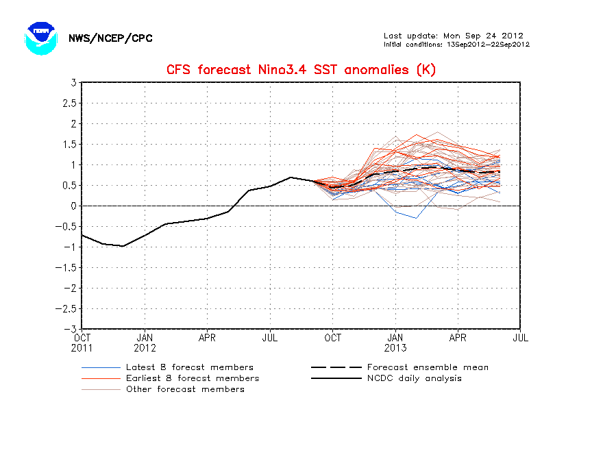
The CFS (NCEP) model already forecasts La Nina by June.

Image
0 likes   
Visit the Caribbean-Central America Weather Thread where you can find at first post web cams,radars
and observations from Caribbean basin members Click Here

User avatar
cycloneye
Admin
Admin
Posts: 145303
Age: 68
Joined: Thu Oct 10, 2002 10:54 am
Location: San Juan, Puerto Rico

Re: ENSO Updates

#1434 Postby cycloneye » Sun May 30, 2010 2:31 pm

The Australian model for ENSO (POAMA) is at Weak La Nina during the peak of the season and coincides with the CFS model.

Image
0 likes   
Visit the Caribbean-Central America Weather Thread where you can find at first post web cams,radars
and observations from Caribbean basin members Click Here

User avatar
cycloneye
Admin
Admin
Posts: 145303
Age: 68
Joined: Thu Oct 10, 2002 10:54 am
Location: San Juan, Puerto Rico

Re: ENSO Updates=CPC 6/1/10=Nino 3.4 at -0.2 / Nino 3 at -0.4

#1435 Postby cycloneye » Tue Jun 01, 2010 11:57 am

Climate Prediction Center 6/1/10 Weekly Update

All points for a transition from Neutral to La Nina to take place in the comming weeks.

Last Week Numbers

Niño 4= +0.3ºC
Nino 3.4= -0.2C
Niño 3= -0.2ºC
Niño 1+2= -0.1ºC


This Week Numbers

Niño 4= -0.4ºC
Niño 3.4= -0.2ºC
Niño 3= -0.4ºC
Niño1+2= -0.6ºC


http://www.cpc.ncep.noaa.gov/products/a ... ts-web.pdf


Image
0 likes   
Visit the Caribbean-Central America Weather Thread where you can find at first post web cams,radars
and observations from Caribbean basin members Click Here

User avatar
cycloneye
Admin
Admin
Posts: 145303
Age: 68
Joined: Thu Oct 10, 2002 10:54 am
Location: San Juan, Puerto Rico

Re: ENSO Updates=Increasing odds of having La Nina

#1436 Postby cycloneye » Tue Jun 01, 2010 2:17 pm

The ENSO models predict La Nina to surface during the summer or early fall.

http://www.bom.gov.au/climate/ahead/ENSO-summary.shtml
0 likes   
Visit the Caribbean-Central America Weather Thread where you can find at first post web cams,radars
and observations from Caribbean basin members Click Here

User avatar
KWT
Category 5
Category 5
Posts: 31415
Joined: Tue Aug 17, 2004 11:02 am
Location: UK!!!

#1437 Postby KWT » Tue Jun 01, 2010 2:27 pm

La Nina will probably be around before the end of June at least on the weeklies, in fact June could end up being the first month to have an overall average into the La Nina range, though we have to wait and see on that front.
0 likes   
Personal Forecast Disclaimer:
The posts in this forum are NOT official forecast and should not be used as such. They are just the opinion of the poster and may or may not be backed by sound meteorological data. They are NOT endorsed by any professional institution or storm2k.org. For official information, please refer to the NHC and NWS products

User avatar
cycloneye
Admin
Admin
Posts: 145303
Age: 68
Joined: Thu Oct 10, 2002 10:54 am
Location: San Juan, Puerto Rico

Re: ENSO Updates

#1438 Postby cycloneye » Wed Jun 02, 2010 12:39 pm

La Nina is really pushing up to the surface.

Image
0 likes   
Visit the Caribbean-Central America Weather Thread where you can find at first post web cams,radars
and observations from Caribbean basin members Click Here

User avatar
cycloneye
Admin
Admin
Posts: 145303
Age: 68
Joined: Thu Oct 10, 2002 10:54 am
Location: San Juan, Puerto Rico

Re: ENSO Updates

#1439 Postby cycloneye » Wed Jun 02, 2010 7:10 pm

Another evidence that La Nina is around the corner is the SOI that has been positive since Mid-April and has not gone back to negative.And the 90 day SOI continues to go up.

Daily SOI Values

Daily 30 day SOI Text

Image
0 likes   
Visit the Caribbean-Central America Weather Thread where you can find at first post web cams,radars
and observations from Caribbean basin members Click Here

User avatar
KWT
Category 5
Category 5
Posts: 31415
Joined: Tue Aug 17, 2004 11:02 am
Location: UK!!!

#1440 Postby KWT » Wed Jun 02, 2010 7:22 pm

If I had to make a punt cycloneye for ASO I'd go for a range between -0.8C to -1.2C, Its quite possible it will be higher then that, but I'd be very surprised if it ended up lower then -1.2C
0 likes   
Personal Forecast Disclaimer:
The posts in this forum are NOT official forecast and should not be used as such. They are just the opinion of the poster and may or may not be backed by sound meteorological data. They are NOT endorsed by any professional institution or storm2k.org. For official information, please refer to the NHC and NWS products


Return to “Talkin' Tropics”

Who is online

Users browsing this forum: Europa non è lontana, riapal and 40 guests