Disturbed area in ITCZ

This is the general tropical discussion area. Anyone can take their shot at predicting a storms path.

Moderator: S2k Moderators

Forum rules

The posts in this forum are NOT official forecasts and should not be used as such. They are just the opinion of the poster and may or may not be backed by sound meteorological data. They are NOT endorsed by any professional institution or STORM2K. For official information, please refer to products from the National Hurricane Center and National Weather Service.

Help Support Storm2K
Message
Author
OURAGAN
Category 1
Category 1
Posts: 451
Joined: Sat Aug 07, 2004 12:18 pm
Location: GUADELOUPE

Disturbed area in ITCZ

#1 Postby OURAGAN » Sun Jul 18, 2010 8:19 am

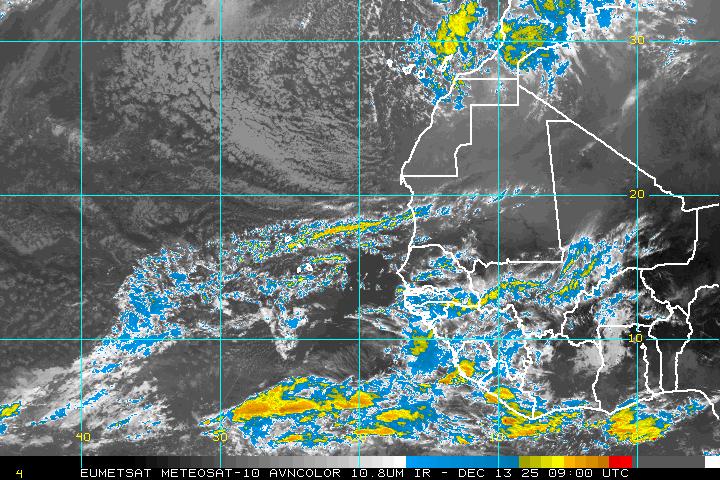
A strong Wave with a 1009 MB low is leaving the coast of Africa:

A WEAK 1009 MB LOW PRES...LIKELY ASSOCIATED WITH THE
NEXT TROPICAL WAVE...IS MOVING OUT OF AFRICA THROUGH SENEGAL.
CURRENTLY...DAKAR IS REPORTING NE WINDS AND LIGHT RAIN. THE
HOVMOLLER DIAGRAM SHOWS THE WESTWARD PROPAGATION OF THIS SYSTEM
DURING THE PAST FEW DAYS. CLUSTERS OF MODERATE TO ISOLATED
STRONG CONVECTION ARE FROM 9N-13N E OF 12W...AND FROM 4N-9N
BETWEEN 20W-25W.

Image

Image
Last edited by cycloneye on Tue Jul 20, 2010 6:19 am, edited 2 times in total.
Reason: Edited title to highlight disturbance in ITCZ
0 likes   

OURAGAN
Category 1
Category 1
Posts: 451
Joined: Sat Aug 07, 2004 12:18 pm
Location: GUADELOUPE

Re: STRONG WAVE WITH 1009 MB OFF THE COAST OF AFRICA

#2 Postby OURAGAN » Sun Jul 18, 2010 8:23 am

Image
0 likes   

User avatar
Gustywind
Category 5
Category 5
Posts: 12334
Joined: Mon Sep 03, 2007 7:29 am
Location: Baie-Mahault, GUADELOUPE

#3 Postby Gustywind » Sun Jul 18, 2010 8:26 am

Ouragan a thread has been opened concerning this twave!
0 likes   

User avatar
Gustywind
Category 5
Category 5
Posts: 12334
Joined: Mon Sep 03, 2007 7:29 am
Location: Baie-Mahault, GUADELOUPE

Re: STRONG WAVE WITH 1009 MB OFF THE COAST OF AFRICA

#4 Postby Gustywind » Sun Jul 18, 2010 8:38 am

OURAGAN wrote:A strong Wave with a 1009 MB low is leaving the coast of Africa:

A WEAK 1009 MB LOW PRES...LIKELY ASSOCIATED WITH THE
NEXT TROPICAL WAVE...IS MOVING OUT OF AFRICA THROUGH SENEGAL.
CURRENTLY...DAKAR IS REPORTING NE WINDS AND LIGHT RAIN. THE
HOVMOLLER DIAGRAM SHOWS THE WESTWARD PROPAGATION OF THIS SYSTEM
DURING THE PAST FEW DAYS. CLUSTERS OF MODERATE TO ISOLATED
STRONG CONVECTION ARE FROM 9N-13N E OF 12W...AND FROM 4N-9N
BETWEEN 20W-25W.

Image

Image

:rarrow: Thread already opened: viewtopic.php?f=31&t=108585&hilit=&start=20
0 likes   

User avatar
HurricaneBelle
S2K Supporter
S2K Supporter
Posts: 1179
Joined: Sun Aug 27, 2006 6:12 pm
Location: Clearwater, FL

#5 Postby HurricaneBelle » Sun Jul 18, 2010 8:39 am

In fairness to the OP, it would help if the original thread were better titled; the thread with this title is a lot less vague than "We are definitely seeing the next area to invest out of afri".
0 likes   

User avatar
cycloneye
Admin
Admin
Posts: 145545
Age: 68
Joined: Thu Oct 10, 2002 10:54 am
Location: San Juan, Puerto Rico

Re: STRONG WAVE WITH 1009 MB OFF THE COAST OF AFRICA

#6 Postby cycloneye » Sun Jul 18, 2010 8:46 am

This thread can stay open apart from what HurricaneBelle said,the other thread was created for another wave as the date of the first post is July 15.
0 likes   
Visit the Caribbean-Central America Weather Thread where you can find at first post web cams,radars
and observations from Caribbean basin members Click Here

User avatar
Gustywind
Category 5
Category 5
Posts: 12334
Joined: Mon Sep 03, 2007 7:29 am
Location: Baie-Mahault, GUADELOUPE

Re: STRONG WAVE WITH 1009 MB OFF THE COAST OF AFRICA

#7 Postby Gustywind » Sun Jul 18, 2010 8:55 am

cycloneye wrote:This thread can stay open apart from what HurricaneBelle said,the other thread was created for another wave as the date of the first post is July 15.

:) ok Cycloneye glad to see that :D. Let's see if this one continues to show signs of organization during the next couple of days...
0 likes   

Cyclone1
Category 5
Category 5
Posts: 2739
Age: 33
Joined: Tue Jun 12, 2007 12:03 pm
Location: Florida

#8 Postby Cyclone1 » Sun Jul 18, 2010 9:09 am

I'll be impressed if it's still here in 24 hours. You know how these waves are.
0 likes   

User avatar
KWT
Category 5
Category 5
Posts: 31415
Joined: Tue Aug 17, 2004 11:02 am
Location: UK!!!

#9 Postby KWT » Sun Jul 18, 2010 9:31 am

The curve of the low is fairly obvious but obviously the convection is all to the south of the low thanks to the SAL. Still we are getting closer to the time when these really need to be watched.
0 likes   
Personal Forecast Disclaimer:
The posts in this forum are NOT official forecast and should not be used as such. They are just the opinion of the poster and may or may not be backed by sound meteorological data. They are NOT endorsed by any professional institution or storm2k.org. For official information, please refer to the NHC and NWS products

User avatar
Gustywind
Category 5
Category 5
Posts: 12334
Joined: Mon Sep 03, 2007 7:29 am
Location: Baie-Mahault, GUADELOUPE

Re:

#10 Postby Gustywind » Sun Jul 18, 2010 9:31 am

Cyclone1 wrote:I'll be impressed if it's still here in 24 hours. You know how these waves are.

Nasty, "poofable" :cheesy: as usual full of surprises :wink:
0 likes   

User avatar
Gustywind
Category 5
Category 5
Posts: 12334
Joined: Mon Sep 03, 2007 7:29 am
Location: Baie-Mahault, GUADELOUPE

Re:

#11 Postby Gustywind » Sun Jul 18, 2010 9:42 am

KWT wrote:The curve of the low is fairly obvious but obviously the convection is all to the south of the low thanks to the SAL. Still we are getting closer to the time when these really need to be watched.

Yeah right! Thanks to the SAL attack :D
Image
0 likes   

User avatar
KWT
Category 5
Category 5
Posts: 31415
Joined: Tue Aug 17, 2004 11:02 am
Location: UK!!!

#12 Postby KWT » Sun Jul 18, 2010 9:47 am

Actually looking at the SAL image there is a little pocket of moisture for this system to work within. I personally still think its early but the models are hinting at a strong wave for 7-10 days time.
0 likes   
Personal Forecast Disclaimer:
The posts in this forum are NOT official forecast and should not be used as such. They are just the opinion of the poster and may or may not be backed by sound meteorological data. They are NOT endorsed by any professional institution or storm2k.org. For official information, please refer to the NHC and NWS products

User avatar
Gustywind
Category 5
Category 5
Posts: 12334
Joined: Mon Sep 03, 2007 7:29 am
Location: Baie-Mahault, GUADELOUPE

#13 Postby Gustywind » Sun Jul 18, 2010 10:05 am

Image
0 likes   

User avatar
cycloneye
Admin
Admin
Posts: 145545
Age: 68
Joined: Thu Oct 10, 2002 10:54 am
Location: San Juan, Puerto Rico

Re: STRONG WAVE WITH 1009 MB OFF THE COAST OF AFRICA

#14 Postby cycloneye » Sun Jul 18, 2010 11:59 am

Updates every 15 minutes.

Image
0 likes   
Visit the Caribbean-Central America Weather Thread where you can find at first post web cams,radars
and observations from Caribbean basin members Click Here

User avatar
KWT
Category 5
Category 5
Posts: 31415
Joined: Tue Aug 17, 2004 11:02 am
Location: UK!!!

#15 Postby KWT » Sun Jul 18, 2010 12:26 pm

Nice curving to the shallow clouds just to the north of the convection. The waves seem to be more and more advanced in the last 2 weeks in terms of development, just need the SAL to ease a little to get things going in the CV region.
0 likes   
Personal Forecast Disclaimer:
The posts in this forum are NOT official forecast and should not be used as such. They are just the opinion of the poster and may or may not be backed by sound meteorological data. They are NOT endorsed by any professional institution or storm2k.org. For official information, please refer to the NHC and NWS products

User avatar
Gustywind
Category 5
Category 5
Posts: 12334
Joined: Mon Sep 03, 2007 7:29 am
Location: Baie-Mahault, GUADELOUPE

#16 Postby Gustywind » Sun Jul 18, 2010 12:56 pm

000
AXNT20 KNHC 181751
TWDAT

TROPICAL WEATHER DISCUSSION
NWS TPC/NATIONAL HURRICANE CENTER MIAMI FL
205 PM EDT SUN JUL 18 2010

TROPICAL WEATHER DISCUSSION FOR NORTH AMERICA...CENTRAL
AMERICA...GULF OF MEXICO...CARIBBEAN SEA...NORTHERN SECTIONS OF
SOUTH AMERICA...AND ATLANTIC OCEAN TO THE AFRICAN COAST FROM THE
EQUATOR TO 32N. THE FOLLOWING INFORMATION IS BASED ON SATELLITE
IMAGERY...METEOROLOGICAL ANALYSIS...WEATHER OBSERVATIONS...AND
RADAR.

BASED ON 1200 UTC SURFACE ANALYSIS AND SATELLITE IMAGERY THROUGH
1715 UTC...

...TROPICAL WAVES...

TROPICAL WAVE HAS MOVED OFF THE W COAST OF AFRICA ALONG 18W S OF
20N MOVING W NEAR 15 KT. SURFACE WIND OBSERVATIONS FROM DAKAR
SENEGAL INDICATE A NW-E WIND SHIFT INDICATING THE PASSAGE OF THE
WAVE. LOW-MID LEVEL CYCLONIC FLOW IS ALSO EVIDENT IN VISIBLE
SATELLITE IMAGERY AND SATELLITE DERIVED WINDS. A SURGE OF DEEP
LAYER MOISTURE IS ALSO PRESENT IN TOTAL PRECIPITABLE WATER
IMAGERY. SCATTERED MODERATE/ISOLATED STRONG CONVECTION IS FROM
9N-14N BETWEEN 14W-17W...AND W OF THE WAVE AXIS FROM 3N-9N
BETWEEN 21W-27W.


FOR ADDITIONAL INFORMATION PLEASE VISIT
HTTP://WWW.HURRICANES.GOV/MARINE

$$

WALTON
0 likes   

User avatar
cycloneye
Admin
Admin
Posts: 145545
Age: 68
Joined: Thu Oct 10, 2002 10:54 am
Location: San Juan, Puerto Rico

Re: STRONG WAVE OFF THE COAST OF AFRICA

#17 Postby cycloneye » Sun Jul 18, 2010 1:44 pm

OURAGAN, I took out from the title the 1009 mb low as there was no mention at the 2 PM discussion.
0 likes   
Visit the Caribbean-Central America Weather Thread where you can find at first post web cams,radars
and observations from Caribbean basin members Click Here

OURAGAN
Category 1
Category 1
Posts: 451
Joined: Sat Aug 07, 2004 12:18 pm
Location: GUADELOUPE

Re: STRONG WAVE OFF THE COAST OF AFRICA

#18 Postby OURAGAN » Sun Jul 18, 2010 1:46 pm

Ok, Cycloneye
0 likes   

User avatar
Gustywind
Category 5
Category 5
Posts: 12334
Joined: Mon Sep 03, 2007 7:29 am
Location: Baie-Mahault, GUADELOUPE

#19 Postby Gustywind » Sun Jul 18, 2010 7:29 pm

000
AXNT20 KNHC 182353
TWDAT

TROPICAL WEATHER DISCUSSION
NWS TPC/NATIONAL HURRICANE CENTER MIAMI FL
805 PM EDT SUN JUL 18 2010

TROPICAL WEATHER DISCUSSION FOR NORTH AMERICA...CENTRAL
AMERICA...GULF OF MEXICO...CARIBBEAN SEA...NORTHERN SECTIONS OF
SOUTH AMERICA...AND ATLANTIC OCEAN TO THE AFRICAN COAST FROM THE
EQUATOR TO 32N. THE FOLLOWING INFORMATION IS BASED ON SATELLITE
IMAGERY...METEOROLOGICAL ANALYSIS...WEATHER OBSERVATIONS...AND
RADAR.

BASED ON 1800 UTC SURFACE ANALYSIS AND SATELLITE IMAGERY THROUGH
2345 UTC...

...TROPICAL WAVES...

TROPICAL WAVE HAS MOVED OFF THE W COAST OF AFRICA ALONG 21W S OF
20N MOVING W NEAR 15 KT. LOW-MID LEVEL CYCLONIC CURVATURE IS
EVIDENT IN SATELLITE IMAGERY AND SATELLITE DERIVED WINDS. A
SURGE OF DEEP LAYER MOISTURE IS ALSO PRESENT IN TOTAL
PRECIPITABLE WATER IMAGERY. SCATTERED MODERATE/ISOLATED STRONG
CONVECTION IS FROM 5N-18N BETWEEN 14W-23W...AND SW OF THE WAVE
AXIS FROM 3N-9N BETWEEN 24W-30W.


$$

GARCIA
0 likes   

User avatar
Gustywind
Category 5
Category 5
Posts: 12334
Joined: Mon Sep 03, 2007 7:29 am
Location: Baie-Mahault, GUADELOUPE

#20 Postby Gustywind » Sun Jul 18, 2010 7:31 pm

Seems that it has poof a bit :cheesy: the SAL is surely for something, but let's wait and see as we're approaching the end of the month of July and the beginning of of August...
0 likes   


Return to “Talkin' Tropics”

Who is online

Users browsing this forum: AtlanticWind, cheezyWXguy, Cpv17, ElectricStorm, hurricanes1234, StPeteMike, Ulf, zzzh and 46 guests