jasons wrote:Ramping-up faster than I thought it would be, that's for sure.
what do you mean jasons
Moderator: S2k Moderators


jasons wrote:Ramping-up faster than I thought it would be, that's for sure.

TeamPlayersBlue wrote:ok, i'll be hibernating on this site again.
Well 2 things. Being from Houston, i dont like our position in this cone. Possible that it swings our way still.
Secondly, do you guy REALLY think this storm will cross much of the GOM and not blossom into at least a CAT 1 or CAT 2 hurricane?
Disclaimer : Not a forecast and should not be taken as one. I'm a finance major not a MET major

Nederlander wrote:I dont think the NW motion is a trend that will continue.. Its going to make jogs and wobbles here and there.. This motion is probably due to the effects of the ULL.. I think it will start bending back to the WNW over the next few hours.. I would say this is coming in somewhere between Key Largo and Miami.. I will make Homestead my mark..
Personal Forecast Disclaimer:
The posts in this forum are NOT official forecast and should not be used as such. They are just the opinion of the poster and may or may not be backed by sound meteorological data. They are NOT endorsed by any professional institution or storm2k.org. For official information, please refer to the NHC and NWS products.


hurricanefloyd5 wrote:jasons wrote:Ramping-up faster than I thought it would be, that's for sure.
what do you mean jasons


Countrygirl911 wrote:Does anybody think this will become a hurricane if so what cat do you thin I am new to these boards

TeamPlayersBlue wrote:ok, i'll be hibernating on this site again
Well 2 things. Being from Houston, i dont like our position in this cone. Possible that it swings our way still.
Secondly, do you guy REALLY think this storm will cross much of the GOM and not blossom into at least a CAT 1 or CAT 2 hurricane?
Disclaimer : Not a forecast and should not be taken as one. I'm a finance major not a MET major
Countrygirl911 wrote:Does anybody think this will become a hurricane if so what cat do you thin I am new to these boards
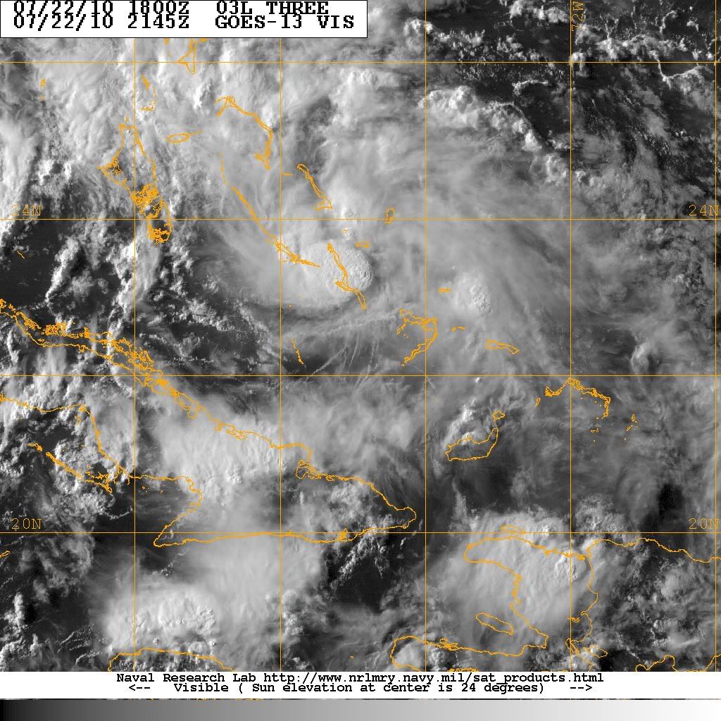
jasons wrote:It's apparent on the WV that the ULL is now really distancing itself from Bonnie...and the ULL is moving almost due west.
Nederlander wrote:Countrygirl911 wrote:Does anybody think this will become a hurricane if so what cat do you thin I am new to these boards
Probably not before its first landfall in FL.. I do think it has a shot, however, in the GOM.. As I eluded to earlier, I think if the ridge builds strong, the further west it will push Bonnie, and the further west she goes, the longer she has to ramp up, assuming the ULL races away and doesnt shear Bonnie to death.. a lot of ifs at this point.. but none of the models have been bullish on a strong system, so I will stick with them at this time, a moderate to strong TS somewhere along the central gulf coast.. just an amateur opinion


SunnyThoughts wrote:

ROCK wrote:she is compacting because she about to be crunched from the NE by the building ridge...nice Bonnie sandwich....she is moving NW now but it wont be much longer...
http://www.ssd.noaa.gov/goes/east/watl/flash-wv.html
Users browsing this forum: No registered users and 66 guests


