ATL: IGOR - Ex Hurricane - Discussion
Moderator: S2k Moderators
-
lonelymike
- S2K Supporter

- Posts: 634
- Joined: Sat Jul 26, 2008 10:12 am
- Location: walton county fla
Re: ATL: Hurricane IGOR - Discussion
Looks like a buzz saw in that frame doesn't he 
0 likes
GO SEMINOLES
-
Windtalker1

- S2K Supporter
- Posts: 523
- Age: 37
- Joined: Sun Jul 31, 2005 11:00 am
- Location: Mesa, Arizona
Re:
Raebie wrote:That's quite a limb.
And a very Strong Limb it is
The posts in this forum are NOT official forecast and should not be used as such. They are just the opinion of the poster and may or may not be backed by sound meteorological data. They are NOT endorsed by any professional institution or storm2k.org. For official information, please refer to the NHC and NWS products.
0 likes
-
brunota2003

- S2K Supporter
- Posts: 9476
- Age: 35
- Joined: Sat Jul 30, 2005 9:56 pm
- Location: Stanton, KY...formerly Havelock, NC
- Contact:
-
Windtalker1
- S2K Supporter
- Posts: 523
- Age: 37
- Joined: Sun Jul 31, 2005 11:00 am
- Location: Mesa, Arizona
Re: ATL: Hurricane IGOR - Discussion
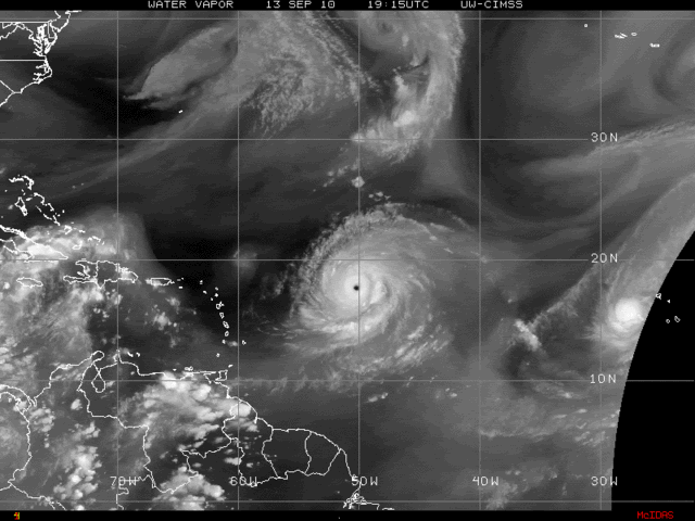
On that water vapor image, it looks to me like it is going to miss him and flatten out, giving the ridge time to build back in.
The posts in this forum are NOT official forecast and should not be used as such. They are just the opinion of the poster and may or may not be backed by sound meteorological data. They are NOT endorsed by any professional institution or storm2k.org. For official information, please refer to the NHC and NWS products.
The posts in this forum are NOT official forecast and should not be used as such. They are just the opinion of the poster and may or may not be backed by sound meteorological data. They are NOT endorsed by any professional institution or storm2k.org. For official information, please refer to the NHC and NWS products.
0 likes
-
stormhunter7

- Category 2

- Posts: 763
- Joined: Mon May 26, 2008 3:13 pm
- Location: Panama City Beach, Florida
- Contact:
Re: ATL: Hurricane IGOR - Discussion
seem that the more northward motion started this after noon?
MIMIC imagery shows a gradual northward movement as Igo moves west? Igor gets close and closer to 18N
http://cimss.ssec.wisc.edu/tropic/real- ... splay.html
MIMIC imagery shows a gradual northward movement as Igo moves west? Igor gets close and closer to 18N
http://cimss.ssec.wisc.edu/tropic/real- ... splay.html
0 likes
The following post is NOT an official forecast and should not be used as such. It is just the opinion of the poster and may or may not be backed by sound meteorological data. It is NOT endorsed by any professional institution including storm2k.org For Official Information please refer to the NHC and NWS products. http://www.nhc.noaa.gov


Re: ATL: Hurricane IGOR - Discussion
I remember Hurricane Floyd - how they kept saying it would make the turn...and it kept going further west. If I remember correctly, the Keys to parts of Virginia were evacuated. It was all about the 'when' the turn would begin....which kept being pushed back. I'm sure they've tweaked the models a bit since 1999.

0 likes
Re: ATL: Hurricane IGOR - Discussion
stormhunter7 wrote:seem that the more northward motion started this after noon?
MIMIC imagery shows a gradual northward movement as Igo moves west? Igor gets close and closer to 18N
http://cimss.ssec.wisc.edu/tropic/real- ... splay.html
thank you i knew i had a good eye.... hey KWT it is clear.....about 280....as the loop shows between 12 and 8 pm. might be a wobble SW right after loop runs out....but then it will wobble back WNW as it has in the latest ramdis loop. but 280 is still officially "West" prob about 278 between noon and 10 pm.
Last edited by cpdaman on Mon Sep 13, 2010 9:12 pm, edited 1 time in total.
0 likes
-
Windtalker1
- S2K Supporter
- Posts: 523
- Age: 37
- Joined: Sun Jul 31, 2005 11:00 am
- Location: Mesa, Arizona
Re: ATL: Hurricane IGOR - Discussion
stormhunter7 wrote:seem that the more northward motion started this after noon?
MIMIC imagery shows a gradual northward movement as Igo moves west? Igor gets close and closer to 18N
http://cimss.ssec.wisc.edu/tropic/real- ... splay.html
Yes, I have to admit that He was tugged to the North for a bit, I would not call it his start of a WNW motion due to the fact that his heading has adveraged around 275 for the last 6 hrs.
0 likes
-
hurricaneCW
- Category 5

- Posts: 1799
- Joined: Wed Mar 03, 2010 6:20 am
- Location: Toms River, NJ
Re: ATL: Hurricane IGOR - Discussion
Igor will make his turn very, very soon. The current trough is not the one that picks him up and recurves him. The current trough is what will induce the wnw/nw movement. Another shortwave will head off the east coast and that will not allow the ridging to rebuild and cause Igor to recurve near Bermuda. The bad news is that if the turn is delayed a bit further, then Igor could pass either right over or just to the west of Bermuda, giving them the worst side of the storm.
0 likes

Hi I new here (but I've been lurking for years) this is a real nice weather community, and I've always heard about D-min having something to do with waning convection. Is this warming of convection due to D-min (is this even the time or hour that D-min occurs), or is this actual weakening of Igor do to dry shear air or some other factor.
thanks
thanks
0 likes
I am just an amateur and a "noob" at that so any speculations that I have made are just that, uneducated speculations. Please refer to the NHC for accurate information.
Thank you all for your thoughts, I've loved reading through this community since '06 and finally decided to post more actively.
-JJ
Thank you all for your thoughts, I've loved reading through this community since '06 and finally decided to post more actively.
-JJ
-
Windtalker1
- S2K Supporter
- Posts: 523
- Age: 37
- Joined: Sun Jul 31, 2005 11:00 am
- Location: Mesa, Arizona
Re: ATL: Hurricane IGOR - Discussion
hurricaneCW wrote:Igor will make his turn very, very soon. The current trough is not the one that picks him up and recurves him. The current trough is what will induce the wnw/nw movement. Another shortwave will head off the east coast and that will not allow the ridging to rebuild and cause Igor to recurve near Bermuda. The bad news is that if the turn is delayed a bit further, then Igor could pass either right over or just to the west of Bermuda, giving them the worst side of the storm.
Here in TN we have no fronts coming through until Thursday Night/Friday Morning which means it will not be off the coast until maybe Sunday? Where will Igor be on Sunday?
0 likes
-
Aric Dunn
- Category 5
- Posts: 21238
- Age: 43
- Joined: Sun Sep 19, 2004 9:58 pm
- Location: Ready for the Chase.
- Contact:
The latest steering analysis still has a ridging in place in the upper steering levels. it actually over the past 6 hours ( at least according cimss) has build in a little more or become better defined. not sure it will hold but it would explain its reluctant to turn.
just toggle back and forth between the different hours.. and 500 and above levels..
http://cimss.ssec.wisc.edu/tropic2/real ... oom=&time=
just toggle back and forth between the different hours.. and 500 and above levels..
http://cimss.ssec.wisc.edu/tropic2/real ... oom=&time=
0 likes
Note: If I make a post that is brief. Please refer back to previous posts for the analysis or reasoning. I do not re-write/qoute what my initial post said each time.
If there is nothing before... then just ask
Space & Atmospheric Physicist, Embry-Riddle Aeronautical University,
I believe the sky is falling...
If there is nothing before... then just ask
Space & Atmospheric Physicist, Embry-Riddle Aeronautical University,
I believe the sky is falling...


-
wxman57

- Moderator-Pro Met

- Posts: 23174
- Age: 68
- Joined: Sat Jun 21, 2003 8:06 pm
- Location: Houston, TX (southwest)
Re: ATL: Hurricane IGOR - Discussion
Igor will turn east of the Caribbean. But it may cross 20N between 56W-58w rather than 55W as per last NHC track.
0 likes

Re: ATL: Hurricane IGOR - Discussion
LCfromFL wrote:I remember Hurricane Floyd - how they kept saying it would make the turn...and it kept going further west. If I remember correctly, the Keys to parts of Virginia were evacuated. It was all about the 'when' the turn would begin....which kept being pushed back. I'm sure they've tweaked the models a bit since 1999.Code: Select all
[img]http://weather.unisys.com/hurricane/atlantic/1999H/FLOYD/track.gif[/img]
Im curious. Does anyone have a link that would show where it was originally suppose to turn north etc?
0 likes
2010 Archive: HURRICANE ALEX, TD TWO, TS BONNIE, TS COLIN, TD FIVE, HURRICANE DANIELLE, HURRICANE EARL, TS FIONA, TS GASTON, TS HERMINE, HURRICANE IGOR, HURRICANE JULIA, HURRICANE KARL, HURRICANE LISA, TS MATTHEW, TS NICOLE, HURRICANE OTTO, HURRICANE PAULA (Active)
-
Aric Dunn
- Category 5
- Posts: 21238
- Age: 43
- Joined: Sun Sep 19, 2004 9:58 pm
- Location: Ready for the Chase.
- Contact:
Re: ATL: Hurricane IGOR - Discussion
canes101 wrote:LCfromFL wrote:I remember Hurricane Floyd - how they kept saying it would make the turn...and it kept going further west. If I remember correctly, the Keys to parts of Virginia were evacuated. It was all about the 'when' the turn would begin....which kept being pushed back. I'm sure they've tweaked the models a bit since 1999.Code: Select all
[img]http://weather.unisys.com/hurricane/atlantic/1999H/FLOYD/track.gif[/img]
Im curious. Does anyone have a link that would show where it was originally suppose to turn north etc?
this was about all i could find
http://www.erh.noaa.gov/mhx/Floyd/images/Track3_hi.jpg
0 likes
Note: If I make a post that is brief. Please refer back to previous posts for the analysis or reasoning. I do not re-write/qoute what my initial post said each time.
If there is nothing before... then just ask
Space & Atmospheric Physicist, Embry-Riddle Aeronautical University,
I believe the sky is falling...
If there is nothing before... then just ask
Space & Atmospheric Physicist, Embry-Riddle Aeronautical University,
I believe the sky is falling...
-
hurricaneCW
- Category 5
- Posts: 1799
- Joined: Wed Mar 03, 2010 6:20 am
- Location: Toms River, NJ
Re: ATL: Hurricane IGOR - Discussion
Generally if a storm was meant to get further west, then a majority of models would show that. Floyd was meant to get further west and so was Ike. With Earl, generally the models showed it going no further west than 75W which is exactly what he did. Igor will not get further west than what a majority of the models show which is between 60-65W.
0 likes
Who is online
Users browsing this forum: No registered users and 49 guests