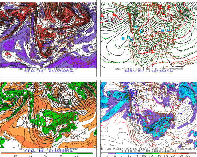
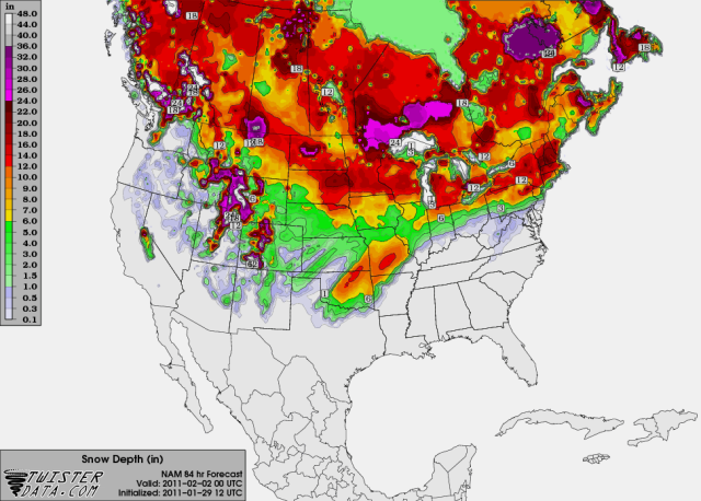
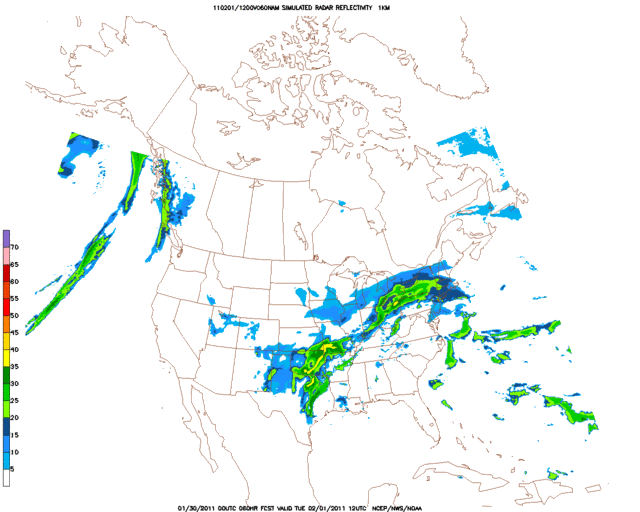
Lots of wintry weather across the southern plains if this run is correct. More snow for central and eastern Oklahoma that on the 00z GFS...
108 HRS
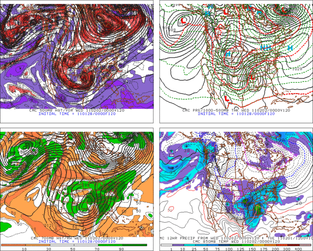
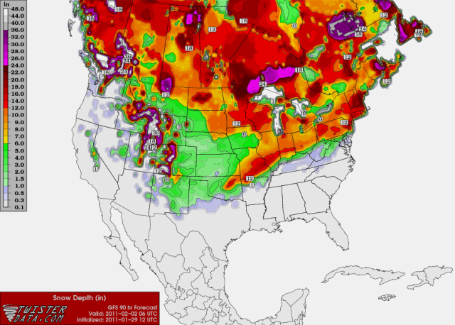
120 HRS
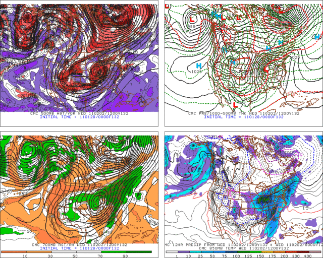
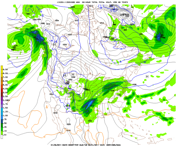
132 HRS
Moderator: S2k Moderators
 The posts in this forum are NOT official forecast and should not be used as such. They are just the opinion of the poster and may or may not be backed by sound meteorological data. They are NOT endorsed by any professional institution or STORM2K.


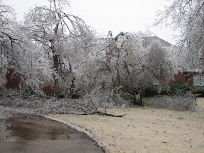
Metalicwx220 wrote:TwisterFanatic wrote:Can't really tell, but it looks like i would get the brunt of the ice if that run verified.
Ice is cooler than snow and better looking.
TwisterFanatic wrote:Metalicwx220 wrote:TwisterFanatic wrote:Can't really tell, but it looks like i would get the brunt of the ice if that run verified.
Ice is cooler than snow and better looking.
Not so nice on civilization.

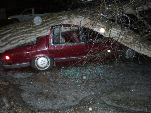
Metalicwx220 wrote:TwisterFanatic wrote:2 years ago we had 2.25 inches of Ice. No power for 5 days. Rural area's had no power for up to 2 weeks.
OMGWere all the trees down


Extremeweatherguy wrote:The ECMWF has also now jumped on board for a significant snowfall across the area, with the 12z run showing QPF values in excess of 0.85" (and perhaps as much as almost 1.00") falling on OKC in a below freezing airmass. And with thicknesses falling below 530 and 850mb temperature falling below -10C, it is likely that by the end of the event, some of the snow ratios could be as high as 15:1 or 20:1, which would be pretty impressive.

Users browsing this forum: No registered users and 151 guests