

Gulf Disturbance Week of June 27th (Is invest 95L)
Moderator: S2k Moderators
Forum rules

The posts in this forum are NOT official forecasts and should not be used as such. They are just the opinion of the poster and may or may not be backed by sound meteorological data. They are NOT endorsed by any professional institution or STORM2K. For official information, please refer to products from the National Hurricane Center and National Weather Service.
Re: Possible Gulf Disturbance (Drought buster?)
Moisture building in the SW Caribbean, the NAM and the GFS both show this moving NW into the BOC in the next few days. Then hopefully it will be pulled north as the trough appoaches out of the Plains.
0 likes
The following post is NOT an official forecast and should not be used as such. It is just the opinion of the poster and may or may not be backed by sound meteorological data. It is NOT endorsed by any professional institution including storm2k.org For Official Information please refer to the NHC and NWS products.
-
jlauderdal
- S2K Supporter

- Posts: 7240
- Joined: Wed May 19, 2004 5:46 am
- Location: NE Fort Lauderdale
- Contact:
Re:
Vortex wrote:Living here in fort lauderdale for 39 years I can't recall a June so dry thus far. It tends to be the rainiest month it's anything but. Something has to give. According to NWSMiami the drought indicator is "exceptional" for the area. I thinks it's safe to say at some point this summer or fall a significant rainfall or 2 is quite likely. Mother nature always balances things out.
looks very dry for at least the next 10 days
0 likes

The tropical wave that will eventually move into the southern GOM/BOC and that could become our suspect area has exploded with convection in the past few hours, but I think it has to do more with interaction with the upper level trough in the eastern GOM as surface pressures are somewhat high and have not fallen compared to 24hrs ago. Heck its satellite presentation looks better than 92E this morning.

0 likes
-
lrak

- S2K Supporter
- Posts: 1770
- Age: 59
- Joined: Thu Jun 21, 2007 2:48 pm
- Location: Corpus Christi, TX
Re: Possible Gulf Disturbance (Drought buster?)
I hope this doesn't turn out to be a week long tease.
0 likes
AKA karl
Also
Personal Forecast Disclaimer:
My posts on this forum are NOT official forecast and should not be used as such. My posts are my basic observations and are definitely not backed by any "well some" meteorological knowledge. For official information, please refer to the NHC and NWS products.
Also
Personal Forecast Disclaimer:
My posts on this forum are NOT official forecast and should not be used as such. My posts are my basic observations and are definitely not backed by any "well some" meteorological knowledge. For official information, please refer to the NHC and NWS products.


Re: Possible Gulf Disturbance (Drought buster?)
This area was just north of Panama a few days ago. The only way this will develop in the BOC is if the persistent trough that has been there for over a week lifts out. At the moment the trough over the BOC is in a good position to add some shear lift to the convection.
0 likes
-
wxman57

- Moderator-Pro Met

- Posts: 23120
- Age: 68
- Joined: Sat Jun 21, 2003 8:06 pm
- Location: Houston, TX (southwest)
Re: Possible Gulf Disturbance (Drought buster?)
Tropical development looks unlikely due to moderate to strong westerly shear in the central to northern Gulf. As for being a "drought buster", almost certainly not. Maybe enough to water the trees/grass if we're lucky in TX/LA coastal areas.
0 likes
-
StarmanHDB

- Tropical Storm

- Posts: 202
- Age: 60
- Joined: Wed Sep 02, 2009 7:59 pm
- Location: West Palm Beach, Florida
Re: Possible Gulf Disturbance (Drought buster?)
wxman57 wrote:Tropical development looks unlikely due to moderate to strong westerly shear in the central to northern Gulf. As for being a "drought buster", almost certainly not. Maybe enough to water the trees/grass if we're lucky in TX/LA coastal areas.
SHEARLY you can't be serious!
0 likes
Re: Possible Gulf Disturbance (Drought buster?)
Looks like this will be mentioned in the next TWO, though as others said with strong shear even warm ocean temps cannot make a system:
http://www.goes.noaa.gov/HURRLOOPS/huirloop.html
http://www.goes.noaa.gov/HURRLOOPS/huirloop.html
0 likes
Re: Possible Gulf Disturbance (Drought buster?)
Obviously drawing together. We'll see if conditions allow it to hold together.
0 likes
-
cycloneye

- Admin

- Posts: 148733
- Age: 69
- Joined: Thu Oct 10, 2002 10:54 am
- Location: San Juan, Puerto Rico
Re: Possible Gulf Disturbance (Drought buster?)
The Belize radar shows plenty of rain moving into the Yucatan from the east.

0 likes
Visit the Caribbean-Central America Weather Thread where you can find at first post web cams,radars
and observations from Caribbean basin members Click Here
and observations from Caribbean basin members Click Here

-
Ivanhater

- Storm2k Moderator

- Posts: 11166
- Age: 39
- Joined: Fri Jul 01, 2005 8:25 am
- Location: Pensacola
Re: Possible Gulf Disturbance (Drought buster?)
Joe Bastardi
Texas... some rain and cooler weather should get down there next week!!!
western gulf may light up with disturbed weather too.
Texas... some rain and cooler weather should get down there next week!!!
western gulf may light up with disturbed weather too.
0 likes
Michael
I don't see upper level conditions that bad developing in the southern GOM/BOC next week as an upper level anticyclone develops over the area as forecasted by models, the only negativity that I see is the tropical wave's trough could get too close to the Mexican coast in GOM and any surface low pressure that wants to get going will have a hard time getting going because of proximity to land.
0 likes
-
brunota2003

- S2K Supporter
- Posts: 9476
- Age: 35
- Joined: Sat Jul 30, 2005 9:56 pm
- Location: Stanton, KY...formerly Havelock, NC
- Contact:
-
Ivanhater
- Storm2k Moderator
- Posts: 11166
- Age: 39
- Joined: Fri Jul 01, 2005 8:25 am
- Location: Pensacola
Re: Possible Gulf Disturbance (Drought buster?)
12z GFS still showing the area of disturbed weather with very heavy rain in the western Gulf....certainly a change in the pattern we have been seeing.
[img]
Uploaded with ImageShack.us[/img]
[img]

Uploaded with ImageShack.us[/img]
0 likes
Michael
-
Ivanhater
- Storm2k Moderator
- Posts: 11166
- Age: 39
- Joined: Fri Jul 01, 2005 8:25 am
- Location: Pensacola
Re: Possible Gulf Disturbance (Drought buster?)
Down to 1003mb with very low shear
[img]
Uploaded with ImageShack.us[/img]
[img]
Uploaded with ImageShack.us[/img]
[img]

Uploaded with ImageShack.us[/img]
[img]

Uploaded with ImageShack.us[/img]
0 likes
Michael
-
southerngale

- Retired Staff

- Posts: 27418
- Joined: Thu Oct 10, 2002 1:27 am
- Location: Southeast Texas (Beaumont area)
Re: Possible Gulf Disturbance (Drought buster?)
wxman57 wrote:Tropical development looks unlikely due to moderate to strong westerly shear in the central to northern Gulf. As for being a "drought buster", almost certainly not. Maybe enough to water the trees/grass if we're lucky in TX/LA coastal areas.
Dream squasher!
0 likes
Please support Storm2k by making a donation today. It is greatly appreciated! Click here: 
 my Cowboys my Rockets my Astros
my Cowboys my Rockets my Astros-
flwxwatcher
- Category 4

- Posts: 926
- Joined: Wed May 16, 2007 3:35 pm
- Location: Central Florida
Re: Possible Gulf Disturbance (Drought buster?)
Still not buying the GFS , though I hope I am wrong and it would be nice to see some other model support for the GFS solution. . 
0 likes
-
cycloneye
- Admin
- Posts: 148733
- Age: 69
- Joined: Thu Oct 10, 2002 10:54 am
- Location: San Juan, Puerto Rico
Re: Possible Gulf Disturbance (Drought buster?)
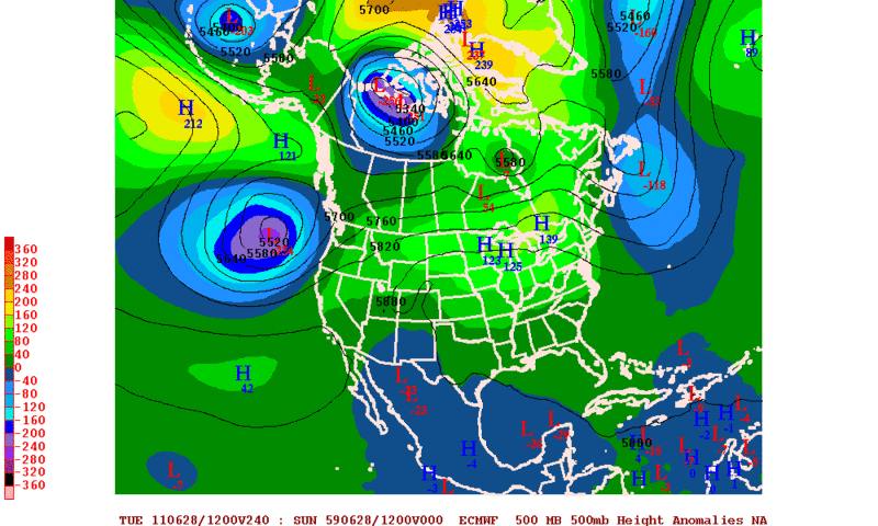
flwxwatcher wrote:Still not buying the GFS , though I hope I am wrong and it would be nice to see some other model support for the GFS solution. .
GFS is not alone anymore as ECMWF has a low in BOC,although the timeframe is later than GFS.

0 likes
Visit the Caribbean-Central America Weather Thread where you can find at first post web cams,radars
and observations from Caribbean basin members Click Here
and observations from Caribbean basin members Click Here
-
Rgv20

- S2K Supporter
- Posts: 2466
- Age: 39
- Joined: Wed Jan 05, 2011 5:42 pm
- Location: Edinburg/McAllen Tx
0 likes
The following post is NOT an official forecast and should not be used as such. It is just the opinion of the poster and may or may not be backed by sound meteorological data. It is NOT endorsed by any professional institution including storm2k.org For Official Information please refer to the NHC and NWS products.
Who is online
Users browsing this forum: No registered users and 40 guests