[img]

Uploaded with ImageShack.us[/img]
[img]

Uploaded with ImageShack.us[/img]
Moderator: S2k Moderators


NDG wrote:I am not holding my breath this time to see if the GFS comes true about a possible BOC system, could be just another normal fall of surface pressures like they are right now down there but nothing close to any deep convection like it was adverstising last week.
Ivanhater wrote:NDG wrote:I am not holding my breath this time to see if the GFS comes true about a possible BOC system, could be just another normal fall of surface pressures like they are right now down there but nothing close to any deep convection like it was adverstising last week.
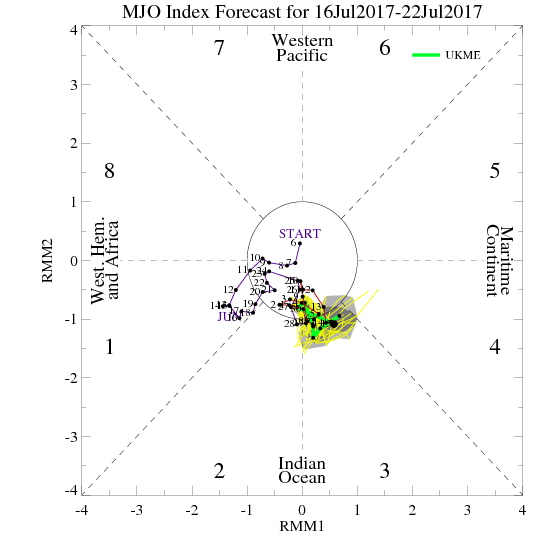
This go round the GFS has support from the Canadian, Euro ensembles and favorable MJO. While I would not hold my breath for development, this certainly has more support than anything else so far this season.


Ivanhater wrote:18z Nogaps is a tad aggressive with our system
BigA wrote:Ivanhater wrote:18z Nogaps is a tad aggressive with our system
Ivanhater, do you have the link for that NOGAPS model? I had a site for it last year, but I can't find it now.
Much thanks.


Garnet1995 wrote:I am sure it will be something...as I have a trip (first) to Pensacola....I want to see what Florida is all about......so sounds about 100 % there will be a system somewhere along I-10 between Houston and Florida...lol


Users browsing this forum: No registered users and 70 guests


