192 hours, intensifying in the Southern Bahamas moving WNW
http://raleighwx.americanwx.com/models/ ... cal192.gif
Pouch P17L in Eastern Atlantic -(Now Invest 97L)
Moderator: S2k Moderators
Forum rules

The posts in this forum are NOT official forecasts and should not be used as such. They are just the opinion of the poster and may or may not be backed by sound meteorological data. They are NOT endorsed by any professional institution or STORM2K. For official information, please refer to products from the National Hurricane Center and National Weather Service.
Re: Pouch P17L SW of CV Islands
0 likes
-
Ivanhater

- Storm2k Moderator

- Posts: 11221
- Age: 39
- Joined: Fri Jul 01, 2005 8:25 am
- Location: Pensacola
Re: Pouch P17L SW of CV Islands
240 approaching Florida Keys....ridge building
http://raleighwx.americanwx.com/models/ ... cal240.gif
http://raleighwx.americanwx.com/models/ ... cal240.gif
0 likes
Michael
Re: Pouch P17L SW of CV Islands
At 228 hours, really bombs it out heading towards S. Florida
At 240 hours, major hurricane hit on South Florida
http://raleighwx.americanwx.com/models/ ... cal240.gif
At 240 hours, major hurricane hit on South Florida
http://raleighwx.americanwx.com/models/ ... cal240.gif
0 likes
Re: Pouch P17L SW of CV Islands
heading towards Pensacola again...pretty much a carbon copy of 6z run
0 likes
-
Ivanhater
- Storm2k Moderator
- Posts: 11221
- Age: 39
- Joined: Fri Jul 01, 2005 8:25 am
- Location: Pensacola

Re: Pouch P17L SW of CV Islands
Ivanhater wrote:276 hours...approaching my neck of the gulf coast as a nasty hurricane!
Uploaded with ImageShack.us
Carbon copy of the 6z run but much faster
0 likes
-
Ivanhater
- Storm2k Moderator
- Posts: 11221
- Age: 39
- Joined: Fri Jul 01, 2005 8:25 am
- Location: Pensacola

-
Aric Dunn
- Category 5

- Posts: 21238
- Age: 43
- Joined: Sun Sep 19, 2004 9:58 pm
- Location: Ready for the Chase.
- Contact:
Re: Pouch P17L SSW of CV Islands
TreasureIslandFLGal wrote:Aric Dunn wrote:The following post is NOT an official forecast and should not be used as such. It is just the opinion of the poster and may or may not be backed by sound meteorological data. It is NOT endorsed by any professional institution including storm2k.org. For Official Information please refer to the NHC and NWS products.
Anyone else notice the last few days of model runs.... there is a remarkable agreement from the GFS, Euro, and a few others.. but the big boys the GFS and EURO over the last few days ( nearly 6 runs of euro and 12 of GFS) have tracked basically within the black cone. I cant recall ( especially this season) when they have been in such good agreement over so many runs. The other oddity is the rather timid GFS has a strong hurricane also in line with the euro. It is rather far out but the deviation is really quite small considering the two models typically dont like to agree... so you cant just pass that off... So if we do get development before the islands I would put a little money on a track somewhere in the cone. which is saying a lot being that the cone is rather narrow and the system is no where near developing yet.
Such a path could be a big storm producer, yet the CONUS may not have to deal with such a monster if it rakes over Hispanola or a big swath of Cuba first. However, this looks scary for someone regardless.
I suspect that the front will assist in lifting this north, but then pull out with the atlantic ridge building westward to close off the escape route to the recurve scenario and force it back to the west.
The posts in this forum are NOT official forecast and should not be used as such. They are just the opinion of the poster and may or may not be backed by sound meteorological data. They are NOT endorsed by any professional institution or storm2k.org. For official information, please refer to the NHC and NWS products.

Add another GFS run to the growing consistency....
0 likes
Note: If I make a post that is brief. Please refer back to previous posts for the analysis or reasoning. I do not re-write/qoute what my initial post said each time.
If there is nothing before... then just ask
Space & Atmospheric Physicist, Embry-Riddle Aeronautical University,
I believe the sky is falling...
If there is nothing before... then just ask
Space & Atmospheric Physicist, Embry-Riddle Aeronautical University,
I believe the sky is falling...
Look at the date for that GFS New Orleans hit: Monday, August 29th (hopefully this will NOT be the K storm in 2011)
Last edited by rockyman on Tue Aug 16, 2011 11:46 am, edited 1 time in total.
0 likes

-
SFLcane

- S2K Supporter

- Posts: 10281
- Age: 48
- Joined: Sat Jun 05, 2010 1:44 pm
- Location: Lake Worth Florida
Re: Pouch P17L SW of CV Islands
Aric you should keep the cone handy to see if future runs of the GFS and ECM stay inside your cone.
0 likes
-
Blown Away

- S2K Supporter
- Posts: 10253
- Joined: Wed May 26, 2004 6:17 am
Re: Pouch P17L SW of CV Islands
The consistency is a building ridge as this system appraoches the SE Bahama area. Let's hope that doesn't happen, Windward Islands, PR, DR, Bahamas, SFL, and Panhandle get a strike!!! Yikes!
0 likes
Hurricane Eye Experience: David 79, Irene 99, Frances 04, Jeanne 04, Wilma 05… Hurricane Brush Experience: Andrew 92, Erin 95, Floyd 99, Matthew 16, Irma 17, Ian 22, Nicole 22…
-
Ivanhater
- Storm2k Moderator
- Posts: 11221
- Age: 39
- Joined: Fri Jul 01, 2005 8:25 am
- Location: Pensacola
Re: Pouch P17L SW of CV Islands
This one looks nasty folks....Both the GFS and Euro showing a building high as it approaches South Florida/Gulf coast. Let's hope models swing away but the consistency is concerning.
0 likes
Michael
-
Aric Dunn
- Category 5
- Posts: 21238
- Age: 43
- Joined: Sun Sep 19, 2004 9:58 pm
- Location: Ready for the Chase.
- Contact:
Re: Pouch P17L SW of CV Islands
Blown Away wrote:The consistency is a building ridge as this system appraoches the SE Bahama area. Let's hope that doesn't happen, Windward Islands, PR, DR, Bahamas, SFL, and Panhandle get a strike!!! Yikes!
this run is similar to georges

0 likes
Note: If I make a post that is brief. Please refer back to previous posts for the analysis or reasoning. I do not re-write/qoute what my initial post said each time.
If there is nothing before... then just ask
Space & Atmospheric Physicist, Embry-Riddle Aeronautical University,
I believe the sky is falling...
If there is nothing before... then just ask
Space & Atmospheric Physicist, Embry-Riddle Aeronautical University,
I believe the sky is falling...
-
PTrackerLA

- Category 5
- Posts: 5281
- Age: 42
- Joined: Thu Oct 10, 2002 8:40 pm
- Location: Lafayette, LA
Re: Pouch P17L SW of CV Islands
Oh the drama you GFS! Another year another system plowing through Miami and New Orleans 
 .
.
0 likes

-
Ivanhater
- Storm2k Moderator
- Posts: 11221
- Age: 39
- Joined: Fri Jul 01, 2005 8:25 am
- Location: Pensacola
Re: Pouch P17L SW of CV Islands
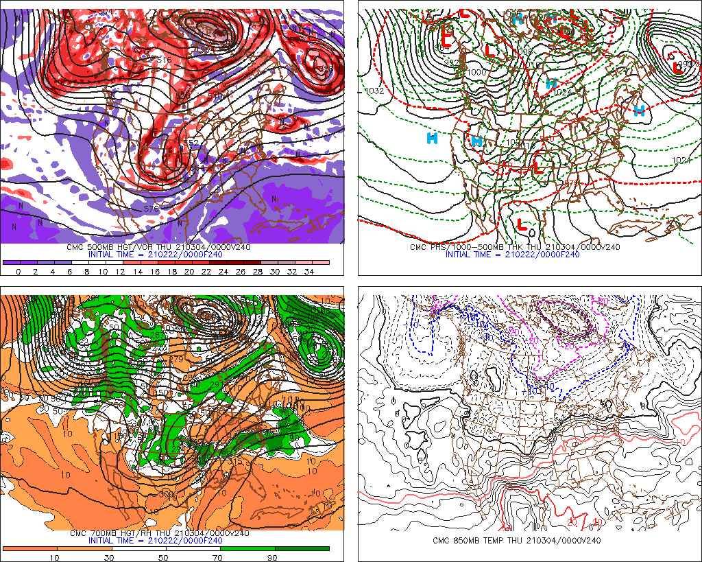
BTW...here is last night's Canadian...240 hours. Approaching South Carolina
0 likes
Michael
-
ConvergenceZone
.gif)
- Category 5
- Posts: 5241
- Joined: Fri Jul 29, 2005 1:40 am
- Location: Northern California
Re: Pouch P17L SW of CV Islands
PTrackerLA wrote:Oh the drama you GFS! Another year another system plowing through Miami and New Orleans
The thing is, I hate to say it, but the US is overdue for a major hurricane to hit. Our incredibly good luck lately can only sustain itself for so long, and because of our long drys pell avoiding a major, I would be absolutely SHOCKED if a major doesn't impact the US this year.
0 likes
-
Ivanhater
- Storm2k Moderator
- Posts: 11221
- Age: 39
- Joined: Fri Jul 01, 2005 8:25 am
- Location: Pensacola
Re: Pouch P17L SW of CV Islands
12z Canadian 144 hours...approaching Hispaniola. The model consistency at this range is amazing!

0 likes
Michael
Who is online
Users browsing this forum: Kingarabian and 212 guests