ATL: IRENE - Models
Moderator: S2k Moderators
- northjaxpro
- S2K Supporter

- Posts: 8900
- Joined: Mon Sep 27, 2010 11:21 am
- Location: Jacksonville, FL
Ivanhater and Wxman57, the latest EURO runs are trending back east reflecting the strength of the trough coming down the East Coast late next week correct?
Earlier runs had it near Pensacola.
Earlier runs had it near Pensacola.
Last edited by northjaxpro on Fri Aug 19, 2011 2:00 pm, edited 1 time in total.
0 likes
NEVER, EVER SAY NEVER in the tropics and weather in general, and most importantly, with life itself!!
________________________________________________________________________________________
Fay 2008 Beryl 2012 Debby 2012 Colin 2016 Hermine 2016 Julia 2016 Matthew 2016 Irma 2017 Dorian 2019
________________________________________________________________________________________
Fay 2008 Beryl 2012 Debby 2012 Colin 2016 Hermine 2016 Julia 2016 Matthew 2016 Irma 2017 Dorian 2019
- PTrackerLA
- Category 5

- Posts: 5281
- Age: 42
- Joined: Thu Oct 10, 2002 8:40 pm
- Location: Lafayette, LA
Re: ATL: INVEST 97L-Models
I guess that's considered a west shift in the Euro whereas the 00z was close to staying offshore the US completely.
0 likes
- Ivanhater
- Storm2k Moderator

- Posts: 11221
- Age: 39
- Joined: Fri Jul 01, 2005 8:25 am
- Location: Pensacola
Re: ATL: INVEST 97L - Models
Actually between 192 hour to 240 hours...the ridge pushes it NW
0 likes
Michael
- northjaxpro
- S2K Supporter

- Posts: 8900
- Joined: Mon Sep 27, 2010 11:21 am
- Location: Jacksonville, FL
Interesting to see what happens with the trough the latter half of next week. It is possible the trough could lift out , and have a similar situation to Elena in '85, where the trough left her behind and meandered around for nearly two days until the ridge forced her back west/northwest to the panhandle. Hope that doesn't happen.
Last edited by northjaxpro on Fri Aug 19, 2011 2:05 pm, edited 2 times in total.
0 likes
NEVER, EVER SAY NEVER in the tropics and weather in general, and most importantly, with life itself!!
________________________________________________________________________________________
Fay 2008 Beryl 2012 Debby 2012 Colin 2016 Hermine 2016 Julia 2016 Matthew 2016 Irma 2017 Dorian 2019
________________________________________________________________________________________
Fay 2008 Beryl 2012 Debby 2012 Colin 2016 Hermine 2016 Julia 2016 Matthew 2016 Irma 2017 Dorian 2019
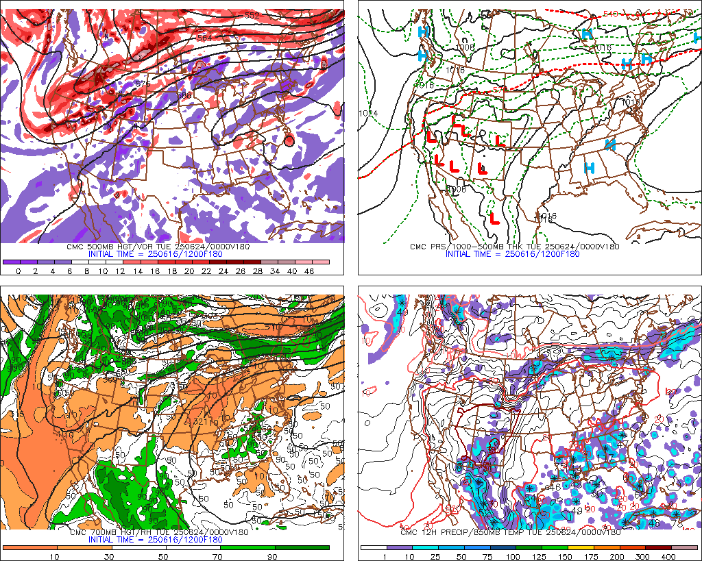
The 12z GFS, Euro, and CMC are in general agreement that the system will be south of eastern Cuba in 5 days. From there, the Euro begins turning sharply northward on Day 5, GFS begins a slower turn northward on Day 6, and CMC implies a gradual turn beginning on Day 7.
Last edited by rockyman on Fri Aug 19, 2011 2:06 pm, edited 1 time in total.
0 likes
- Ivanhater
- Storm2k Moderator

- Posts: 11221
- Age: 39
- Joined: Fri Jul 01, 2005 8:25 am
- Location: Pensacola
Re:
northjaxpro wrote:Ivanhater and Wxman57, the latest EURO runs are trending back east reflecting the strength of the trough coming down the East Coast late next week correct?
Earlier runs had it near Pensacola.
Last Euro had it run up the east coast so a definite shift west. Canadian and GFS today have shifted west today as well. I do think we are honing in on a Gulf/Florida solution slowly but surely.
0 likes
Michael
- Ivanhater
- Storm2k Moderator

- Posts: 11221
- Age: 39
- Joined: Fri Jul 01, 2005 8:25 am
- Location: Pensacola
Re: ATL: INVEST 97L - Models
BTW//12z Canadian long range...deep in the southern Gulf


0 likes
Michael
- northjaxpro
- S2K Supporter

- Posts: 8900
- Joined: Mon Sep 27, 2010 11:21 am
- Location: Jacksonville, FL
Yeah, Ivanhater, it looks like the ridging should be strong enough to push this system westward to at least Eastern or Southeast GOM in about 7 days. After that, all bets are off as to what this system will do or where it is headed.
0 likes
NEVER, EVER SAY NEVER in the tropics and weather in general, and most importantly, with life itself!!
________________________________________________________________________________________
Fay 2008 Beryl 2012 Debby 2012 Colin 2016 Hermine 2016 Julia 2016 Matthew 2016 Irma 2017 Dorian 2019
________________________________________________________________________________________
Fay 2008 Beryl 2012 Debby 2012 Colin 2016 Hermine 2016 Julia 2016 Matthew 2016 Irma 2017 Dorian 2019
-
OuterBanker
- S2K Supporter

- Posts: 1761
- Joined: Wed Feb 26, 2003 10:53 am
- Location: Nags Head, NC
- Contact:
-
plasticup
Re: ATL: INVEST 97L - Models
Just remember that this isn't the first monster our models have seen in the Gulf.
0 likes
- cycloneye
- Admin

- Posts: 149435
- Age: 69
- Joined: Thu Oct 10, 2002 10:54 am
- Location: San Juan, Puerto Rico
Re: ATL: INVEST 97L - Models
18z Tropical Models.
Code: Select all
WHXX01 KWBC 191909
CHGHUR
TROPICAL CYCLONE GUIDANCE MESSAGE
NWS NATIONAL HURRICANE CENTER MIAMI FL
1909 UTC FRI AUG 19 2011

DISCLAIMER...NUMERICAL MODELS ARE SUBJECT TO LARGE ERRORS.
PLEASE REFER TO NHC OFFICIAL FORECASTS FOR TROPICAL CYCLONE
AND SUBTROPICAL CYCLONE INFORMATION.

ATLANTIC OBJECTIVE AIDS FOR

DISTURBANCE INVEST (AL972011) 20110819 1800 UTC

        ...00 HRS...   ...12 HRS...   ...24 HRS. ..   ...36 HRS...
        110819  1800   110820  0600   110820  1800   110821  0600

         LAT    LON     LAT    LON     LAT    LON     LAT    LON
BAMS    13.6N  49.3W   14.0N  52.4W   14.8N  55.6W   15.8N  58.8W
BAMD    13.6N  49.3W   14.2N  52.3W   14.9N  55.3W   15.6N  58.2W
BAMM    13.6N  49.3W   13.9N  52.5W   14.6N  55.8W   15.3N  58.9W
LBAR    13.6N  49.3W   14.0N  52.8W   14.7N  56.3W   15.3N  59.8W
SHIP        25KTS          29KTS          36KTS          45KTS
DSHP        25KTS          29KTS          36KTS          45KTS

        ...48 HRS...   ...72 HRS...   ...96 HRS. ..   ..120 HRS...
        110821  1800   110822  1800   110823  1800   110824  1800

         LAT    LON     LAT    LON     LAT    LON     LAT    LON
BAMS    16.9N  62.1W   18.7N  68.7W   20.4N  74.8W   20.7N  80.2W
BAMD    16.4N  61.0W   17.8N  66.0W   19.6N  70.4W   22.0N  74.6W
BAMM    16.2N  62.0W   17.5N  68.0W   18.8N  73.3W   19.8N  77.4W
LBAR    15.9N  63.1W   16.6N  69.2W   17.6N  73.3W     .0N    .0W
SHIP        54KTS          70KTS          77KTS          79KTS
DSHP        54KTS          70KTS          63KTS          65KTS

         ...INITIAL CONDITIONS...
LATCUR =  13.6N LONCUR =  49.3W DIRCUR = 275DEG SPDCUR =  18KT
LATM12 =  13.4N LONM12 =  45.5W DIRM12 = 273DEG SPDM12 =  19KT
LATM24 =  13.2N LONM24 =  41.3W
WNDCUR =   25KT RMAXWD =   75NM WNDM12 =   25KT
CENPRS = 1007MB OUTPRS = 1010MB OUTRAD =  175NM SDEPTH =   M
RD34NE =    0NM RD34SE =    0NM RD34SW =    0NM RD34NW =   0NM
0 likes
Visit the Caribbean-Central America Weather Thread where you can find at first post web cams,radars
and observations from Caribbean basin members Click Here
and observations from Caribbean basin members Click Here
-
weatherguy2
- Tropical Depression

- Posts: 72
- Joined: Sun Aug 01, 2010 2:45 am
-
Aric Dunn
- Category 5

- Posts: 21238
- Age: 43
- Joined: Sun Sep 19, 2004 9:58 pm
- Location: Ready for the Chase.
- Contact:
0 likes
Note: If I make a post that is brief. Please refer back to previous posts for the analysis or reasoning. I do not re-write/qoute what my initial post said each time.
If there is nothing before... then just ask
Space & Atmospheric Physicist, Embry-Riddle Aeronautical University,
I believe the sky is falling...
If there is nothing before... then just ask
Space & Atmospheric Physicist, Embry-Riddle Aeronautical University,
I believe the sky is falling...
- Blown Away
- S2K Supporter

- Posts: 10253
- Joined: Wed May 26, 2004 6:17 am
Re: ATL: INVEST 97L - Models
TVCN, BAMD, and Nogaps say Florida.
0 likes
Hurricane Eye Experience: David 79, Irene 99, Frances 04, Jeanne 04, Wilma 05… Hurricane Brush Experience: Andrew 92, Erin 95, Floyd 99, Matthew 16, Irma 17, Ian 22, Nicole 22…
Re: ATL: INVEST 97L - Models
Models are just models and long range hours are to dramatic to follow. Many years of going crazy watching the long range models.
0 likes
The following post is NOT an official forecast and should not be used as such. It is just the opinion of the poster and may or may not be backed by sound meteorological data. It is NOT endorsed by any professional institution including storm2k.org For Official Information please refer to the NHC and NWS products.
Re:
Wow...if that were to verify, that could be a disaster for almost all of Florida..pretty much rides the west coast all the way until Georgia...of course, IF it develops after Hispaniola
It means something if the Euro keeps intensifying this storm after going through the Hispaniola and Cuba and emerges into the Straits run after run
0 likes
- Ivanhater
- Storm2k Moderator

- Posts: 11221
- Age: 39
- Joined: Fri Jul 01, 2005 8:25 am
- Location: Pensacola
Re: ATL: INVEST 97L - Models
KatDaddy wrote:Models are just models and long range hours are to dramatic to follow. Many years of going crazy watching the long range models.
Important point. It is important to remember we are just analyzing these PARTICULAR model runs. Does not mean that is what is going occur.
0 likes
Michael
- Ivanhater
- Storm2k Moderator

- Posts: 11221
- Age: 39
- Joined: Fri Jul 01, 2005 8:25 am
- Location: Pensacola
Re: ATL: INVEST 97L - Models
12z GFS Ensemble mean...potent system in the central Gulf


0 likes
Michael
Who is online
Users browsing this forum: No registered users and 79 guests

