
http://www.goes.noaa.gov/HURRLOOPS/huirloop.html
it seems like outflow from an area of disturbed weather near Central America has developed in the past few days...
Some of that cloud cover was over South Florida yesterday and it did create some out-of-season convective (CB) cloud cover during the early and late afternoon hours, from what I could see...
Frank2
Disturbed Weather - NW Caribbean Sea (Is invest 90L)
Moderator: S2k Moderators
Forum rules

The posts in this forum are NOT official forecasts and should not be used as such. They are just the opinion of the poster and may or may not be backed by sound meteorological data. They are NOT endorsed by any professional institution or STORM2K. For official information, please refer to products from the National Hurricane Center and National Weather Service.
Disturbed Weather - NW Caribbean Sea (Is invest 90L)
Last edited by cycloneye on Sun Feb 05, 2012 11:41 am, edited 1 time in total.
Reason: To add invest 90L
Reason: To add invest 90L
0 likes
-
gatorcane

- S2K Supporter

- Posts: 23708
- Age: 48
- Joined: Sun Mar 13, 2005 3:54 pm
- Location: Boca Raton, FL
Re: Disturbed Weather - NW Caribbean Sea
I know its early February but if it were during hurricane season, certainly would be drawing attention.
Definitely doesn't look like February down there right now -- or even over SE Florida with lows near 70F and highs in the 80s for the forseeable future.
Looks like late May or June actually.
Every once in a while (through quite rare), something tropical gets going in the WCAR during the offseason, wonder if this will be one of those times?
I do see some spin down there just off of Belize
0 likes


Re: Disturbed Weather - NW Caribbean Sea

Actually it doesn't I just wanted to post the first one of the year.
0 likes

-
MGC

- S2K Supporter
- Posts: 5940
- Joined: Sun Mar 23, 2003 9:05 pm
- Location: Pass Christian MS, or what is left.
Re: Disturbed Weather - NW Caribbean Sea
Would be something to have a Feb system...but, I'm afraid the shear is a bit too strong....MGC
0 likes
-
Hurricanehink

- S2K Supporter
- Posts: 2045
- Joined: Sun Nov 16, 2003 2:05 pm
- Location: New Jersey
Re: Disturbed Weather - NW Caribbean Sea

It's the 60th anniversary of this guy. Perhaps that storm was similar to what we have now down there.
Last edited by Hurricanehink on Fri Feb 03, 2012 3:52 pm, edited 1 time in total.
0 likes
-
cycloneye

- Admin

- Posts: 149275
- Age: 69
- Joined: Thu Oct 10, 2002 10:54 am
- Location: San Juan, Puerto Rico
Re: Disturbed Weather - NW Caribbean Sea
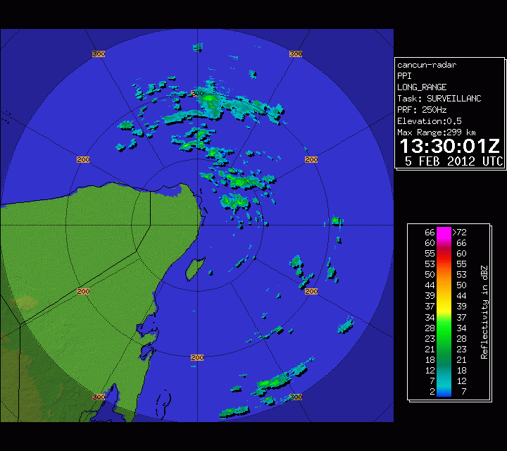
Nothing turning in a pronnounced way on the radar.


0 likes
Visit the Caribbean-Central America Weather Thread where you can find at first post web cams,radars
and observations from Caribbean basin members Click Here
and observations from Caribbean basin members Click Here

Re: Disturbed Weather - NW Caribbean Sea
That Yucatan channel blob is in the one spot of green in the entire basin.

0 likes

Very interesting system for this time of the year, but of course is not like we are talking a pure tropical disturbance.
Broad cyclonic circulation off the coast of the NE Yucatan P is better defined than what it was the last couple of days.
Hope the rain makes it to the Orlando area where is needed really bad.
Broad cyclonic circulation off the coast of the NE Yucatan P is better defined than what it was the last couple of days.
Hope the rain makes it to the Orlando area where is needed really bad.
0 likes

-
wxman57

- Moderator-Pro Met

- Posts: 23172
- Age: 68
- Joined: Sat Jun 21, 2003 8:06 pm
- Location: Houston, TX (southwest)
Re: Disturbed Weather - NW Caribbean Sea
It has been declared an invest, but it's certainly not tropical and it's in an area of extremely strong upper-level winds. Just some rain for south Florida over the next 24-36 hours as it moves across.
TROPICAL CYCLONE GUIDANCE MESSAGE
NWS NATIONAL HURRICANE CENTER MIAMI FL
1619 UTC SUN FEB 5 2012
DISCLAIMER...NUMERICAL MODELS ARE SUBJECT TO LARGE ERRORS.
PLEASE REFER TO NHC OFFICIAL FORECASTS FOR TROPICAL CYCLONE
AND SUBTROPICAL CYCLONE INFORMATION.
ATLANTIC OBJECTIVE AIDS FOR
DISTURBANCE INVEST (AL902012) 20120205 1200 UTC
...00 HRS... ...12 HRS... ...24 HRS. .. ...36 HRS...
120205 1200 120206 0000 120206 1200 120207 0000
LAT LON LAT LON LAT LON LAT LON
BAMS 22.0N 86.0W 22.7N 86.4W 23.0N 86.5W 23.3N 86.4W
BAMD 22.0N 86.0W 24.0N 84.7W 26.3N 82.3W 29.0N 77.5W
BAMM 22.0N 86.0W 22.9N 85.7W 23.7N 84.7W 24.9N 83.0W
LBAR 22.0N 86.0W 22.9N 85.3W 24.2N 83.8W 25.2N 80.8W
SHIP 25KTS 31KTS 34KTS 31KTS
DSHP 25KTS 31KTS 34KTS 31KTS
...48 HRS... ...72 HRS... ...96 HRS. .. ..120 HRS...
120207 1200 120208 1200 120209 1200 120210 1200
LAT LON LAT LON LAT LON LAT LON
BAMS 23.8N 86.2W 25.5N 84.5W 28.1N 82.1W 31.9N 76.4W
BAMD 31.3N 68.8W 29.7N 50.6W 25.6N 45.5W 20.8N 45.2W
BAMM 26.7N 80.2W 30.1N 69.6W 32.3N 55.5W 30.6N 48.2W
LBAR 26.1N 77.0W 25.9N 68.9W 26.3N 63.5W 23.5N 60.6W
SHIP 20KTS 0KTS 0KTS 0KTS
DSHP 24KTS 0KTS 0KTS 0KTS
...INITIAL CONDITIONS...
LATCUR = 22.0N LONCUR = 86.0W DIRCUR = 0DEG SPDCUR = 0KT
LATM12 = 22.0N LONM12 = 86.0W DIRM12 = 360DEG SPDM12 = 0KT
LATM24 = 22.0N LONM24 = 86.0W
WNDCUR = 25KT RMAXWD = 100NM WNDM12 = 25KT
CENPRS = 1014MB OUTPRS = 1016MB OUTRAD = 150NM SDEPTH = M
RD34NE = 0NM RD34SE = 0NM RD34SW = 0NM RD34NW = 0NM
0 likes
-
cycloneye
- Admin
- Posts: 149275
- Age: 69
- Joined: Thu Oct 10, 2002 10:54 am
- Location: San Juan, Puerto Rico
Re: Disturbed Weather - NW Caribbean Sea (Is invest 90L)
Go to active Storms/invests forum to continue the discussions about this Febuary invest.
viewtopic.php?f=59&t=112468&p=2212985#p2212985
viewtopic.php?f=59&t=112468&p=2212985#p2212985
0 likes
Visit the Caribbean-Central America Weather Thread where you can find at first post web cams,radars
and observations from Caribbean basin members Click Here
and observations from Caribbean basin members Click Here
Who is online
Users browsing this forum: No registered users and 104 guests