2012 WPAC season

This is the general tropical discussion area. Anyone can take their shot at predicting a storms path.

Moderator: S2k Moderators

Forum rules

The posts in this forum are NOT official forecasts and should not be used as such. They are just the opinion of the poster and may or may not be backed by sound meteorological data. They are NOT endorsed by any professional institution or STORM2K. For official information, please refer to products from the National Hurricane Center and National Weather Service.

Help Support Storm2K
Message
Author
User avatar
cycloneye
Admin
Admin
Posts: 145382
Age: 68
Joined: Thu Oct 10, 2002 10:54 am
Location: San Juan, Puerto Rico

Re: 2012 WPAC season

#141 Postby cycloneye » Mon Jul 02, 2012 10:52 am

euro6208 wrote:el nino is here! looks like the west pacific is starting to react as convection is blowing up all over the place even to the international dateline...


Image

Image
0 likes   
Visit the Caribbean-Central America Weather Thread where you can find at first post web cams,radars
and observations from Caribbean basin members Click Here

euro6208

Re: 2012 WPAC season

#142 Postby euro6208 » Sun Jul 08, 2012 11:36 am

although Super Typhoon Guchol peaked at 130 knots category 4, Dr. Ryan Maue PhD in Meteorology believes he peaked at 140 knots category 5 strength. dvorak and satellite estimates from CIMSS all supported cat 5 strength...who knows it could have been higher ... :eek:

This is what he has to say:

Super Typhoon Guchol likely reached 140 knots and the post-season analysis will adjust accordingly (at least it should). The final ACE will tally around 27 or 28 probably putting Guchol in the top 5 (1st overall) of the year for the Northern Hemisphere.

Image

Image

we'll see....
0 likes   

euro6208

Re: 2012 WPAC season

#143 Postby euro6208 » Sun Jul 08, 2012 12:25 pm

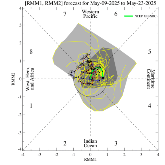
mmm looks like the epac is responding to our future el nino (although i think it's already here) with daniel and emilia. here in the wpac, models don't show any development anytime in the future furthermore, the mjo is over the indian ocean but is expected to return to the western hemisphere. i think this is just the calm before the season really kicks it up a notch as el nino gets stronger.


Image
0 likes   

dexterlabio
Category 5
Category 5
Posts: 3468
Joined: Sat Oct 24, 2009 11:50 pm

Re: 2012 WPAC season

#144 Postby dexterlabio » Mon Jul 09, 2012 8:41 am

as far as i remember the real action in the WPAC normally starts during August then peaks at September. If El Nino really kicks in by September and affect the conditions in the WPAC then the peak will likely be on October then extend until December...just like in 2009 and 2006.

i believe we can see some TC development without MJO but that will likely be not so interesting to track. for now we can just enjoy the calm and sunny weather until the wet phase of MJO returns and El Nino manifests in the future. This be a good time to get ready and save energy. :lol:
0 likes   
Personal Forecast Disclaimer:
The posts in this forum are NOT official forecast and should not be used as such. They are just the opinion of the poster and may or may not be backed by sound meteorological data. They are NOT endorsed by any professional institution or storm2k.org. For official information, please refer to the NHC and NWS products.

euro6208

Re: 2012 WPAC season

#145 Postby euro6208 » Mon Jul 09, 2012 11:39 am

July update from http://www.tropicalstormrisk.com

TSR raises its forecast and anticipates the 2012 Northwest Pacific typhoon season will see
activity about 10% above the 1965-2011 climate norm.


May Update was 26/16/9...July update is now 27/17/9 so a little bit more activity.


There is a 45% probability that the 2012 NW Pacific typhoon season ACE index will be above-average
(defined as an ACE index value in the upper tercile historically (>336)), a 39% likelihood it will be nearnormal (defined as an ACE index value in the middle tercile historically (235 to 336) and a 16% chance it
will be below-normal (defined as an ACE index value in the lower tercile historically (<235)).
0 likes   

dexterlabio
Category 5
Category 5
Posts: 3468
Joined: Sat Oct 24, 2009 11:50 pm

Re: 2012 WPAC season

#146 Postby dexterlabio » Mon Jul 09, 2012 7:47 pm

we already had 6 named tropical cyclones in WPAC...is this below or above average in terms of the numbers so far?
0 likes   
Personal Forecast Disclaimer:
The posts in this forum are NOT official forecast and should not be used as such. They are just the opinion of the poster and may or may not be backed by sound meteorological data. They are NOT endorsed by any professional institution or storm2k.org. For official information, please refer to the NHC and NWS products.

Typhoon Hunter
WesternPacificWeather.com
Posts: 1221
Joined: Wed Oct 11, 2006 11:37 am
Location: Tokyo
Contact:

Re: 2012 WPAC season

#147 Postby Typhoon Hunter » Tue Jul 10, 2012 7:06 pm

dexterlabio wrote:we already had 6 named tropical cyclones in WPAC...is this below or above average in terms of the numbers so far?


The average to date is 5.4 so we are slightly above average in terms of activity. Dread to think what activity we'd see in Wpac if the MJO was stuck over us instead of Indian Ocean / W hemisphere!
0 likes   
James - Documenting tropical cyclones...

http://www.youtube.com/TyphoonHunter

phwxenthusiast
Category 2
Category 2
Posts: 637
Joined: Wed Mar 24, 2010 3:10 am
Location: Holbrook, NY (Long Island)

#148 Postby phwxenthusiast » Wed Jul 11, 2012 1:09 am

we'll probably see this quiet regime extend into the latter part of July... many conflicting signals at the moment but CFI and GFS 2 week MJO and OLR forecasts kinda hint at suppressive conditions in the Western Pacific; we could even be slightly below-average as we head into August...
0 likes   

euro6208

Re: 2012 WPAC season

#149 Postby euro6208 » Wed Jul 11, 2012 10:48 am

darn mjo! if you continued moving to the east, we will be mighty active right now but it doesn't matter...this delay in mjo will likely cause our waters/conditions to get even more favorable as our next storms develop (updated page 1), potentially into monster storms...as we head into the *ber* months of the year, it is very dreadful to think what will happen...
0 likes   

dexterlabio
Category 5
Category 5
Posts: 3468
Joined: Sat Oct 24, 2009 11:50 pm

Re: 2012 WPAC season

#150 Postby dexterlabio » Wed Jul 11, 2012 11:07 am

everything will really depend on the MJO, I believe. The significant warming of the waters over the Pacific has stopped which is keeping El Nino at bay for now...if MJO returns to WPAC, I expect big time warming and by that time, El Nino might be here officially. It just needs a little push from the MJO. As always been said, El Nino may influence the conditions in the WPAC and raise the TC activity and may as well extend the typhoon season into December.

If I assume it would take 60days for the wet phase pf MJP to return in WPAC since its onset last June, then August is the latest time when we'll see more interesting systems.
0 likes   
Personal Forecast Disclaimer:
The posts in this forum are NOT official forecast and should not be used as such. They are just the opinion of the poster and may or may not be backed by sound meteorological data. They are NOT endorsed by any professional institution or storm2k.org. For official information, please refer to the NHC and NWS products.

dexterlabio
Category 5
Category 5
Posts: 3468
Joined: Sat Oct 24, 2009 11:50 pm

#151 Postby dexterlabio » Wed Jul 11, 2012 11:21 am

the statistical MJO forecast is opposite to the dynamical forecast ensembles. i don't know which is more reliable.
0 likes   
Personal Forecast Disclaimer:
The posts in this forum are NOT official forecast and should not be used as such. They are just the opinion of the poster and may or may not be backed by sound meteorological data. They are NOT endorsed by any professional institution or storm2k.org. For official information, please refer to the NHC and NWS products.

euro6208

Re: 2012 WPAC season

#152 Postby euro6208 » Wed Jul 11, 2012 11:23 am

dexterlabio wrote:everything will really depend on the MJO, I believe. The significant warming of the waters over the Pacific has stopped which is keeping El Nino at bay for now...if MJO returns to WPAC, I expect big time warming and by that time, El Nino might be here officially. It just needs a little push from the MJO. As always been said, El Nino may influence the conditions in the WPAC and raise the TC activity and may as well extend the typhoon season into December.

If I assume it would take 60days for the wet phase pf MJP to return in WPAC since its onset last June, then August is the latest time when we'll see more interesting systems.


not only extending 2012 but 2013 might start very early with the first half producing significant storms...
0 likes   

euro6208

Re: 2012 WPAC season

#153 Postby euro6208 » Thu Jul 12, 2012 11:39 am

Image
0 likes   

euro6208

Re: 2012 WPAC season

#154 Postby euro6208 » Sun Jul 15, 2012 12:42 am

as others have said, the epac is by far more interesting than the wpac or the atlantic...what does the future have in store for the wpac? i see 5 months of super activity starting next month with a developing el nino and a slew of powerful typhoons...
0 likes   

RobWESTPACWX
WestPACMet
WestPACMet
Posts: 1616
Joined: Fri Sep 17, 2010 2:26 am
Location: Tokyo, Japan
Contact:

Re: 2012 WPAC season

#155 Postby RobWESTPACWX » Sun Jul 15, 2012 3:34 am

I saw NOAA just announced the start of El Nino, its going to be interesting the coming month. Aug is typically the most active for the west pac, going to be an interesting month in deed.

Image
0 likes   
Satellites, Charts and Forecasting tools for East Asia at WESTERNPACIFICWEATHER.COM

User avatar
cycloneye
Admin
Admin
Posts: 145382
Age: 68
Joined: Thu Oct 10, 2002 10:54 am
Location: San Juan, Puerto Rico

Re: 2012 WPAC season

#156 Postby cycloneye » Sun Jul 15, 2012 7:42 pm

Is interesting that Ex Daniel has flared a little bit as it approaches the dateline. Will it make a run to redevelop in the WPAC?

Image
0 likes   
Visit the Caribbean-Central America Weather Thread where you can find at first post web cams,radars
and observations from Caribbean basin members Click Here

euro6208

Re: 2012 WPAC season

#157 Postby euro6208 » Mon Jul 16, 2012 1:22 am

08W is such a large storm with outflow extending to the philippine sea. euro is forecasting tropical cyclone formation in this area later this week and track towards luzon, hainan island and vietnam...

Image

Image

Image

Image
0 likes   

Typhoon Hunter
WesternPacificWeather.com
Posts: 1221
Joined: Wed Oct 11, 2006 11:37 am
Location: Tokyo
Contact:

#158 Postby Typhoon Hunter » Tue Jul 17, 2012 2:25 am

ECM 00z really ramps up Wpac activity with Khanun drifting towards the Koreas followed by Vicente passing south of Hong Kong and hitting Leizhou peninsula and Beibu Gulf followed hot on heels by likely Saola!
0 likes   
James - Documenting tropical cyclones...

http://www.youtube.com/TyphoonHunter

dexterlabio
Category 5
Category 5
Posts: 3468
Joined: Sat Oct 24, 2009 11:50 pm

Re: 2012 WPAC season

#159 Postby dexterlabio » Tue Jul 17, 2012 9:40 am

interesting times. if both Vicente and Saola ever do emerge in the coming days, that would be a big catch up for the first 2 weeks of july with no activity. :lol:
0 likes   
Personal Forecast Disclaimer:
The posts in this forum are NOT official forecast and should not be used as such. They are just the opinion of the poster and may or may not be backed by sound meteorological data. They are NOT endorsed by any professional institution or storm2k.org. For official information, please refer to the NHC and NWS products.

euro6208

Re: 2012 WPAC season

#160 Postby euro6208 » Tue Jul 17, 2012 11:09 am

it was fun tracking all those epac storms (daniel,emilia,and fabio) and admire their beauty like many other storms in this basin, weak or strong. good thing mostly all of them don't affect land but here in the west pacific, we continuously get hit by all of these tropical cyclones causing death and destruction. what a contrast although it is *normal* ... :(
0 likes   


Return to “Talkin' Tropics”

Who is online

Users browsing this forum: afswo, Cpv17, cycloneye, Google Adsense [Bot], hohnywx, Stratton23, USTropics and 47 guests