ATL: ERNESTO - Post-Tropical

Moderator: S2k Moderators

Message
Author
Sanibel
Category 5
Category 5
Posts: 10375
Joined: Mon Aug 30, 2004 11:06 pm
Location: Offshore SW Florida

Re: ATL: FIVE - Tropical Depression

#741 Postby Sanibel » Thu Aug 02, 2012 6:49 am

The posts in this forum are NOT official forecast and should not be used as such. They are just the opinion of the poster and may or may not be backed by sound meteorological data. They are NOT endorsed by any professional institution or storm2k.org. For official information, please refer to the NHC and NWS products.


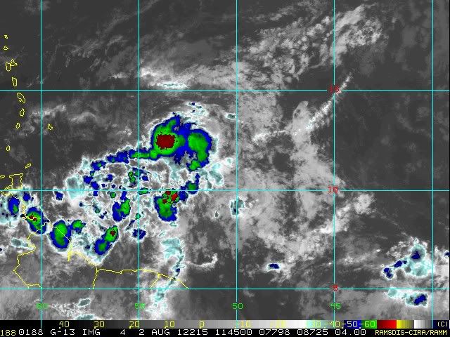
The time of the season is important with this system because it has shown-up just at the transition period into prime season conditions. Hostile July conditions are lingering but this system has the advantage of a developed circulation prior to entering the Caribbean. I think it's over the hump and presents a possible danger downstream if it survives and manages to enter the Gulf. It has an untapped area ahead that was showing plenty of cyclone soup to draw upon in the last weeks. SST's in the Lessers will keep this one going IMO.
Last edited by Sanibel on Thu Aug 02, 2012 9:13 am, edited 1 time in total.
0 likes   

tolakram
Admin
Admin
Posts: 20009
Age: 62
Joined: Sun Aug 27, 2006 8:23 pm
Location: Florence, KY (name is Mark)

Re: ATL: FIVE - Models

#742 Postby tolakram » Thu Aug 02, 2012 6:50 am

Roundup. Looking at vorticity for Euro and GFS since they lose or have a very weak low at the 72 hour frame.

Image

Image

Image
0 likes   
M a r k
- - - - -
Join us in chat: Storm2K Chatroom Invite. Android and IOS apps also available.

The posts in this forum are NOT official forecasts and should not be used as such. Posts are NOT endorsed by any professional institution or STORM2K.org. For official information and forecasts, please refer to NHC and NWS products.

User avatar
NDG
S2K Supporter
S2K Supporter
Posts: 15446
Joined: Sun Jul 09, 2006 10:14 pm
Location: Orlando, FL

#743 Postby NDG » Thu Aug 02, 2012 6:56 am

Shear this morning is not as strong as it was last night when I went to bed, UL winds seem to be now blowing from the south if not SSE than from the W, a little more friendly to TD 5.
0 likes   

User avatar
knotimpaired
Category 1
Category 1
Posts: 495
Joined: Fri May 20, 2005 4:14 am
Location: Vieques, PR
Contact:

Re: Re:

#744 Postby knotimpaired » Thu Aug 02, 2012 6:57 am

Gustywind wrote:
knotimpaired wrote:
Gustywind wrote:Anyway, there's a TD somewhere east of the Lesser Antilles. Us in the islands must monitor carefully this system. That's not the best moment to let our guard down. Any changes in terms of intensity and track could have big implications, so let's wait and see, hoping that nothing too bad occur :).


Good morning Gusty,

I am curious about something. In Fort-de-France right now besides the Friendship, you have 5 Cargo vessels in Port. Is this normal or are you starting to get the ships into port because of TD5 for safe harbour?

K

Hi Knotimpaired, that's an excellent question :) ! But unhopefully i have no answers about that, i'm curious too.


I will keep an eye out for the ships in the area of the watches and see if there is a trend. The Michael J (345') left Roseau enroute for Castries but it seems to maybe be heading to you at this point. He is still about 20 NM away. You also have a 345' Cargo ship at achor, the Kerforms.

I always wondered at what point the larger vessels decided to head in.
0 likes   

chrisjslucia
S2K Supporter
S2K Supporter
Posts: 236
Joined: Thu Oct 09, 2008 8:27 pm
Location: St Lucia

Re:

#745 Postby chrisjslucia » Thu Aug 02, 2012 6:57 am

NDG wrote:It seems to me, hard to tell a little bit with a such a short loop of vis sat pix, that the LLC has moved a little further south closer to the deeper convection, closer to 12.5N and not at 12.9N as the latest fix by the NHC.


Interesting. The projected path by NHC now shows (8.00am info) TD5 crossing over St Lucia somewhere close to Dennery, 13.9, after showing the point as the south of Martinique last night. If it is further south at present we may see St Vincent as the crossing point. All of us in the region can only expect major rain and and strong winds as a minimum, so preparation is certainly needed. Thankfully the Government of St Lucia has had a programme of drain clearance for the past month that will be a major help. Meanwhile to Gustywinds and all other in the Eastern Caribbean, take care and be safe and as dry as possible! We will send you info as it passes tomorrow, if we keep power and internet services.
0 likes   

User avatar
NDG
S2K Supporter
S2K Supporter
Posts: 15446
Joined: Sun Jul 09, 2006 10:14 pm
Location: Orlando, FL

Re: ATL: FIVE - Models

#746 Postby NDG » Thu Aug 02, 2012 7:02 am

What a difference from last night.

Image[/quote]
Image
0 likes   

sandyb
Tropical Storm
Tropical Storm
Posts: 221
Age: 64
Joined: Thu Jul 12, 2007 3:09 pm

Re: ATL: FIVE - Models

#747 Postby sandyb » Thu Aug 02, 2012 7:06 am

http://www.meteo.psu.edu/~gadomski/CMCT ... ml#picture
can someone explain this why is cmc showing east coast
0 likes   
CARTERET COUNTY NC

Dean4Storms
S2K Supporter
S2K Supporter
Posts: 6358
Age: 62
Joined: Sun Aug 31, 2003 1:01 pm
Location: Miramar Bch. FL

#748 Postby Dean4Storms » Thu Aug 02, 2012 7:14 am

It does look better this morning and I think it makes a run for TS status today.
0 likes   

User avatar
cycloneye
Admin
Admin
Posts: 145351
Age: 68
Joined: Thu Oct 10, 2002 10:54 am
Location: San Juan, Puerto Rico

Re: ATL: FIVE - Models

#749 Postby cycloneye » Thu Aug 02, 2012 7:17 am

NDG wrote:What a difference from last night.

http://img860.imageshack.us/img860/4970/184cg.jpg

http://i20.photobucket.com/albums/b245/ndgarcia/188.jpg[/quote]

You can also see how fast it has been moving.
0 likes   
Visit the Caribbean-Central America Weather Thread where you can find at first post web cams,radars
and observations from Caribbean basin members Click Here

User avatar
NDG
S2K Supporter
S2K Supporter
Posts: 15446
Joined: Sun Jul 09, 2006 10:14 pm
Location: Orlando, FL

Re: ATL: FIVE - Models

#750 Postby NDG » Thu Aug 02, 2012 7:18 am

sandyb wrote:http://www.meteo.psu.edu/~gadomski/CMCTROPATL_12z/cmcloop.html#picture
can someone explain this why is cmc showing east coast


Because it's the crazy uncle, ;)
It is usually poleward bias many times.
BTW, that was yesterday's 12z run, last night's run shows it entering the FL straights threatening Key West and then tracking towards FL's big bend area.

Image
Last edited by NDG on Thu Aug 02, 2012 7:19 am, edited 1 time in total.
0 likes   

AHS2011
Tropical Storm
Tropical Storm
Posts: 134
Joined: Sun Jun 05, 2011 7:39 am

Re: ATL: FIVE - Models

#751 Postby AHS2011 » Thu Aug 02, 2012 7:18 am

sandyb wrote:http://www.meteo.psu.edu/~gadomski/CMCTROPATL_12z/cmcloop.html#picture
can someone explain this why is cmc showing east coast


Not start a hype-fest, but if the models start verifying more east, then I think we could experience what we experienced in the early days of Irene during last August.
0 likes   
"People might not get all they work for in this world, but they must certainly work for all they get."- Frederick Douglass

AHS2011
Tropical Storm
Tropical Storm
Posts: 134
Joined: Sun Jun 05, 2011 7:39 am

Re: ATL: FIVE - Models

#752 Postby AHS2011 » Thu Aug 02, 2012 7:18 am

Not to start*
0 likes   
"People might not get all they work for in this world, but they must certainly work for all they get."- Frederick Douglass

christchurchguy
Tropical Low
Tropical Low
Posts: 43
Joined: Sat Sep 19, 2009 10:31 am

#753 Postby christchurchguy » Thu Aug 02, 2012 7:20 am

Looks like a rather compact system. When will recon arrive?
0 likes   

User avatar
NDG
S2K Supporter
S2K Supporter
Posts: 15446
Joined: Sun Jul 09, 2006 10:14 pm
Location: Orlando, FL

Re: ATL: FIVE - Models

#754 Postby NDG » Thu Aug 02, 2012 7:25 am

cycloneye wrote:


You can also see how fast it has been moving.


Yes indeed. If it keeps it up it could be affecting Barbados as early as the predawn hours of tomorrow morning.
Last edited by NDG on Thu Aug 02, 2012 7:29 am, edited 1 time in total.
0 likes   

User avatar
NDG
S2K Supporter
S2K Supporter
Posts: 15446
Joined: Sun Jul 09, 2006 10:14 pm
Location: Orlando, FL

Re:

#755 Postby NDG » Thu Aug 02, 2012 7:27 am

christchurchguy wrote:Looks like a rather compact system. When will recon arrive?


At 18z is the scheduled arrival.
0 likes   

AHS2011
Tropical Storm
Tropical Storm
Posts: 134
Joined: Sun Jun 05, 2011 7:39 am

Re: ATL: FIVE - Tropical Depression

#756 Postby AHS2011 » Thu Aug 02, 2012 7:41 am

NDG wrote:
christchurchguy wrote:Looks like a rather compact system. When will recon arrive?


At 18z is the scheduled arrival.


18z translates to 6:00 P.M. EST, correct?
0 likes   
"People might not get all they work for in this world, but they must certainly work for all they get."- Frederick Douglass

User avatar
NDG
S2K Supporter
S2K Supporter
Posts: 15446
Joined: Sun Jul 09, 2006 10:14 pm
Location: Orlando, FL

Re: ATL: FIVE - Tropical Depression

#757 Postby NDG » Thu Aug 02, 2012 7:42 am

AHS2011 wrote:
NDG wrote:
christchurchguy wrote:Looks like a rather compact system. When will recon arrive?


At 18z is the scheduled arrival.


18z translates to 6:00 P.M. EST, correct?


2 PM Eastern
0 likes   

RL3AO
Moderator-Pro Met
Moderator-Pro Met
Posts: 16308
Joined: Thu Jun 14, 2007 10:03 pm
Location: NC

Re: ATL: FIVE - Tropical Depression

#758 Postby RL3AO » Thu Aug 02, 2012 7:43 am

AHS2011 wrote:
NDG wrote:
christchurchguy wrote:Looks like a rather compact system. When will recon arrive?


At 18z is the scheduled arrival.


18z translates to 6:00 P.M. EST, correct?


18z = 6 pm UTC or 2pm EDT.
0 likes   

AHS2011
Tropical Storm
Tropical Storm
Posts: 134
Joined: Sun Jun 05, 2011 7:39 am

Re: ATL: FIVE - Tropical Depression

#759 Postby AHS2011 » Thu Aug 02, 2012 7:44 am

oh, okay. thanks
0 likes   
"People might not get all they work for in this world, but they must certainly work for all they get."- Frederick Douglass

tolakram
Admin
Admin
Posts: 20009
Age: 62
Joined: Sun Aug 27, 2006 8:23 pm
Location: Florence, KY (name is Mark)

Re: ATL: FIVE - Tropical Depression

#760 Postby tolakram » Thu Aug 02, 2012 7:46 am

Here is a handy table to have: http://hurricanes.noaa.gov/zulu-utc.html
0 likes   
M a r k
- - - - -
Join us in chat: Storm2K Chatroom Invite. Android and IOS apps also available.

The posts in this forum are NOT official forecasts and should not be used as such. Posts are NOT endorsed by any professional institution or STORM2K.org. For official information and forecasts, please refer to NHC and NWS products.


Return to “2012”

Who is online

Users browsing this forum: No registered users and 4 guests