
Global model runs discussion
Moderator: S2k Moderators
-
cycloneye

- Admin

- Posts: 149479
- Age: 69
- Joined: Thu Oct 10, 2002 10:54 am
- Location: San Juan, Puerto Rico
Re: Global Model Runs Discussion
And here is the 240 hour final frame of the 12z Euro run,just north of Leewards. It not develops strong as GFS but it has it all the way to this position.
0 likes
Visit the Caribbean-Central America Weather Thread where you can find at first post web cams,radars
and observations from Caribbean basin members Click Here
and observations from Caribbean basin members Click Here

Re:
Hybridstorm_November2001 wrote:Some very scary model plots there. Thank goodness they are long range.
Agreed.
Interesting model run though as it comes right to me in Nova Scotia. However, I won't hold my breath on that actually coming to realm.
0 likes

Re: Global Model Runs Discussion
cycloneye wrote:And here is the 240 hour final frame of the 12z Euro run,just north of Leewards. It not develops strong as GFS but it has it all the way to this position.
http://oi48.tinypic.com/n33fj5.jpg[/img]
Finally, Euro jumps onboard showing more than just a surface reflection. Kudos again to the GFS for sniffing this out several days ago. GFS is on a roll this year. CMC is still silent. Even the NOGAPS is in on it.
NOGAPS 144hr

0 likes
The following post is NOT an official forecast and should not be used as such. It is just the opinion of the poster and may or may not be backed by sound meteorological data. It is NOT endorsed by any professional institution including storm2k.org For Official Information please refer to the NHC and NWS products.
-
gatorcane

- S2K Supporter

- Posts: 23708
- Age: 48
- Joined: Sun Mar 13, 2005 3:54 pm
- Location: Boca Raton, FL
The long-range GFS and ECMWF ensembles are both showing a very zonal pattern across North America and the Western Atlantic by day 10 with High pressure that builds in over the Eastern Half of the United States. Assuming this verifies, the pattern would open up the door for a CONUS hit from the east. Both models are in excellent agreement on the pattern:


Last edited by gatorcane on Mon Aug 06, 2012 4:21 pm, edited 1 time in total.
0 likes


Re: Global Model Runs Discussion
18z GFS shows a stronger system that finds a weakness in the ridge. So far GFS and Euro vary greatly in strength. Euro is much weaker and keeps it further west. With the system the GFS is predicting it will very difficult to make it across. Still very early and many more runs to watch.
0 likes
The following post is NOT an official forecast and should not be used as such. It is just the opinion of the poster and may or may not be backed by sound meteorological data. It is NOT endorsed by any professional institution including storm2k.org For Official Information please refer to the NHC and NWS products.
-
SFLcane

- S2K Supporter
- Posts: 10281
- Age: 48
- Joined: Sat Jun 05, 2010 1:44 pm
- Location: Lake Worth Florida
Re: Global Model Runs Discussion
Riptide wrote:Latest visible/IR of the African disturbance.
http://www.nrlmry.navy.mil/nexdat/CONUS ... DAYNGT.jpg
This wave is now highlighted by tpc...
000
ABNT20 KNHC 062340
TWOAT
TROPICAL WEATHER OUTLOOK
NWS NATIONAL HURRICANE CENTER MIAMI FL
800 PM EDT MON AUG 6 2012
FOR THE NORTH ATLANTIC...CARIBBEAN SEA AND THE GULF OF MEXICO...
THE NATIONAL HURRICANE CENTER IS ISSUING ADVISORIES ON TROPICAL
STORM ERNESTO...LOCATED ABOUT 295 MILES EAST ISLA ROATAN HONDURAS.
A TROPICAL WAVE...ACCOMPANIED BY A SURFACE LOW PRESSURE SYSTEM...
IS LOCATED ABOUT 275 MILES SOUTHWEST OF THE CAPE VERDE ISLANDS.
ALTHOUGH THUNDERSTORM ACTIVITY HAS BEEN GRADUALLY INCREASING
OVER THE PAST SEVERAL HOURS...UPPER-LEVEL WINDS ARE ONLY MARGINALLY
CONDUCIVE FOR ANY SIGNIFICANT DEVELOPMENT TO OCCUR. THIS SYSTEM HAS
A LOW CHANCE...20 PERCENT...OF BECOMING A TROPICAL CYCLONE DURING
THE NEXT 48 HOURS AS IT MOVES WESTWARD AT ABOUT 15 MPH.
ELSEWHERE...TROPICAL CYCLONE FORMATION IS NOT EXPECTED DURING THE
NEXT 48 HOURS.
$$
FORECASTER STEWART
0 likes
-
cycloneye
- Admin
- Posts: 149479
- Age: 69
- Joined: Thu Oct 10, 2002 10:54 am
- Location: San Juan, Puerto Rico
Re: Global Model Runs Discussion

0 likes
Visit the Caribbean-Central America Weather Thread where you can find at first post web cams,radars
and observations from Caribbean basin members Click Here
and observations from Caribbean basin members Click Here
-
somethingfunny

- ChatStaff

- Posts: 3926
- Age: 37
- Joined: Thu May 31, 2007 10:30 pm
- Location: McKinney, Texas
Re: Global Model Runs Discussion
edit: I didn't see that a new thread was created! I'll leave this post here anyway since it shows some other fantasycanes way off in the horizon.
Quiet tonight! Why? Well, because the 0z GFS completely dropped the system. That's two of the last four GFS runs now without the system doing anything more than traverse the ocean as a weak storm at best.
The 0z GFS was MUCH stronger with the Bermuda High, and I think that's why it didn't develop this "Gordon" (Helene?) this time. It pushes the wave across much more quickly than previous runs which would suppress development, and it hurdles into the Gulf without ever organizing. It's the ripple in the 1016mb isobar in the Gulf here at the 348 hour frame. This run does have some more la-la land Cape Verde storms, they go fishing in this run:

The 0z Euro has a much weaker high, and actually a ridiculously strong cold front swinging down the Eastern Seaboard. This is the 240 hour frame, and the wave we're discussing has almost reached the Turks and Caicos:

Quiet tonight! Why? Well, because the 0z GFS completely dropped the system. That's two of the last four GFS runs now without the system doing anything more than traverse the ocean as a weak storm at best.
The 0z GFS was MUCH stronger with the Bermuda High, and I think that's why it didn't develop this "Gordon" (Helene?) this time. It pushes the wave across much more quickly than previous runs which would suppress development, and it hurdles into the Gulf without ever organizing. It's the ripple in the 1016mb isobar in the Gulf here at the 348 hour frame. This run does have some more la-la land Cape Verde storms, they go fishing in this run:
The 0z Euro has a much weaker high, and actually a ridiculously strong cold front swinging down the Eastern Seaboard. This is the 240 hour frame, and the wave we're discussing has almost reached the Turks and Caicos:
0 likes
I am not a meteorologist, and any posts made by me are not official forecasts or to be interpreted as being intelligent. These posts are just my opinions and are probably silly opinions.

Re: Global Model Runs Discussion
CMC & GFS are onto something in the Keys at about 120 hrs
Even Euro has a faint 850mb vorticity as well.
http://moe.met.fsu.edu/cgi-bin/cmctc2.c ... =Animation
http://moe.met.fsu.edu/cgi-bin/gfstc2.c ... =Animation
http://moe.met.fsu.edu/cgi-bin/ecmwf-op ... =Animation
Looks like there will be ascendance in the region at that time
http://www.cpc.ncep.noaa.gov/products/p ... egfs.shtml
0 likes
-
gatorcane
- S2K Supporter
- Posts: 23708
- Age: 48
- Joined: Sun Mar 13, 2005 3:54 pm
- Location: Boca Raton, FL
The GFS is certainly cranking out some rather impressive Cape Verde storms for the next couple of weeks. Not sure whether I really believe that yet, especially since the ECMWF is not near as bullish and the fact the conditions across the MDR don't look all that great especially with the high levels of SAL around. Nonetheless the SAL should start to weaken over the next couple of weeks if you look back at climatology so we will see what happens.
At least the GFS is showing all of these systems recurving so far, except the 18Z GFS run shows one that could make a run at the CONUS. At least it is 384 hours from now so likely won't verify:

At least the GFS is showing all of these systems recurving so far, except the 18Z GFS run shows one that could make a run at the CONUS. At least it is 384 hours from now so likely won't verify:
0 likes

Re: Global Model Runs Discussion
CMC latched on to the NOGAPS runs.....homegrown coming off SA...heading into the GOM
...rut roh....
http://moe.met.fsu.edu/cgi-bin/cmctc2.c ... =Animation
...rut roh....
http://moe.met.fsu.edu/cgi-bin/cmctc2.c ... =Animation
0 likes
-
SouthFLTropics

- Category 5

- Posts: 4258
- Age: 50
- Joined: Thu Aug 14, 2003 8:04 am
- Location: Port St. Lucie, Florida
Re: Global Model Runs Discussion
Is it possible that the models are picking up on development of all of the convection that has been left in Ernesto's wake that is now back over PR and Haiti?
SFT
SFT
0 likes
Fourth Generation Florida Native
Personal Storm History: David 79, Andrew 92, Erin 95, Floyd 99, Irene 99, Frances 04, Jeanne 04, Wilma 05, Matthew 16, Irma 17, Ian 22, Nicole 22, Milton 24
Personal Storm History: David 79, Andrew 92, Erin 95, Floyd 99, Irene 99, Frances 04, Jeanne 04, Wilma 05, Matthew 16, Irma 17, Ian 22, Nicole 22, Milton 24
-
WeatherCat
- S2K Supporter
- Posts: 19
- Joined: Tue Jul 26, 2011 3:28 pm
- Location: Houston/Galveston, TX
Global Model Runs Discussion
Joe B mentioned yesterday that he was keeping an eye on the wave currently moving through the Windwards ... could that be what the model has picked up on?
0 likes
__________
The above post is NOT an official forecast and should not be used as such. It is the opinion of the poster and may or may not be backed by sound meteorological data. WeatherCat posts are NOT endorsed by any professional institution, including storm2k.org. For official information, please refer to NHC and NWS products.
The above post is NOT an official forecast and should not be used as such. It is the opinion of the poster and may or may not be backed by sound meteorological data. WeatherCat posts are NOT endorsed by any professional institution, including storm2k.org. For official information, please refer to NHC and NWS products.
-
CYCLONE MIKE
- Category 5
- Posts: 2183
- Joined: Tue Aug 31, 2004 6:04 pm
- Location: Gonzales, LA
Re: Global Model Runs Discussion
Have been wondering about the homegrown systems this year? That was the big deal this preseason was all the close in develpoment we were supposed to see.
0 likes
Re: Global Model Runs Discussion
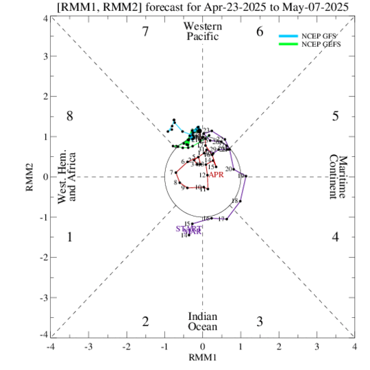
The MJO has arrived in W. Atlantic just in time for all the action that the GFS has been forecasting.
http://www.cpc.ncep.noaa.gov/products/precip/CWlink/MJO/combphase_noCFSfull.gif
http://www.cpc.ncep.noaa.gov/products/precip/CWlink/MJO/combphase_noCFSfull.gif
0 likes
The following post is NOT an official forecast and should not be used as such. It is just the opinion of the poster and may or may not be backed by sound meteorological data. It is NOT endorsed by any professional institution including storm2k.org For Official Information please refer to the NHC and NWS products.
Re: Global Model Runs Discussion
18Z NOGAPS still has it in the long range this time following the CMC....not sure but it looks to originate down in the deep carib....
https://www.fnmoc.navy.mil/wxmap_cgi/cg ... t=Tropical
https://www.fnmoc.navy.mil/wxmap_cgi/cg ... t=Tropical
0 likes
-
SouthFLTropics
- Category 5
- Posts: 4258
- Age: 50
- Joined: Thu Aug 14, 2003 8:04 am
- Location: Port St. Lucie, Florida
Re: Global Model Runs Discussion
The models must be sniffing out development of the convection that is over the Greater Antilles right now...That is the only thing that makes sense. It would appear that it develops and moves north within an 84-100 hour timeframe. That puts it up our way this weekend. Will be interesting to see how this plays out.
SFT
SFT
0 likes
Fourth Generation Florida Native
Personal Storm History: David 79, Andrew 92, Erin 95, Floyd 99, Irene 99, Frances 04, Jeanne 04, Wilma 05, Matthew 16, Irma 17, Ian 22, Nicole 22, Milton 24
Personal Storm History: David 79, Andrew 92, Erin 95, Floyd 99, Irene 99, Frances 04, Jeanne 04, Wilma 05, Matthew 16, Irma 17, Ian 22, Nicole 22, Milton 24
-
Hurricane Alexis

- Category 2

- Posts: 683
- Age: 29
- Joined: Thu Jun 14, 2012 7:59 pm
- Location: Miami,Florida
Re: Global Model Runs Discussion
This is interesting. So far only 2 models showing development.
0 likes
Personal Forecast Disclaimer:
The posts in this forum are NOT official forecast and should not be used as such. They are just the opinion of the poster and may or may not be backed by sound meteorological data. They are NOT endorsed by any professional institution or storm2k.org. For official information, please refer to the NHC and NWS products.
The posts in this forum are NOT official forecast and should not be used as such. They are just the opinion of the poster and may or may not be backed by sound meteorological data. They are NOT endorsed by any professional institution or storm2k.org. For official information, please refer to the NHC and NWS products.

Who is online
Users browsing this forum: No registered users and 53 guests