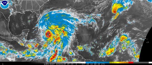
#736 Postby SootyTern » Wed Oct 24, 2012 8:50 pm
Something weird just happened that may be making the storm appear to have gone more NE recently. A big burst of convection on the W side appears to have blown up and 'squished' the eye into a teardrop shape temporarily. Burst now seems to be wrapping around to the S and SE and the eye looks more circular again, and the storm seems to be back on track to be close to the next NHC forecast point, or maybe a tad east of the point it just passed.
Personal Forecast Disclaimer:
The posts in this forum are NOT official forecast and should not be used as such. They are just the opinion of the poster and may or may not be backed by sound meteorological data. They are NOT endorsed by any professional institution or storm2k.org. For official information, please refer to the NHC and NWS products.
0 likes


