
Global model runs discussion
Moderator: S2k Moderators
-
cycloneye

- Admin

- Posts: 149475
- Age: 69
- Joined: Thu Oct 10, 2002 10:54 am
- Location: San Juan, Puerto Rico
Re: Global Model Runs Discussion
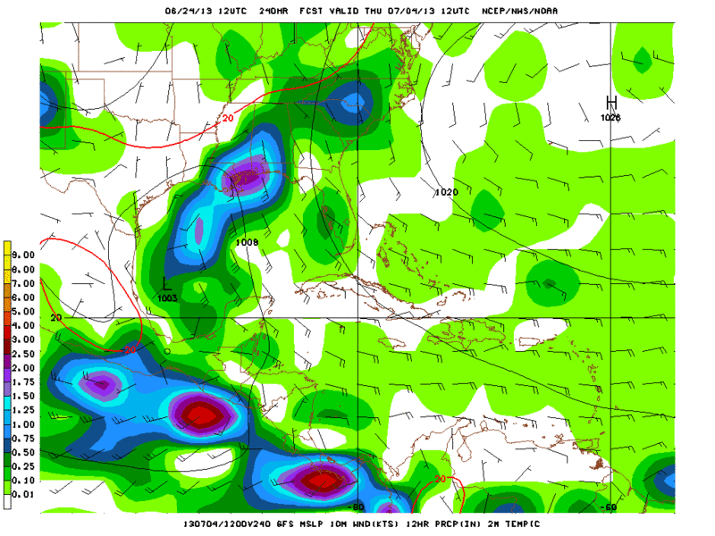
06z GFS has a weak TS making landfall near Grand Isle, Louisiana.
0 likes
Visit the Caribbean-Central America Weather Thread where you can find at first post web cams,radars
and observations from Caribbean basin members Click Here
and observations from Caribbean basin members Click Here
-
cycloneye
- Admin
- Posts: 149475
- Age: 69
- Joined: Thu Oct 10, 2002 10:54 am
- Location: San Juan, Puerto Rico
Re: Global Model Runs Discussion
Here are other graphics of the 00z CMC run.

0 likes
Visit the Caribbean-Central America Weather Thread where you can find at first post web cams,radars
and observations from Caribbean basin members Click Here
and observations from Caribbean basin members Click Here


Re: Global Model Runs Discussion
Looks like a Lousiana hit on that CMC run,but it's early and that can change.
0 likes
Re: Global Model Runs Discussion
This weekend could be interresting if the models continue to develop a storm in the GOM.
0 likes
-
cycloneye
- Admin
- Posts: 149475
- Age: 69
- Joined: Thu Oct 10, 2002 10:54 am
- Location: San Juan, Puerto Rico
Re: Global Model Runs Discussion
perk wrote:This weekend could be interresting if the models continue to develop a storm in the GOM.
Is not for next weekend but for the 4th of July holiday.
0 likes
Visit the Caribbean-Central America Weather Thread where you can find at first post web cams,radars
and observations from Caribbean basin members Click Here
and observations from Caribbean basin members Click Here
Re: Global Model Runs Discussion
cycloneye wrote:perk wrote:This weekend could be interresting if the models continue to develop a storm in the GOM.
Is not for next weekend but for the 4th of July holiday.
I realize that we're talking about the july 4th week,but what I meant was this weekend we will be nearing the short term time frame
0 likes
-
cycloneye
- Admin
- Posts: 149475
- Age: 69
- Joined: Thu Oct 10, 2002 10:54 am
- Location: San Juan, Puerto Rico
Re: Global Model Runs Discussion
perk wrote:cycloneye wrote:perk wrote:This weekend could be interresting if the models continue to develop a storm in the GOM.
Is not for next weekend but for the 4th of July holiday.
I realize that we're talking about the july 4th week,but what I meant was this weekend we will be nearing the short term time frame
Ok,thanks for the clarification.
0 likes
Visit the Caribbean-Central America Weather Thread where you can find at first post web cams,radars
and observations from Caribbean basin members Click Here
and observations from Caribbean basin members Click Here

Re: Global Model Runs Discussion
GFS paints the development stages of Barry all over again, vorticity to develop off of Nicaraguan/Honduran coast by the end of this week into the weekend from the TW moving in that direction, but gain some latitude as there will not be a narrow ridge to its north across the GOM.
Both the GFS and ECMWF have a weakness across the MS River Valley and big time ridging across the western Atlantic in the 8-10 day range, so no threat to the FL Peninsula at this time but the central gulf coast keep a look out for it.
Both the GFS and ECMWF have a weakness across the MS River Valley and big time ridging across the western Atlantic in the 8-10 day range, so no threat to the FL Peninsula at this time but the central gulf coast keep a look out for it.
0 likes
-
Dean4Storms
- S2K Supporter

- Posts: 6358
- Age: 63
- Joined: Sun Aug 31, 2003 1:01 pm
- Location: Miramar Bch. FL
-
gatorcane

- S2K Supporter
- Posts: 23708
- Age: 48
- Joined: Sun Mar 13, 2005 3:54 pm
- Location: Boca Raton, FL
Re:
Dean4Storms wrote:The CMC begins to develop this off the western tip of Cuba, significantly eastward.
240 hour 00Z CMC images below. Note the CMC has been upgraded this year and seems to be doing better with tropical cyclogenesis not spinning up so many phantom systems. Develops the system between Cuba and the Yucatan at 180 hours so you can see where the model thinks it will move and how strong it will get:

0 likes
-
caneman
Re: Re:
wxman57 wrote:caneman wrote:BigB0882 wrote:That's bullish but then again, it is the CMC. Bears watching.
CMC did well with Andrea though. And it also had an upgrade though right? So, I say it bears (no pun intended) watching.
The Canadian model develops absolutely everything, so occasionally it will be right.
Thanks wxman57,
I'm aware that they do that. Point being was that with an upgrade, how it did with Andrea that perhaps it may be more accurate and needs some attention.
0 likes
-
wxman57

- Moderator-Pro Met

- Posts: 23174
- Age: 68
- Joined: Sat Jun 21, 2003 8:06 pm
- Location: Houston, TX (southwest)
Re: Re:
caneman wrote:
Thanks wxman57,
I'm aware that they do that. Point being was that with an upgrade, how it did with Andrea that perhaps it may be more accurate and needs some attention.
I haven't noticed any difference yet in the number of spurious storms it predicts (world-wide).
0 likes
-
Rgv20

- S2K Supporter
- Posts: 2466
- Age: 39
- Joined: Wed Jan 05, 2011 5:42 pm
- Location: Edinburg/McAllen Tx
12zGFS continues to show development on the early part of July..

0 likes
The following post is NOT an official forecast and should not be used as such. It is just the opinion of the poster and may or may not be backed by sound meteorological data. It is NOT endorsed by any professional institution including storm2k.org For Official Information please refer to the NHC and NWS products.
-
catskillfire51
- S2K Supporter
- Posts: 480
- Age: 39
- Joined: Sun Aug 26, 2012 5:40 pm
- Location: Lake Jackson, TX
-
cycloneye
- Admin
- Posts: 149475
- Age: 69
- Joined: Thu Oct 10, 2002 10:54 am
- Location: San Juan, Puerto Rico
Re: Global Model Runs Discussion
I believe this MJO surge is giving GFS fits with the changes of scenarios it is going thru on every run and we won't know what will become of this for a while.
0 likes
Visit the Caribbean-Central America Weather Thread where you can find at first post web cams,radars
and observations from Caribbean basin members Click Here
and observations from Caribbean basin members Click Here
-
cycloneye
- Admin
- Posts: 149475
- Age: 69
- Joined: Thu Oct 10, 2002 10:54 am
- Location: San Juan, Puerto Rico
Re: Global Model Runs Discussion
Don't shoot the messenger  12z CMC.


0 likes
Visit the Caribbean-Central America Weather Thread where you can find at first post web cams,radars
and observations from Caribbean basin members Click Here
and observations from Caribbean basin members Click Here
-
Rgv20
- S2K Supporter
- Posts: 2466
- Age: 39
- Joined: Wed Jan 05, 2011 5:42 pm
- Location: Edinburg/McAllen Tx

0 likes
The following post is NOT an official forecast and should not be used as such. It is just the opinion of the poster and may or may not be backed by sound meteorological data. It is NOT endorsed by any professional institution including storm2k.org For Official Information please refer to the NHC and NWS products.
-
JonathanBelles
- Professional-Met

- Posts: 11430
- Age: 35
- Joined: Sat Dec 24, 2005 9:00 pm
- Location: School: Florida State University (Tallahassee, FL) Home: St. Petersburg, Florida
- Contact:
Re: Global Model Runs Discussion
cycloneye wrote:Don't shoot the messenger
http://www.tropicaltidbits.com/analysis ... atl_37.png
 On a holiday week, Luis! lol just kidding
 I'll believe it when I see it
0 likes
-
floridasun78
- Category 5

- Posts: 3755
- Joined: Sun May 17, 2009 10:16 pm
- Location: miami fl
Who is online
Users browsing this forum: No registered users and 62 guests