Global model runs discussion
Moderator: S2k Moderators


Re: Global Model Runs Discussion
Actually you both can be right,because the ridge could extend west or be weakened by a trough.Will depend on the actual timing of the system.
0 likes
-
SFLcane

- S2K Supporter

- Posts: 10281
- Age: 48
- Joined: Sat Jun 05, 2010 1:44 pm
- Location: Lake Worth Florida
Re: Global Model Runs Discussion
CYCLONE MIKE wrote:Ridge forecast to build in during the week only to weaken as a weak front tries to slide in for the weekend. So anything will be shunted off to the north before reaching the states. Don't see the gulf in a bad position this season. Either the Bermuda high is ridiculously strong and will send whatever storms that may come into mexico or the weekly persistant east coast trof will recurve them north.
+1
0 likes
-
cycloneye

- Admin

- Posts: 149472
- Age: 69
- Joined: Thu Oct 10, 2002 10:54 am
- Location: San Juan, Puerto Rico
Re: Global Model Runs Discussion
CYCLONE MIKE wrote:Ridge forecast to build in during the week only to weaken as a weak front tries to slide in for the weekend. So anything will be shunted off to the north before reaching the states. Don't see the gulf in a bad position this season. Either the Bermuda high is ridiculously strong and will send whatever storms that may come into mexico or the weekly persistant east coast trof will recurve them north.
The only way the GOM has threats by TC's this season is if they form in Western Caribbean or near the Bahamas and move in that direction.
0 likes
Visit the Caribbean-Central America Weather Thread where you can find at first post web cams,radars
and observations from Caribbean basin members Click Here
and observations from Caribbean basin members Click Here


Re:
Ntxw wrote:Quick update on the MJO and models forecasting it. GFS sends it back into the wrong phases IMO (remember MJO does not go backwards) and most of the weak convection there is exists in the eastern IO/western Maritime but very incoherent. Euro is expecting a renewal wave in the IO which I am more inclined to believe since there is some +mountain torque event support. There could be development during this period but likely rogue. After that it will take about 30-45 days for the new MJO wave to progress back into the favorable phases which if it gets going soon should be about mid to late August. Still favor that period intact with best climo.
0 likes
The above post and any post by Ntxw is NOT an official forecast and should not be used as such. It is just the opinion of the poster and may or may not be backed by sound meteorological data. It is NOT endorsed by any professional institution including Storm2k. For official information, please refer to NWS products.
Help support Storm2K!

-
Kingarabian

- S2K Supporter
- Posts: 16364
- Joined: Sat Aug 08, 2009 3:06 am
- Location: Honolulu, Hawaii
Re: Re:
Ntxw wrote:Ntxw wrote:Quick update on the MJO and models forecasting it. GFS sends it back into the wrong phases IMO (remember MJO does not go backwards) and most of the weak convection there is exists in the eastern IO/western Maritime but very incoherent. Euro is expecting a renewal wave in the IO which I am more inclined to believe since there is some +mountain torque event support. There could be development during this period but likely rogue. After that it will take about 30-45 days for the new MJO wave to progress back into the favorable phases which if it gets going soon should be about mid to late August. Still favor that period intact with best climo.
I still stand by this idea. GFS is very much struggling with the MJO forecast, it's confusing it with an oceanic kelvin wave that will more likely spark development in the EPAC vs Atlantic. It's been overzealous about returning the MJO backwards (cannot happen) from the Maritimes (currently there) to Africa and IO, I suspect this may be one of the causes for the model to over do systems in it's medium to long range.
Yeah bro, look at that:

But that Kelvin Wave is there so we should see some activity regardless of the GFS being right or wrong, right?
0 likes
RIP Kobe Bryant
0 likes
The above post and any post by Ntxw is NOT an official forecast and should not be used as such. It is just the opinion of the poster and may or may not be backed by sound meteorological data. It is NOT endorsed by any professional institution including Storm2k. For official information, please refer to NWS products.
Help support Storm2K!
Help support Storm2K!
-
Kingarabian
- S2K Supporter
- Posts: 16364
- Joined: Sat Aug 08, 2009 3:06 am
- Location: Honolulu, Hawaii
Re:
Ntxw wrote::uarrow: Yeah, unlike over in the Atlantic the Euro does show some kind of development in the EPAC. It won't be a long period though, short window maybe of a week before the Kelvin waves move on, GFS probably overdoing that too. It's not coupled with the MJO so if anything does come, thinking it will be isolated and small but chances of development are definitely more likely than in the other basins.

Yup. Like you said, the Euro has minimal activity in the Pacific.
Bears watching.. for me at least!
0 likes
RIP Kobe Bryant
-
Kingarabian
- S2K Supporter
- Posts: 16364
- Joined: Sat Aug 08, 2009 3:06 am
- Location: Honolulu, Hawaii

-
Yellow Evan

- Professional-Met

- Posts: 16240
- Age: 27
- Joined: Fri Jul 15, 2011 12:48 pm
- Location: Henderson, Nevada/Honolulu, HI
- Contact:


Re: Global Model Runs Discussion
Does anyone with access to long range models show anything in the future? Please post some as I am getting bored. 
0 likes
-
cycloneye
- Admin
- Posts: 149472
- Age: 69
- Joined: Thu Oct 10, 2002 10:54 am
- Location: San Juan, Puerto Rico
Re: Global Model Runs Discussion
MetroMike wrote:Does anyone with access to long range models show anything in the future? Please post some as I am getting bored.
Well,nothing right now that the models have but as we enter the month of August,I am sure they will start to pick up activity.
0 likes
Visit the Caribbean-Central America Weather Thread where you can find at first post web cams,radars
and observations from Caribbean basin members Click Here
and observations from Caribbean basin members Click Here
-
cycloneye
- Admin
- Posts: 149472
- Age: 69
- Joined: Thu Oct 10, 2002 10:54 am
- Location: San Juan, Puerto Rico
Re: Global Model Runs Discussion
Let's see when the models begin to show development as the peak of the season draws closer. Will the models in 2013 have several areas at the same time developing at peak time? This was in 2010.

0 likes
Visit the Caribbean-Central America Weather Thread where you can find at first post web cams,radars
and observations from Caribbean basin members Click Here
and observations from Caribbean basin members Click Here
-
SFLcane
- S2K Supporter
- Posts: 10281
- Age: 48
- Joined: Sat Jun 05, 2010 1:44 pm
- Location: Lake Worth Florida
Re: Global Model Runs Discussion
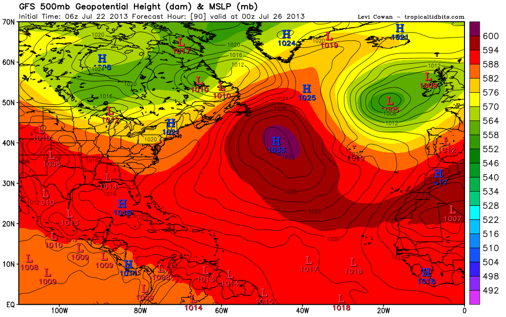
Looking at 500mb since May i suspect some of those storms wont be recurving.
0 likes


-
ninel conde
Re: Global Model Runs Discussion
MetroMike wrote:Does anyone with access to long range models show anything in the future? Please post some as I am getting bored.
read a book on past great hurricanes, lol
0 likes
-
ninel conde
Re: Global Model Runs Discussion
cycloneye wrote:Let's see when the models begin to show development as the peak of the season draws closer. Will the models in 2013 have several areas at the same time developing at peak time? This was in 2010.
posting that was cruel, lol. before i read it was 2010 i thought the bone dry air was finally gone.
0 likes
-
cycloneye
- Admin
- Posts: 149472
- Age: 69
- Joined: Thu Oct 10, 2002 10:54 am
- Location: San Juan, Puerto Rico
Re: Global Model Runs Discussion
Nothing yet from the models as July comes to a close and August arrives. Let's see when the lid goes off.
0 likes
Visit the Caribbean-Central America Weather Thread where you can find at first post web cams,radars
and observations from Caribbean basin members Click Here
and observations from Caribbean basin members Click Here


Re: Global Model Runs Discussion
cycloneye wrote:Nothing yet from the models as July comes to a close and August arrives. Let's see when the lid goes off.
Yes, not too far away now. We should start to see something by the end of this week as the model starts to reach the peak portion of the season starting in late August. I have noticied the Ridge is forecast to persist in its current state which would be bad news for landfalling areas.
0 likes
The following post is NOT an official forecast and should not be used as such. It is just the opinion of the poster and may or may not be backed by sound meteorological data. It is NOT endorsed by any professional institution including storm2k.org For Official Information please refer to the NHC and NWS products.
-
Hybridstorm_November2001

- S2K Supporter
- Posts: 2817
- Joined: Sat Aug 21, 2004 2:50 pm
- Location: SW New Brunswick, Canada
- Contact:
Re: Global Model Runs Discussion
blp wrote:cycloneye wrote:Nothing yet from the models as July comes to a close and August arrives. Let's see when the lid goes off.
Yes, not too far away now. We should start to see something by the end of this week as the model starts to reach the peak portion of the season starting in late August. I have noticied the Ridge is forecast to persist in its current state which would be bad news for landfalling areas.
Perhaps than again, knowing the early season we've had and the ongoing lack of model support for development, perhaps not.
The following post is NOT an official forecast and should not be used as such. It is just the opinion of the poster and may or may not be backed by sound meteorological data. It is NOT endorsed by any professional institution including storm2k.org For Official Information please refer to the NHC and NWS products.
0 likes
Who is online
Users browsing this forum: No registered users and 40 guests