Tropical Wave in Central Atlantic (Is Invest 97L)
Moderator: S2k Moderators
Forum rules

The posts in this forum are NOT official forecasts and should not be used as such. They are just the opinion of the poster and may or may not be backed by sound meteorological data. They are NOT endorsed by any professional institution or STORM2K. For official information, please refer to products from the National Hurricane Center and National Weather Service.
-
hurricaneCW
- Category 5

- Posts: 1799
- Joined: Wed Mar 03, 2010 6:20 am
- Location: Toms River, NJ
Re: Tropical Wave in East Atlantic (Pouch 25L) 0% / 30%
I like how it's staying intact through DMIN, it gives me better hope that it could develop plus it has a nice moisture envelope around it.
0 likes
-
cycloneye

- Admin

- Posts: 149503
- Age: 69
- Joined: Thu Oct 10, 2002 10:54 am
- Location: San Juan, Puerto Rico
Re: Tropical Wave in East Atlantic (Pouch 25L) 0% / 30%
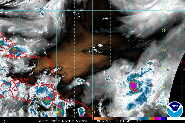
The latest saved image.

0 likes
Visit the Caribbean-Central America Weather Thread where you can find at first post web cams,radars
and observations from Caribbean basin members Click Here
and observations from Caribbean basin members Click Here
-
ozonepete
- Professional-Met

- Posts: 4743
- Joined: Mon Sep 07, 2009 3:23 pm
- Location: From Ozone Park, NYC / Now in Brooklyn, NY
Re: Re:
Gustywind wrote:Glad to see you back on this topic Ozonepete. As many of this board, i appreciate your bright analysis
Thanks, bro. You are as bright as any bulb on here.
Just take a look at how rapidly this is consolidating and it seems the core may form well south of 15 degrees. This means all of the islands had better start watching.

0 likes
-
Hurricane Andrew

- S2K Supporter

- Posts: 1891
- Age: 27
- Joined: Sun May 23, 2010 2:53 pm
- Location: KS
-
gatorcane

- S2K Supporter
- Posts: 23708
- Age: 48
- Joined: Sun Mar 13, 2005 3:54 pm
- Location: Boca Raton, FL
Agree with Ozonepete that it could be consolidating further south than the GFS is showing which means it would be more difficult to miss the islands with it so far south.
Here is something else to look at. Look at all the moisture out there around this wave in the upper-levels. There is some orange way off the NW but boy has that shrunk...what a difference a week makes as far as the dry air goes in the MDR.
MDR is primed for development now!
Here is something else to look at. Look at all the moisture out there around this wave in the upper-levels. There is some orange way off the NW but boy has that shrunk...what a difference a week makes as far as the dry air goes in the MDR.
MDR is primed for development now!
0 likes
-
Meteorcane

- Category 2

- Posts: 559
- Joined: Thu Jul 21, 2011 6:49 am
- Location: North Platte Nebraska
Re: Tropical Wave in East Atlantic (Pouch 25L) 0% / 30%
From WV it appears very solid right now, and is holding its own on IR (despite it being nearly DMIN), I think if we can get some vort consolidation (which it should as convection increases, due to greater moisture/basin-wide instability, MJO pulse etc.) this thing could be something to watch.
0 likes
-
ozonepete
- Professional-Met
- Posts: 4743
- Joined: Mon Sep 07, 2009 3:23 pm
- Location: From Ozone Park, NYC / Now in Brooklyn, NY
Re:
gatorcane wrote:Agree with Ozonepete that it could be consolidating further south than the GFS is showing which means it would be more difficult to miss the islands with it so far south.
Here is something else to look at. Look at all the moisture out there around this wave in the upper-levels. There is some orange way off the NW but boy has that shrunk...what a difference a week makes as far as the dry air goes in the MDR.
MDR is primed for development now!
Right, gator. And it looks like it's moving into low shear as well. This really has to be watched closely.
0 likes

-
ozonepete
- Professional-Met
- Posts: 4743
- Joined: Mon Sep 07, 2009 3:23 pm
- Location: From Ozone Park, NYC / Now in Brooklyn, NY
Re:
abajan wrote:I would be very surprised if the next TWO still had development potential at 0% and 30%. This thing looks very healthy.
You and me both.
0 likes
-
cycloneye
- Admin
- Posts: 149503
- Age: 69
- Joined: Thu Oct 10, 2002 10:54 am
- Location: San Juan, Puerto Rico
Re: Re:
ozonepete wrote:gatorcane wrote:Agree with Ozonepete that it could be consolidating further south than the GFS is showing which means it would be more difficult to miss the islands with it so far south.
Here is something else to look at. Look at all the moisture out there around this wave in the upper-levels. There is some orange way off the NW but boy has that shrunk...what a difference a week makes as far as the dry air goes in the MDR.
MDR is primed for development now!
http://i1276.photobucket.com/albums/y47 ... 60233d.jpg
Right, gator. And it looks like it's moving into low shear as well. This really has to be watched closely.
And also heading to warmer sst's.

0 likes
Visit the Caribbean-Central America Weather Thread where you can find at first post web cams,radars
and observations from Caribbean basin members Click Here
and observations from Caribbean basin members Click Here
-
Hurricane Andrew
- S2K Supporter
- Posts: 1891
- Age: 27
- Joined: Sun May 23, 2010 2:53 pm
- Location: KS
The posts in this forum are NOT official forecast and should not be used as such. They are just the opinion of the poster and may or may not be backed by sound meteorological data. They are NOT endorsed by any professional institution or storm2k.org. For official information, please refer to the NHC and NWS products.
IMO
24 Hours: 10%
48 Hours: 30%
120 Hours: 70%
IMO
24 Hours: 10%
48 Hours: 30%
120 Hours: 70%
0 likes
The Enthusiast
NREMT-AEMT, WX nerd
Irene '11, Sandy '12, Irma '17 (SAR)
"Hard to think we were born to live this way..." -Wage War
-
Hurricane Alexis

- Category 2
- Posts: 683
- Age: 29
- Joined: Thu Jun 14, 2012 7:59 pm
- Location: Miami,Florida
Re:
Alyono wrote:Hang on everyone
The actual wave is well EAST of the convection... closer to 34W. This isn't really consolidating that well
So the convection can just poof at any time?
0 likes
Personal Forecast Disclaimer:
The posts in this forum are NOT official forecast and should not be used as such. They are just the opinion of the poster and may or may not be backed by sound meteorological data. They are NOT endorsed by any professional institution or storm2k.org. For official information, please refer to the NHC and NWS products.
The posts in this forum are NOT official forecast and should not be used as such. They are just the opinion of the poster and may or may not be backed by sound meteorological data. They are NOT endorsed by any professional institution or storm2k.org. For official information, please refer to the NHC and NWS products.
Re: Re:
Hurricane Alexis wrote:Alyono wrote:Hang on everyone
The actual wave is well EAST of the convection... closer to 34W. This isn't really consolidating that well
So the convection can just poof at any time?
not really sure
However, we are starting to get more convection now back near 34W. That is where the wave is and where any development will occur.
0 likes
-
SFLcane

- S2K Supporter
- Posts: 10281
- Age: 48
- Joined: Sat Jun 05, 2010 1:44 pm
- Location: Lake Worth Florida
Re: Tropical Wave in East Atlantic (Pouch 25L) 0% / 30%
Hoping this gets invested soon would like to see some models run HWRF,GFDL etc..agree on moisture field has indeed increased out there across the MDR should be an interesting few weeks ahead.
0 likes

Re: Tropical Wave in East Atlantic (Pouch 25L) 0% / 30%
the NAVGEM has been showing 2 areas consolidating in prior runs...which took awhile to do...maybe this is what it was seeing....
0 likes
-
StormTracker

- S2K Supporter
- Posts: 2909
- Age: 59
- Joined: Thu Jun 29, 2006 6:06 am
- Location: Quail Heights(Redlands), FL.
Re: Tropical Wave in East Atlantic (Pouch 25L) 0% / 30%
Further south & further east Aly? That's not good for the islands! Less shear? More moisture?
0 likes
Something's wrong when you regret, things that haven't happened yet!
-
ozonepete
- Professional-Met
- Posts: 4743
- Joined: Mon Sep 07, 2009 3:23 pm
- Location: From Ozone Park, NYC / Now in Brooklyn, NY
Re: Tropical Wave in East Atlantic (Pouch 25L) 0% / 30%
A common scenario for these CV waves is for convection to trail the wave axis initially off the African coast but then start to run ahead of it as it gets midway towards the islands. In these cases the building convection consolidates ahead of the wave axis and the center will form somewhere in between, i.e. at the back of the main cluster of convection. That's what looks like is going on here. There is already mid-level rotation occurring around 11 to 12N and 36 to 37W and that's where an MLC is likely forming.
0 likes
Who is online
Users browsing this forum: No registered users and 262 guests