Tropical Wave in Central Atlantic (Is Invest 97L)

This is the general tropical discussion area. Anyone can take their shot at predicting a storms path.

Moderator: S2k Moderators

Forum rules

The posts in this forum are NOT official forecasts and should not be used as such. They are just the opinion of the poster and may or may not be backed by sound meteorological data. They are NOT endorsed by any professional institution or STORM2K. For official information, please refer to products from the National Hurricane Center and National Weather Service.

Help Support Storm2K
Message
Author
User avatar
cycloneye
Admin
Admin
Posts: 145321
Age: 68
Joined: Thu Oct 10, 2002 10:54 am
Location: San Juan, Puerto Rico

Re:

#521 Postby cycloneye » Fri Aug 30, 2013 1:56 pm

Alyono wrote:I'm not sure that is the global hawk

That may be the G-IV recon giving recon obs


That is it.

Friday, Aug 30, 2013

G-IV: Will ferry down to St. Criox from MacDill AFB. Take off for the 3 hour flight is scheduled for 1500 UTC (11AM Eastern).

Saturday, Aug. 31, 2013

G-IV: Is tasked by HRD to fly a genesis research mission taking off at 1300 UTC (9AM Eastern) from
St Criox and recover back in St. Criox. The G-IV will fly the tropical wave currently located at 14N 47W. No HRDers will be on this flight.

http://noaahrd.wordpress.com/2013/08/30 ... m-eastern/
0 likes   
Visit the Caribbean-Central America Weather Thread where you can find at first post web cams,radars
and observations from Caribbean basin members Click Here

LarryWx
S2K Supporter
S2K Supporter
Posts: 6305
Joined: Sun Sep 07, 2003 2:04 pm
Location: GA

Re: Tropical Wave in Central Atlantic (Pouch 25L) 10% / 20%

#522 Postby LarryWx » Fri Aug 30, 2013 2:02 pm

Folks,

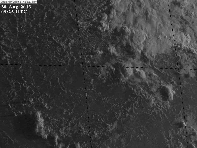
We have kind of an interesting situation regarding pouch 25 in the central Atlantic. Whereas the GFS and Euro runs (through 12Z) continue to do nothing with it, the CMC for at least the 4th run in a row has it become a cat 2-3 hurricane and threaten the US east coast. As a matter of fact, today's 12Z CMC actually slams Wilmington with a 968 mb hurricane at hour 216. See the attached map. Actually, it forms a TD by Monday morning 9/2 (72 hours) near the Leewards. Normally, I wouldn't give the CMC the time of day when the GFS and Euro are far different due to its inferiority and tendency to show false TC's. Therefore, I rarely post CMC maps and I'm not one to hype the tropics without a sound meteorological reason. Furthermore, I'm still not betting on it scoring a coup as of now. However, and this is a big however, the MJO is now getting close to an amplitude of 2.00 in phase 1 and rising further. If the Euro and GFS ensemble mean MJO forecasts were to verify, it would peak near 2.30 in phase 1 ~9/1-2, which is consistent with what the Euro has been showing for days. A 2.30 amplitude MJO in phase 1 would be the 2nd strongest MJO in either phase 1 or phase 2 near the peak of the season (8/21-9/20) since at least 1975! It would just beat the 9/5/81 peak of 2.21. Here are the two strongest as of now and the TC geneses while the MJO was 1.50+ in phase 1 or 2 just for the storms that eventually became hurricanes:


-3.08 peak 8/28/79: cat 5 David, cat. 4 Frederic, cat 2 Gloria

-2.21 peak 9/5/81: cat 1 Emily, cat 3 Floyd, cat 2 Gert


Actually, a whopping six total TC's formed during the strong 1979 MJO!


So, I'm wondering if it is possible that the Euro and GFS are not responding enough to this strong phase 1 MJO being that we're looking at about a one in 15 or so year event near the season's peak. Could it be that the CMC is responding more appropriately?

Any opinions?

Edit: I can't get the 216 hour CMC map to post here for some reason!
0 likes   
Personal Forecast Disclaimer:
The posts in this forum are NOT official forecasts and should not be used as such. They are just the opinion of the poster and may or may not be backed by sound meteorological data. They are NOT endorsed by any professional institution or storm2k.org. For official information, please refer to the NHC and NWS products.

User avatar
ROCK
Category 5
Category 5
Posts: 9484
Age: 54
Joined: Tue Aug 17, 2004 7:30 am
Location: Kemah, Texas

Re: Tropical Wave in Central Atlantic (Pouch 25L) 10% / 20%

#523 Postby ROCK » Fri Aug 30, 2013 2:06 pm

I never discount the CMC as it does find a nut here and there. That said, the way the GFS and EURO have been behaving with genesis I wouldnt discount the NAM!!!
0 likes   

User avatar
ROCK
Category 5
Category 5
Posts: 9484
Age: 54
Joined: Tue Aug 17, 2004 7:30 am
Location: Kemah, Texas

Re: Tropical Wave in Central Atlantic (Pouch 25L) 10% / 20%

#524 Postby ROCK » Fri Aug 30, 2013 2:10 pm

RECON for a pouch....man that is something new :lol:

My bet is the NHC is nervous since many of these models are showing something except the 2 big boys. They have been saving plenty of money this year so why not run a mission on this.
0 likes   

User avatar
blp
Category 5
Category 5
Posts: 2840
Age: 46
Joined: Thu Sep 09, 2004 7:51 pm
Location: Miami, FL
Contact:

Re: Tropical Wave in Central Atlantic (Pouch 25L) 10% / 20%

#525 Postby blp » Fri Aug 30, 2013 2:12 pm

On the 12z euro you can track it over Andros Islandl Bahamas. A tad more defined than the 00z. I am still interested.

12z
Image

00z
Image
0 likes   
The following post is NOT an official forecast and should not be used as such. It is just the opinion of the poster and may or may not be backed by sound meteorological data. It is NOT endorsed by any professional institution including storm2k.org For Official Information please refer to the NHC and NWS products.

Alyono
Professional-Met
Professional-Met
Posts: 6961
Joined: Fri Apr 26, 2013 3:52 pm
Location: Texas Coast

Re: Tropical Wave in Central Atlantic (Pouch 25L) 10% / 20%

#526 Postby Alyono » Fri Aug 30, 2013 2:17 pm

ROCK wrote:RECON for a pouch....man that is something new :lol:

My bet is the NHC is nervous since many of these models are showing something except the 2 big boys. They have been saving plenty of money this year so why not run a mission on this.


These are research flights, not operational flights
0 likes   

User avatar
blp
Category 5
Category 5
Posts: 2840
Age: 46
Joined: Thu Sep 09, 2004 7:51 pm
Location: Miami, FL
Contact:

Re: Tropical Wave in Central Atlantic (Pouch 25L) 10% / 20%

#527 Postby blp » Fri Aug 30, 2013 2:19 pm

It will be interesting to see if the second tier models(NAM, CMC, FIM, NAVGEM) can 1up the top tier models(GFS and Euro). It almost never happens but in this crazy year who knows.
0 likes   
The following post is NOT an official forecast and should not be used as such. It is just the opinion of the poster and may or may not be backed by sound meteorological data. It is NOT endorsed by any professional institution including storm2k.org For Official Information please refer to the NHC and NWS products.

User avatar
wxman57
Moderator-Pro Met
Moderator-Pro Met
Posts: 22979
Age: 67
Joined: Sat Jun 21, 2003 8:06 pm
Location: Houston, TX (southwest)

Re:

#528 Postby wxman57 » Fri Aug 30, 2013 2:26 pm

Alyono wrote:I'm not sure that is the global hawk

That may be the G-IV recon giving recon obs


Probably G-IV as the Global Hawk doesn't have tail-mounted Doppler. I know they had planned to fly the GH out there this week.
0 likes   

HurricaneDREW92
Category 1
Category 1
Posts: 320
Age: 26
Joined: Sun Jul 28, 2013 11:56 am
Location: Boston, MA

Re: Tropical Wave in Central Atlantic (Pouch 25L) 10% / 20%

#529 Postby HurricaneDREW92 » Fri Aug 30, 2013 2:43 pm

WRF has this as a TS Monday (72 hours)
0 likes   
This post is NOT AN OFFICIAL FORECAST and should not be used as such. It is just the opinion of the poster and may or may not be backed by sound meteorological data. It is NOT endorsed by any professional institution including storm2k.org. For Official Information please refer to the NHC and NWS products.

-THE ABOVE IS THE OPINION OF DREW ONLY

CrazyC83
Professional-Met
Professional-Met
Posts: 34002
Joined: Tue Mar 07, 2006 11:57 pm
Location: Deep South, for the first time!

#530 Postby CrazyC83 » Fri Aug 30, 2013 2:44 pm

Sometimes all the models are wrong! Consider Hurricane Julia in 2010 - most models dissipated it from a tropical storm; in reality it strengthened to a Cat 4 in an unlikely spot.
0 likes   

User avatar
cycloneye
Admin
Admin
Posts: 145321
Age: 68
Joined: Thu Oct 10, 2002 10:54 am
Location: San Juan, Puerto Rico

Thoughts on activity as heart of season nears

#531 Postby cycloneye » Fri Aug 30, 2013 3:07 pm

Canadian is an outlier.

THE WPC FORECAST BLEND INCLUDES THE CANADIAN AND ECMWF/ECMWF
ENSEMBLES FOR SYSTEM DEPICTION OVER THE PACIFIC AND NORTH
AMERICA...BUT DOES NOT ADVOCATE OUTLIER CANADIAN DEPICTED DEEP
TROPICAL DEVELOPMENT NEXT WEEK FROM THE CARRIBEAN TO OFF THE ERN
US.

http://www.srh.noaa.gov/productview_all ... n=6&max=61
0 likes   
Visit the Caribbean-Central America Weather Thread where you can find at first post web cams,radars
and observations from Caribbean basin members Click Here

User avatar
Gustywind
Category 5
Category 5
Posts: 12334
Joined: Mon Sep 03, 2007 7:29 am
Location: Baie-Mahault, GUADELOUPE

#532 Postby Gustywind » Fri Aug 30, 2013 3:48 pm

TROPICAL WEATHER DISCUSSION
NWS NATIONAL HURRICANE CENTER MIAMI FL
205 PM EDT FRI AUG 30 2013

AN ATLANTIC OCEAN TROPICAL WAVE IS FROM 20N50W TO 6N50W MOVING W
AT 15 KT. SCATTERED MODERATE CONVECTION IS E OF THE WAVE AXIS
FROM 14N-17N BETWEEN 44W-50W. UPPER-LEVEL WINDS ARE FORECAST TO
REMAIN UNFAVORABLE FOR DEVELOPMENT. THIS SYSTEM HAS A LOW CHANCE
OF BECOMING A TROPICAL CYCLONE DURING THE NEXT 48 HOURS...AND A
LOW CHANCE OF BECOMING A TROPICAL CYCLONE DURING THE NEXT 5
DAYS...AS IT MOVES WESTWARD ACROSS THE EASTERN CARIBBEAN SEA.
0 likes   

User avatar
Riptide
Category 2
Category 2
Posts: 753
Age: 34
Joined: Fri Jul 23, 2010 3:33 pm
Location: Cape May, New Jersey
Contact:

Re: Tropical Wave in Central Atlantic (Pouch 25L) 10% / 20%

#533 Postby Riptide » Fri Aug 30, 2013 4:06 pm

The structure and 850mb vort is improving, it has that "look" of a developing TC with the comma-shape convection.

Image
0 likes   

User avatar
ROCK
Category 5
Category 5
Posts: 9484
Age: 54
Joined: Tue Aug 17, 2004 7:30 am
Location: Kemah, Texas

Re: Tropical Wave in Central Atlantic (Pouch 25L) 10% / 20%

#534 Postby ROCK » Fri Aug 30, 2013 4:33 pm

0 likes   

User avatar
HurricaneMaster_PR
Category 2
Category 2
Posts: 795
Joined: Tue Jul 22, 2003 6:23 pm
Location: San Juan, Puerto Rico

Tropical Wave in Central Atlantic (Pouch 25L) 10% / 20%

#535 Postby HurricaneMaster_PR » Fri Aug 30, 2013 4:36 pm

ROCK wrote:http://www.tropicaltidbits.com/analysis/models/nam/2013083018/nam_reflectivity_watl.html

18Z NAM really likes PR.... :lol:


How about the Canadian?! Lol
0 likes   

USTropics
Professional-Met
Professional-Met
Posts: 2651
Joined: Sun Aug 12, 2007 3:45 am
Location: Florida State University

#536 Postby USTropics » Fri Aug 30, 2013 4:56 pm

Even though it's not currently an invest, RAMDIS has Floater 2 setup to track this pouch:

http://rammb.cira.colostate.edu/ramsdis/online/tropical.asp
0 likes   

OuterBanker
S2K Supporter
S2K Supporter
Posts: 1731
Joined: Wed Feb 26, 2003 10:53 am
Location: Nags Head, NC
Contact:

Re: Tropical Wave in Central Atlantic (Pouch 25L) 10% / 20%

#537 Postby OuterBanker » Fri Aug 30, 2013 5:02 pm

:roll: Nam likes PR
:eek: :eek: Canadian destroys Wilmington

Thank God no one takes either one seriously. :wink:
0 likes   

USTropics
Professional-Met
Professional-Met
Posts: 2651
Joined: Sun Aug 12, 2007 3:45 am
Location: Florida State University

#538 Postby USTropics » Fri Aug 30, 2013 5:11 pm

Saved visible animate .gif for today:

Image
0 likes   

Alyono
Professional-Met
Professional-Met
Posts: 6961
Joined: Fri Apr 26, 2013 3:52 pm
Location: Texas Coast

#539 Postby Alyono » Fri Aug 30, 2013 5:25 pm

that UL seems to be even more defined.

As i said 2 days ago, this is dead. The CMC appears to have an unrealistic upper level pattern, that is why it is developing the system
0 likes   

User avatar
cycloneye
Admin
Admin
Posts: 145321
Age: 68
Joined: Thu Oct 10, 2002 10:54 am
Location: San Juan, Puerto Rico

Re: Tropical Wave in Central Atlantic (Pouch 25L) 10% / 20%

#540 Postby cycloneye » Fri Aug 30, 2013 5:27 pm

Off-Topic= There is big news concerning severe weather. Go to the Sticky 2013 U.S Severe Weather thread to see a big downgrade of a tornado
0 likes   
Visit the Caribbean-Central America Weather Thread where you can find at first post web cams,radars
and observations from Caribbean basin members Click Here


Return to “Talkin' Tropics”

Who is online

Users browsing this forum: Bobd33, cycloneye, dl20415, gatorcane, Google Adsense [Bot], Hurricane2022, Ian2401, TomballEd and 54 guests