The NWS out of N.O.,LA. seems to think there is chance some of the moisture may head north.
AREA FORECAST DISCUSSION
NATIONAL WEATHER SERVICE NEW ORLEANS LA
412 AM CDT THU SEP 12 2013
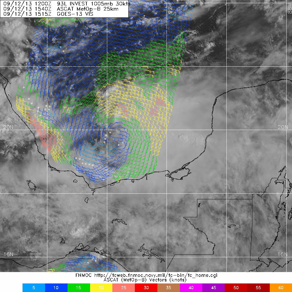
MEANWHILE...A TROPICAL WAVE TRACKING ACROSS THE YUCATAN PENINSULA
THIS MORNING WILL EMERGE IN BAY OF CAMPECHE LATER TODAY. THE WAVE
WILL BE FAIRLY SLOW TO MOVE ACROSS THE BAY...POSSIBLY NOT REACHING
LAND AGAIN UNTIL EARLY NEXT WEEK. GLOBAL MODELS DO SUGGEST
DEVELOPMENT WITH THIS SYSTEM IS POSSIBLE AS CONDITIONS APPEAR TO BE
FAVORABLE FOR THIS TO OCCUR. THE GOOD NEWS IS THAT BY THEN...UPPER
TROUGH TO THE NORTHEAST WILL BE EJECTING AND A WEAK RIDGE WILL BE
BUILDING BACK IN OVER THE GULF COAST. THE GENERAL MODEL CONSENSUS IS
THAT THIS HIGH SHOULD KEEP THE TROPICAL FEATURE HEADED WEST INTO
MEXICO OR EXTREME SOUTH TEXAS
BUT IT MAY STILL SEND ENOUGH MOISTURE
NORTH INTO THE CWA FOR SCATTERED SHOWERS AND THUNDERSTORMS TO
DEVELOP THIS WEEKEND INTO EARLY NEXT WEEKwxman57 wrote:djmikey wrote::?: Just curious. I know everyone is discussing "landfall" location, but what will the storm do AND go after landfall? Will she continue west? Will she turn northward? And can we expect ANY moisture from her in TX AFTER landfall? All I have read is her possible landfall location and nothing on where she will go after landfall. Many tropical systems create havoc of flooding rains days after they have made landfall. Just wondring if we can POSSIBLY expect a piece of her later down the road. Thanks!
It appears that the ridge will remain over Texas through early next week. That would keep all the moisture from this storm well south of SE TX.


