FWIW, I just looked at the qpf values for Austin (KAUS) for this coming winter event per the GFS. Again, remember last week we had only .08".
0z - .09"
6z - .21"
12z - .14"
18z - .16"
Oh, and the last three GFS runs have kept Austin's temperature BELOW freezing from 12z Tuesday until 15z Wednesday. So all of that QPF will be of a frozen variety (freezing rain/sleet/snow/maybe even graupel).
Texas Winter 2013-2014
Moderator: S2k Moderators
Forum rules
 The posts in this forum are NOT official forecast and should not be used as such. They are just the opinion of the poster and may or may not be backed by sound meteorological data. They are NOT endorsed by any professional institution or STORM2K.

The posts in this forum are NOT official forecast and should not be used as such. They are just the opinion of the poster and may or may not be backed by sound meteorological data. They are NOT endorsed by any professional institution or STORM2K.
-
Portastorm

- Storm2k Moderator

- Posts: 9955
- Age: 63
- Joined: Fri Jul 11, 2003 9:16 am
- Location: Round Rock, TX
- Contact:
Re: Texas Winter 2013-2014
0 likes
Any forecasts under my name are to be taken with a grain of salt. Get your best forecasts from the National Weather Service and National Hurricane Center.
-
ThunderSleetDreams

- S2K Supporter

- Posts: 1510
- Age: 43
- Joined: Tue Dec 20, 2011 4:42 pm
- Location: S of Weimar, TX
Re: Texas Winter 2013-2014
Conroe meteogram is wow... Bottoms out at 14 and 3-5 inches if snow depending on onset of precip
0 likes
#NeverSummer
I hibernate when it gets above 75 degrees!
I hibernate when it gets above 75 degrees!
-
Rgv20

- S2K Supporter
- Posts: 2466
- Age: 39
- Joined: Wed Jan 05, 2011 5:42 pm
- Location: Edinburg/McAllen Tx
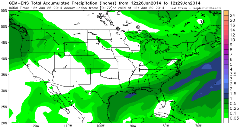
Below is the 12zCMC Ensembles forecast Precip Totals thru Wednesday Morning, clearly the operational 12zCMC is an outlier among its ensembles.

0 likes
The following post is NOT an official forecast and should not be used as such. It is just the opinion of the poster and may or may not be backed by sound meteorological data. It is NOT endorsed by any professional institution including storm2k.org For Official Information please refer to the NHC and NWS products.

Re: Texas Winter 2013-2014
Lets not forget the other element, powerful Arctic front is coming down the plains associated with big high pressure. A ground blizzard is currently ongoing in the Northern Plains. Wxman57 still dreams of 1986...

0 likes
The above post and any post by Ntxw is NOT an official forecast and should not be used as such. It is just the opinion of the poster and may or may not be backed by sound meteorological data. It is NOT endorsed by any professional institution including Storm2k. For official information, please refer to NWS products.
Help support Storm2K!
-
wxman57

- Moderator-Pro Met

- Posts: 23174
- Age: 68
- Joined: Sat Jun 21, 2003 8:06 pm
- Location: Houston, TX (southwest)
Re: Texas Winter 2013-2014
HouTXmetro wrote:wxman57 wrote:Interesting 18Z GFS meteogram for Houston. About 2-4" snow and a low Wed of 17, and that's just 2m temps. MOS will probably be colder:
http://home.comcast.net/~cgh57/iahgfs18zjan26.gif
How likely is that to verify in precip amounts and that 17? What are you thoughts on the latest model "trends"?
If we do get a covering of snow/ice across Houston on Tuesday then when the short wave passes Tuesday night we'll get a lot colder than if there was no ice on the ground.
0 likes
I would like to add this for the Houston metro area (and really much of SE Texas). Temperatures this go around will be colder than last week which was marginally 30-32 when the precip fell. This time it's going to be the 27-29 range, that makes a big difference on the roads. If 1-2 inches of sleet/frz rain (quite possible) were to fall in those temps there will be a lot of headaches not just on bridges and overpasses. Could be similar to what DFW saw in December with those temperatures. For a region not to have seen weather like such in a long time, it's dangerous. Unfortunately the other side of something like this is there will be loss of life or property for people who are not prepared and assume they can brave it if it verifies.
0 likes
The above post and any post by Ntxw is NOT an official forecast and should not be used as such. It is just the opinion of the poster and may or may not be backed by sound meteorological data. It is NOT endorsed by any professional institution including Storm2k. For official information, please refer to NWS products.
Help support Storm2K!
Help support Storm2K!
-
gboudx

- S2K Supporter
- Posts: 4090
- Joined: Thu Sep 04, 2003 1:39 pm
- Location: Rockwall, Tx but from Harvey, La
For NTX folks, Steve McCauley will be running his Stat Method on the February 3-6 timeframe later.
Significant precipitation will avoid north Texas this week, but there are still signs of a major pattern shift coming up as we go into the first week of February. Specifically, the days from Feb 3 - Feb 6 look interesting from a precipitation standpoint, and I will be running the stat method on this later this afternoon after I get a few hours of studying in for the day.
0 likes
-
Houstonia

- S2K Supporter
- Posts: 829
- Age: 61
- Joined: Fri Oct 11, 2002 9:45 am
- Location: Sharpstown, Houston, Harris County, Southeast Texas.
Re:
Yeah, I'm getting a bit concerned about people trying to get home from work on Tuesday night. I don't sees school closures happening until after the roads get bad.  . I had friends griping about closures last week, claiming THEY didn't see any ice. This coming from people who didn't need to use the freeways mostly.
Ntxw wrote:I would like to add this for the Houston metro area (and really much of SE Texas). Temperatures this go around will be colder than last week which was marginally 30-32 when the precip fell. This time it's going to be the 27-29 range, that makes a big difference on the roads. If 1-2 inches of sleet/frz rain (quite possible) were to fall in those temps there will be a lot of headaches not just on bridges and overpasses. Could be similar to what DFW saw in December with those temperatures. For a region not to have seen weather like such in a long time, it's dangerous. Unfortunately the other side of something like this is there will be loss of life or property for people who are not prepared and assume they can brave it if it verifies.
0 likes
Re:
gboudx wrote:For NTX folks, Steve McCauley will be running his Stat Method on the February 3-6 timeframe later.Significant precipitation will avoid north Texas this week, but there are still signs of a major pattern shift coming up as we go into the first week of February. Specifically, the days from Feb 3 - Feb 6 look interesting from a precipitation standpoint, and I will be running the stat method on this later this afternoon after I get a few hours of studying in for the day.
Oklahoma, North Texas, West Texas, and Arkansas should be monitoring that time frame. There's been a lot of noise from the OP and Ensemble guidance. The current MJO/Kelvin wave will arrive and the -PNA will kick out some big systems.
0 likes
The above post and any post by Ntxw is NOT an official forecast and should not be used as such. It is just the opinion of the poster and may or may not be backed by sound meteorological data. It is NOT endorsed by any professional institution including Storm2k. For official information, please refer to NWS products.
Help support Storm2K!
Help support Storm2K!
Re: Re:
Houstonia wrote:Yeah, I'm getting a bit concerned about people trying to get home from work on Tuesday night. I don't sees school closures happening until after the roads get bad.
Yep it's not fun. A lot of talk is snow but really what the NAM/GFS are showing is a big sleet storm for Houston ending as a little snow. Will be a mess if that verified
0 likes
The above post and any post by Ntxw is NOT an official forecast and should not be used as such. It is just the opinion of the poster and may or may not be backed by sound meteorological data. It is NOT endorsed by any professional institution including Storm2k. For official information, please refer to NWS products.
Help support Storm2K!
Help support Storm2K!

Re: Re:
It was bad enough trying to get home on Thursday night (2 hours on the bus to Katy; usually takes 45 min or so). Depending on what the models are showing tomorrow, there's a big chance I'm not going into the office on Tuesday. Just not worth the risk.Houstonia wrote:Yeah, I'm getting a bit concerned about people trying to get home from work on Tuesday night. I don't sees school closures happening until after the roads get bad.
0 likes


Re: Texas Winter 2013-2014
My concern would be power outages. I have a generator and gas heat, so we will be fine.
I'm waiting for wxman57 to bring the heat up to 90 degrees.
I'm waiting for wxman57 to bring the heat up to 90 degrees.
0 likes
-
cycloneye

- Admin

- Posts: 149451
- Age: 69
- Joined: Thu Oct 10, 2002 10:54 am
- Location: San Juan, Puerto Rico
Re: Texas Winter 2013-2014
00z NAM at 42 hours. Houston/Galveston/Beamont look at this.

0 likes
Visit the Caribbean-Central America Weather Thread where you can find at first post web cams,radars
and observations from Caribbean basin members Click Here
and observations from Caribbean basin members Click Here
-
TeamPlayersBlue

- Category 5

- Posts: 3530
- Joined: Tue Feb 02, 2010 1:44 am
- Location: Denver/Applewood, CO
Ummmm what? Is that sleet?
0 likes
Personal Forecast Disclaimer:
The posts in this forum are NOT official forecast and should not be used as such. They are just the opinion of the poster and may or may not be backed by sound meteorological data. They are NOT endorsed by any professional institution or storm2k.org. For official information, please refer to the NHC and NWS products.
The posts in this forum are NOT official forecast and should not be used as such. They are just the opinion of the poster and may or may not be backed by sound meteorological data. They are NOT endorsed by any professional institution or storm2k.org. For official information, please refer to the NHC and NWS products.
-
Texashawk

- Category 2

- Posts: 579
- Joined: Tue Aug 14, 2007 1:50 am
- Location: Missouri City, TX (Houston)
Re: Texas Winter 2013-2014
cycloneye wrote:00z NAM at 42 hours. Houston/Galveston/Beamont look at this.
If that verified... Holy @#:$:&/!
0 likes
-
southerngale

- Retired Staff

- Posts: 27418
- Joined: Thu Oct 10, 2002 1:27 am
- Location: Southeast Texas (Beaumont area)

 my Cowboys
-
TeamPlayersBlue
- Category 5
- Posts: 3530
- Joined: Tue Feb 02, 2010 1:44 am
- Location: Denver/Applewood, CO
Re: Texas Winter 2013-2014
stormlover2013 wrote:That's all snow!!!
How can you tell? The high reflectivity? Im liking it. Thats crazy heavy snow though
That means precip before 6pm too. Tad early. Holy. Moly.
0 likes
Personal Forecast Disclaimer:
The posts in this forum are NOT official forecast and should not be used as such. They are just the opinion of the poster and may or may not be backed by sound meteorological data. They are NOT endorsed by any professional institution or storm2k.org. For official information, please refer to the NHC and NWS products.
The posts in this forum are NOT official forecast and should not be used as such. They are just the opinion of the poster and may or may not be backed by sound meteorological data. They are NOT endorsed by any professional institution or storm2k.org. For official information, please refer to the NHC and NWS products.
NAM is mostly all sleet for SE Texas, one heck of an sleet storm
0 likes
The above post and any post by Ntxw is NOT an official forecast and should not be used as such. It is just the opinion of the poster and may or may not be backed by sound meteorological data. It is NOT endorsed by any professional institution including Storm2k. For official information, please refer to NWS products.
Help support Storm2K!
Help support Storm2K!
Who is online
Users browsing this forum: No registered users and 70 guests