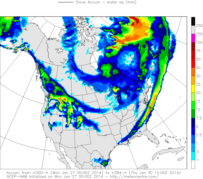
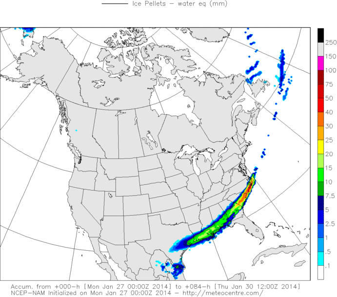
wxman22 wrote:I think David Paul might of been referring to In-House models...
That was my impression, especially with the Futurecast graphic he was displaying. Let me know if you have any idea about what they use for input in that one.
Moderator: S2k Moderators
 The posts in this forum are NOT official forecast and should not be used as such. They are just the opinion of the poster and may or may not be backed by sound meteorological data. They are NOT endorsed by any professional institution or STORM2K.
wxman22 wrote:I think David Paul might of been referring to In-House models...


TeamPlayersBlue wrote:The key in his forecast was the band of precip trained over the same area. If that were to happen, then 5-7 inches is without a doubt a possibility.
BigB0882 wrote:Come on guys, no need to argue. We all know that NO ONE can accurately predict snowfall amounts, even 1 hour before the event starts. Ntxw has been GREAT in providing tons of information and really knows his stuff. I am sure he is just giving his opinion and letting you know not to bank everything on one forecast by one person. In his defense, there are NO models showing those amounts of snow so his wondering is quite understandable.
BUT, for the record, I hope you do get 6 inches! I hope we all do! ALL SNOW. hehe
Jagno wrote:Okay, help me understand something. I seem to always be caught in the middle here. Now we are seeing this "Futurecast" with the potential for 5"+ in SE Texas, west of me, and other models showing the same 5"+ east of me in Baton Rouge. Why does our local forecasts only call for 1/4" of possible sleet/ice and 1/2" of snow possible here in Lake Charles?


mcheer23 wrote:According to KHOU (Houston)
"The snow will begin in our northern counties late Monday night and by Tuesday morning snow and sleet will be falling from the immediate Houston area all the way to the coast. Snow totals are generally expected to be 1 to 2 inches area wide, with some spots picking up 3 to 5 inches of the white stuff."


Ntxw wrote:The Euro seems to be the dry one of the bunch (minus the crazy uncle Canadian). A little less than 0.10 of an inch of liquid, 0.20 tenths for northern and eastern areas. So sleet or snow it amounts to 0.5-1 inch of stuff for most of SE Texas core being closer to Jasper which is around 1.5inches. But it's been fairly bearish on the qpf from the start anyway.

Ntxw wrote:The Euro seems to be the dry one of the bunch (minus the crazy uncle Canadian). A little less than 0.10 of an inch of liquid, 0.20 tenths for northern and eastern areas. So sleet or snow it amounts to 0.5-1 inch of stuff for most of SE Texas core being closer to Jasper which is around 1.5inches. But it's been fairly bearish on the qpf from the start anyway.

MississippiWx wrote:Ntxw wrote:The Euro seems to be the dry one of the bunch (minus the crazy uncle Canadian). A little less than 0.10 of an inch of liquid, 0.20 tenths for northern and eastern areas. So sleet or snow it amounts to 0.5-1 inch of stuff for most of SE Texas core being closer to Jasper which is around 1.5inches. But it's been fairly bearish on the qpf from the start anyway.
Euro does kick out the upper level disturbance south of Baja. Trending towards the GFS at the 500mb level. Will be interesting if the precip amounts start going up in response. Euro is slightly wetter overall, but still dry in comparison.

South Texas Storms wrote:Yeah the 0z Euro is slightly drier than the 12z run. You think I have a good chance of seeing 1-2 inches of sleet/snow here in CLL, Ntxw?
Users browsing this forum: No registered users and 85 guests